I was running in the hills along the western margin of the San Fernando Valley and reveling in the Autumn-like weather. The hills were parched, brown, and the soil dessicated. In 128 days it had not rained.
An area of low pressure was producing some clouds and even a little rain in some parts of Los Angeles County. The last time it had been this cool in the afternoon was in mid-June. The pleasant temperature was a welcome change from the 80s, 90s and 100s of Summer.
Precipitation from the 2015-16 Godzilla El Nino fell short of expectations, with Downtown Los Angeles only recording 65% of normal rainfall and the drought continuing into its fifth year. How long would we have to wait until we received widespread rainfall?
At the moment the expectation is for ENSO Neutral conditions to prevail this Winter. Neutral conditions give forecasters little leverage on which to base their Winter outlook, but based on last year’s Southern California precipitation forecasts, we didn’t have much leverage then either.
With a warming planet, we appear to be in a new regime. Forecasts based on 1950-2000 analogs may no longer be applicable. As of September 15 the Climate Prediction Center’s Precipitation Outlook for Southern California for December, January and February is the equivalent of flipping a three-sided coin.
We may just have to wait and see what the Winter brings.
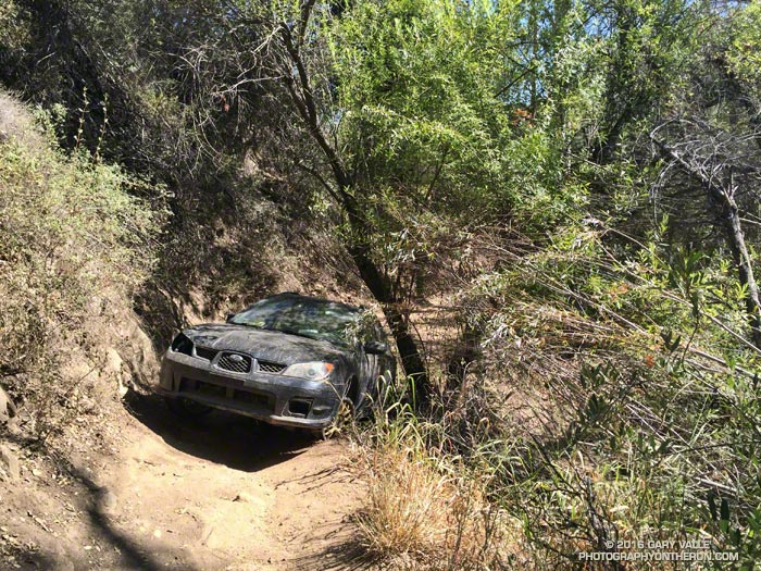
When you run a lot of miles, you see a lot of things, but I have to say I never expected to see a Subaru Impreza at Sulphur Springs on the the Cheeseboro Canyon Trail.
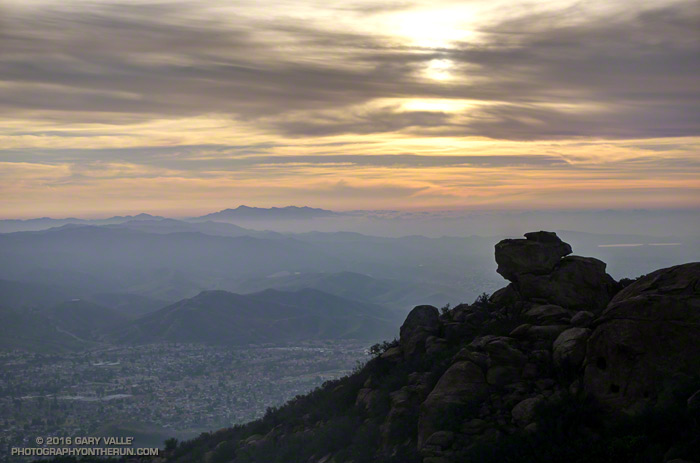
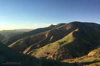
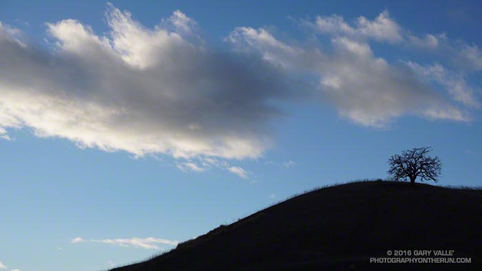
Been enjoying the views from Rocky Peak Road a lot this past month. That’s Simi Valley, with Boney Mountain in the distance. On a clear day the view extends to the Channel Islands.
That viewpoint is at about mile 4.5 of the Bandit 50K/30K/15K and there are many other superb views along the way. This year, as a result of the L.A. Marathon date change, the Bandit races were moved from President’s Day weekend to January 30. El Nino or not, we had near perfect running weather for the event. Thanks to Randy, Sarita & crew and all the volunteers for all the work putting together the eight edition of the Bandit Ultra Trail Run!
Rocky Peak Road
The Tuesday following Bandit I’d run farther than planned, so on Wednesday the plan had been to drive over to Simi Valley and do a short recovery run/hike up the Chumash Trail. As I parked on Flanagan Drive, it occurred to me it would be a good day to see if the linkup from the Chumash trailhead to the Hummingbird trailhead was once again possible. The 9.3 mile Hummingbird-Chumash loop used to be a favorite, but because of construction I had not done the loop since 2010. An out and back to check out the first couple of miles of the loop would be the perfect recovery run!
I was happy to discover the trails east of Chumash Park and behind the cemetery had not changed. Construction of the extension of Mt. Sinai Drive appears to be mostly complete, but residential construction along the street is ongoing. The work day was ending, so running the quarter-mile stretch of Mt. Sinai Drive to get to Kuehner didn’t seem to be an issue.
Once on Kuehner my thought was, “What now?” The run was going to be too short if I turned around, so I decided to go just “15 minutes up the Hummingbird Trail.”
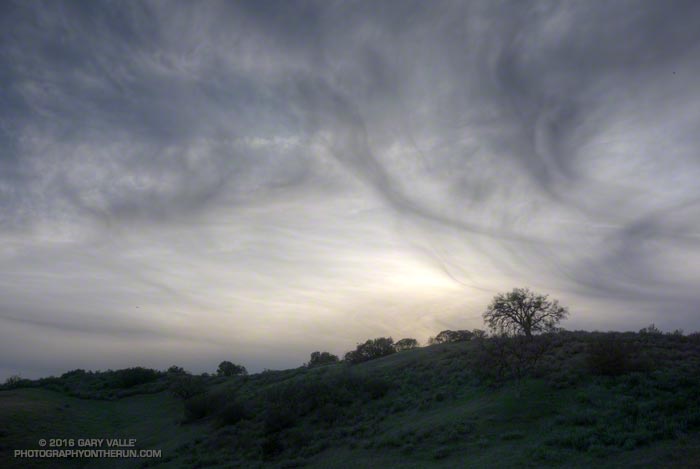
Greening hills along the Chumash Trail
Right… I soon found myself most of the way up the trail and estimating what time I needed to get to the top of Hummingbird in order to make it to the Chumash Trail and complete the loop before dark. I’m sure my pace was not too far off what it had been in the 50K, just a few days before. At some point an official trail is supposed to link the bottom of the Chumash and Hummingbird Trails, and I hope that is in the not too distant future.
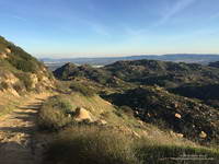
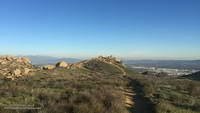
The single track trails in Rocky Peak Park — and even Rocky Peak Road — tend to be technical. It’s excellent training and I try to run there at least once a week. A run I’ve been doing frequently is an out and back from the Chumash trailhead to an airy overlook near Rocky Peak. (This run also passes the point on Rocky Peak Road where the title photo was taken.) Today, as I approached the overlook I saw that it was occupied by a pair of large ravens.
Often seen in pairs, ravens are perceptive, intelligent birds. Depending on the situation, they can be somewhat tolerant of humans. Sometimes it is possible to pass within a few feet of them and not make them fly. They really don’t want to waste the energy if they don’t have to.
Overlook near Rocky Peak
As I worked up the path to the overlook I could see that the birds were watching me intently and trying to decide if I posed a threat. Knowing they are curious birds, I clucked my tongue in an attempt to mimic one of their more simple calls. Perhaps they were perplexed by the garbled raven-talk coming from the troublesome, large, bipedal, wingless creature. In any case they didn’t fly and continued to watch me. As “politely” as I could, I moved up and about four feet to their left, sharing the high point. For seconds I stood by them on the overlook, enjoying the view.
I’d flown a hang glider from a point such as this and understood why it was so special to the birds. With care, I turned away from them and walked down an alternate path. Slowly turning my head, I could see they had not flown.
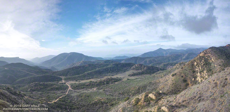
Cheeseboro Canyon is the prominent canyon on the left of the photo. The dirt road is the Cheeseboro Ridge Trail — a power line service road. The Sheep Corral Trail follows the flat-ish terrain in the little valley. It links the Cheeseboro Ridge Trail to the top of the Cheeseboro Canyon Trail about a quarter-mile to the west (right) at Shepherds’ Flat.
There are innumerable trail runs, hikes and rides that pass through here. Here’s a NPS map of the Cheeseboro/Palo Comado area trails (PDF). On this cool, mid-January day I was doing the Upper Las Virgenes Canyon – Cheeseboro Ridge Loop.
Originally posted January 7, 2016 and rewritten to reflect the current rainfall totals for Downtown Los Angeles. Rain season totals have been updated as of March 31.
Based on 1981-2010 climate normals Downtown Los Angeles (USC) receives, on average, 1.04 inches of rain in November, 2.33 inches of rain in December, and 3. 12 inches in January. This past November Los Angeles recorded only 0.01 inch of rain, and in December only 0.57 inch. January rainfall was a few hundredths above normal at 3.17 inches.
The 2015-16 El Nino is one of the three strongest El Ninos in the past 65 years; the other two were 1982-83 and 1997-98. How does the amount of rain we’ve had so far this rainfall year compare to the other two? Is this El Nino failing to produce the expected amount of rainfall in Los Angeles?
On January 7, when this post was originally written, the rain year totals were in the same ballpark for the date as during the 1982-83 and 1997-98 El Ninos. That is no longer the case, and Los Angeles rainfall totals are falling far behind those other big El Ninos.
As of January 31 Downtown Los Angeles (USC) has recorded only 6.97 inches of rain for this rain year, which is 0.47 inch below normal. At this point during the 1982-83 El Nino Los Angeles had already recorded 12.98 inches of rain, and in the 1997-98 El Nino 9.15 inches. (See updates below.)
The good news is that the Sierra snowpack is above average. That helps with the water supply, but not so much with naturally-occurring local groundwater and other drought impacts in Southern California. It does help that the Los Angeles rain year total is nearly normal, but I’m still waiting to see running water in upper Las Virgenes Creek.
Remarkably, as of this morning, the medium range models are forecasting dry weather to predominate over the next 10 days or so and both the GFS and ECMWF show a mega-ridge of high pressure developing over the West Coast this weekend. We’ll see!
Update:
As of March 31 Downtown Los Angeles (USC) has recorded only 9.36 inches of rain for 2015-16 rain year, which is 68.5% of normal. At this point during the 1982-83 El Nino Los Angeles had already recorded 25.72 inches of rain, and in the 1997-98 El Nino 26.89 inches. All the data for the April 1 Sierra Snow Course Measurements are not available yet, but it looks like the snowpack will be around 85% of normal. In 1983 the weighted statewide average snowpack was 227% of normal and in 1998 it was 158% of normal.