
Update of a post from December 30, 2006.
The Chumash-Las Llajas Loop is a scenic 9.3 mile trail run in the eastern Simi Valley. Run counterclockwise, it combines a strenuous climb on a single-track trail and fire road with a fast-paced 4-mile downhill on a dirt road. The cumulative elevation gain/loss on the loop is about 1600′.
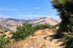
I like to do the loop starting at the Las Llajas Canyon trailhead on Evening Sky Drive. A short jog up Evening Sky Dr., then across a field, and you’re on your way up the Chumash Trail. From this point, it’s an approximately 1000′ climb over 2.7 miles of rocky trail to Rocky Peak fire road.
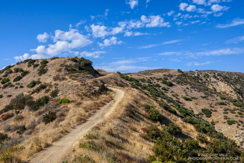
After turning left (north) on Rocky Peak fire road, a short downhill is followed by three-quarters of a mile of climbing to “Fossil Point.” A short detour off the main fire road leads to a cairn marking the high point. From here there is a panoramic view of Oat Mountain, San Fernando Valley, San Gabriel Mountains, Santa Monica Mountains, Simi Valley, Boney Mountain, Channel Islands, and Ventura Mountains.
Exposures of fossil shells are found near the high point. According to the area’s Dibblee geology map, these may have been deposited in shallow marine lagoons a couple million years ago.
From the high point, the loop continues north on Rocky Peak Road. At first, it descends steeply, then climbs to a hilltop with a few valley oaks. Partway up the hill, a roadcut reveals the long roots of the chamise plants on the hillside.
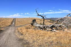
Following a short downhill, the road continues past a fallen valley oak that was killed by the 2011-2015 drought. There is a fork in the road here. The road connecting to Las Llajas Canyon goes up a short hill to an overlook of the canyon. From the top of the hill, there are more than 4 miles of downhill through the winding canyon. There used to be oil field equipment on the connector between Rocky Peak Rd. and Las Llajas Canyon, but it has been removed.
If the creek in the canyon is flowing, there are several places where the (usually) small stream crosses the road. In the Spring and early Summer, many species of wildflowers can be found in the canyon.
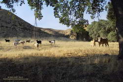
Some of the wildlife, and not-so-wild animals, I’ve encountered on the loop include rattlesnakes and other snakes, deer, longhorn cattle, roadrunners, and a kangaroo rat. Although others have seen mountain lions in the area, I’ve only photographed their tracks.
The loop ends with a short, steep climb up a paved road. At the top of the hill, turn left to return to the trailhead.
Explore the scenery and terrain on the Chumash-Las Llajas Loop trail run using our high resolution, interactive, 3D viewer. The imagery is so detailed, it’s almost like being there! To change the view, use the control on the upper right side of the screen, the CTRL key and your mouse, or touch gestures. Track and placename locations are approximate and subject to errors. Poor weather, and other conditions may make this route unsuitable for this activity. (It is also possible to start the loop at the Chumash Trail trailhead at the end of Flanagan Dr.)
The title photo is a section of Rocky Peak fire road between the top of the Chumash Trail and Fossil Point. It is from a run on October 6, 2020.
Some related posts: Chumash Trail Rocks & Snow, Exploring Las Llajas, Marr Ranch Wildflowers, Things Found on the Chumash Trail