Category Archives: trail running

Chumash Trail Out and Back to Rocky Peak Road

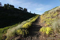
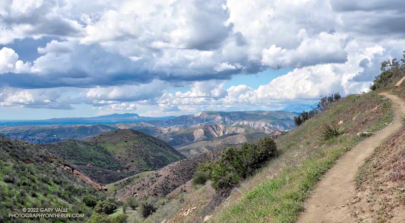
A spectacular Spring day on the Chumash Trail in Simi Valley

Originally published June 28, 2008. Updated December 30. 2022.

Without a doubt, the Chumash Trail is one of my favorite short “after work” trail runs. Popular among hikers, mountain bikers, and runners, the Chumash Trail starts on Flanagan Drive in eastern Simi Valley and ascends the convoluted western flank of Rocky Peak Park to Rocky Peak Fire Road. It’s single-track trail all the way, gaining about 1175′ over 2.7 miles.

From a trail runner’s training perspective, it is a nearly ideal short, technical, higher heart rate workout. It has a few tough sections but is generally very runnable. When I’m chugging up the trail, it seems just about the time my heart rate is going to go lactic, the trail will back off or contour. Because I usually run the trail near my aerobic maximum, it’s a great indicator of where I am in my training. Over-training, or any other fitness issue, is usually plainly — and sometimes painfully — evident.

In many ways running down the Chumash Trail is more difficult than running up. It can be very challenging to run down a rocky, technical section of trail with any speed. Running a trail like the Chumash Trail can help develop the skill and strength necessary to do downhills with better technique and more speed.

I don’t think I’ve ever run this trail fresh, but a couple of times a year, when my legs feel good, it’s fun to really push the Chumash Trail up and down. Like most running, there’s a balance — push too hard on the up and there won’t be enough left to push the down.

Here is an interactive, 3D terrain view of the Chumash Trail Out & Back to Rocky Peak Road. The map can be zoomed, tilted, rotated, and panned using the navigation control on the right. Track and placename locations are approximate and subject to errors. Poor weather and other conditions may make this route unsuitable for this activity.

There are several ways to extend the basic out and back. One option is to turn left on Rocky Peak Road and run a mile to “Fossil Point.” Another is to turn right and run 1.6 mile to the Rock Peak overlook.

Some related posts: Chumash Trail Mule Deer, Category Is: Things Found on the Chumash Trail, Chumash Trail Rocks & Snow, Chumash-Las Llajas Loop

San Bruno Mountain and Windy Hill Trail Runs

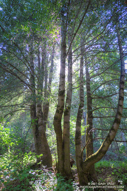
California bay trees in Windy Hill Open Space Preserve near the bottom of the Razorback Ridge Trail.
California bay – Windy Hill Open Space Preserve

With vaccinations on the increase and Covid on the decline, it was wonderful to once again be able to visit family.

As we always try to do, Brett and I got in a couple of runs. We usually do at least one run that is new to me, and there are certainly plenty from which to choose in the Bay Area.

Oxeye Daisy along the Old Ranch Trail in San Bruno Mountain Park
Oxeye Daisy along the Old Ranch Trail

Our first run was on San Bruno Mountain. We’d previously done the Ridge Trail, so this time opted to do a variation of the Summit Loop. The parking lot at the base was was closed, so we started the run using the Old Ranch Road Trail. This was a plus because it added a little mileage and there were a lot of wildflowers along the trail, including monkeyflower, iris, lupine, yellow paintbrush, daisy, and foxglove.

Brett running up the Summit Loop Trail on San Bruno Mountain
Summit Loop Trail, near the top.

It was an excellent run on single-track trail. As is the rule on San Bruno, it was a bit breezy, with hazy views of the surrounding communities and the Pacific. An island of open space in an urban sea, San Bruno Mountain is a miracle of land conservation, and an area to be relished. Here is a map of trails in the area.

The next day, after watching a spirited youth soccer match, we headed south on 280. On the way, Brett filled me in on the runs he likes to do in Windy Hill Open Space Preserve and Huddart Park. We couldn’t go wrong with either choice but finally decided to save Huddart Park for another day.

Brett running through thimbleberry on a lush section of the Razorback Ridge Trail
Razorback Ridge Trail

Windy Hill Open Space Preserve is on the northeast-facing slopes of the Santa Cruz Mountains above Portola Valley. We parked near the Alpine Trailhead and ran up the road to the Eagle Trail. Corte Madera Creek was running, but low. Although the grasses along the trail were green and the undergrowth was relatively lush, I suspect the conditions were more like July than May. Open hillsides looked mid-Summer dry and the lichen on the trees was drab and desiccated.

Like the rest of California, the Santa Cruz Mountains have seen well below average precipitation this rain season. One station near Windy Hill, Woodside 3.4 S, recorded only about 28% (12″) of normal precipitation from October 1 to May 19. Another station, Skyline Ridge Preserve, recorded about 41%  of normal (16.5″) from October 1 to May 3.

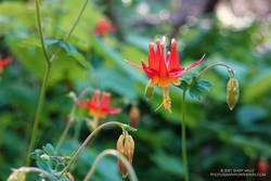
Western columbine along the Lost Trail in Windy Hill Open Space Preserve
Western columbine

From the Eagle Trail/Private Road we turned onto the Razorback Ridge Trail. According to my Garmin track, the Razorback Ridge Trail gains 1000′ or so over 2.4 miles to its junction with the Lost Trail. It’s all runnable, switch-backing up a thimbleberry and fern-lined trail, shaded by California bay trees.

While the Razorback Ridge Trail continues up another 0.4 miles to Skyline Blvd., we turned right onto the Lost Trail. This trail parallels Skyline as it works in and out of the tributary ravines of Jones Gulch, on its way over to the Hamms Gulch Trail. Along the way there were views across the valley to Mt. Diablo, some 40 miles distant. Western columbine was blooming along the trail, its bright red color complimenting the green theme.

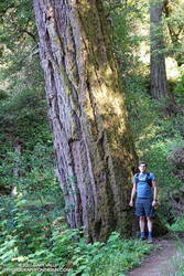
Large Douglas-fir along the Lost Trail in Windy Hill Open Space Preserve
Large Douglas-fir along the Lost Trail

At the top of Jones Gulch, there is an impressive, old-growth Douglas-fir. At chest height, it is about as wide as Brett is tall. This would put its diameter at over 72″ and its circumference at over 220″, suggesting an age in the neighborhood of 350 years.

The run down the Hamms Gulch Trail was as good as the run up Razorback Ridge. Given the weather was nearly perfect for a hike or run, we were surprised to see only a dozen or so people on the trail.

From where we were parked the run worked out to about 8 miles, with about 1500′ of gain/loss. Here is a trail map of the area, and here is an interactive, 3D terrain view of my GPS track of the loop. The interactive map can be zoomed, tilted, rotated, and panned. To change the view, use the control on the upper right side of the screen.

Some related posts: Breezy San Bruno Mountain Ridge, San Francisco Sights Trail Run, Miwok Wanderings

Three Points – Mt. Hillyer Loop

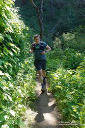
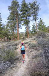
Trail runner on the Mt. Hillyer Trail in the San Gabriel Mountains
Mt. Hillyer Trail

Snow — if there has been snow — disappears quickly from the middle elevations of the San Gabriels this time of year. Activity increases with the rising snowline, as visitors eye their favorite trails and peaks.

I was driving up Hwy 2 to Three Points to do a run with Skye. In a normal year we would be doing the Three Points – Mt. Waterman Loop, but for the second time in 11 years, the trails in the Mt. Waterman area had been closed by a wildfire. In 2009, the Station Fire burned 160,557 acres in the San Gabriel Mountains, and just last year, the Bobcat Fire burned 115,796 acres. In several places, including Mt. Waterman, the Bobcat Fire burned terrain that had been burned in the Station Fire.

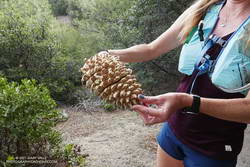
Coulter pine cone, heavy with resin

With entry prohibited in most of the Bobcat Fire burn area, the Three Points Loop around Mt. Waterman was out for now. Instead, we decided to do a segment of the traditional AC100 course from Three Points to Chilao, and then return to Three Points using the Silver Moccasin Trail.

Here’s an overview of both the Three Points – Mt. Hillyer Loop (yellow) and the Three Points – Mt. Waterman Loop (red). An overlay of the Bobcat Fire BAER Soil Burn Severity has ben added to the Google Earth image. The burn severity classes are high (red), moderate (yellow), low (light green), unburned/very low (dark green), and no data (black). Trail and placemark locations are approximate.

Trail runner on the PCT near Sulphur Springs Road
PCT near Sulphur Springs Road

On today’s run we followed the Pacific Crest Trail northbound from Three Points toward Sulphur Springs Trail Camp. Just before the camp, the PCT splits. We followed the left fork (uphill), and then around to the South Fork Little Rock Creek drainage and Sulphur Springs Road. The PCT parallels the road for about a half-mile, then crosses the road. At this point we left the PCT behind and continued up the road (5N04) to Alder Saddle and forest road 3N17. We continued left (south) on 3N17, bearing left on Santa Clara Divide Road at a fork, and going uphill to Rosenita Saddle.

At Rosenita Saddle we turned right (southwest) onto the Mt. Hillyer Trail. The trail starts at the back of a small parking area. The trail climbs to the high point of Mt. Hillyer, and then descends through large granite boulders in the Horse Flats bouldering area. (If you are a rock climber, bring your shoes!) The Mt. Hillyer Trail intersects the Silver Moccasin Trail near the Horse Flats Campground.

To add a little mileage and elevation gain, we turned right (south) on the Silver Moccasin Trail and continued to Chilao Campground. After saying hi to Chilao, we turned around and followed the Silver Moccasin Trail north, back to Three Points.

The trail run was a little over 13 miles, with a cumulative elevation gain of about 2100′. The high point was about 6200′, on Mt. Hillyer. The route-finding on the loop can be a bit tricky the first time around.

Out and Back Trail Run to Mugu Peak

Above are thumbnails of a few photos from a 20-mile out and back trail run to Mugu Peak from the Wendy Drive Trailhead. The run was on October 17, 2020. Click on an image for a larger photo and more information.

There are several ways to get to Mugu Peak from the Wendy Drive Trailhead on Potrero Road. When I do this run I’m usually looking to do a longer, faster-paced run without a huge amount of elevation gain. That translates to running down Big Sycamore Canyon to Wood Ranch Road and then either running up the Backbone Trail or Hell Hill to the “hub,” and from there to La Jolla Valley and Mugu Peak.

Here are archived maps of Rancho Sierra Vista/Satwiwa and Pt. Mugu State Park, originally from the NPS Santa Monica Mountains web site. Also see the Pt. Mugu State Park maps on VenturaCountyTrails.org. Please note that as of October 2020 the lower half of the La Jolla Canyon Trail is still closed.

One of Southern California Edison’s remote weather stations is in Sycamore Canyon, near the Danielson ranch house and multi-use area.

Some related posts: La Jolla Valley & Mugu Peak from Wendy Drive, Wendy Drive – Mugu Peak Challenge, Busy Mugu Peak, Breakaway

Chumash-Las Llajas Loop

Rocky Peak Fire Road between the Chumash Trail and Fossil Point

Update of a post from December 30, 2006.

The Chumash-Las Llajas Loop is a scenic 9.3 mile trail run in the eastern Simi Valley. Run counterclockwise, it combines a  strenuous climb on a single-track trail and fire road with a fast-paced 4-mile downhill on a dirt road. The cumulative elevation gain/loss on the loop is about 1600′.

View of Oat Mountain from near the top of the Chumash Trail.
Nearing the top of the Chumash Trail

I like to do the loop starting at the Las Llajas Canyon trailhead on Evening Sky Drive. A short jog up Evening Sky Dr., then across a field, and you’re on your way up the Chumash Trail. From this point, it’s an approximately 1000′ climb over 2.7 miles of rocky trail to Rocky Peak fire road.

After turning left (north) on Rocky Peak fire road, a short downhill is followed by three-quarters of a mile of climbing to “Fossil Point.” A short detour off the main fire road leads to a cairn marking the high point. From here there is a panoramic view of Oat Mountain, San Fernando Valley, San Gabriel Mountains, Santa Monica Mountains, Simi Valley, Boney Mountain, Channel Islands, and Ventura Mountains.

Exposures of fossil shells are found near the high point. According to the area’s Dibblee geology map, these may have been deposited in shallow marine lagoons a couple million years ago.

From the high point, the loop continues north on Rocky Peak Road. At first, it descends steeply, then climbs to a hilltop with a few valley oaks. Partway up the hill, a roadcut reveals the long roots of the chamise plants on the hillside.

Road connecting Rocky Peak Road to Las Llajas Canyon.

Following a short downhill, the road continues past a fallen valley oak that was killed by the 2011-2015 drought. There is a fork in the road here. The road connecting to Las Llajas Canyon goes up a short hill to an overlook of the canyon. From the top of the hill, there are more than 4 miles of downhill through the winding canyon. There used to be oil field equipment on the connector between Rocky Peak Rd. and Las Llajas Canyon, but it has been removed.

If the creek in the canyon is flowing, there are several places where the (usually) small stream crosses the road. In the Spring and early Summer, many species of wildflowers can be found in the canyon.

Cattle on the Las Llajas Loop

Some of the wildlife, and not-so-wild animals, I’ve encountered on the loop include rattlesnakes and other snakes, deer, longhorn cattle, roadrunners, and a kangaroo rat. Although others have seen mountain lions in the area, I’ve only photographed their tracks.

The loop ends with a short, steep climb up a paved road. At the top of the hill, turn left to return to the trailhead.

Here’s a 3D, interactive view of a GPS trace of my usual route. (It is also possible to start the loop at the Chumash Trail trailhead at the end of Flanagan Dr.)

The title photo is a section of Rocky Peak fire road between the top of the Chumash Trail and Fossil Point. It is from a run on October 6, 2020.

Some related posts: Chumash Trail Rocks & Snow, Exploring Las Llajas, Marr Ranch WildflowersThings Found on the Chumash Trail

San Gorgonio Mountain Snow Follow Up

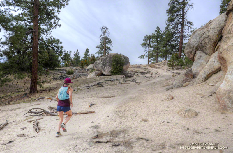
Hiker working up the Sky High Trail on San Gorgonio Mountain in Southern California
Hiker on the Sky High Trail

One of the things I’d been curious to see when running the Kodiak 50K in mid-August was how the summit snow band on San Gorgonio Mountain was holding up. The answer turned out to be fairly well. Now, a few weeks later, I was back on Gorgonio, chugging up the South Fork Trail, and on my way to see if any snow remained on the mountain.

Runoff from thunderstorms during the week had left the trail rocky and rutted. From the views of the mountain I’d glimpsed from the trail, I wondered if the rain had also washed away any remaining patches of snow.

Snow band near the summit of San Gorgonio Mountain. September 7, 2019.
Snow band near the summit of San Gorgonio Mountain on September 7, 2019.

In addition to that question, I also want to follow up on my earlier “field checks” this Summer and see how much water there was in Dry Lake, and if any snow remained in the avalanche debris above Dry Lake.

I was about a quarter-mile from the Dry Lake – Dollar Lake junction at South Fork Meadows, making decent time, when I heard footsteps behind me. I stepped to the side so he could pass, and we talked as we worked up the trail. Kevin said he’d been climbing in the Sierra just about every weekend and was really well-acclimated.

I asked him what route he was doing to the summit, and he said the Dry Lake route. I told him I was doing the Dollar Lake Trail route up and the Dry Lake route down. He was clearly moving faster than me and said he was shooting for a time of 4:20 to the summit. I mentioned the Dollar Lake route was shorter and faster, and depending on the number of stops for photos, I expected to get to the summit in around 3:45. We talked about some Sierra peaks and being in the mountains, and after a couple of minutes, he began to pull away.

Trail runner at Dry Lake on San Gorgonio Mountain
Dry Lake on September 7, 2019.

The early morning temperature had been a little more chilly than my earlier trips up Gorgonio this Summer. I debated pulling on my sleeves, but by the time I was in the sun on the Dollar Lake Trail, the temperature had warmed to a comfortable 50-something — perfect for ascending the peak.

The summit of San Gorgonio was a very busy place when I arrived. I’d estimate 40-50 people were on or around the summit. Most were part of one huge group that had come up Vivian Creek.

The good news was part of the summit snow band had not melted. Wow! It was September 7, and there was still snow in Southern California!

Copernicus Sentinel satellite imagery of snow on San Gorgonio Mountain on August 27, 2019.

Kevin caught up to me on the descent of the Sky High Trail. We’d both made the summit within a couple of minutes of our projections, leaving little doubt that the Dollar Lake Trail is the fastest route to the summit from the South Fork Trailhead.

I didn’t see any snow remaining in the avalanche debris above Dry Lake. The lake itself was in great shape, and the streams at South Fork Meadows were flowing nearly as vigorously as they had been a month ago.

I’ve added a couple of photos from this trip to the San Gorgonio Mountain Snow, Avalanches and Glaciers slideshow.

Update November 26, 2019. A small amount of snow from the 2018-19 season has survived on San Gorgonio Mountain until the first persistent snow of the 2019-20 season! Copernicus Sentinel satellite imagery from November 17, 2019 showed small patches of snow in two areas. The first winter storm of the season brought snow to the mountains a couple days later, and more snow is expected over the Thanksgiving holidays.

Update October 21, 2019. Copernicus Sentinel satellite imagery from October 21, 2019 still showed a few very small patches of snow on San Gorgonio Mountain. One of the patches is at a surprisingly low elevation of about 10,360′.

Update September 18, 2019. Copernicus Sentinel satellite imagery from September 18, 2019 still showed a few small patches of snow on San Gorgonio Mountain.

Related post: San Gorgonio Mountain Snow, Avalanches and Glaciers