Rocketdyne – Sage Ranch Pollution

Refuse in the creek bed between Santa Susana Field Laboratory and Sage Ranch.

Updated 02/21/08.

In late September 2005, the Topanga Fire burned many thousands of acres in the Simi Hills. One of the side effects of the fire was to reveal the extent of the refuse that was in the creek bed that runs east-west between Boeing’s Santa Susana Field Laboratory and Sage Ranch Park.

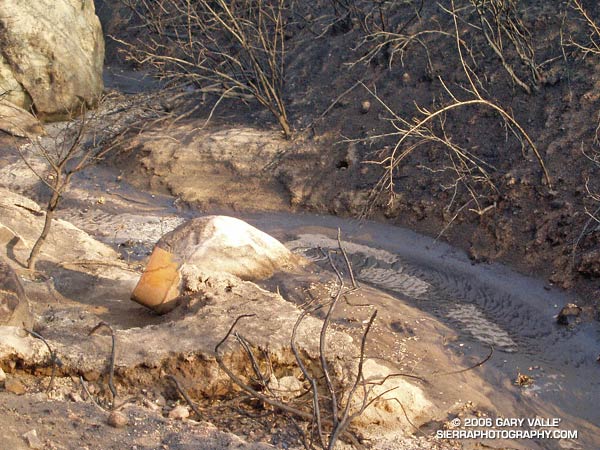
The rusty storage drum in the photograph above is just one of several drums and other refuse I saw partially buried in the sediments of the creek.

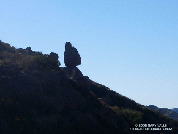
These photographs are from a run at Sage Ranch on October 21, 2005. In March and April 2006 some restoration and other environmental work was done in this area, and some of the refuse pictured may have been removed. The area is recovering from the fire, and the section of the creek bed pictured is now so overgrown it is difficult to tell.

This topographic map shows the location of the creek relative to Sage Ranch and Rocketdyne, and (in red) the Sage Ranch loop trail. The creek is part of the Meier Canyon drainage, which flows into Simi Valley.

Here are some additional sources of information regarding environmental issues in the area:

Department of Toxic Substances Control Santa Susana Field Laboratory Site Investigation and Cleanup Web Site

Department of Toxic Substances Control Project Documents: Santa Susana Field Laboratory

Boeing: About Us – Environment – Santa Susana Field Laboratory

Wikipedia: Santa Susana Field Laboratory

Balance Rock

Balance Rock above Echo Cliffs.

My plan had been to run out the Mishe Mokwa Trail to the Backbone Trail, and then head west towards Sycamore Canyon. I needed to be back in the Valley before noon, so about an hour out I would head back. Running past Echo Cliffs, I tried to pick out some of the steep climbing routes, and contemplated delicately perched Balance Rock. Sections of the trail facing into the morning sun are already warm, but shaded areas are cool and pleasant. Unlike the hot weather at the end of July, it isn’t like running in Death Valley.

By the time I reached the idyllic, oak-shaded area at Split Rock, I’d pretty much forgotten about Balance Rock and was trying to recall the trail choices ahead. But as I rounded a corner, I couldn’t help but notice a small spur trail marked with a sign announcing “Balance Rock – Not a NPS Maintained Trail.”

The last couple of times I had been on the Mishe Mokwa trail, I’d been on long point to point runs, and couldn’t be impulsive. Not so this time – so I hung a right and went to check out the rock. Here is a closer view.

The rocks of this area owe their striking appearance to a dramatic geologic history. The Dibblee geology map indicates that Boney Mountain, Echo Cliffs, and the summit of Sandstone Peak are exposures of 16.1 to 13.1 million year old Conejo Volcanics, probably deposited as volcanic talus and debris-flows.

After taking a few photos, I returned to the Mishe Mokwa Trail, and jogged up to the Backbone Trail. Out of time, I had no choice but to turn east on the Backbone Trail and return to the car. On the way back I did take a few extra minutes to run up the short spur trail to the summit of 3111 ft. Sandstone Peak, the highest point in the Santa Monica Mountains.

The Mishe Mokwa – Sandstone Peak loop has much to recommend it. In terms of scenic value per mile, the approximately 6 mile loop is hard to beat. This National Park Service PDF provides additional information and a trail map of the Circle X Ranch area.

Note: The mileage figure does not include the side trip to Balance Rock. The use trail to the rock – at least the one I followed – was brushy in a few spots.

Seeing Red

Indian Paintbrush (Castilleja affinis) in Cheeseboro Canyon.

In this case, Indian Paintbrush (prob. Castilleja affinis), Scarlet LarkSpur (Delphinium cardinale), and Indian Pink (Silene laciniata) in the Cheeseboro Canyon area of Southern California.

As is the case with many wildfires, one of the side effects of the 2005 Topanga Fire has been to promote a population explosion in many species of wildflowers. Scarlet Larkspur has been especially prevalent in some areas, such as upper Cheeseboro Canyon.

These photos were taken on a run to Simi Peak from the Las Virgenes Rd. trailhead of the Upper Las Virgenes Open Space Preserve on June 11, 2006. I like to go out via upper Las Virgenes Canyon, and come back through Cheeseboro Canyon. This variation is about 16 miles, with an elevation gain and loss of about 2000 ft. The run can be extended to about 21 miles by starting at El Scorpion Park, near Vanowen and Valley Circle. Following are links to trail maps for Upper Las Virgenes Canyon Open Space Preserve and Cheeseboro/Palo Comado Canyons.

Related post: Simi Peak Out & Back

Humboldt Lily

Humboldt Lily (Lilium humboldtii ssp. ocellatum) in Upper Las Virgenes Canyon Open Space Preserve.

I had been running for nearly an hour, and the heat was oppressive. Following an unusually cool Spring, it had been tough to adjust to afternoon temperatures of nearly 100 degrees. Running from the Victory Trailhead of the Upper Las Virgenes Canyon Open Space Preserve, the exposed “main drag” had been like an oven. The refreshing green hills of Spring had turned a golden brown, and the muddy ruts of a Ranger’s truck had been baked to the hardness of concrete. In Las Virgenes Canyon there had still been a little water in the creek, and I had scooped water into my hat and poured the cooling liquid over my head and down my back.

That had been a couple miles ago. Now the best the stream could do is turn the trail sandy as it snaked along the canyon. Running through the broken shadows of Oaks, Willows and Sycamores, I rounded a corner, and could only exclaim, “Wow!”

If the red of a Snow Plant is startling to see on the forest floor, then seeing the gold and burgundy of a Humboldt Lily (Lilium humboldtii ssp. ocellatum) in a shaded corner of this sizzling landscape is at least surprising. This showy lily is a California native, not an escaped ornamental. It occurs sporadically in shaded canyon bottoms, often near stream courses. Because of its specific habitat, it is relatively uncommon. As a result it is listed in the California Native Plant Society’s Inventory of Rare and Endangered Plants as being uncommon and fairly endangered in California.

(Photograph from yesterday, June 22, 2006.)