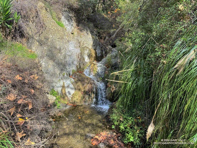
The Temescal Canyon “waterfall” is an immensely popular cascade, most often accessed from Temescal Gateway Park using the Temescal Canyon Trail. Judging from the number of people on the trail, a loop incorporating the Temescal Canyon and Temescal Ridge Trails is also very popular.
Even though many refer to it as a waterfall, it’s not a dramatic river-wide fall, such as Nevada Fall in Yosemite. Picture a Japanese garden with a gurgling little stream, cascading down through rocks into a pool, surrounded by an artistic arrangement of plants and trees. There’s even the requisite bridge to complete the composition. It would be meditative if it were not so popular.
Over the past few weeks, I’ve run from the Top of Reseda (Marvin Braude Mulholland Gateway Park) to the Temescal Canyon Cascade two ways — a 15-mile out-and-back and a 21-mile loop.
The out-and-back route from the Top of Reseda was one of those “I’ll just go a little bit farther” runs. It had rained the day before and the NWS forecast called for a chance of showers in the morning and then showers likely in the afternoon.
With the weather unsettled, I didn’t have a particular plan in mind. When I started the run, it looked like it might rain at any time, so I decided to run to Temescal Peak, and then play it by ear from there. Once on Temescal Peak, the weather seemed to be holding, so I continued to Temescal Lookout. From the Lookout, Green Peak was just a “little bit further,” and in a few minutes, I was standing on top.
I continued to be drawn down Temescal Ridge in this fashion, and before I knew it was at the junction of the Temescal Ridge and Temescal Canyon Trails. From there, it was only a half-mile down to the cascade.
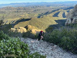
Two weeks later, I was back at the Top of Reseda. It had rained an inch and a half in Downtown Los Angeles a couple of days before, and a well-advertised multi-day rain event was forecast to begin the following day.
The previous weekend, a friend and I had climbed/run to Sandstone Peak from Wendy Drive. Temps in the sun reached into the 80s, and maybe I talked too much and ate and drank too little. On the way back, I hit the wall near the turn onto the Upper Sycamore Trail.
This morning, I had no idea how my legs were going to feel. My loosely defined plan was to run out the Rogers Road segment of the Backbone Trail from the Top of Reseda and see. If the legs held up, I’d continue to Will Rogers State Historic Park. If not, maybe I’d do Goat Peak or something else.
The temperature was in the 40s most of the way down to Will Rogers. With the cool weather, it seemed my running was back to normal. From Will Rogers, I headed over to Rivas Canyon, where I found Sierra Club volunteers hard at work on the Rivas Canyon Trail. This enjoyable trail links Will Rogers to Temescal Canyon and is a key part of the loop.
Once down in Temescal Canyon, there was a constant stream of hikers going up the Temescal Canyon Trail to the cascade. With the recent rain and good weather, the cascade had more water and more people than on the run in January. A large group rested near the bridge, and hikers hustled and bustled up and down the trail. The little cascade gurgled and burbled in the morning sun, glistening bubbles popping up beneath the plunging stream and then disappearing as they wandered downstream.
Soon, I was chugging up the trail toward its junction with the Temescal Ridge Trail, retracing my steps from two weeks before.
Some related posts:
– Will Rogers – Rivas Canyon – Temescal Canyon Trail Run
– Go Figure: An Extended Version of the Will Rogers – Temescal Canyon Loop
– Sandstone Peak from Wendy Drive
