Tag Archives: backbone trail

Backbone Trail Run: Encinal Canyon to Triunfo Peak

A eucalyptus tree marks the Triunfo Peak Access trail on the Yerba Buena segment of the Backbone Trail
The Triunfo Peak Access trail forks off the Backbone Trail at a prominent eucalyptus tree.

Following more wet weather, I was back on the Backbone Trail and running in the direction of Mishe Mokwa from the Encinal Canyon trailhead. But this time, instead of going to Mishe Mokwa, I planned to do an out-and-back run to Triunfo Peak (2658′).

Echo Cliffs from Yellow Hill Fire Road on Triunfo Peak (thumbnail).
Echo Cliffs from Yellow Hill Fire Road on Triunfo Peak. Click to enlarge.

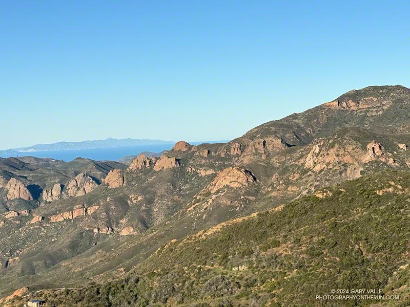
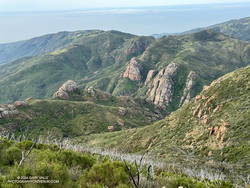
Whenever I’ve been on the Yerba Buena segment of the Backbone Trail, I’ve been curious about this peak. Situated on the crest of the Santa Monica Mountains, east of Sandstone Peak, it seemed like it might be an outstanding viewpoint, and I wasn’t disappointed.

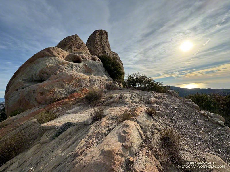
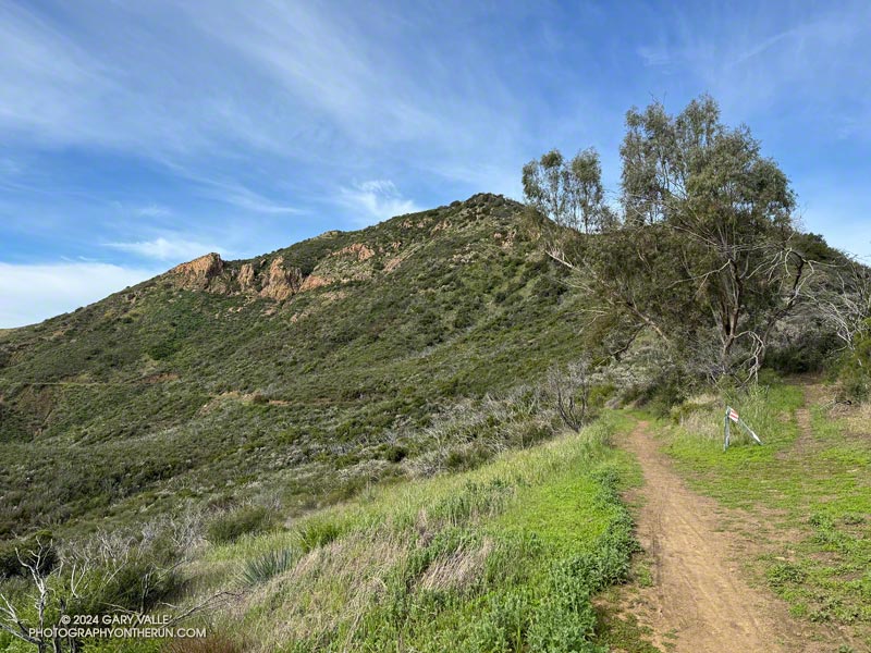
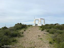
About a half-mile up the Backbone Trail from the Encinal Canyon trailhead, I was surprised to be able to get a glimpse of the peak. Historic topo maps labeled the fire lookout on Triunfo Peak as “Triunfo Lookout” and now the peak is often referred to by that name.

Rock formations near the Grotto from Triunfo Peak (thumbnail).
Rock formations near the Grotto. Click to enlarge.

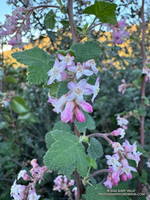
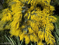
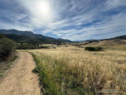
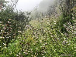
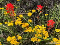
It was another beautiful morning on the Backbone Trail. A chilly 39 degrees at the trailhead, it warmed quickly as I ran up the trail toward Mulholland Highway and then Etz Meloy Mtwy fire road. The bloom of bigpod Ceanothus was in full swing, and the lilac blooms of hairy-leaved Ceanothus were already following suit.

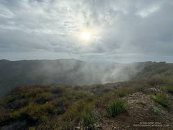
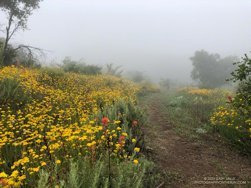
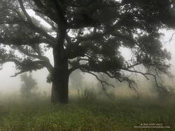
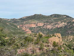
Thin high clouds veiled the sun and muted the scene as I descended the Backbone Trail to Yerba Buena Road. To the west Triunfo Peak/Lookout, Boney Mountain, and Sandstone Peak filled the skyline, their rocky prominences inviting further exploration.

Summit of Triunfo Peak (thumbnail).
Summit of Triunfo Peak. Click to enlarge.

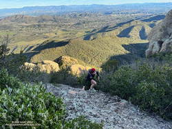
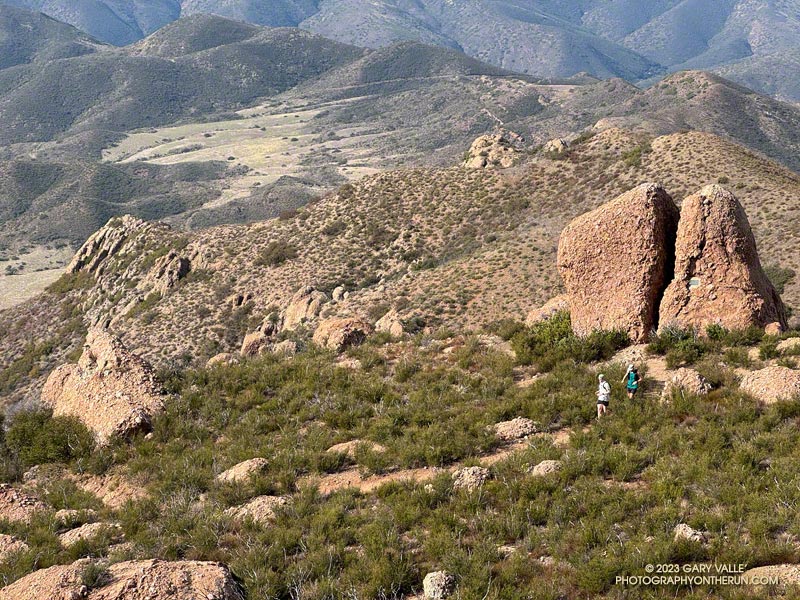
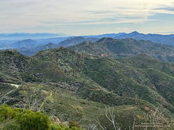
About two miles west of the Yerba Buena Road, a makeshift sign indicated where the trail to the peak could be accessed. In 40-50 yards the side trail led to Yellow Hill Fire Road — the old lookout service road. It had recently been cleared of brush. From the sign on the Backbone Trail, it was about three-quarters of a mile to the top of the Triunfo Peak, with an elevation gain of about 380 feet.

According to the Former Fire Lookout Sites Register and Fire Lookouts websites, the lookout on Triunfo Peak was established in the early 1930s and taken out of service in the late 1960s. A steel lookout tower originally on Blue Ridge in Angeles National Forest was first moved to Bodle Peak around 1930, then moved and reassembled on Triunfo Peak in 1935.

View east from Triunfo Peak along the crest of the Santa Monica Mountains (thumbnail).
View east from Triunfo Peak along the crest of the Santa Monica Mountains. Click to enlarge.

The photograph of the lookout tower when it was on Blue Ridge suggests the shrine-like concrete structure found on the summit of Triunfo Peak is the footing for the tower. Google Earth imagery shows a similarly-sized footing on Bodle Peak -— a square a little larger than eight feet on a side. The tower is  described  as having an “8×8 observation cabin.”

A short connector trail is being constructed on the wet/northwest side of Trunfo Peak. When the trail is complete, it will connect the Backbone Trail to Yellow Hill Fire Road, near the summit of Triunfo Peak. The new trail will enable those doing the Backbone Trail to climb Triunfo Peak and return to the Backbone Trail without backtracking.

Related post: Rainy Season Trail Running on the Backbone Trail

Rainy Season Trail Running on the Backbone Trail

Rock formations below Triunfo Lookout, with the Channel Islands in the distance. From the Etz Meloy section of the Backbone Trail.
The Backbone Trail contours around Triunfo Peak (on the right) above the rock band that extends across the photo. The Channel Islands are in the distance.

The Backbone Trail between Encinal Canyon and Mishe Mokwa is one of the must-do sections of the 68-mile trail. Engineered to be multi-use, this exceptionally scenic stretch of the Backbone Trail is popular with riders, hikers, and runners alike.

Chaparral Currant (Ribes malvaceum) blooming along the Backbone Trail (Thumbnail)
Chaparral Currant

It’s also a pretty good place for a trail run after rainy weather like we’ve had this February. Although the parking lot at the Encinal Trailhead was quite wet this morning, the  Backbone Trail was in decent shape most of the way to the Mishe Mokwa trailhead. There were a few muddy and wet spots, but it was generally easy to work around them. And I didn’t have to change my shoes before driving home.

The out & back run worked out to about 21-miles, with a surprisingly moderate gain/loss of about 2500′. The weather and visibility were excellent. Striking rock formations and the Channel Islands could be seen from one side of Etz Meloy Mtwy fire road, and snow on Alamo Mountain and other Ventura County peaks from the other side.

On the way back, as I was working up the long hill on the northwest side of Triunfo Lookout, a descending mountain biker commented that a large group of bikers were at “the corner.” The overlook at this prominent switchback has a wide-ranging view of Mishe Mokwa, Boney Mountain, and Sandstone Peak, and some prefer to turn around here. This variation is about 3.5 miles shorter (round-trip) than dropping down into the canyon and going all the way to Mishe Mokwa.

Explore the scenery and terrain on the Backbone Trail of this out-and-back trail run and hike from Encinal Canyon to Mishe Mokwa using our high resolution,  interactive, 3D viewer. The imagery is so detailed, it’s almost like being there! To change the view, use the control on the upper right side of the screen, the CTRL key and your mouse, or touch gestures. Track and placename locations are approximate and subject to errors. Poor weather, and other conditions may make this route unsuitable for this activity. Here’s  an elevation profile of the route.

Some related posts:
Encinal Canyon to Mishe Mokwa Out and Back Trail Run
Kanan to Mishe Mokwa and Back
Kanan to Mishe Mokwa to Wendy Drive
Night Training for the Backbone Ultra

Running to the Temescal Canyon Cascade From the Top of Reseda (Two Ways)

Temescal Canyon Cascade

The Temescal Canyon “waterfall” is an immensely popular cascade, most often accessed from Temescal Gateway Park using the Temescal Canyon Trail. Judging from the number of people on the trail, a loop incorporating the Temescal Canyon and Temescal Ridge Trails is also very popular.

Even though many refer to it as a waterfall, it’s not a dramatic river-wide fall, such as Nevada Fall in Yosemite. Picture a Japanese garden with a gurgling little stream, cascading down through rocks into a pool, surrounded by an artistic arrangement of plants and trees. There’s even the requisite bridge to complete the composition. It would be meditative if it were not so popular.

Cloud-shrouded view northwest from Temescal Peak to the Cathedral Rocks/Hub area. (Thumbnail)
Cloud-shrouded view of the Cathedral Rocks/Hub area.

Over the past few weeks, I’ve run from the Top of Reseda (Marvin Braude Mulholland Gateway Park) to the Temescal Canyon Cascade two ways — a 15-mile out-and-back and a 21-mile loop.

The out-and-back route from the Top of Reseda was one of those “I’ll just go a little bit farther” runs. It had rained the day before and the NWS forecast called for a chance of showers in the morning and then showers likely in the afternoon.

High Point (Goat Peak) from Temescal Ridge. (Thumbnail)
High Point (Goat Peak) from Temescal Ridge.

With the weather unsettled, I didn’t have a particular plan in mind. When I started the run, it looked like it might rain at any time, so I decided to run to Temescal Peak, and then play it by ear from there. Once on Temescal Peak, the weather seemed to be holding, so I continued to Temescal Lookout. From the Lookout, Green Peak was just a “little bit further,” and in a few minutes, I was standing on top.

I continued to be drawn down Temescal Ridge in this fashion, and before I knew it was at the junction of the Temescal Ridge and Temescal Canyon Trails. From there, it was only a half-mile down to the cascade.

Scrambling up Boney Mountain's Western Ridge (aka Mountaineer's Route) on an adventure run to Sandstone Peak. (Thumbnail)
Scrambling up Boney Mountain’s Western Ridge

Two weeks later, I was back at the Top of Reseda. It had rained an inch and a half in Downtown Los Angeles a couple of days before, and a well-advertised multi-day rain event was forecast to begin the following day.

The previous weekend, a friend and I had climbed/run to Sandstone Peak from Wendy Drive. Temps in the sun reached into the 80s, and maybe I talked too much and ate and drank too little. On the way back, I hit the wall near the turn onto the Upper Sycamore Trail.

Cootamundra wattle (Acacia baileyana) in Will Rogers State Historic Park. (Thumnbnail)
Cootamundra wattle at Will Rogers.

This morning, I had no idea how my legs were going to feel. My loosely defined plan was to run out the Rogers Road segment of the Backbone Trail from the Top of Reseda and see. If the legs held up, I’d continue to Will Rogers State Historic Park. If not, maybe I’d do Goat Peak or something else.

The temperature was in the 40s most of the way down to Will Rogers. With the cool weather, it seemed my running was back to normal. From Will Rogers, I headed over to Rivas Canyon, where I found Sierra Club volunteers hard at work on the Rivas Canyon Trail. This enjoyable trail links Will Rogers to Temescal Canyon and is a key part of the loop.

Cactus and agave along the Rivas Canyon Trail. (Thumbnail)
Cactus and agave along the Rivas Canyon Trail.

Once down in Temescal Canyon, there was a constant stream of hikers going up the Temescal Canyon Trail to the cascade. With the recent rain and good weather, the cascade had more water and more people than on the run in January. A large group rested near the bridge, and hikers hustled and bustled up and down the trail. The little cascade gurgled and burbled in the morning sun, glistening bubbles popping up beneath the plunging stream and then disappearing as they wandered downstream.

Soon, I was chugging up the trail toward its junction with the Temescal Ridge Trail, retracing my steps from two weeks before.

Some related posts:
Will Rogers – Rivas Canyon – Temescal Canyon Trail Run
Go Figure: An Extended Version of the Will Rogers – Temescal Canyon Loop
Sandstone Peak from Wendy Drive

A Displaced Bridge, Exceptional Backbone Trail Views, and a Card Table Along the Bulldog Loop

Rock formation along the Backbone Trail. Photography by Gary Valle'

The photograph above was taken a few steps off the Backbone Trail, between the Corral Canyon Trailhead and Mesa Peak Motorway fire road. Also in the area was a set of table and chairs that might be used for an ocean-view card game or a lunch break.

These scenes were about halfway through a variation of the Bulldog Loop that starts/ends at the Cistern Trailhead on Mulholland Highway. The route follows the Cistern, Lookout, and Cage Creek Trails down to the Crags Road Trail, just east of where it crosses Malibu Creek.

A permanent bridge used to span the creek, but after being washed out several times in Winter floods, a “seasonal” bridge was put in place. The seasonal bridge is removed when there is a threat of flooding, such as during the rainy season.

This morning, the temperature in the canyon was in the mid-thirties. That was cool enough that I didn’t want to get wet, and I hoped the removal of the bridge had been delayed. But several days of rain were in the forecast, and as I neared the creek, I could see the bridge now lay alongside trail.

A log spanned the creek where the bridge once stood. Using a suitable stick as a hiking pole, it was easy to cross the log, stay dry, and continue the loop.

Some related posts:
Best Trailhead to Start the Bulldog Loop?
Bulldog Loop Plus the Phantom Loop
After the Woolsey Fire: Bulldog Loop

Which Stretch of the Backbone Trail Has the Longest Uninterrupted Descent and Most Elevation Loss?

Runners descending the Backbone Trail pass Chamberlain Rock.

It’s a section of the westbound Backbone Trail that starts two miles west of Sandstone Peak and continues down the Chamberlain, Old Boney, and Blue Canyon Trails to the Danielson Multi-Use Area and Big Sycamore Canyon Fire Road. At the point where the trail turns south on the fire road, it has dropped about 2400 feet in 4.8 miles. Continuing south on the fire road, the Backbone Trail gradually descends another 100 feet over a mile and a half until it starts up the Wood Canyon Vista Trail.

What about the long downhill between Saddle Peak and Malibu Canyon? That would be a contender if it weren’t for a gradual uphill that starts a little east of the Piuma Road crossing. It gains about 180 feet over 0.8 mile. If that break in the downhill is ignored, then the stats for the two descents are similar.

Boney Mountain from Satwiwa.

This morning, I did the Backbone Trail segment from Sandstone Peak to the Danielson Multi-Use Area as part of a loop from the Wendy Drive Trailhead on Potrero Road in Newbury Park. Including the optional side trip to Sandstone Peak, the loop totals about 18 miles with around 4000′ gain/loss.

Fires and heavy rain the past decade have taken their toll on the Backbone Trail and other trails in the Santa Monica Mountains. Today, except for a short stretch near Chamberlain Rock, most of the long downhill was in decent shape and enjoyable to run.

Here’s an interactive, 3D terrain view of a GPS trace of my route. The eastern ridge route is also shown. The map can be zoomed, tilted, rotated, and panned using the navigation control on the right. Track and placename locations are approximate and subject to errors. Poor weather and other conditions may make this route unsuitable for this activity.

Some related posts:
Not So Busy Sandstone Peak
Looking for Boney Mountain
Backbone Trail Mystery

A Really Overgrown Trail, Thirty Creek Crossings, and Thousands of Wildflowers

Yarrow and paintbrush along the Old Boney Trail in Pt. Mugu State Park.
Old Boney Trail in Pt. Mugu State Park.

Starting at the Wendy Drive Trailhead, I’d crossed Satwiwa, run down Danielson Road, rock-hopped across Upper Sycamore Creek, and picked up the Old Boney Trail. The condition of the Old Boney Trail between Danielson Road and the Fossil Trail junction was better than expected. Maybe the trail was going to be in good shape after all.

A section of the Old Boney Trail overgrown with black sage following the wet rain season of 2022-2023.
A section of the Old Boney Trail overgrown with black sage.

Wrong! Once I passed the turnoff to the Fossil Trail, the vegetation closed in. In places it was so thick I couldn’t see the trail at my feet, much less a few yards ahead. All I could do is smile and work my way through it. Everything was overgrown — bushes, grasses, wildflowers. And everything was wet with dew. A hundred yards past the Fossil Trail, I was soaked from head to toe.

I tried to see the positive. It was an amazing display of the effect of a wet rainy season. Without trail work and use, it wouldn’t take long for the trail to be completely consumed.

The Old Boney Trail continued to be a tangle of chaparral for about two miles — until I reached the Backbone Trail at Blue Canyon. At that point, it becomes part of the Backbone Trail system, and I was relieved to see that some work had recently been done on the trail.

Coast live oak and fog along the Old Boney Trail in Pt. Mugu State Park.
Coast live oak along the Old Boney Trail.

As I worked up the Backbone Trail toward the Chamberlain Trail junction, I recalled other times I’d run to Serrano Valley using Old Boney. What would the condition of the trail be beyond this point? I’d been on that part of the Old Boney Trail following a wet rain season and knew how overgrown it could be. Some refer to that section of trail as “tick alley.”

But when I got to the junction, surprise, surprise, the Old Boney Trail had been trimmed. More than two miles of trail were groomed. It was good all the way to the Serrano Valley Trail and partway into Serrano Valley. The trail in Serrano Valley was a little overgrown, but NOTHING like the Old Boney Trail between the Fossil and Backbone Trails.

Part of the fun of doing this route is all the stream crossings in Serrano Canyon — what is it 13 or 14? Today, most of these could be done without getting your shoes wet — especially if you have poles. I didn’t have poles, and my shoes and socks were already wet, so I didn’t worry about keeping them dry. Some sections of the Serrano Canyon Trail were also overgrown, but not bad. However, there was a lot of poison oak, some of which wasn’t avoidable.

Paintbrush and golden yarrow along Sycamore Canyon Fire Road in Pt. Mugu State Park.
Paintbrush and golden yarrow

After getting a drink of water at the faucet at the junction of the Serrano Canyon Trail and Sycamore Canyon Fire Road, I headed up-canyon. Almost immediately, the fire road crossed Big Sycamore Canyon Creek. I did this first crossing without getting my shoes wet, but nine more crossings followed, and most resulted in soaked shoes. The water crossings and wildflowers helped distract me from the five mile run up Sycamore Canyon to the Upper Sycamore Trail.

Getting off Sycamore Canyon Road and onto the Upper Sycamore Trail was a relief. Whatever run I do from Wendy Drive, I always finish it via this trail. The trail gets enough use that it was in good shape. This time all the creek crossings could easily be rock-hopped.

Even with a few tedious sections, it was an adventurous and mostly enjoyable 20 miles. Here are some photos taken along the way.

Some related posts: Old Boney to Serrano Valley, Plus Fireline and Overlook; Looking for Ogres in Serrano Canyon; Running to Serrano and La Jolla Valleys from Wendy Drive; You Can’t Run Just Part Way Up Serrano Canyon