It’s uncommon to have back-to-back Rain Years with 20+ inches of rain in Los Angeles. During Rain Year 2022-2023, Downtown Los Angeles (USC) recorded 28.4 inches of rain — about two times normal. This rain year Los Angeles has already had about 21 inches of rain, so another big year is in progress.
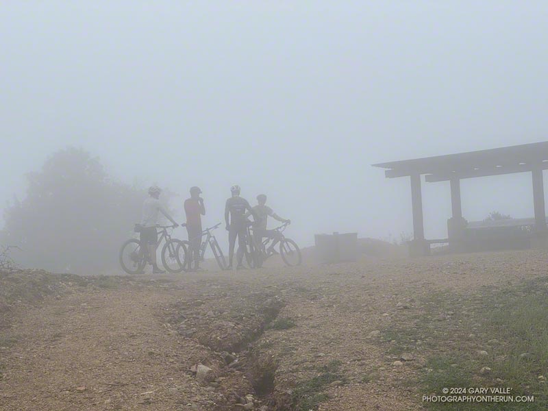
Curious to see how the trail conditions compare to last year, on February 17th and 25th I ran the Trippet Ranch Loop in Topanga State Park.
The big surprise was that the fire roads on the loop — Fire Road #30, Eagle Springs Fire Road, and a short section of Eagle Rock Fire Road — generally fared better than last year. Fire Road #30 had some damage along it’s shoulder, but I did not see the numerous mudslides along these roads like last year.
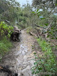
A little mud on the Musch Trail.
The news on the trails was divided. One of the more unusual events occurred where the Garapito Trail crosses the east fork of Garapito Creek. A mudslide from a gully on the northwest side of the creek crossed the creek, and left a pile of debris on the trail. The stream may have been dammed by mud and debris for a short time. Farther up the trail, about a half-mile from Eagle Rock Fire Road, a section of the trail collapsed in a slide.
The Temescal Canyon “waterfall” is an immensely popular cascade, most often accessed from Temescal Gateway Park using the Temescal Canyon Trail. Judging from the number of people on the trail, a loop incorporating the Temescal Canyon and Temescal Ridge Trails is also very popular.
Even though many refer to it as a waterfall, it’s not a dramatic river-wide fall, such as Nevada Fall in Yosemite. Picture a Japanese garden with a gurgling little stream, cascading down through rocks into a pool, surrounded by an artistic arrangement of plants and trees. There’s even the requisite bridge to complete the composition. It would be meditative if it were not so popular.
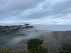
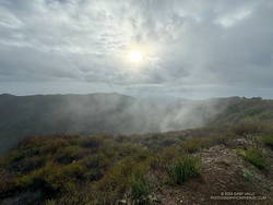
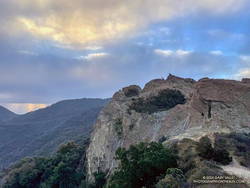
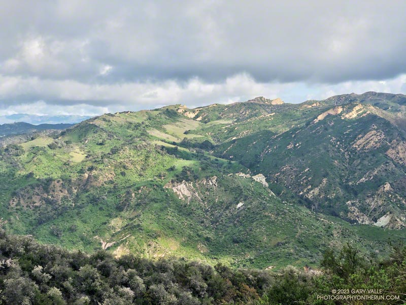
Cloud-shrouded view of the Cathedral Rocks/Hub area.
Over the past few weeks, I’ve run from the Top of Reseda (Marvin Braude Mulholland Gateway Park) to the Temescal Canyon Cascade two ways — a 15-mile out-and-back and a 21-mile loop.
The out-and-back route from the Top of Reseda was one of those “I’ll just go a little bit farther” runs. It had rained the day before and the NWS forecast called for a chance of showers in the morning and then showers likely in the afternoon.
High Point (Goat Peak) from Temescal Ridge.
With the weather unsettled, I didn’t have a particular plan in mind. When I started the run, it looked like it might rain at any time, so I decided to run to Temescal Peak, and then play it by ear from there. Once on Temescal Peak, the weather seemed to be holding, so I continued to Temescal Lookout. From the Lookout, Green Peak was just a “little bit further,” and in a few minutes, I was standing on top.
I continued to be drawn down Temescal Ridge in this fashion, and before I knew it was at the junction of the Temescal Ridge and Temescal Canyon Trails. From there, it was only a half-mile down to the cascade.
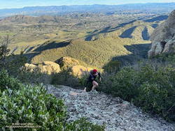
Scrambling up Boney Mountain’s Western Ridge
Two weeks later, I was back at the Top of Reseda. It had rained an inch and a half in Downtown Los Angeles a couple of days before, and a well-advertised multi-day rain event was forecast to begin the following day.
The previous weekend, a friend and I had climbed/run to Sandstone Peak from Wendy Drive. Temps in the sun reached into the 80s, and maybe I talked too much and ate and drank too little. On the way back, I hit the wall near the turn onto the Upper Sycamore Trail.
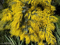
Cootamundra wattle at Will Rogers.
This morning, I had no idea how my legs were going to feel. My loosely defined plan was to run out the Rogers Road segment of the Backbone Trail from the Top of Reseda and see. If the legs held up, I’d continue to Will Rogers State Historic Park. If not, maybe I’d do Goat Peak or something else.
The temperature was in the 40s most of the way down to Will Rogers. With the cool weather, it seemed my running was back to normal. From Will Rogers, I headed over to Rivas Canyon, where I found Sierra Club volunteers hard at work on the Rivas Canyon Trail. This enjoyable trail links Will Rogers to Temescal Canyon and is a key part of the loop.
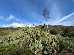
Cactus and agave along the Rivas Canyon Trail.
Once down in Temescal Canyon, there was a constant stream of hikers going up the Temescal Canyon Trail to the cascade. With the recent rain and good weather, the cascade had more water and more people than on the run in January. A large group rested near the bridge, and hikers hustled and bustled up and down the trail. The little cascade gurgled and burbled in the morning sun, glistening bubbles popping up beneath the plunging stream and then disappearing as they wandered downstream.
Soon, I was chugging up the trail toward its junction with the Temescal Ridge Trail, retracing my steps from two weeks before.
Lately, I’ve been doing another option — adding an out and back from the Hub to Temescal Peak and Temescal Lookout and then continuing on the Trippet Ranch Loop from the Hub.
This extends the run to about 16 miles, plus Temescal Peak and Temescal Lookout are excellent viewpoints (video).
California fuchsia along Fire Road #30, near the Hub.
Downtown Los Angeles (USC) finished the 2022-2023 Water Year with 31.07 inches of rain, making it the seventh wettest on record in Los Angeles. The rainfall total includes about three inches of rain from former Hurricane Hilary as it moved through Southern California as a rare tropical storm and post-tropical cyclone.
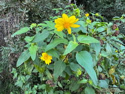
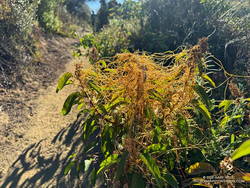
Canyon sunflower blooming out of season along Fire Road #30.
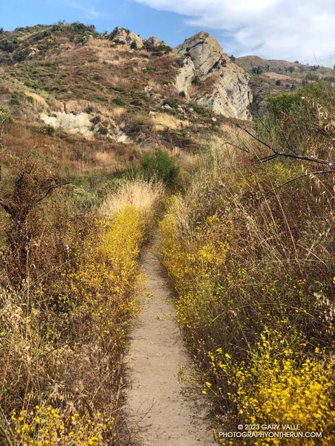
The effects of all that rain can be seen on just about any trail in Southern California. It has resulted in a false Spring in many areas, with greening hills, out-of-season wildflowers, flowing creeks, and profuse growth throughout the area.
This morning, I returned to the Top of Reseda and Topanga State Park to do a variation of the Trippet Ranch Loop and continue exploring and enjoying the unusual conditions.
After running up to the Hub, this variation does an out and back to Temescal Peak and Temescal Lookout. After returning to the Hub, the route continues on Eagle Springs Fire Road down to Trippet Ranch. From Trippet Ranch, it works back to the Top of Reseda using the Musch and Garapito Trails and connecting sections of fire road. This interactive, 3D terrain map shows a GPS track of the trail run.
Dodder growing on laurel sumac on the Musch Trail.
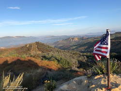
Visiting Temescal Peak and Temescal Lookout increases the run’s mileage from 12.5 miles to 16. On a clear day, the runner is rewarded with far-reaching views of the coast, West L.A., Downtown, and the surrounding mountains.
While most of the roads and trails on this route are frequently used and in decent condition, the Garapito Trail has been overgrown all Summer. As of October 8, it was still overgrown. Some people I’ve encountered on the trail were OK with this, but others haven’t been so happy. If desired, the trail can be bypassed by continuing to the Hub on Eagle Rock Fire Road and retracing your route back to the Top of Reseda.
The 17.5-mile Trailer Canyon – Santa Ynez Canyon Trail – Trippet Ranch Loop is a longer version of the venerable Trippet Ranch loop from the Top of Reseda. It might also be called the Three Vistas Loop because it visits three high points in Topanga State Park with 360-degree, panoramic views.
Eagle Rock from Temescal Peak.
The run starts and ends the same as the Trippet Ranch Loop. After running up to the Hub on Fire Road #30, instead of continuing straight on Eagle Springs Fire Road, this route turns left on Temescal Ridge Fire Road. The fire road is followed up to where the Backbone Trail single-track forks left off the road. The Backbone Trail is followed a tenth of a mile east, where a path leads up and left to the top of Temescal Peak.
The view from this little peak is superb. On a day with good visibility, the view can extend beyond Mt. Baldy to San Gorgonio Mountain and San Jacinto Peak. The next overlook on this route, Temescal Lookout, is about a half-mile (as the crow flies) to the south. The third overlook, Eagle Rock, is about a mile to the west.
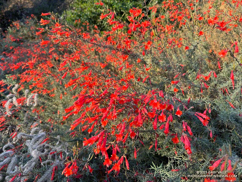
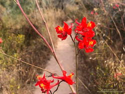
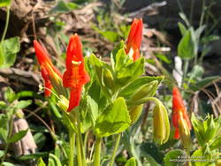
Scarlet larkspur.
From Temescal Peak, the route returns to Temescal Ridge Fire Road. I usually follow the use-trail back down and across the Backbone Trail and then continue on the use-trail to the fire road.
The next stop, Temescal Lookout, is about a mile from the top of Temescal Peak and just off Temescal Ridge Fire Road. When doing this loop, I run up a dirt access road on the north side of the lookout and then descend a use trail on the south side. Once the site of a fire lookout, it also has an excellent view. This photo of Downtown and San Jacinto Peak was taken from the viewpoint.
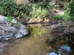
Pool on Santa Ynez Creek.
Once back on Temescal Ridge Fire Road and headed south, it’s less than a half-mile to the turn-off down Trailer Canyon Fire Road and then another 2.3 miles down to Michael Lane in Pacific Palisades. On the way down, there are good views of where the loop is headed next — Santa Ynez Canyon. A large part of Santa Ynez Canyon was burned in the May 2021 Palisades Fire.
After turning right (west) on Michael Lane, the street is followed around and down to Vereda de la Montura. A right turn here leads to the Santa Ynez Canyon Trailhead in about a quarter-mile. This is where some route-finding fun begins.
A bit more than a mile from the trailhead, the Santa Ynez Canyon Trail climbs out of the bottom of the canyon and up onto a broad ridge. Another mile of uphill, and it tops out at Eagle Springs Fire Road. After turning left, it’s less than a half-mile down to the Trippet Ranch parking lot.
Humboldt lily.
The previous weekend I’d done the Trippet Ranch Loop, so knew what the expect on the remainder of the run. Other than being a little overgrown, the Musch Trail was in reasonable shape. There were still some late-season blooms of showy penstemon, yellow monkeyflower, and white snapdragon along the trail. This time of year, the round pincushions of buckwheat are common. Water was available at the start of the Musch Trail and at Musch Camp.
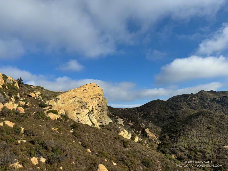
Eagle Rock is the third viewpoint on the loop, and the most popular. The massive rock formation overlooks Santa Ynez Canyon and has an airy, 360-degree view. On a clear day, Santa Monica Bay, Palos Verdes Peninsula, and Catalina can be seen to the south. On weekends, it’s rare to find the top empty. The summit had just been vacated as I climbed up and was reoccupied by another hiker as I walked down.
Returning to Eagle Rock Fire Road, I turned right and continued northeast a tenth of a mile to the top of the Garapito Trail.
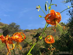
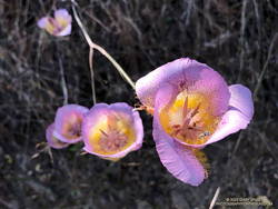
Plummer’s mariposa lily.
A little more than three miles long, the Garapito Trail is one of my favorite trails in the Santa Monica Mountains. Several sections of the trail are overgrown at the moment. At one point, not too far from Fire Road #30, it was necessary to bushwhack through a dense patch of six-foot-tall giant rye grass.
Two lilies listed on the CNPS Inventory of Rare and Endangered Plants of California were blooming along the Garapito Trail — Plummer’s mariposa lily and Humboldt lily. Both plants have a Rare Plant Rank of 4.2, which indicates they are of limited distribution and moderately threatened in California. Thanks to our very wet rain season, the eye-catching red of scarlet larkspur was unusually prevalent along the trail.
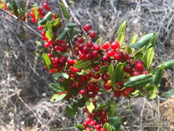
Redberry.
The Garapito Trail ends at Fire Road #30. Normally the route would cross the fire road and follow the Bent Arrow Trail to dirt Mulholland, but the trail was damaged by rainy season storms and is still closed.
Turning left onto Fire Road #30, I retraced my steps from earlier in the morning and in a few minutes was back to the trailhead at the Top of Reseda (Marvin Braude Mulholland Gateway Park).
Upper Santa Ynez Canyon and Eagle Rock from East Topanga Fire Road
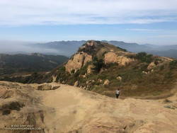
The view from Parker Mesa Overlook was the uniform gray of the inside of a cloud. I was about 30 minutes too early, and the low clouds hadn’t cleared. The Pacific Ocean was out there somewhere.
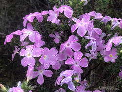
Even so, the run from the Top of Reseda to the Overlook had been excellent. The hills and canyons were painted in a muted palette of sun and shadow. Purple-pink prickly phlox brightened the roadside, and the “Beech-nut Gum” scent of Bigpod Ceoanthus filled the air.
Prickly phlox along East Topanga Fire Road
Fire Road #30, Eagle Springs Fire Road, and East Topanga Fire Road had all been cleared of the sluffs and slides that resulted from January’s rainstorms. Overnight, there had been a little drizzle, but the fire roads hadn’t been muddy at all.
Rather than just retracing my steps, on the way back to the Top of Reseda I opted to do the Musch and Garapito Trails. I had run the Garapito Trail in mid-January but hadn’t been on the Musch Trail since the January deluge.
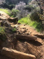
The Trippet Ranch parking lot had been packed, and several groups appeared to be on their way to Eagle Rock via the Musch Trail. Overall, the trail weathered the storms reasonably well, but one badly eroded section and a couple other spots will need some work.
Damaged section of the Musch Trail
While it still had some issues, use of the Garapito Trail had moderated its condition since the last time I was on it. Some brush that had blocked the trail had been removed, and paths were evolving through the collapsed sections of trail. However, some extra care was still required in some spots.
The Bent Arrow Trail was closed, necessitating a return to dirt Mulholland on Fire Road #30, following the same route as had been used at the beginning of the run.
Here is an interactive, 3D terrain view of a GPS track (yellow) to Parker Mesa Overlook from the Top of Reseda. The Bent Arrow Trail is temporarily closed for repair and is shown in red. To change the view, use the control on the upper right side of the screen. Track and placename locations are approximate and subject to errors. Poor weather and other conditions may make this route unsuitable for this activity.