Category Archives: nature|trees

Leaf Vein Networks

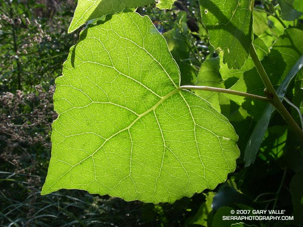
Study of a leaf of a Fremont cottonwood (Populus fremontii) along Las Virgenes Creek in Upper Las Virgenes Canyon Open Space Preserve.

Who hasn’t pondered the intriguing network formed by the interconnected veins of a leaf? Like many apparently complex self-organized structures, there is a recognizable pattern, but the basis of the pattern is difficult to grasp.

Remarkably, research published in 2002 (S. Bohn et al., Phys. Rev. E, June 2002.) found that there is a simple relationship governing the angles between vein segments in the leaves of dicotyledons, and that this relationship is universal. The study also found that the observed vein angles can be reproduced using a simple force model.

Numerical analysis of leaf scans revealed that the angles between vein segments are directly related to the thickness of the segments. When the vein sizes are similar, the connection appears to form a three-way junction with the angle between the veins about 120 degrees. If the vein sizes are dissimilar, with one much larger than the other, the smaller vein joins the larger at about a 90 degree angle.

The photograph is of a leaf of a Fremont cottonwood (Populus fremontii) along Las Virgenes Creek in Upper Las Virgenes Canyon Open Space Preserve. It was taken on a run from the Victory trailhead on May 16, 2007.
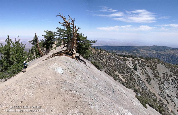
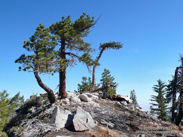
Wally Waldron Limber Pine

A grizzled guardian of the San Gabriel Mountains, the Wally Waldron Tree stands defiantly astride an airy, rock strewn ridge, just below the summit of 9399 ft. Mt. Baden-Powell.

A grizzled guardian of the San Gabriel Mountains, the Wally Waldron Tree stands defiantly astride an airy, rock strewn ridge, just below the summit of 9399 ft. Mt. Baden-Powell.

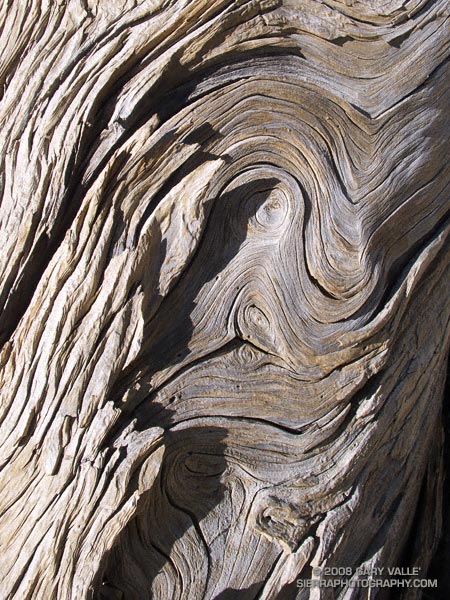
Perched on the brink of the mountain’s precipitous southeast face, the weather-sculpted Limber Pine is at an elevation and in an environment similar to the 4000+ yr. old White Mountain Bristlecone Pines. Burnished and hardened, the tree’s huge, gnarled roots anchor it firmly to the mountain, helping it to resist the whims of weather and time. The tree is estimated to be 1500 years old.

We had stopped to visit the tree part way through an approximately 23.5 mile loop from Islip Saddle. Our route had descended to South Fork Campground (4560′), before climbing back up to Vincent Gap and Mt. Baden-Powell. In a few minutes we would continue to Baden-Powell’s summit, and from there follow the PCT along the crest back to Islip Saddle. Here’s a Google Earth image and Google Earth KMZ file of a GPS trace of the loop.

Water Notes: The little stream on the Manzanita Trail about 1.5 miles from Vincent Gap was still running. The flow from Little Jimmy Spring was lower than normal, but still very reasonable. We did not detour to Lamil Spring.

Related posts: Vincent Gap – Little Jimmy Spring Out & Back, Complications, Heat Wave

Little Jimmy Spring Incense Cedar

A large incense-cedar (Calocedrus decurrens) near Little Jimmy Spring in the San Gabriel Mountains of Southern California.

This is the large incense-cedar (Calocedrus decurrens) mentioned in the post Snowless San Gabriels. It is located on a northeast facing slope near Little Jimmy Spring at an elevation of about 7460′ in the San Gabriel Mountains of Southern California. A vertical panorama better shows the size of this tree.

The scar from the 2002 Curve Fire can be seen on the left side of the tree. The black and white cap is about 7 inches wide and suggests a diameter of perhaps 70-80 inches. According to the species information in the FEIS database, in Southern California the largest incense-cedars generally have a diameter at breast height (d.b.h.) of 36-48 inches, but in the Sierra Nevada frequently reach diameters of 84 inches. According to the database, trees over about 200 years old are subject to dry rot, but large trees are often over 500 years old.

Related posts: Pine Mountain Juniper, Heat Wave, Lightning Tree

Three Points – Mt. Waterman Loop

Trail sign on the Mt. Waterman Trail in the San Gabriel Mountains.

Five miles of (mostly) downhill to go. Running through an old growth forest of Jeffrey Pine, Sugar Pine and Incense Cedar, I relished being on a pine needle covered trail at 7000 ft. in the San Gabriel Mountains.

In a record dry water year, I had been curious to see how the mountains were faring. Although creeks were very low and grasses dry, my impression was that groundwater resources were not quite as bad. The usual springs and seeps still muddied the trail. In 2005 the San Gabriel Mountains were deluged with rain, and in the 2006 the rainfall was nearly normal, so some carryover would be expected.

Update May 27, 2007. My impression of groundwater resources may have been overly optimistic. On a run to Mt. Baden-Powell from Islip Saddle, I stopped by Little Jimmy Spring. It was nearly as low as in late August 2002, when Los Angeles had just experienced its driest water year on record. This year will likely break the 2001-2002 record.

Even so, it was obviously much drier than normal. There were fewer wildflowers, and some young Incense Cedars looked as if they might be stressed. On the plus side, manzanita and currant were blooming in profusion, and perhaps 30-35 scarlet red stalks of snow plant were seen on the loop.

About three miles from Three Points I happened upon another Jeffrey Pine that had been struck by lightning. This strike appeared to more energetic than the bolt that struck the tree on the Baldy North Backbone Trail. The spiral scar was wider and braided at some points, and the strike ignited the tree. Where the Baldy tree was on a sharp ridge crest, this tree was several hundred feet below the main crest in an area where the trail started to work around a projecting ridge.

More about this loop and a Google Earth image of the course can be found in the post Manzanita Morning.