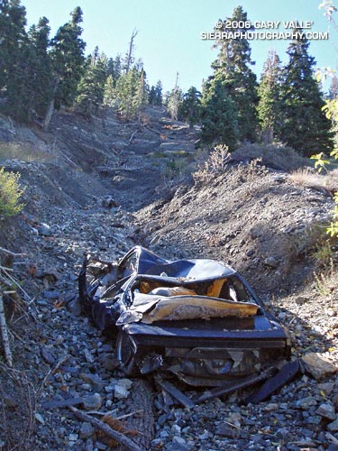
A totaled vehicle is an odd thing to find on a section of trail seemingly well away from any road. In this case, Angeles Crest Highway (Hwy 2) is nearly out of sight and about a half mile up a very rough canyon. (Photo from October 23, 2005.)

A totaled vehicle is an odd thing to find on a section of trail seemingly well away from any road. In this case, Angeles Crest Highway (Hwy 2) is nearly out of sight and about a half mile up a very rough canyon. (Photo from October 23, 2005.)
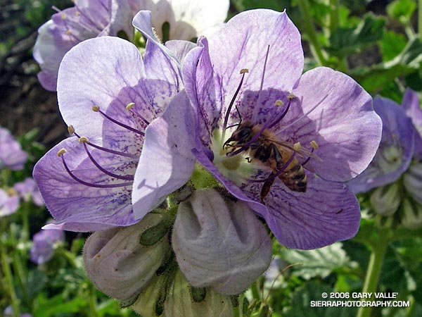
Like the Star Lily, Large Flowered Phacelia (Phacelia grandiflora) appears to be a “fire follower,” blooming in the Simi Hills in the aftermath of the Topanga Fire.
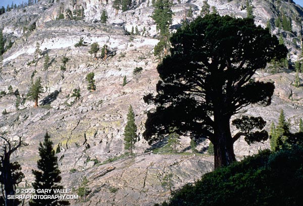
This photograph was taken early in the morning in the canyon of the Middle Fork of the San Joaquin River, on a solo trail run from Agnew Meadows to Tuolumne Meadows in Yosemite National Park, in the Summer of 1986 or 1987. My route followed the river trail to Thousand Island Lake, and then the PCT over Island and Donohue Passes, and down Lyell Canyon to the Tioga Road. It was a wonderful and adventurous run in a stunning area.
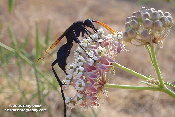
Tarantula Hawks are among the largest of wasps, and are said to have one of the most painful stings of any insect. As chilling as any science fiction, female tarantula hawks hunt, attack and paralyze a tarantula, and then use the spider’s inert — but still living — body as a host for the wasp’s egg and developing larva.
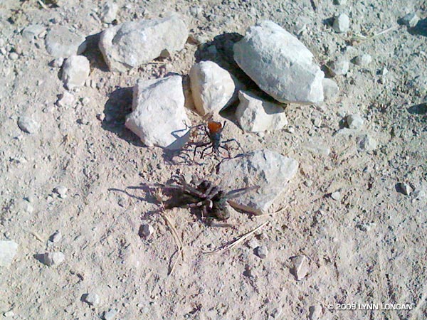
Males have straight antennae, and females curled antennae. This may be because the long, showy antennae of the male would be a serious liability when battling a tarantula. The title photo is of a male on a narrow-leaf milkweed (Asclepias fascicularis) at the start of the Chumash Trail in Simi Valley. Here’s another photo, taken in Las Llajas canyon by runner Lynn Longan, in which a female tarantula hawk has just attacked and paralyzed a tarantula.
Several good runs start at the Chumash trailhead, and many variations are possible. It’s 2.6 miles up the trail to Rocky Peak Rd, and from there you can do out and backs north or south along the fire road, or loops via Las Llajas canyon, the Hummingbird Trail, or the Lower Stagecoach Trail. (Photo from a run on September 14, 2005.)
Related post: Sting of the Tarantula Hawk, Chumash Trail Training
Bear Creek is an isolated tributary of Arroyo Seco Creek, north of Pasadena, in the San Gabriel Mountains. This photo was taken on a spectacular Fall day in upper Bear Canyon on a long trail run that started at Clear Creek Station. The route worked around the north side of Strawberry Peak to Red Box, down to the West Fork, up the Valley Forge trail on Mt. Wilson to Eaton Saddle, then through the Mueller Tunnel and past San Gabriel Peak and Mt. Lowe to Tom Sloan Saddle. From here it continued down into Bear Canyon, up the Gabrielino Trail to Switzers, and then back to Clear Creek using the Nature’s Canteen trail. (Photo from November 11, 2005.)
Related post: Strawberry – Bear Canyon Loop.
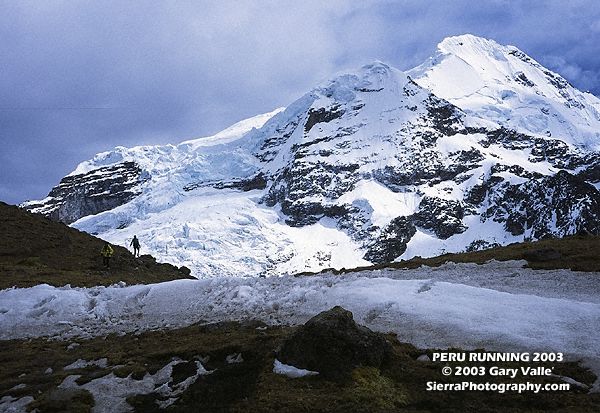
A runner descends the trail below Palomani Pass (16,600 ft.) on a Circuit of Mt. Ausangate (20,905 ft.) in the Peruvian Andes. Once acclimated, running at that altitude wasn’t as bad as I thought it might be, and when you return home, those 10,000 ft. trails feel like you’re running at sea level. The trip was arranged by my good friend Devy Reinstein of Andes Adventures and was unforgettable. (Photo taken July 23, 2003.)