Category Archives: photography|landscape

Clearing Clouds on Boney Mountain

Clearing clouds on Boney Mountain in Southern California's Santa Monica Mountains.

Clouds still covered the rocky summit of Boney Mountain as we scrambled up the steep trail on its northern flank. A few hours before a weak front had passed through the area, thickening the clouds and generating a few showers.

Now the clouds were lifting and dissipating, and the just-bathed chaparral glistened in the intermittent sun. This morning, like many mornings in recent weeks, was remarkable. The mountains were alive with the color and vitality of Spring. Purple shooting stars and wild hyacinth adorned the trail, and groves of manzanita and red shanks shone electric green in the warm light.

What better way to begin a day?

Related post: Boney Mountain – Big Sycamore Canyon Circuit

Google search: $g(landscape photography), $g(trail running), $g(Boney Mountain), $g(red shanks)

Ahmanson – Cheeseboro Ridge Loop

Spring afternoon on the Cheeseboro Ridge Trail.

The Cheeseboro Ridge keyhole loop is a slightly shorter variation of the Ahmanson – Cheeseboro Canyon keyhole loop described in the post Classic Cheeseboro Canyon. Since it ascends the Cheeseboro Ridge Trail, instead of descending Cheeseboro Canyon, the ridge route has a bit more elevation gain.

Cheeseboro Ridge separates Las Virgenes Canyon and Cheeseboro Canyon and on a clear day the views are outstanding. Running the ridge is particularly enjoyable in the Spring when temps are cool and the hills are green. In the heat of summer, the surface of the road develops a powder-like layer of silty dust and the experience isn’t nearly so pleasant.

If starting at the Victory Trailhead of Upper Las Virgenes Canyon Open Space Preserve, the length of the run is about 12.75 miles with an elevation gain and loss of about 1600 ft. Here are a Google Earth image and Google Earth KMZ file of a GPS trace of the route, and links to trail maps for Upper Las Virgenes Canyon Open Space Preserve and Cheeseboro/Palo Comado Canyons.

A Long Run Kind of Day

Saddle Peak from the Backbone Trail, in the Santa Monica Mountains, near Los Angeles. Mt. Baldy can be seen in the distance.

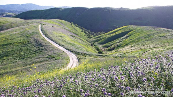
The beauty and intensity of the day was infectious. Hours before a cold low pressure trough digging down from the Pacific Northwest had carried showers, thunder, hail, and chilly temps into Southern California. Its rainfall had refreshed the greens of the hills, and accentuated the yellows, purples and reds of the wildflowers along the trail. Its blustery winds had cleansed the sky.

A few minutes before I had completed one run, and now was starting another. I wasn’t certain how much farther I would run — I just knew I had to run.

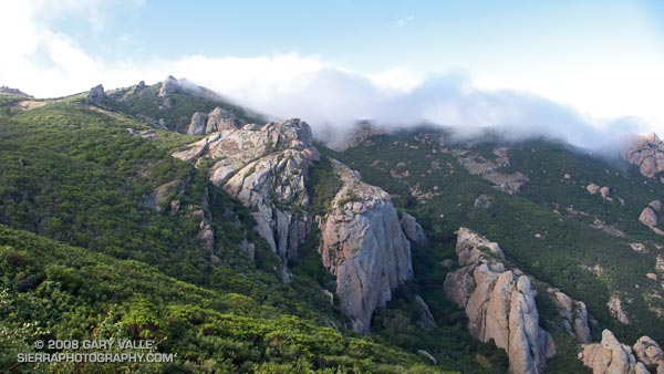
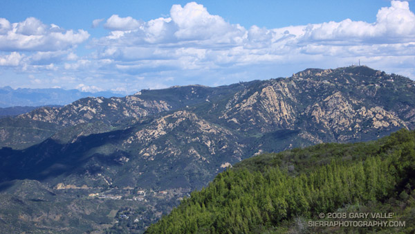
The day had begun with friends on the Secret Trail in Calabasas. We had run up and over the shoulder of Calabasas Peak, and then ascended Saddle Peak via the Stunt High Trail and Backbone Trail. The view from the summit of Saddle Peak had extended beyond Santa Monica Bay and Palos Verdes Peninsula to the South Bay and Saddleback Mountain. New snow glistened on Mt. Baldy, and to the west the rocky summits on Boney Mountain stood in bold relief.

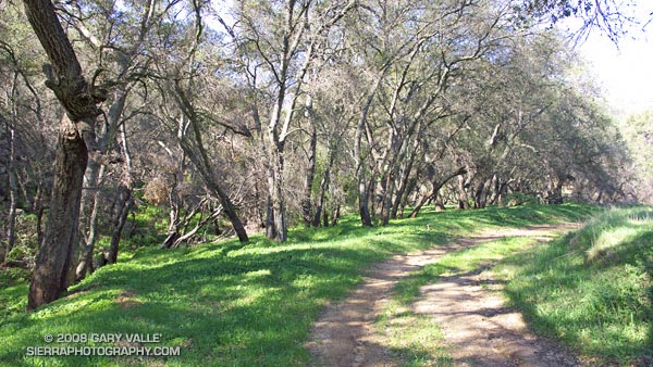
That 14.5 mile run had ended at Tapia Park. Now I was on the Tapia Spur Trail on the first climb of the Bulldog Loop. On the wind sheltered slope the bright yellow blossoms of tree poppy had begun to unfurl, absorbing the warmth of the midday sun. Distant peaks loomed to within an arm’s reach, and my legs seemed to draw energy directly from the trail. It was a long run kind of day.

Notes: The title photograph is of Saddle Peak from the Backbone Trail, in the Santa Monica Mountains, near Los Angeles. Mt. Baldy can be seen in the distance. The combined length of the runs was about 29 miles with an elevation gain of about 5000 ft.

Some related posts: Tapia Bound, Bulldog Loop and the Corral Fire, Fog Along Malibu Creek

Vernal Pool at China Flat

Vernal pool near the sheep corral at China Flat in the Simi Hills.

In normal to wet rain seasons vernal pools can be found throughout the Simi Hills. The pool pictured above is near the sheep corral at China Flat, and another small pond was found nearby, along Albertson Motorway fire road. I’ve also found vernal pools in the Rocky Peak area and near Sage Ranch.

Geologically, the Simi Hills are characterized by the sandstone rocks of the Chatsworth formation. These inclined layers are of varying hardness, and erode at different rates. It’s my guess that water collects in sandy soils between, or at the base of, the more resistant layers.

The photographs of the ponds at China Flat are from Sunday’s Scenic Route to Simi Peak run.

Scenic Route to Simi Peak

Oaks along the route to Simi Peak.

When the rainy season turns wet and the grasses green, all routes to Simi Peak are scenic, but the varied trails and terrain, and the wilderness feel of the more remote sections of this 21.5 mile run makes it one of my local favorites.

It is a longer variation of the route described in the post Upper Las Virgenes Canyon Backcountry. The run starts at the Victory (or Vanowen, or Las Virgenes) trailhead of Upper Las Virgenes Canyon Open Space Preserve and explores the headwaters of Las Virgenes Creek. At the junction of the power line service road and “backcountry” trail, instead of turning south up the power line service road, this option works west over to Albertson Motorway fire road, and on to China Flat and Simi Peak.

Here’s a Google Earth image and Google Earth KMZ file of a GPS trace of the route.