Category Archives: trails

Old Santa Susana Stage Road

Old Santa Susana Stage Road

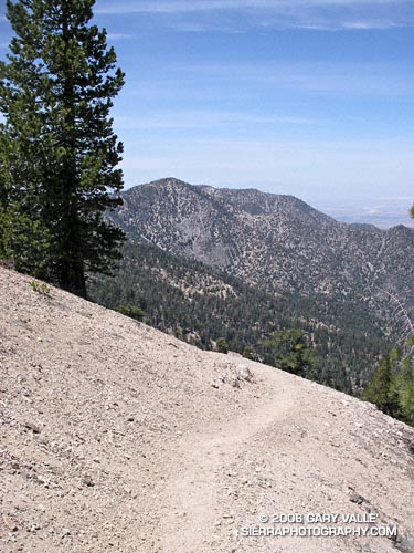
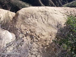
Running or hiking up the Old Santa Susana Stage Road, if you stop and listen carefully, you may hear a sharp whistle, a raspy shout, or a few choice expletives echoing from the canyon walls. It would have taken a barrage of such oaths, and a lot more, to get a stage up and over this harrowing grade.

The image of the Simi Pacific Coast Stage in the book Simi Valley: A Journey Through Time, helps to complete the mental picture. Steep, narrow, and unforgiving, the Stage Road must have produced stark terror in more than a few passengers.

Established in 1861, the “Devil’s Slide” stage road was a link in the Pacific Coast Stage Line between Los Angeles and San Francisco. It follows the route of the original Spanish trail connecting the San Fernando and Santa Buenaventura Missions. Prior to the arrival of the Spanish, the route is said to have been “an old Indian trail,” connecting Chumash communities in Simi Valley to Gabrielino communities in the San Fernando Valley.

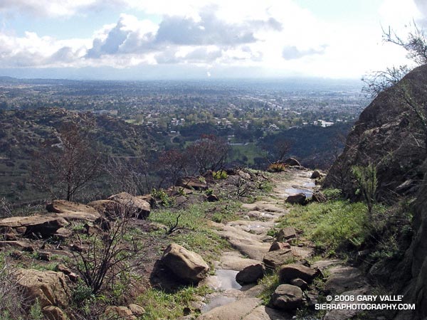
Old Santa Susana Stage Road is located in Santa Susana Pass State Historic Park. The park was created in 1998 to protect the Stage Road and other cultural resources in the area. A General Plan characterizing the purpose and long-term vision for the park is in under development, and through a series of meetings, public input on the plan is being requested. The second such meeting is scheduled for Tuesday, June 20, 2006 at 8:30 P.M. at Chatsworth Park South. See the General Plan web page for additional details.

There is currently no “official” trail leading to the Stage Road. Since the area was burned in the Topanga Fire last Fall, it’s important to stay on existing dirt roads and trails to help promote recovery, and avoid damaging sensitive habitat or species.

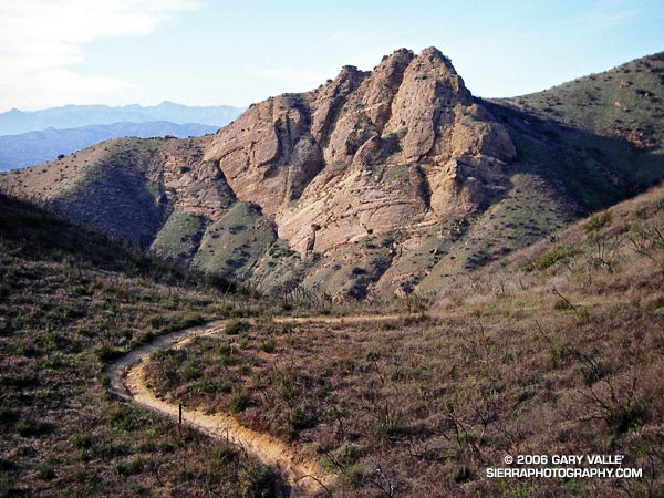
(Photograph from a run on February 19, 2006.)

PCT Above Windy Gap

Mt. Williamson from the PCT above Windy Gap.

Mt. Williamson from the PCT above Windy Gap

Update May 21, 2009. Angeles Crest Highway (SR2) has since been re-opened to Islip Saddle, and through to Wrightwood.

There’s more of a wilderness feel in the Angeles Forest high country today. A big chunk of Angeles Crest Highway is closed. From Eagles Roost to Mt. Baden-Powell, and back again, the absence of vehicle noise has been startling. There have been no squealing tires, warbling sirens, or red-lined RC51’s echoing up from Highway 2. Instead, the loudest sound is Little Jimmy spring water splashing at my feet. High on a ridge, a Clark’s Nutcracker tells me I’m in the mountains. and overhead, the wind plays quietly in the boughs of an immense Incense Cedar.

It’s been a blazing, triple digit day down in the valleys, and even at 8000 ft. the south-facing slopes have been warm. Chased by the warm weather, several PCTers trek northward; hoping that by the time they get to the Sierra the passes will not be choked with snow. Most have seemed enthusiastic, and eager to face the challenges ahead.

The crux of this day’s adventure looms around the corner at Islip Saddle. The steep 1.5 mile climb to near the summit of Mt. Williamson, and 1.5 mile descent to Hwy. 2 will retrace earlier miles of my trek. A mirror image of this morning’s pleasant ascent, this afternoon’s climb will be a cruel and evil twin. The 1200 ft. elevation gain will bring the day’s total to around 7000 ft.

Descending to the parking lot at Islip Saddle, I automatically look for my car. The lot is empty. Tufts of grass growing in in the pavement cracks waft in the breeze. A couple of PCTers rest in the shade of the restroom. A bird sings a cheerful tune from a nearby tree. I head on up the trail…

Today’s photograph is of a nice downhill section of trail at about 8200 ft, northbound on the PCT, above Windy Gap. That’s Mt. Williamson in the background. I was surprised I didn’t run into anyone that was doing Mt. Williamson. Williamson Rock is in the area closed by the Forest Service to protect critical habitat of the mountain yellow-legged frog, but Mt. Williamson is outside of the closed area (PDF Map). The Hwy 2 closure is about 0.25 mile west of Eagles Roost, and only adds about 2 scenic miles to the round trip up Williamson. If your favorite hikes or runs start at Islip Saddle, here’s a topo map of the area that shows the approximate mileages from the locked gate on Hwy 2 to Islip Saddle. For more information regarding the closure of Williamson Rock, see the  Access Fund Williamson Rock page for more information.

Spring Growth

New growth on a Big Cone Douglas Fir (Pseudotsuga macrocarpa) in the San Gabriel Mountains.

Bright green highlights new growth on a Big Cone Douglas Fir (Pseudotsuga macrocarpa) in the San Gabriel Mountains near Josephine Peak and Strawberry Peak.

These peaks are popular lower elevation summits, that can be snow-free in Winter, or a blast furnace in Summer. Josephine Peak (5558 ft.) was once the site of fire lookout, and a fire road leads from Clear Creek Station to its summit. From the west, via Clear Creek or Colby Canyon, Strawberry Peak (6164 ft.) is a more difficult ascent that requires careful route-finding and rudimentary rock climbing skills. Many hikers prefer to do Strawberry from the east, starting at Red Box.

The day this photograph was taken, I wasn’t climbing Strawberry Peak, but instead was running a circuit around the peak. Part of the Angeles National Forest Trail Race course, the circuit is an excellent 15 mile loop with an elevation gain/loss of about 2700 ft. Here’s a Google Earth image and Google Earth KMZ file of a GPS trace of the Strawberry Peak Circuit. A longer variant of this route is described in Fall Leaves on Bear Creek and Strawberry – Bear Canyon Loop.

Chumash Rock

Chumash Rock from the Chumash Trail.

Practically any objective can be a good excuse for an adventure. Each time up or down the Chumash Trail, I pondered the prominent rock formation northwest of the trail and wondered what I might find there.

My first thought was to find a direct route across the deep canyon that parallels the Chumash Trail. Recons from a couple of points on the trail revealed this was a bad idea. Sections of the canyon that looked passable from above were incised, with crumbling, near-vertical walls. A Plan B was required.

A look at a topo map suggested it might be possible to access the formation from Las Llajas Canyon. An advantage of this approach was that, if it worked, it could be part of a loop. On a cool January morning, I decided to give it a go.

From Las Llajas Canyon, an old, overgrown roadbed led up a side canyon to a point where there was no obvious route. The canyon bottom did not look promising, and steep slopes bounded both sides of the canyon. After scrambling several hundred feet up a south-facing slope, I found a deer trail that seemed to be headed in the direction I wanted to go.

This game trail was the key. It reflected the cumulative experience of many deer dealing with the terrain issues I faced. It was remarkably efficient and appeared to be the path that expended the least energy to reach the main ridge. That is, if you’re a deer. At one point, I was forced to backtrack when the trail crossed a steep, exposed slope better suited to those with four legs and cervid hooves.

Chumash Rock

Once on the main ridge, it didn’t take long to reach the rock formation.

According to the Dibblee geologic map of the area, the formation is positioned on the south branch of the Simi Fault. The steeply inclined layers of cobble that are embedded in the formation might have been deposited as part of a fan delta some 60 million years ago. This cobble is also encountered at several places along the Chumash Trail.

Near the summit of the formation I found some chiseled inscriptions. They were very weathered. The most prominent might be either a “93” or “33” over the top of a “W,” and another is perhaps a “DH.” It’s hard to tell.

Chiseled inscriptions near the summit of Chumash Rock.

Of the three high points comprising the formation, I scrambled to the top of two. The easternmost summit (on the far right when viewed from the Chumash Trail) involved climbing on loose cobble, and looked like an accident waiting to happen. Here’s a photo from the middle tooth, looking down the ridge.

As I climbed down from the summit to a saddle northeast of the rock formation, I spooked a deer, and it bounded into a brush-filled gully.

Continuing up the ridge, it eventually intersected Rocky Peak Rd. at its high point near some bivalve fossil beds. According to the Dibblee map, these are much younger than the rock formation’s cobble and may have been deposited in shallow marine conditions or lagoons a couple million years ago.

At Rocky Peak Rd. I had the option of returning via Las Llajas Canyon but decided to complete the approximately 8-mile route using the Chumash Trail.

This interactive, 3D terrain map shows the approximate route used to get to Chumash Rock and then complete the loop. The hike/run was on January 29, 2006.

Olancha Peak Sierra Panorama

Part of the Panorama from Olancha Peak.

Part of the Panorama from Olancha Peak

Olancha Peak (12,123 ft.) is the prominent, pyramidal peak seen on the Sierra crest from Hwy 395, south of Olancha. Its rocky summit is above tree line, and in some years snow can persist in the east-facing summit gullies and other sun-protected areas into late June, or early July.

There are better choices for a run in the Sierra, but early in the summer when the passes on other routes are blocked by snow, Olancha may be passable. Views from the summit of Olancha Peak are expansive, and the running on the PCT was enjoyable. Round trip, the distance is an arduous 20 miles, with over 6300 ft. of elevation gain and loss.

The trail starts at Sage Flat, at a relatively low elevation of 5800 ft. As a result, in warm weather it can be hot and dusty. In addition, the trail segment up to Olancha Pass (9200 ft.) can have a lot of pack train traffic. To lessen the chance of encountering horses or mules on the trail, I opted to follow a very steep and rough “cow driveway” that shortcuts 1.3 miles of the trail up to Olancha Pass. It’s hard to imagine driving cattle up this swath, and judging from the cow femur I saw sticking up from the rubble, the cattle don’t find it so easy either.

Beyond Olancha Pass, the aesthetics improve, and a spur trail is followed northwest along Summit Meadow to a junction with the Pacific Crest Trail. The PCT eventually leads to the west slopes of Olancha Peak, and from here the summit is a short second class scramble. Here’s a Google Earth image and Google Earth KMZ file of a GPS trace of my route.

This summit panorama is from a run on June 26, 2005. The view shows the headwaters of the N.F. and S.F. Kern River, and the high peaks of the Southern Sierra. From south (left) to north (right) are the Little Kern, the N.F. Kern near Hole in the Ground, Kern Peak, the Great Western Divide, the Kaweah Group, Junction Meadow, Mt. Whitney, and Mt. Langley.

Sage Ranch Sunset


Sunset at Sage Ranch Park, a few weeks following the Topanga Fire.


Sunset at Sage Ranch Park, a few weeks following the Topanga Fire. The loop at Sage Ranch is about 2.4 miles. My usual route here is an out and back of about 4.5 miles. It’s a good short-day run with an elevation gain/loss of about 700 ft. (Photo from a run on November 14, 2005.)