Category Archives: trails|smmc open space

Tarantula Hawk

Tarantula Hawk on narrow-leaf milkweed (Asclepias fascicularis Dcne.)

Tarantula Hawks are among the largest of wasps, and are said to have one of the most painful stings of any insect. As chilling as any science fiction, female tarantula hawks hunt, attack and paralyze a tarantula, and then use the spider’s inert — but still living — body as a host for the wasp’s egg and developing larva.


This female tarantula hawk wasp has just attacked and paralyzed the tarantula.
Males have straight antennae, and females curled antennae. This may be because the long, showy antennae of the male would be a serious liability when battling a tarantula. The title photo is of a male on a narrow-leaf milkweed (Asclepias fascicularis) at the start of the Chumash Trail in Simi Valley. Here’s another photo, taken in Las Llajas canyon by runner Lynn Longan, in which a female tarantula hawk has just attacked and paralyzed a tarantula.

Several good runs start at the Chumash trailhead, and many variations are possible. It’s 2.6 miles up the trail to Rocky Peak Rd, and from there you can do out and backs north or south along the fire road, or loops via Las Llajas canyon, the Hummingbird Trail, or the Lower Stagecoach Trail. (Photo from a run on September 14, 2005.)

Related post: Sting of the Tarantula Hawk, Chumash Trail Training

Ferns Along the Garapito Trail

Ferns along the Garapito Trail, Topanga State Park.

Ferns along the Garapito Trail, Topanga State Park.

Chaparral has been described as an elfin forest, and there is probably no better trail in the Santa Monica Mountains to see why, than the Garapito Trail. From the fire road near Eagle Rock, the trail seemingly dives into a tunnel of chaparral, and doesn’t emerge until it ends at Temescal Fire Road, some 2.5 miles away.

This day I ran a 12 mile figure-eight course from the end of Reseda to Trippet Ranch via the Hub, and then returned via the Musch, Garapito, and Bent Arrow trails. Fire roads out– trails back. A shorter option goes directly to the Garapito Trail via the Hub, and then returns via the Bent Arrow trail. This is about 7.5 miles. A longer option tacks on an out and back to Parker Mesa at Trippet Ranch.

San Fernando Valley from Rocky Peak

San Fernando Valley from Rocky Peak

Updated May 3, 2008.

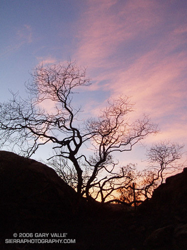
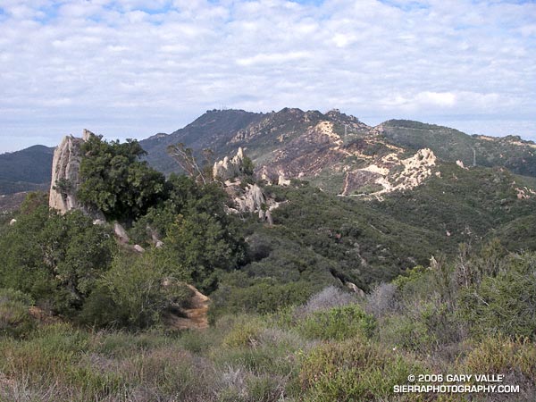
Whether it’s raining, 100 degrees, or snowing (!) you’re likely to see someone hiking, mountain-biking, or running Rocky Peak road in  Rocky Peak Park. Switchbacking up from the 118 freeway, the fire road climbs along the spine of the Santa Susana mountains. It’s proximity to the San Fernando and Simi Valleys, and array of route variations, make it the choice of many for a morning or afternoon workout.

It’s not because it’s easy — the route is steep from the start, gaining 500 ft. in the first three-quarters of a mile, and 1200 ft. in just over 2 miles.

Following are some approximate one-way distances and elevation gains.

Hummingbird Trail: 0.8 miles 500 ft.

High point at turnoff to peak: 2.4 miles 1200 ft.

Johnson Motorway: 3.2 miles 1350 ft.

Chumash Trail: 3.8 miles 1390 ft.

Fossils: 4.8 miles 1800 ft.

Las Llajas Loop turnoff: 5.5 miles 1950 ft.

End of Rocky Peak Rd at Las Llajas Cyn Rd.: 6.3 2070 ft.

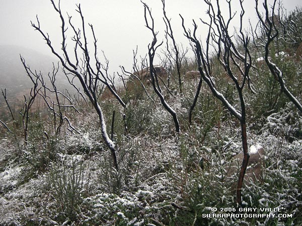
Related posts: Chumash Trail Snow, Oat Mountain Snow, Sunset Snow Shower.

Google search: $g(Rocky Peak), $g(Hummingbird Trail), $g(Chumash Trail)

Chumash Trail Snow

Snow along the Chumash Trail - March 11, 2006
Snow along the Chumash Trail – March 11, 2006

Snow highlights skeletal fingers of burned chaparral along the Chumash Trail in eastern Simi Valley. The chaparral was burned in the 2003 Simi Fire. More info and a couple of additional photos can be found in my Coyote Oak Journal entry Chaparral Snow.

Related post: Chumash Trail Rocks & Snow (December 2008)

Rock Formations Along the Backbone Trail

Rock formations along the Backbone Trail in Malibu Creek State Park.

Rock formations along the Backbone Trail in Malibu Creek State Park. This segment of trail is part of the Malibu Creek Trail Challenge and Bulldog 25K and 50K.

The final quarter-mile of the infamous Bulldog climb can be seen along the right skyline. I’d just struggled up that a few minutes before. An elevation gain of 1700 ft. in 3.5 miles sounds not-so-hard sitting in front of a computer, but the climb has few breaks and is longer and steeper than those figures convey.

The Bulldog climb is part of the ~14.5 mile Bulldog Loop — an excellent course that is popular among runners and mountain bikers. My Polar HRM says the elevation gain/loss on the loop is about 2700 ft., and a quick calculation using the elevation profile in Sporttracks gives a gain/loss of 2500-2600 ft. 

In 2004 Sal Bautista ran the slightly shorter version of the loop done in the Malibu Creek Trail Challenge in under 1.5 hours! Here’s a Google Earth image of a GPS trace of the Bulldog loop.