Excursion to Ross Mountain

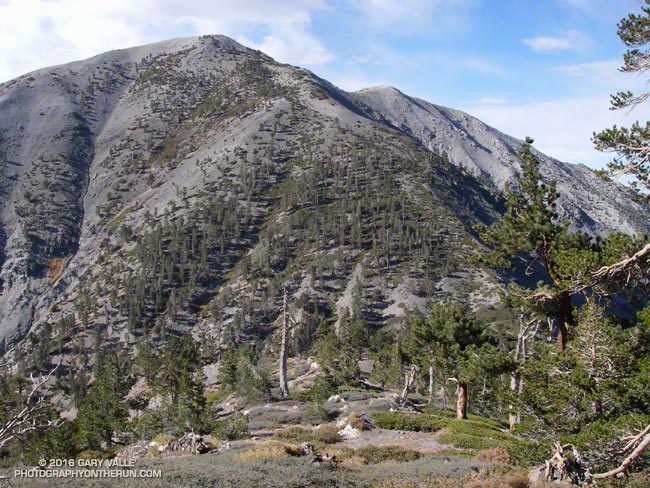
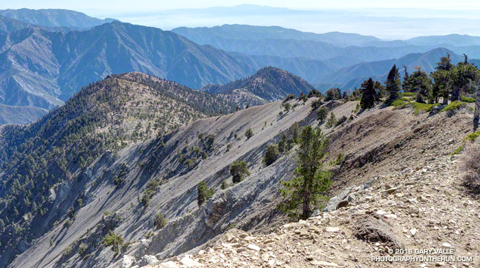
Ross Mountain on South Ridge of Mt. Baden-Powell.
South Ridge of Mt. Baden-Powell, with Ross Mountain at its end.

Nearly every time I’ve climbed Mt. Baden-Powell I’ve wondered about the long ridge extending south from its summit. And nearly every time I’ve summited Baden-Powell I’ve been in the middle of another running adventure, and unable to explore more than a few hundred yards down the ridge. But today I wasn’t running to Eagles Roost or doing a long loop from Islip Saddle. Today the plan was to climb Ross Mountain, a peak far down on Mt. Baden Powell’s south ridge.
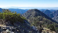
Ross Mountain
Ross Mountain

Major mountain ridges are often isolated, aesthetic and adventurous — characteristics that are magnets to mountaineers. While not technically difficult, the excursion to Ross Mountain is demanding. The first step is to climb Baden-Powell — a four mile trek with 2800′ of gain, that tops out at an elevation of about 9400′. From the top of Baden-Powell a use trail then leads down the south ridge three miles over varied terrain to Ross Mountain.

For the most part the use trail is relatively distinct and follows the anticipated route down the ridge. Even so, it is usually not as easy to follow a use trail as it is a conventional trail. It had rained a few days before, and the tracks of the last group to do Ross were vague. The most distinct tracks on the trail were from the recent passage of a bighorn sheep.
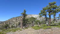
Bench on Mt. Baden-Powell's South Ridge.
Bench on Mt. Baden-Powell’s South Ridge.

The route to Ross drops 2100′ in 2.5 miles, then ascends 200′ over the remaining half-mile to the peak. The descent is not continuous. About a mile from Baden-Powell the ridge is interrupted by a large bench, and there are other ups and downs along the way. The ridge can be seen in profile in this image or the PhotographyontheRun masthead.
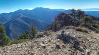
Pine Mountain, Dawson Peak, Mt. Baldy, Ontario Peak, Iron Mountain and Santiago Peak.

The ridge projects into one of the more rugged areas of the San Gabriel Mountains — the Sheep Mountain Wilderness. To the west is the deep canyon of the East Fork, with Pine Mountain, Dawson Peak, Mt. Baldy and Iron Mountain towering above. To the west is the very remote canyon of the Iron Fork, sweeping up to form the 9000′ crest between Throop Peak and Mt. Burnham.

The ridge hosts a wide variety of conifers — limber pine, lodgepole pine, white fir, sugar pine, Jeffrey pine and even a few incense cedars. Life on the ridge is tough, and many of the trees are contorted, broken or stunted. It appears to have been a good year for the sugar pines, and some were heavily laden with cones. Overall the health of the trees on the ridge appeared to be good, with surprisingly few trees in obvious distress from the drought.
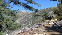
Mt. Baden-Powell from Ross Mountain.

A little more than three hours after leaving Vincent Gap I zig-zagged up the final few steep steps to the 7402′ summit of Ross Mountain. Not unlike other vantage points along the ridge, the summit was a pretty spot under a sugar pine tree, but in this case with a small cairn and rain-soaked summit register.

After procrastinating a bit and checking out the south side of Ross Mountain’s elongated summit, I began the journey back to Baden-Powell.
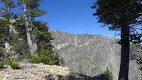
Complex geology at head of Mine Gulch on Mt. Baden-Powell.
Complex geology at head of Mine Gulch.

Surprisingly, considering my plodding pace coming back up the ridge, it took almost exactly the same amount of time to get back to Vincent Gap as it had to go to Ross Mountain. As it worked out, the time lost on the climb back up the ridge was offset by the superb run down the Baden-Powell Trail.

According to my Garmin fenix 3’s barometric altimeter the total gain/loss on this adventure was about 5100′. If the gain/loss is calculated from the GPS track using 1/3 arc-sec DEMs it works out to about 5400′. The round trip distance was 14 miles.

Related post: Return to Ross Mountain

Vincent Gulch and the Mine Gulch Trail

Mine Gulch Trail near Vincent Gap

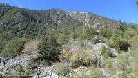
Nearly back to Vincent Gap after visiting Big Horn Mine, I debated whether to run part way down Vincent Gulch on the Mine Gulch Trail. The Mine Gulch Trail leads to the confluence of Vincent Gulch, Prairie Fork, and Mine Gulch on the headwaters of the East Fork San Gabriel River.

The only reason I was hesitant was that hunters might not expect anyone else to be down in the isolated canyon. On the way out to Big Horn Mine I’d encountered a couple of hunters and heard the occasional report of a deer rifle down in Vincent Gulch. After my experience in Colby Canyon the previous Saturday, I hoped my neon-yellow-green Mt. Disappointment 50K shirt would help make me more visible.

Hiking up the East Fork to kayak from the Bridge to Nowhere.

I’d wanted to check out the Mine Gulch Trail for a long time. Back before the drought, when rainy season storms would sometimes rejuvenate the streams of Southern California, the West and East Forks of the San Gabriel River were a local alternative to the three hour drive up to kayak the Kern River. My kayaking partner Gary Gunder, myself and other local kayakers had paddled as high on the East Fork as the Bridge to Nowhere. In 2003 Gary kayaked the upper East Fork from the Iron Fork. We’d done a lot of hiking with our kayaks and we began to wonder if it might make more sense to hike down the Mine Gulch Trail from Vincent Gap, rather than hiking up the East Fork.

Bigleaf maple along the Mine Gulch Trail.

Reaching the well-marked trail junction a quarter-mile from Vincent Gap, I turned down the Mine Gulch Trail. I was finally going to see what the trail was like!

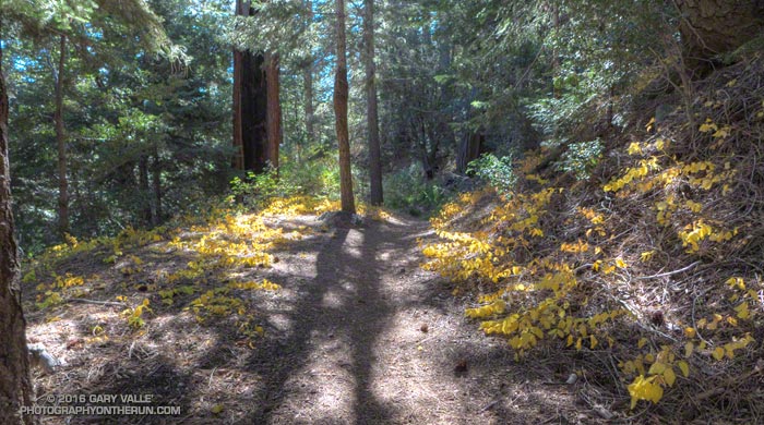
I had been expecting the Mine Gulch Trail to be a rough, overgrown and little-used path. After crossing an area stripped of trees by sporadic debris flows and avalanches, I was stunned to be running in an idyllic forest of pine, fir and oak on a wide, needle-covered trail bordered with golden leaves of snowberry.

Tom Vincent's cabin in Vincent Gulch.
Tom Vincent’s cabin in Vincent Gulch.

Continuing to descend, the trail passed near Tom Vincent’s cabin site and then a mile or so from Vincent Gap started a series of long switchbacks. A couple of switchbacks down, at an elevation of about 5900′, was a small stand of ponderosa pines. Ponderosa pines are less common in the San Gabriels than the similar Jeffrey pine, but can usually be distinguished by their smaller cones. The trees had drawn my attention because one of them was especially drought-stressed.

Vincent Gulch and Mt. Baden-Powell from the Mine Gulch Trail.
Vincent Gulch and Mt. Baden-Powell

Below the switchbacks and about two miles from Vincent Gap, the trail crosses a stream bed. The seems to be a spot where many hikers turn around. The trail sees less use beyond this point, and as it descends the east side of the gulch it becomes increasingly adventurous and isolated.

About three miles in I encountered a group of four hunters hiking up the trail. They were a bit surprised to see someone running down the trail and asked if I knew about a “flat” area down the trail. Now I realize they must have been referring to Cabin Flat, which was some distance and much bushwhacking away.

Mine Gulch Trail low in Vincent Gulch.

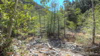
After encountering the hunters, the trail became less distinct and more disconnected. The “good” sections of trail were relatively long and the game became to piece together the sections of old trail, rather than traipsing through the rubble of the ravine. Intending to be back at Vincent Gap by about 1:00, I continued working down the gulch about another 30 minutes and finally turned around about a half-mile before the Prairie Fork junction.

Terrain in lower Vincent Gulch.
Where’s the trail?

Having just solved the main trail-finding puzzles on the way down, the ascent of the gulch was relatively fast and took about as much time as the descent. Part way up the switchbacks I caught up to the hunting group on their way out. They joked around, asking what my “secret” was. I told them I’d still be down in the canyon if I was loaded down with the 50-60 pounds of gear they were carrying.

Running down the Manzanita Trail, then over to Big Horn Mine, and then down the Mine Gulch Trail had been an enjoyable stream of thought adventure. I’d found Icy Springs was still running and learned more about the geology and history of the San Gabriels. While I probably wouldn’t be carrying my kayak down Vincent Gulch, becoming familiar with the trail did open the door to other adventures.

The Big Pines Trail Marathon — First Organized Mountain Ultra in the U.S?

Mt. Baldy from the North Backbone Trail

What would you think of a 44 mile trail race with 10,000’+ of gain that climbs Mt. Baden-Powell… and Mt. Baldy… by the North Backbone Trail… at night… by the light of a full moon… with the requirement to carry 10 percent of your body weight, NOT including the additional weight of food and water?

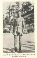
Paul V. Engelhardt, winner of the Big Pines Trail Marathon in 1934, 1935 and 1936. Photo: Los Angeles County Department of Parks and Recreation

The Big Pines Trail Marathon was first run on August 23-24, 1934. Based on the description in the Autumn 1934 edition of Trails Magazine, the course would rank high among the toughest mountain courses we run today.

“Starting at Jackson Lake at an elevation of 6,000 feet, it leads over the Blue Ridge Range at 7,800 feet, down to the Big Rock-Vincent Gulch divide, 6,500 feet, up 4 miles by 38 switchbacks to the summit of Mt. Baden-Powell, 9,389 feet, back to the head of Big Rock, and east along the summit of Blue Ridge, over Lookout Peak, 8,505 feet, east over Wright Mountain to the Prairie Fork-Lytle Creek divide at 7,800 feet, over Pine Mountain, 9,661 feet, and Mt. Dawson, 9,551 feet, to the summit of Mt. San Antonio, 10,080 feet. Turning back here, crossing again the saddle at the head of Lytle Creek to the Oak Canyon trail, down through Wrightwood and up to Big Pines Park, where the finish line is at the Davidson Arch, elevation 6,864 feet.”

The winner of the inaugural 41 mile race was 24 year old Paul V. Engelhart, an Assistant Scout Master, in 14 hours, 45 minutes, 15 seconds. Second place went to 17 year old Fairfax High School track team member Bain J. Bain in 14 hours, 48 minutes.

Trails Magazine Big Pines Trail Marathon Trophy. Photo: Los Angeles County Department of Parks and Recreation.

In 1935 the Start was moved to coincide with the Finish at Davidson Arch, increasing the mileage to 44 miles. According to the Trails Magazine report, the race began at 5 p.m., the seven contestants starting at 10-minute intervals.

“This year’s preparations were most complete with nine checking stations, four of which checked two ways, and patrol cars covering all roads which closely paralleled the course for 18 miles. At Guffey Camp, which the contestants passed twice, at 24 miles and 38 miles, there was a field hospital station with a doctor in constant attendance, and on the summit of Mt. San Antonio, 10,000 feet in the air and 32 miles from the start, a four man team from the First Aid and Rescue Division, Disaster Unit, Alhambra Red Cross…”

Engelhardt won again in 1935 in a time of 13 hours and 32 minutes and for the third time in 1936 in a time of 13 hours and 13 minutes. In the Fourth Annual event in 1937 Engelhardt’s record for the 44 mile course was broken by Ray Ebel, who finished in a time of 13 hours 3 minutes.

“In this year’s race, as in those that have gone before, it was decidedly demonstrated that a thorough knowledge of the course is essential to win or even to finish. Of the four who passed Pine Mountain, three were off the course at some point, two of them seriously.”

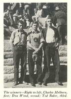
Winners of the 1938 Fifth Annual Big Pines Trail Marathon. Photo: Los Angeles County Department of Parks and Recreation.

Perhaps in an effort to make the course more straightforward, it was changed for the Fifth Annual race in 1938. Instead of returning from Mt. Baden-Powell and climbing Mt. Baldy via the North Backbone trail, the course continued west along the route of the present day Pacific Crest Trail (and AC100) to Windy Gap. At Windy Gap (then called Islip Saddle) the course descended to Crystal Lake Recreation Camp, turning around at the Ranger Headquarters for the 20 mile return to the Finish at Big Pines.

“It was a wild night on the mountain top, with winter temperatures and a gale of wind, a night which will be long remembered by both the contestants and those in charge of the checking and radio stations. Out of thirteen starters only six finished…”

Even in bad weather, the new forty mile course was more runnable and faster-paced. The report in Trails Magazine describes a competitive race that Big Pines Ski Club member Charles Melhorn won in 9 hours and 23 minutes — just 17 minutes ahead of Marine Reservist Don Wood. That works out to an average pace of 14 min/mile, with much of the running at night!

Glimpse of Autumn

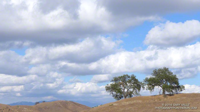
Oaks and clouds Upper Las Virgenes Canyon Open Space Preserve

I was running in the hills along the western margin of the San Fernando Valley and reveling in the Autumn-like weather. The hills were parched, brown, and the soil dessicated. In 128 days it had not rained.

An area of low pressure was producing some clouds and even a little rain in some parts of Los Angeles County. The last time it had been this cool in the afternoon was in mid-June. The pleasant temperature was a welcome change from the 80s, 90s and 100s of Summer.

Precipitation from the 2015-16 Godzilla El Nino fell short of expectations, with Downtown Los Angeles only recording 65% of normal rainfall and the drought continuing into its fifth year. How long would we have to wait  until we received widespread rainfall?

At the moment the expectation is for ENSO Neutral conditions to prevail this Winter. Neutral conditions give forecasters little leverage on which to base their Winter outlook, but based on last year’s Southern California precipitation forecasts, we didn’t have much leverage then either.

With a warming planet, we appear to be in a new regime. Forecasts based on 1950-2000 analogs may no longer be applicable. As of September 15 the Climate Prediction Center’s Precipitation Outlook for Southern California for December, January and February is the equivalent of flipping a three-sided coin.

We may just have to wait and see what the Winter brings.

Malibu Creek State Park Redwoods: Fighting the Drought

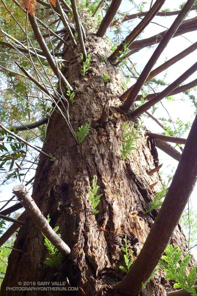
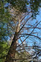
Epicormic sprouts along the trunk of a drought-stressed coast redwood in Malibu Creek State Park. July 3, 2016.

Recently, I revisited the coast redwoods along Century Lake in Malibu Creek State Park . Several months ago I’d been disheartened to find many of these trees severely stressed by our five year drought. Several of the trees had lost most of their foliage. Based on my own photos and those from Google Earth, the trees had rapidly deteriorated in just a few months.

I started at the the westernmost redwood near the junction of the Forest Trail and Crags Road and worked east along the Forest Trail. I expected to see a decline in the trees since my last visit, but surprisingly that wasn’t the case. If anything the trees looked they might be doing a little better.

Apparently dead coast redwood at Malibu Creek State Park
Possibly dead coast redwood at Malibu Creek State Park

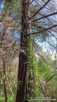
From west to east I counted about 16 trees or clonal clusters of trees. Of these, the trees on the bank of Century Lake appear to be the most severely impacted. At least one tree, with poison oak growing up its trunk, may have died.

A common drought response is for a plant to reduce its foliage. The size of its leaves may be reduced and leaf shape modified to reduce water loss. In some cases trees will become dormant and lose their foliage. Trees may also enter seasonal dormancy early and the period of dormancy may be extended.

It’s been my experience that trees respond to severe water stress in a manner similar to losing their foliage in a fire. One redwood that had appeared to be dead in March, now has new epicormic sprouts over the length of its trunk.

Basal sprouting of coast redwood at Malibu Creek State Park

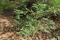
Another mechanism by which a redwood may survive the drought is by clonal sprouting from buds in its basal burl. It is common for coast redwoods to have numerous basal sprouts and sometimes these develop into additional trunks.

The easternmost redwood is of particular interest because it appears to be naturally-germinated. For now it is stressed, but surviving.

The survival of these trees is not only dependent on the drought, but climate factors such as temperature and fog frequency and persistence. Only time will tell if some of the trees are resilient enough to survive.

Related post: The Malibu Creek State Park Redwoods Are Dying

The Malibu Creek State Park Redwoods Are Dying

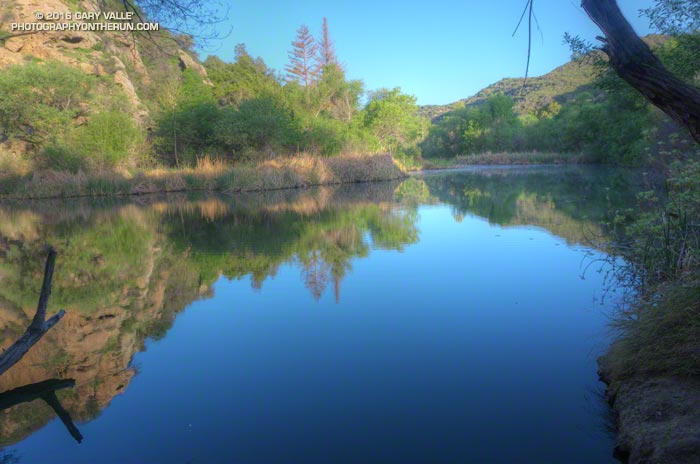
Century Lake, Malibu Creek State Park. March 26, 2016.

Illuminated by a just-risen sun, Goat Buttes reflected sharply on the lake’s surface. Ducks squabbled near some reeds and a bullfrog’s resonant croaking filled the canyon.

Part way through the Bulldog Loop, I’d paused for a moment at Century Lake in Malibu Creek State Park to enjoy the tranquility of the early morning. I snapped a photo and then noticed something very disturbing. The hundred year old coast redwoods across the lake looked brown.

Dying coast redwoods at Century Lake in Malibu Creek State Park. March 26, 2016.
Dying coast redwoods at Century Lake in Malibu Creek State Park

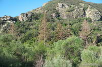
I tried to convince myself it was just the golden hue of the warm morning light, but it wasn’t. From Crags Road I could see at least one tree appeared to be dead, and most of the others were highly-stressed, if not dying. A detour to the other side of the lake on the Forest Trail confirmed the bleak situation.

Dead coast redwood at Century Lake in Malibu Creek State Park. March 26, 2016.
Dead coast redwood at Century Lake

Although coast redwoods have been planted in several areas of Southern California, they do not occur naturally here. The southernmost stand of naturally-occurring coast redwoods is about 200 miles north of Malibu Creek State Park in the Southern Redwood Botanical Area of Las Padres National Forest.

Redwoods have widespread, but shallow, root systems. Drought and warming temperatures are a worst case scenario for these trees, with the upper layer of soil being moisture-starved and baked.

The redwoods appeared to be healthy in June 2011, August 2012, and January 2013. This photo was taken December 13, 2014 and may show the first hint of discolored and thinning foliage. On May 1, 2015 — just 4 1/2 months later — Google Earth imagery clearly shows several discolored trees.

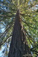
This coast redwood along the Forest Trail shows some foliage discoloration, but is in better shape than the trees closer to Century Lake.
This redwood is in better condition than those along the shore of Century Lake.

Ironically the redwoods closest to the lake appear to be the most severely affected. This tree away from the lake on the Forest Trail appears to be in better shape, but it too is showing signs of stress.

Malibu Creek State Park isn’t the only locale in Southern California where redwoods are dying. According to this May 2015 San Gabriel Valley Tribune article, 15 redwoods were removed from Verdugo Park in Glendale, and redwoods in other areas of Southern California have also been affected.

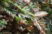
Browning foliage of a coast redwood along Century Lake in Malibu Creek State Park.
Browning foliage of a coast redwood in Malibu Creek State Park

As mentioned in an earlier post, the 2004 article “What’s up with the redwoods?” by James Downer, discusses a dramatic decline in coast redwoods planted in Ventura County and describes some of the problems that can affect this tree.

Drought and climate impacts are not limited to redwoods in Southern California. Endemic redwoods, particularly those in the southern extent of their range have also been significantly impacted.

Redwoods update July 27, 2016: Malibu Creek State Park Redwoods: Fighting the Drought

Some related posts: Malibu Creek State Park Coast Redwoods, Reeds and Redwoods, Coast Redwoods Along the Forest Trail