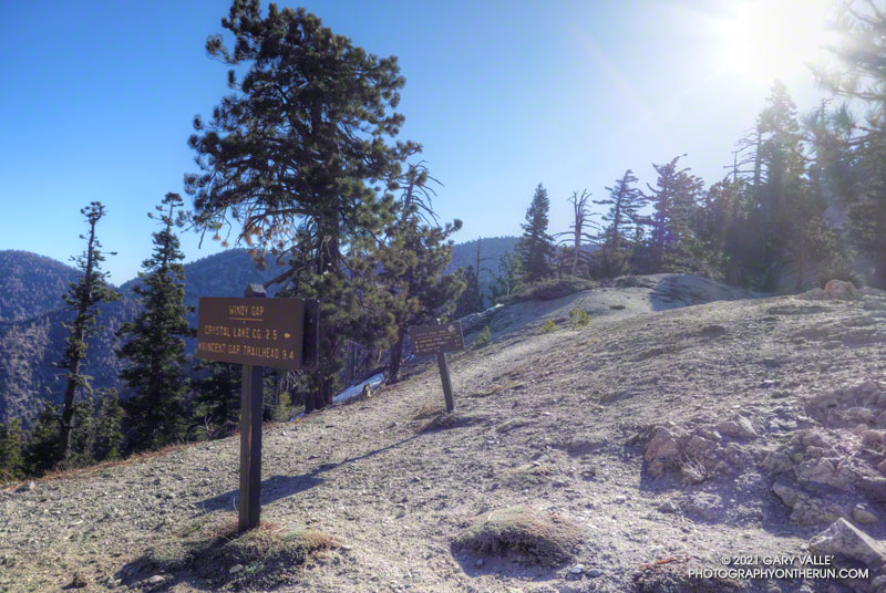
There was hardly any wind on the drive out to Azusa, and I wondered if the offshore wind event forecast to peak this morning was going to happen. But after winding up Highway 39 to the Windy Gap Trailhead, all doubts vanished. The wind was blowing in powerful gusts that shook the car and my enthusiasm.
Not only was it windy, it was cold. I briefly debated going down to warmer climes — temps were forecast to be in the 80s and 90s in the valleys — but decided to at least run up to Windy Gap and see what it was like there.
As is often the case, once I got moving, it wasn’t too bad on the Windy Gap Trail. It was very windy in some spots and nearly calm in others – just what you would expect on the lee size of a mountain ridge. One thing was consistent — there was almost no sunlight on the trail.
I’d been curious to see how the run/hike to Windy Gap (7588′) from the Windy Gap Trailhead (5836′) in the Crystal Lake Recreation Area compared to starting at the Islip Saddle Trailhead (6650′) on Hwy 2. It turns out the distance using either approach is the same — a little over 2.5 miles. But, the Windy Gap Trailhead is lower, so starting there adds a little over 800′ of gain. Today, that extra gain was helping to keep me warm.
As I worked up the last long switchback I could see and hear the trees on the crest being buffeted by the wind. Reaching Windy Gap I’d was relieved to see that it looked the same as it always has. As shown on fire maps, Windy Gap was not burned in the Bobcat Fire.
That relief was short-lived as I was just about knocked down by a gust of wind. I’ve passed by Windy Gap many times, and the wind this morning was the strongest I’ve experienced there.
Later I found that several gusts over 50 mph were recorded at Chilao that morning. Because of terrain effects, I would not be surprised if the gusts at Windy Gap were 60 mph or more. The gusts were “stop you in your tracks, blow you over” strong. And it was cold. The temperature sensor on my pack read 34°F.
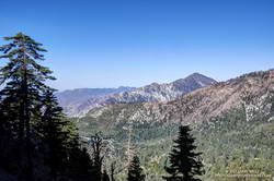
Out of curiosity, I ran a short distance along the PCT to see if conditions improved. That was a bad idea. I turned around and got the heck off the crest.
Running back down the Windy Gap Trail, I wasn’t ready to call it a day. It occurred to me that I could run down to the South Mt. Hawkins Trail — the old South Hawkins Lookout service road — and then run up to South Mt. Hawkins. Maybe the old road would be more wind-protected than the Windy Gap Trail.
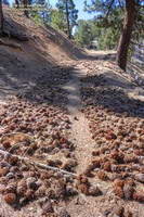
And maybe not! Looking at the topography, I could not figure out why the wind on some sections of the South Mt. Hawkins road was so strong. Some gusts were as strong as at Windy Gap. The noise from the wind in the trees was deafening, and amplified my concern about falling trees and flying debris. I did not want to have a “Weather Channel” moment.
Although the wind was strong, the sun was now higher, and some sections of the road were warmed by the sun. This made a big difference. As I wound into and out of the side canyons, the temperature varied from the high 30s to the low 50s. In two places there were small, dirty patches of icy snow.
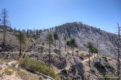
The South Mt. Hawkins Lookout was destroyed in the 2002 Curve Fire. Many, many thousands of trees were killed in that fire and the process of (natural) reforestation can be seen on the slopes above the road.
Ironically, the wind and temperature were relatively moderate on the summit of South Mt. Hawkins! After taking a few photos, I descended the “Ridge Trail” to the South Mt. Hawkins trail/road, and made my way back to the Windy Gap Trail and the trailhead.
Some related posts: Did Lightning Start the 2002 Curve Fire?, Crest of the Angeles
