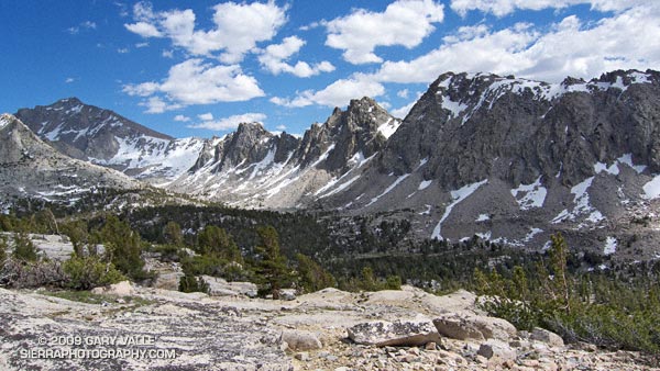
From Sunday’s out and back trail run from Onion Valley, over Kearsarge Pass, to Glen Pass. University Peak is the peak in shadow on the left of the photograph.

From Sunday’s out and back trail run from Onion Valley, over Kearsarge Pass, to Glen Pass. University Peak is the peak in shadow on the left of the photograph.
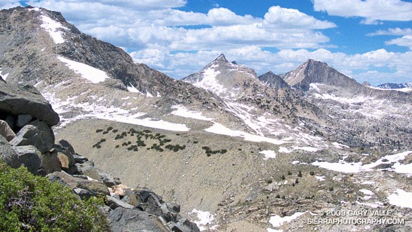
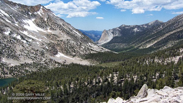
Mt. Cotter and Mt. Clarence King from Glen Pass.
The last time I was on Glen Pass was a brisk and brilliant October morning in the late 70’s. Overnight, the first cold front of the season had covered the trail with a few inches of snow. Working up toward the pass, bright fingers of gold had reached through long shadows to illuminate the angular, lichen-covered rocks, and the new snow had sparkled in celebration of Winter’s rapid approach.
Today, I’m back on Glen Pass, once again reveling in the wildness and beauty of my surroundings. There is almost no wind, and even at 12,000′ the day is warm. Refreshed by late season storms, the remaining snow is bright and youthful, accenting the elegant lines of the rugged alpine terrain. In counterpoint to the snow, a patchwork of clouds decorate the intensely blue sky.
In the outdoors, each place and day is remarkable in its own way.
Here are a few photographs from the run:
University Peak (13,589’/4142 m) from the Kearsarge Pass Trail.
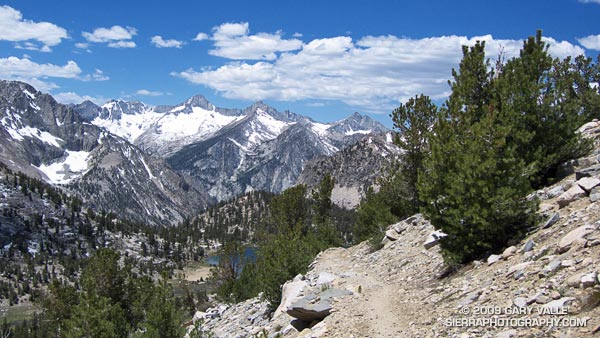
Spectacular running at 11,000′ near Bullfrog Lake. The snowy peaks are (l-r) South Guard, Mt. Brewer, North Guard, and Mt. Francis Farquhar.
Charlotte Dome from the PCT/John Muir Trail, south of Glen Pass.
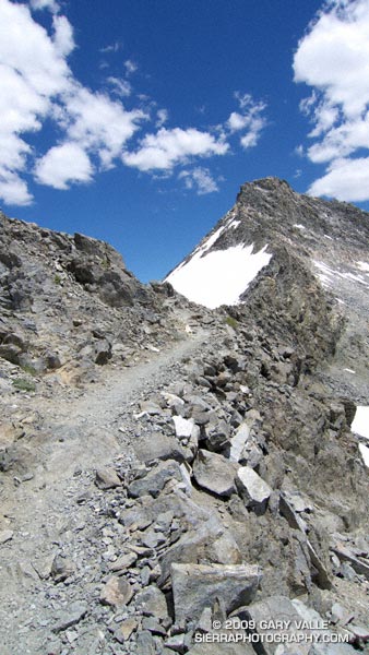
Switchbacks on the south side of Glen Pass. If you look closely you can see a pair of hikers working up the trail.
Nearing the top of Glen Pass (11,978’/3651 m).
The out and back trail run from Onion Valley (9200’/2804 m), over Kearsarge Pass (11823’/3604 m), to Glen Pass (11,978’/3651 m) worked out to about 20 miles, with an elevation gain/loss of about 4750 ft. Here’s a Cesium browser View of a GPS trace of my route and an elevation profile generated in SportTracks.
Related post: Up and Over Kearsarge Pass
Maybe because we’re involved in outdoor sports, we’re more aware of basic human anatomy than some other segments of the population, but I am still stupefied to read the results of a recent study in which less than one-third (31.4%) of the participants correctly identified the location of the lungs on a diagram of the human body.
The study, published in BMC Family Practice (2009, 10:43), was intended to evaluate the anatomical knowledge of different patient groups and the general public, and compare the results to a similar study done in 1970.
In the 2009 study, less than half (46.5%) of the participants correctly identified the location of the heart, and a little more than one-third (38.4%) could identify the location of the stomach.
The percentage correct for each item of the anatomy tested (heart, lungs, stomach, intestines, bladder, thyroid, liver and kidneys) averaged 51.4% in 1970 and 52.5% in the 2009 study.
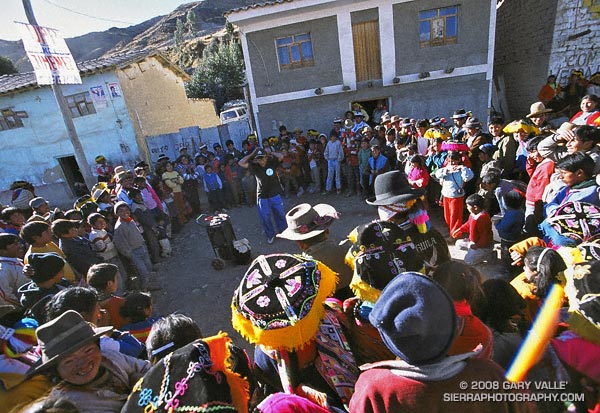
Our stopover at the Peruvian highland village of Tinqui was one of many memorable experiences on my running trip to Peru. At 12,400′, Tinqui is the trailhead for the Ausangate Circuit — an adventurous route around Mt. Ausangate that crosses two 16,500′ passes.
A 4-5 hour bus ride from Cusco, Tinqui is pleasantly remote and rustic. We arrived on a Sunday afternoon, and after getting settled into our hostel, walked down the dusty main street to the market. Music and laughter erupted from a nearby crowd…
“She told me her name was billie jean, as she caused a scene
Then every head turned with eyes that dreamed of being the one
Who will dance on the floor in the round”
Boombox at his side, a blue-jeaned and baseball-capped performer treated the crowd to his best Michael Jackson.
Later that evening, breathing deeply and thinking of the run ahead, I drifted to sleep on the distant, interleaving harmonies of a Catholic Mass sung in the native Quechua language — far from home, but not very far from the nearest boombox, and the influence of Michael Jackson.
Related posts: Peru Running, Runner on Circuit of Mt. Ausangate
Google search: $g(michael jackson), $g(trail running), $g(Peru), $g(adventure travel)
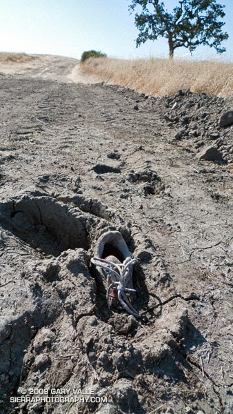
Exactly as I found it on my run at Ahmanson today. Looked like a fairly new running shoe.
Last year on this date, Southern California was in the middle of a heatwave. On June 20, 2008, Los Angeles Pierce College in Woodland Hills reached a record-setting high of 111°F, and on June 21 the temp reached 108°F!
Not so this June! So far this month, Downtown Los Angeles has not had a day when the average temperature was above normal. And it’s not only the low elevation stations that have been cool. Several times this month the overnight low at the Big Pines RAWS, near Wrightwood in the San Gabriel Mountains, has dropped into the thirties, and daytime temps have averaged more than 10 degrees below normal.
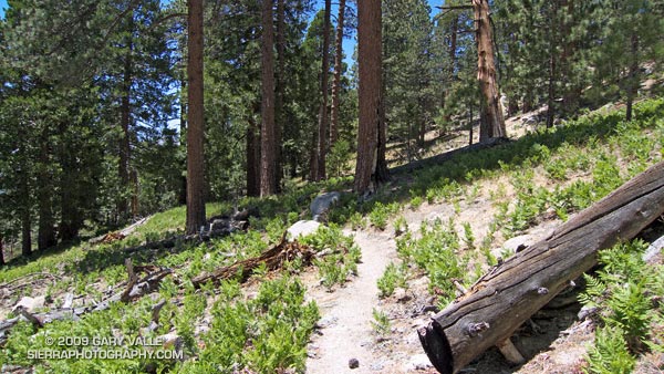
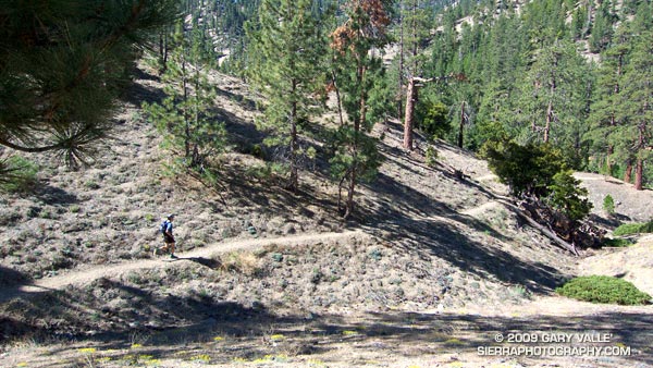
This translates to great running weather in Southern California, and near perfect weather for trail running in the San Gabriel Mountains. Today, did the Three Points – Buckhorn loop, along with a short detour up to the summit of Waterman Mountain. The route worked out to about 23 miles with a reality-checked elevation gain/loss of about 3800′. Here’s a Cesium browser View of a GPS trace of the run.
The title photo is of Dave Burke, cruising down a nice section of the PCT between Cloudburst Summit and Cooper Canyon.
Related post: Three Points Loop Plus Mt. Waterman