Caught in a Thunderstorm on Rocky Peak

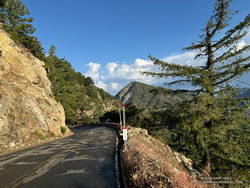
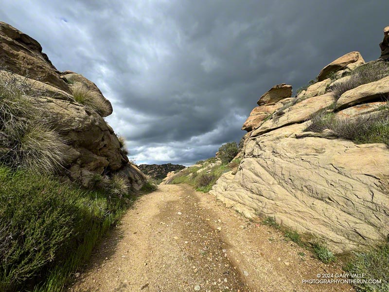
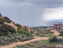
Sun and gathering clouds on Rocky Peak Road before a strong thunderstorm
Sun and gathering clouds on Rocky Peak Road

Rocky Peak Road is an exceptionally popular hiking and biking trail that starts at Santa Susana Pass, on the north side of the 118 Freeway. Regardless of the time of day or weather I ALWAYS see someone on this trail.

The plan for this afternoon’s run was to do an out and back on Rocky Peak Road to the top of the Chumash Trail (3.8 miles) or to Fossil Point (4.8 miles).

Another runner was finishing their workout as I started up the initial steep climb. Glistening in the warm sun, runoff from yesterday’s storm streaked some of the sandstone rocks, and ephemeral streams gurgled in the ravines and gullies.

Thanks to the sandstone geology, the dirt road wasn’t as muddy as most other local trails would be. Although heavily eroded from numerous Winter storms, it was still near the top of my list of places to run during periods of wet weather.

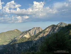
In the aftermath of yesterday’s storm the weather was spectacular. The temperature was warm enough to run in shorts and short-sleeves but still comfortable chugging up Rocky Peak Road’s steep hills. Puffy cumulus clouds filled the sky, creating postcard views at every turn.

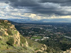
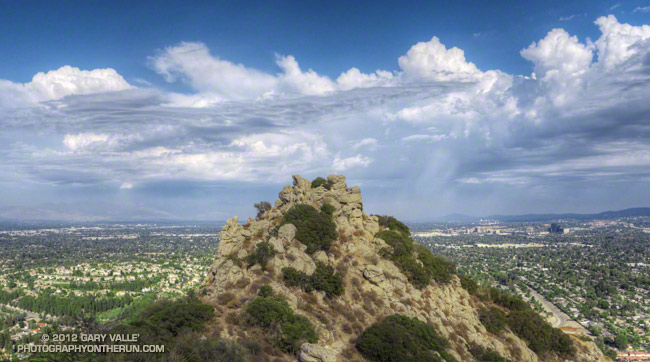
Clouds developing over the San Fernando Valley (thumbnail)
Clouds developing over the San Fernando Valley. Click to enlarge.

More focused about getting up the hill than any weather concerns, I continued past the top of the Hummingbird Trail and through a gap in the rocks to a section of road with a good view of the San Fernando Valley and San Gabriel Mountains.

I’d been in a situation similar to this several times on Rocky Peak. As a storm moves east from Los Angeles, energy circulating around the low can sometimes result in “back-door” precipitation. In this scenario, clouds build-up over the mountains to the north and then drift over the San Fernando Valley, producing showers — and sometimes — thunderstorms.

But today’s scenario was a bit more complicated. A much larger area, extending east to the San Gabriel Mountains, was rapidly destabilizing. What had been a picturesque sky at the start of the run was now congested and ominous. The question wasn’t so much if it was going to rain, but if a thunderstorm was going to develop.

As I continued up the road, the sky darkened, the temperature cooled, and the wind became more gusty and fitful. A little chilly, I pulled on my arm sleeves. I laughed nervously as I mistook the roar of a passing jet for thunder. That was a jet, right?

When people say they are “doing Rocky Peak,” they are often referring to a high point on Rocky Peak Road that is west of the actual peak and about 2.4 miles from the trailhead. The final climb to this high point is a good one — gaining about 450 feet over three-quarters of a mile.

The road on this stretch is oriented in such a way that the terrain hides the view to the north. I was anxious to get to the top of the hill so I could get a better idea of what the weather was doing. As I worked up the road, I would occasionally feel the cold splash of a raindrop on one leg or the other.

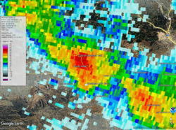
Doppler radar of strong thunderstorm over Rocky Peak (Thumbnail)
Doppler radar of strong thunderstorm over Rocky Peak. Click to enlarge.

Nearing the top, I thought, “I may get wet, but at least there’s been no thunder.” Within seconds of that proclamation, and as I reached the highest point, there was a long, loud, crackling peal of thunder.

One look at the sky and all thoughts of continuing to the Chumash Trail were gone. I turned around and started running down the hill, hoping to avoid the worst of the storm.

First one pea-sized hailstone hit the ground, then another, and then a sleety barrage of rain and hail poured from the sky. Instantly soaked, I shuddered as thunder echoed overhead and cold rain ran down my back. Muddy water flowed in rivulets down the sodden road and I cautioned myself to run fast, but not too fast.

I didn’t expect to outrun the storm, but hoped I might move to a part of it that was less intense. And that’s what happened. As I descended, the deluge gradually diminished. Most of the activity seemed to be behind me and a little to the east.

Severe thunderstorm over Porter Ranch - Northridge area (Thumbnail)
Severe thunderstorm moving into the Porter Ranch – Northridge area. Click to enlarge.

By the time I got down to the Hummingbird Trail, it was only sprinkling. The strong cell that had been over Rocky Peak had drifted southeast, and was now over the Porter Ranch – Northridge area.

National Weather Service Doppler Radar tells the story. At the start of the run there were scattered, mostly weak echoes. At 3:06 pm, as I was starting up the last long hill, a cell northwest of Rocky Peak was developing and drifting southeast. Over the next 16 minutes the cell continued to move southeastward and strengthen, and at 3:22 pm was over the Rocky Peak area. I turned around and started down as the cell moved into that area.

The cell over Rocky Peak continued to strengthen, and at 3:39 pm had drifted over the Porter Ranch – Northridge area. At 3:44 pm the NWS issued a Severe Thunderstorm Warning for Western Los Angeles County.

Here are a GOES-18 satellite loop and Doppler Radar loop that show the development and track of the Rocky Peak thunderstorm.

Some related posts:
Rainy Weather Running on Rocky Peak Road
Running Between Raindrops: Chumash Trailhead to Rocky Peak
Thunderstorm

Acton Thunderstorm

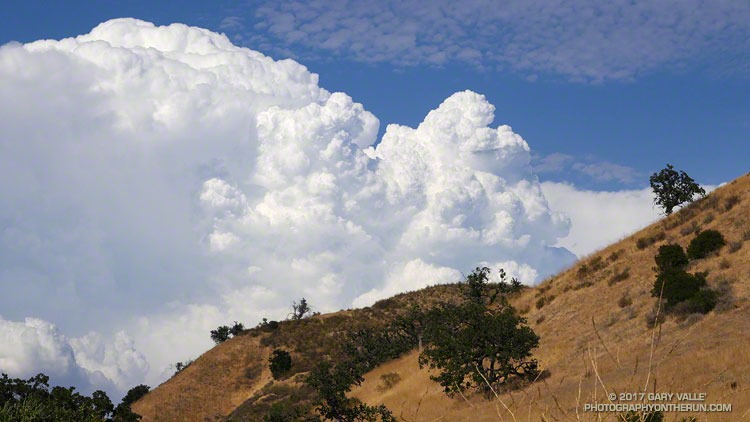
Developing thunderstorm over the Acton area, north of Los Angeles, from Ahmanson Ranch near the Los Angeles County - Ventura County border.

Developing thunderstorm over the Acton area, north of Los Angeles, from Ahmanson Ranch near the Los Angeles County – Ventura County border. The photo was taken about 4:10 p.m. PDT today, during another hot and humid Ahmanson run.

Cloud tops were reported to be over 50,000 feet. The distance from Ahmanson Ranch (now Upper Las Virgenes Canyon Open Space Preserve) to Acton is about 35 miles.

Southern California Thunderstorms an El Nino Calling Card?

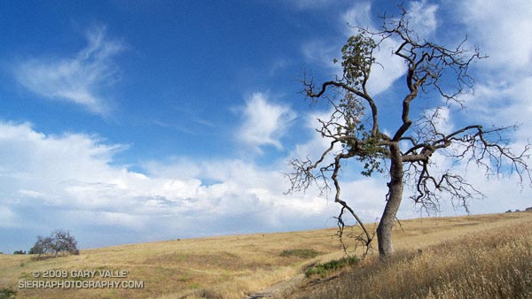
Valley oak on Lasky Mesa, with a line of thunderstorms in the distance.

Off to the south, I heard the distant rumble of thunder. The developing line of thunderstorms had swept through the West Valley about an hour before I began my run at Ahmanson Ranch.

Unusual weather for June. Not so much that there were thunderstorms, but that the thunderstorms were in part the result of an unseasonably strong jet embedded in the base of an upper level low.

It’s a bit of a stretch, but an argument could be made that these storms were a calling card of an increasingly energetic atmosphere, and a developing El Niño.

Several factors point to an increased probability of El Niño conditions developing over the next few months. Among them, Equatorial Pacific SSTs have increased, and the subsurface heat content is the highest it’s been since the El Niño of 2006-07.

But as the short-lived 2006-07 El Niño event demonstrates, an El Niño is more than just warm Pacific equatorial SSTs. Through complex forcing and feedback mechanisms, the atmosphere and oceans have to cooperate on a global scale. Generally speaking the atmosphere speeds up when there is an El Niño, and slows down during a La Nina.

And it looks like the atmosphere may be speeding up. Orbits of the Global Wind Oscillation, a measure of atmospheric momentum, have been shifting upward, in the direction of more energetic values usually associated with an El Niño.

But an El Niño is not a done deal. The climate system is just leaning in that direction. As climate scientist Klaus Wolter has pointed out, in a similar situation in 1973-1975, the climate fell back into a La Niña for another year. At this point it appears we may be diverging from that analog case. We’ll see!

Update June 6, 2009. The April-May Multivariate ENSO Index (MEI) value, released today, has increased by 0.54 to +0.34. As discussed by MEI originator, Klaus Wolter, the 3-month rise of the MEI since January-February is the 4th highest on record for this time of year, exceeded only by the strong Niño of 1997. According to Dr. Wolter, if next month’s MEI rank is at least the same as this month (37th), “it would be unprecedented for it to drop below that high-neutral ENSO-phase range by the end of 2009, virtually excluding a return to La Niña, based on the MEI record since 1950.”

Related links: ENSO Diagnostic Discussion, ENSO Wrap-Up

Thunderstorm

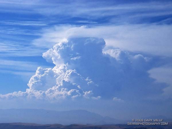
Developing cumulonimbus near Mt. Abel

Developing Cumulonimbus Near Mt. Abel

Saturday, Pierce College in Woodland Hills set an all-time record high temperature of 119°F. Following a preliminary review, a NWS forecaster said this was probably the highest temperature ever recorded at an official weather station in Los Angeles County.

To escape this oppressive heat, and avoid the scorching temperatures of last week’s long run, my intent was to get to the highest elevation possible, as early as possible, and stay as cool as possible. At an elevation of about 8400′, the Mt. Pinos Chula Vista trailhead is nearly 2000′ higher than Islip Saddle in the San Gabriel Mountains, and is usually a good choice for a run on a warm day.


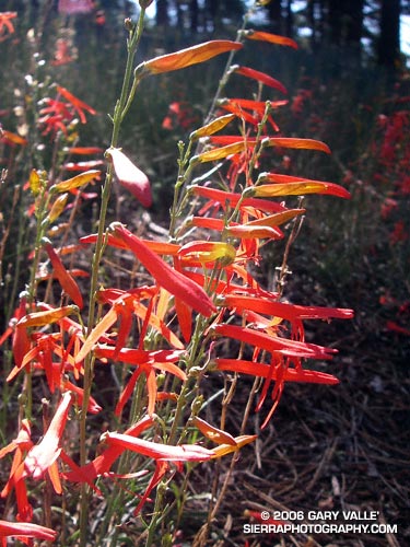
San Gabriel beardtongue (Penstemon labrosus) near Sheep Camp.
A little after 7:30 a.m., under nearly cloudless skies, I jogged out of the Mt. Pinos parking lot reveling in the cool mountain air. I didn’t have a specific route in mind, but thought I would probably do a longer variation of the Mt. Pinos to Mt. Abel run described in my Vincent Tumamait Trail post. Energized by the cool temperature, it didn’t take long to work up and over the summits of Mt. Pinos (8831′) and Sawmill Mountain (8816′), and then down the North Fork Trail to the spring at Sheep Camp (8200′).

Surrounded by the greens of the spring, and the yellows and reds of wildflowers, I gulped cold water, and thought about where to run. A sign at the “T” with the Tumamait Trail listed the distance to “Lily Meadows Camp” as 3 miles. I hadn’t been on that section of North Fork trail since preparing to run the Inca Trail in 2003.

Deciding to continue down to Lily Meadows Camp, I crossed over the spring and followed the little used, pine needle covered trail southeast along the hillside. The trail dropped steeply along a rounded ridge, where mountain quail fretted among the manzanita and fallen trees, and the minty fragrance of Pennyroyal drifted up from the margins of the trail. Quicly losing elevation, I reminded myself that whatever I ran down, I would have to go back up.

After about a mile and a half, the path switchbacked down to the North Fork of Lockwood Creek. Here, the grade lessened and long stretches of nearly perfect trail running led to Lily Meadows Camp (6250′). Old growth Jeffry pines towered above the camp, and a Monarch butterfly flittered about on a current of air. The pleasant, Sierra-like environment was a welcome change from the 100 degree heat of the previous week!


The first cloud!
An 1800′ climb and an hour later, I’m back at Sheep Camp, refilling my Camelbak®. Suddenly a shadow sweeps over the forest, and a small cloud – the first cloud – looms overhead. It’s just after 11:00 a.m., and the heat of the day has triggered some cloud development. After taking a few photos and eating a Clif® Bar, I decide I better get going, and jog up to the junction with the Tumamait Trail.

Reaching the trail junction at about 11:30 a.m., what had been a single tattered cloud in the sky is now several, and my “inner voice” of experience says, “Turn right, you can be back to the car in under an hour!” But it has been such an enjoyable day, and there aren’t that many clouds… I turn left towards Mt. Abel.

At first, shadow and sun play tag among the trees and I join in, chasing the clouds down the twisting and turning trail. The partly cloudy skies are postcard perfect, and I wonder if my concerns are ill-founded. But as the superb downhill segment transitions to up, a gray gloom invades the forest. At Mt. Abel Road, it’s noon. Rationalizing that the extra minutes required to scramble up to Mt. Abel’s summit won’t hurt, I cross the road and head up the steep slope.


The sun breaks through the darkening sky, illuminating the face of Grouse Mountain.
Seven minutes later, I’m back at Mt. Abel road. For a brief moment, a narrow shaft of sun breaks through the darkening sky, illuminating the face of Grouse Mountain. It washes across the slopes of the mountain, and then suddenly all is in shadow. At that instant, I know I’m in a race that I cannot win.

A quarter mile down the trail, the first cold drops of rain dampen my bare legs, and in another quarter mile, there is a rumble of thunder to the north, and then another rumble behind me. Part way up Grouse Mountain, there is a flash, and then directly above me an immediate ear-splitting, crackling clap of thunder. From the first few clouds to the first lightning has taken little more than an hour!

In an astonishingly short period of time, the rain, lightning and thunder grow in magnitude. Flash – boom! Flash – boom! The storm engulfs me as it grows in intensity. In the expanded microseconds that follow each lightning flash, I  breathe a sigh of relief that I’m not struck, and then bodily recoil from the immediate and overwhelming power of the crashing thunder.

Cresting the shoulder of Grouse Mountain, I think back to a storm in the San Gabriels, where instead of striking an obvious ridge, a bolt of lightning struck a nondescript tree on the slopes below. There is no place to hide from this monster. I adopt a tactic of almost sprinting through open areas, past tall trees, and when the electric motor smell of ozone fills the air. In areas that seem a little safer, I slow my pace.

At the top of another long climb, near the North Fork trail junction, I’m surprised to see a group of 8 or 9 hikers huddled under a pine tree. They are probably surprised to see someone running along the hilltops. From the first rumble of thunder, I’ve been considering whether hunkering down in the forest off the ridge might be a better strategy. If I had my shell pants, or my runner’s emergency bivi sack (a plastic trash bag), it might be. But wearing just my rain shell, a short-sleeve synthetic top and running shorts, I’m under-dressed for this get together.

Off to the east, in the direction of Mt. Pinos, the sky seems lighter. Maybe the wind is shifting the cells to the west and north. I have no idea how long this thing is going to last, and the pounding rain and gusty winds are sleety cold. I don’t want to stop. Not at all sure it is the better choice, I wish the hikers the best, and continue up the trail toward Sawmill Mountain.

The storm, and my emotions, wax and wane in a recognizable, but hard to define pattern. Periods of awe, elation and fear cycle with the storm. It has only been 30 minutes since the rain and thunder began, but in my distorted world, it might have been 30 hours. The steady rain has flooded the trail, and I feel like I am crossing a never ending creek.


Hurried photo near the top of Sawmill Mountain, when the storm was nearing peak intensity.
As I near the summit plateau of Sawmill Mountain, erratic gusts of wind tear at the trees. Then suddenly, as if a dam has broken, a deluge of lightning, thunder, rain and hail spills from the sky. It is the most intense rain I have ever experienced. A pounding rain, thick with hail, driven by a downburst of wind and gravity. Torrents of water cascade down the trail. It is ferocious.

Running through the maelstrom across the plateau, ahead I can see the point where the trail drops off the summit, and descends to a saddle. I just have to get there. Lightning flashes, and thunder booms behind me. My feet are numbed and cold, and I wonder how water on the trail can be calf deep.  Reaching the shoulder of the mountain, I start to descend. From time to time I get a glimpse of Mt. Pinos, and I can see a little smudge of blue under the dark clouds over the summit. As I descend toward the saddle, the intensity of the storm seems to be diminishing. There is still lightning, thunder and rain, but for a moment the focus of the storm seems to be shifting elsewhere. I take a deep breath, and debate what I’m going to do about getting over the exposed summit of Mt. Pinos.


Looking back at ridge on Sawmill Mountain from shoulder of Mt. Pinos.
There are still two groups of active cells. The main thunderstorm complex seems to be behind me, toward Mt. Abel; but there is also an active group of cells just north of Mt. Pinos. While I’ve seen no lightning strike the summit of Mt. Pinos, it is almost a certainty. I decide to work up the switchbacks toward the summit, continuing my tactic of minimizing my time in areas that are exposed. The rain has nearly stopped, and I haven’t smelled ozone since on Sawmill Mountain, but some sections of the trail are frighteningly exposed. Working up to the highest point that appears to offer some protection, I pause and listen. The timing may be right. The thunderstorm activity seems to be in a down cycle.

I leave my alcove. In seconds I’ve rounded a rocky rib of the peak, and am suddenly the tallest and most linear object on its bare shoulder. Thunder rumbles off to the north, a reminder I don’t need. Heart pounding, I’ve already pushed the pace as much as the grade, elevation, and my body will allow, and now there is nothing for me to do but run.

It is not a relief to reach the summit. I see a bolt of lightning strike to the northeast, near a radio tower less than a quarter mile away. Partially hidden from view, I can’t tell if the lightning struck the tower, or a ridge beyond. It doesn’t matter. I have to get off the summit.


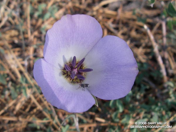
Mariposa lily (Calochortus invenustus) west of Mt. Pinos.
Running along the road from the observation point, I’m nervous about going in the direction of the relay tower, and the last lightning strike. I know the road will soon turn downhill, but as hard as I am running, I don’t seem to be getting anywhere. Finally, I see, and then round the turn. Another 50 yards, and for the moment I’m safe. A dash across one meadow, and then another, and the main danger is past.

To the east, I see more blue sky, and broken clouds. Continuing to descend, I hear a group of Chickadees chattering in a nearby tree. They sound happy. So am I.

Here’s a Google Earth image and Google Earth KMZ file of a GPS trace of my route.

Epilogue: According to the American Meteorological Society, lightning kills more people per year on average than hurricanes and tornadoes combined. For more information regarding lightning safety, please see the National Weather Service Lightning Safety page. Here’s what the thunderstorm looked like on radar.

(The title photograph is of a developing cumulonimbus near Mt. Abel. It was taken on a run at Sage Ranch on July, 19, 2006.)

A Warm Day on Blue Ridge and the North Backbone Trail

Clouds, pines, and Pine Mountain from Blue Ridge in the San Gabriel Mountains

Angeles Crest Highway was still closed between Red Box and Vincent Gap, and the heatwave continued. I was trying to decide where to run.

I briefly considered the Circuit Around Strawberry Peak, but yesterday at 10:00 a.m., the “in-the-shade” temperature at Clear Creek was already 92°F, and the “in-the-sun” fuel temperature 109°F. By 1:00 p.m., the fuel temp reached a scorching 122°F!

Although trailheads such as Three Points and Islip Saddle couldn’t be accessed using Angeles Crest Highway, the highway was open from Wrightwood to Inspiration Point and Vincent Gap. After seeing the temps at Clear Creek, it took about two seconds to make the decision to head to the San Gabriels’ high country.

 sulfur flower-lined section of the PCT east of Inspiration Point
sulfur flower-lined section of the PCT east of Inspiration Point

From Inspiration Point (7,365′), I ran east on the PCT about 7 miles to the North Backbone Trailhead on Mt. Baldy. Over most of that stretch, the temperature was a blissful 60-something degrees. Other times, I’ve driven to this trailhead — which requires a high-clearance vehicle — or run to the trailhead from Wrightwood. But the run along Blue Ridge is a favorite. It is especially scenic, with fantastic views of Mt. Baden-Powell, Iron Mountain, Pine Mountain, and Mt. Baldy.

About a quarter-mile east of the top of the Acorn Trail, the PCT passes within a few feet of one of the Wright Mountain landslides. The canyon-size landslide is prehistoric, but smaller landslides and mudflows occur periodically within the primary scar. The debris cone of a dramatic 1941 mudflow is an unmistakable feature on satellite photos.

Peak 8555 and Pine Mountain from the PCT.

Less than a mile beyond the overlook of the landslide, I left the PCT and jogged down to the North Backbone Trailhead. After a short descent, I started up the steep use trail toward Peak 8555. On the way up, San Gorgonio Mountain and San Jacinto Peak were visible in the haze to the east.

Peak 8555 is the first high point on Baldy’s North Backbone. It is an idyllic spot with a great view of Mt. Baden-Powell and the surrounding terrain. But you might not want to linger here in a thunderstorm — spiral scars on the trunks of trees suggest the point is repeatedly struck by lightning.

Crossing the top of a chute on Mt. Baldy's North Backbone.
Crossing the top of a chute on Mt. Baldy’s North Backbone.

Following a short descent, I resumed climbing the steep, somewhat loose ridge. After about ten minutes, I scrambled onto the crest of the ridge and crossed the top of a prominent, rocky chute. More than a thousand feet below, avalanche-hardened snow gleamed white in the sun at the base of the chute.

Another 10 minutes of climbing and I reached the Pine Mountain Juniper. Straddling the rocky crest at an elevation of about 9000′, this stalwart tree is estimated to be 800 – 1000 years old. It is a remarkable tree in a remarkable location. Except for one short, steep, eroded section, the remainder of the trail to the top of Pine Mountain (9648′) was relatively straightforward.

Dawson Peak and Mt. Baldy from Pine Mountain's south summit.
Dawson Peak and Mt. Baldy from Pine Mountain’s south summit.

Pine is the second-highest peak in the San Gabriels and has excellent views of the surrounding terrain. It is higher than Mt. Baden-Powell (9399′) and Dawson Peak (9575′) but a few hundred feet lower than Mt. Baldy (10,064′).

From Pine Mountain, the North Backbone trail continues over Dawson Peak another 2.5 miles to Mt. Baldy. There was still a long ribbon of snow along the east side of the upper North Backbone, but it looked like the trail might avoid it. I would have liked to confirm that, but today the top of Pine was my planned turnaround point. As it was, with the warm weather, I thought I might run short on water on the return to Inspiration Point.

Leaving Pine behind, I started back down — jogging when it made sense — but trying not to do anything stoopid. On the way down, I kept reaching behind me and squeezing the bladder in my hydration pack. I guess I was hoping that it would magically be more full than the last time I checked. It never was.

San Gabriel beardtongue along the PCT on Blue Ridge.

Back at the North Backbone Trailhead, and definitely low on water, I decided it was a good time to run the dirt road back to the top of the Acorn Trail and see how much shorter it was than the PCT. The answer was not much — only about a tenth of a mile.

I’d been willing to push the water envelope because it had been a heavy snow year. I expected the spring near Guffy Camp would probably be running. I’d passed the side trail to the spring a bunch of times but never ventured down the steep slope. My impression was that the spring was often low or nearly dry. This time when I reached the side trail, I headed down.

Pumphouse at Guffy Spring, surrounded by giant larkspur.

And down and down… It sure seemed like a long way to the spring, but when I checked the track, it was less than a quarter-mile with an elevation loss of about 200′.

As I walked up to the spring, a flurry of birds scattered in every direction. Eight-foot-tall larkspurs surrounded the spring, and an old pump house was adjacent to it. While not exactly gushing, the flow from the spring was more than adequate and refreshingly cold. I drank several cups of water and added some to my hydration pack.

Clouds over Mt. Baden-Powell from the PCT east of Inspiration Point
Clouds over Mt. Baden-Powell

Back on the PCT, the temperature was generally in the mid-eighties but was warmer on south-facing slopes. At about 1:00 p.m., the in-the-sun fuel temperature at the Big Pines RAWS was 109°F. I was very happy to have the extra water.

Here are a few photos from the out and back trail run to Pine Mountain from Inspiration Point.

Explore the scenery and terrain of this out-and-back trail run and hike from Inspiration Point to Pine Mountain using our high resolution,  interactive, 3D viewer. The imagery is so detailed, it’s almost like being there! To change the view, use the control on the upper right side of the screen, the CTRL key and your mouse, or touch gestures. Track and placename locations are approximate and subject to errors. Snow, ice, poor weather, and other conditions may make this route unsuitable for this activity.

Some related posts: Inspiration Point to the Pine Mountain Juniper and Pine Mountain, Mt. Baldy from Wrightwood Via the Acorn and North Backbone Trails, North Backbone Trail Revisited