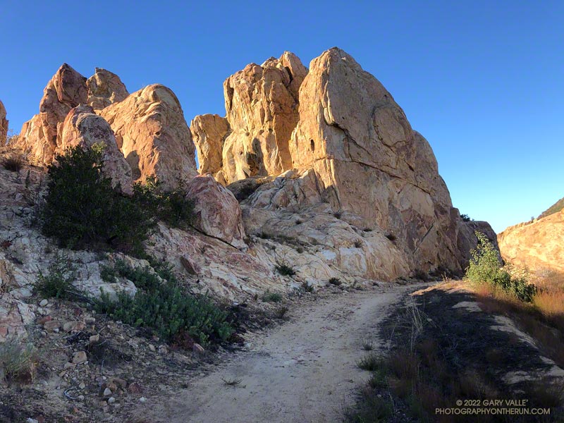
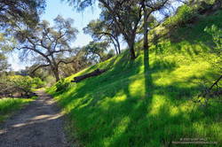
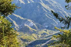
Runners working up a hill above the Placerita Canyon Rd. aid station. Photo: Paksit Photos
I don’t know why. But for some reason, I had it in my head that the turnaround point for the Placerita Canyon 30K was the halfway point of the course.
I had just passed the third aid station and was climbing a short — but steep — hill. From there, it was at least a couple of miles to the turnaround, and my projected time to that crucial point was adding up to more than I expected.
The thing was, I felt good and was enjoying the race. Everything seemed to be going well. It’s fun to run new trails, and I hadn’t run any of these.
The temp had been near freezing at the start, but the initial steep climb and energetic descent took care of that. The course would continue in this vein as a series of ups and downs on fire roads, single-track trails, and a bridle path. A few of the hills were slow and strenuous, but those were offset by fast-paced running on a mile and a half of bridle path. The longest hill was out of Aid Station #2 — 700 feet of gain over about 1.6 miles.
My confusion about the turnaround point could have been easily remedied by simply checking the mileage on my watch. It’s on the second data screen, and I only had to push a button to see it. But like a small, annoying rock in my shoe, it just didn’t seem to matter that much.
Eventually, somewhere around the Fair Oaks Aid Station, I checked my average pace. It was about at my goal pace. That’s when I realized the halfway point had to be behind me. When I reached the “Turn Back!” sign, I checked the mileage. It was 11.7 miles. A bit more than 6 miles to go. That was better!
As it turns out, the halfway point on the way out had been near Uncle Remi Trail junction. This outstanding single-track trail is a direct route down to Placerita Canyon and would be our route on the way back.
About 40 minutes later, I was running down the flowing turns of the Uncle Remi Trail. It didn’t take long to get to Placerita Canyon Road, and I soon found myself chugging up the last (long) hill. There were a couple of runners ahead of me that I’d been chasing for miles. Although I didn’t catch them, the attempt seemed to shorten the final 1.5-mile climb.
Partway down the subsequent descent, I heard a cheer in the distance as the pair crossed the finish line. A couple of minutes later, I also enjoyed the finish-line applause.
This was the inaugural running of the Placerita Canyon Trail Runs 10K, Half Marathon+, and 30K. As you would expect at a KH Races event, everything was well done – from the marking of the course to the aid station fare. The hills were green, the trails in good shape, and the weather invigorating. All the runners were super-friendly, and the aid station and course volunteers were very helpful. Thank you!
As I worked up the Bulldog climb on this morning’s run, I started to reminisce about the original Bulldog 50K course. When I reached the top, instead of making the usual turn to the left on Castro Peak Mtwy, I turned right, toward Castro Peak.
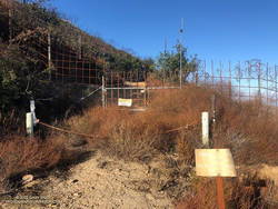
Barrier marking the private property line on Castro Peak Mtwy fire road.
Prior to 2004, this was the route of the Bulldog 50K. Back then, the 50K course worked over the shoulder of Castro Peak to the top of Upper Solstice Canyon, and then followed the Backbone Trail back to the top of Corral Canyon. The course had to be changed when the landowner closed a short stretch of dirt road on Castro Peak.
Today, I ran a bit more than a half-mile before reaching the razor and barbed-wire-laced barrier blocking the road. Then it was back to running the Bulldog – Phantom Loop combo and enjoying the spectacular Fall day.
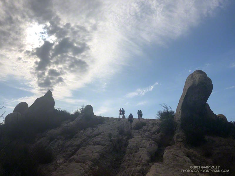
When I parked at Malibu & Piuma to do the Bulldog Loop on Sunday, I didn’t know that I was going to be swept up in a Bulldog Ultra training run.
I had just started up Bulldog Mtwy fire road when the first group of speedy runners swarmed past. The strenuous climb to the Castro Peak Mtwy gains about 1750 feet over 3.4 miles. Much of its infamy is due to the oven-like conditions typically experienced on the second loop during the Bulldog 50K.
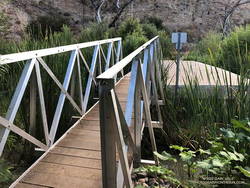
New bridge extension across Malibu Creek on the Crags Road trail, east of the M*A*S*H site.
This morning, the climb was a little warm in spots, but not bad. There was a good turnout for the training run and nearly everyone was enjoying the run.
On the way up I had an interesting conversation with a runner that had just done their first 100 miler and was going to pace someone in the AC100 this weekend.
In case you haven’t heard, State Parks has finally come up with a solution to the repeatedly washed-out footbridge across Malibu Creek, east of the M*A*S*H site. An extension was added to the massive block of concrete that formed the foundation of the old bridge. No more shaky log crossings — at least for a while.
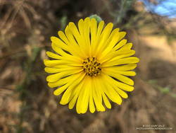
Common Madia (Madia elegans) at the bottom of the Bulldog Mtwy fire road.
Here’s an interactive, 3D terrain view of the Bulldog loop. The map can be zoomed, tilted, rotated, and panned. To change the view, use the control on the upper right side of the screen. Track and placename locations are approximate and subject to errors. Poor weather and other conditions may make this route unsuitable for this activity.
Good luck to all the runners doing Bulldog — especially those doing their first trail race or ultra!
Bigcone Douglas-fir along East Canyon Mtwy fire road.
I hadn’t seen a hiker, runner, or mountain biker since turning off East Canyon Mtwy fire road. That was about 2 miles ago. I checked my watch — it read 18 miles. Had I’d made a wrong turn?
Today’s plan was to do the first 25 miles of the Santa Clarita Ultra & Trail Runs 50K. A week ago I’d run the first (blue) and third (yellow) sections of the course, and today’s run would theoretically combine the first (blue) and second (orange) sections.
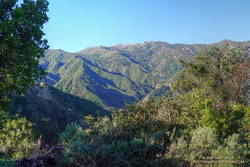
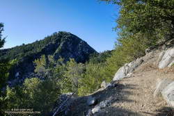
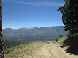
Oat Mountain from the Towsley Canyon Loop Trail
So far, the run had gone well. It had started with an extended version of the popular Towsley Canyon Loop in Ed Tavis Park. After climbing up oil-rich Wiley Canyon to a view point at an elevation of about 2450′, the course descended a series of long switchbacks, and passed through a gap in Towsley Canyon known as the Narrows. A mile down the canyon from the Narrows I’d used segments of the Elder Loop and Taylor Loop trails to run over to Lyon Canyon.
After switching from a bottle to a pack, I’d run on the Old Road over to the East Canyon Trailhead. From there the course followed East Canyon and Sunshine Canyon fire roads to Mission Point. The climb up to Jones Junction gains about 1300′ in 3 miles, then it’s another 1.5 miles over to Mission Point (2771′), the high point on the course.
Green along the Taylor Loop Trail.
One of the highlights of the run up East Canyon was the very healthy-looking Bigcone Douglas-firs higher on the road. Now relegated to the cooler climes of steep, north-facing mountain slopes, the species used to be far more widespread in Southern California.
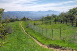
On the way to Mission Point, the views of the San Fernando Valley from the crest were outstanding, and gave a perspective of the Valley I had not seen before. Apart from having to detour along fence lines bordering private property, and continuous gunfire in a section of the canyon that is near a popular gun club, the run to Mission Point was excellent.
Detour around private property on the way to Mission Point.
Returning from Mission Point there was another part of the course I needed to do — an out and back on Weldon Mtwy. Which brings me back to mile 18 of today’s run. After turning off East Canyon Mtwy on what I thought was Weldon Mtwy, I had expected the fire road to loose elevation relatively quickly. But that wasn’t happening.
Instead of running down a canyon, I was running along a ridge — a long ridge. Below and to my right was what looked like a landfill. Below and to my left I could see the Old Road and Santa Clarita. They seemed a long way down.
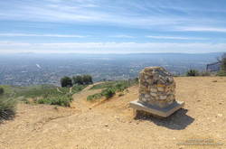
Mission Point, Three Trees and the San Fernando Valley.
There were several ways I could have checked where I was — my watch has maps; my phone had maps; and I had a map in my pack. But I wasn’t in trouble and was already two miles down this road — whatever it was. If I wasn’t on Weldon Mtwy, it would still be a trail I hadn’t done.
After a couple of “I’ll just go a little farther down and see what I can see” episodes, I eventually turned around and headed back up the fire road. When I got back to East Canyon Mtwy, I checked the yellow pole marking the junction of the fire roads — it was marked “WELDON.” Later, I checked my track and found I had turned around a half-mile from the Newhall Pass Trailhead. Now I know.
Overall, I’d enjoyed the course, and decided I would register for the 50K. But registration closed early, and now I see the event has been postponed until November. Oh well, I still got to run in a new area and check out some interesting trails!
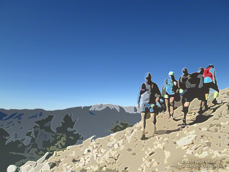
After so many years of doing the Angeles National Forest Trail Race, I’m not sure I even had a choice. At about 7:00 a.m. on Saturday, July 11, 2020, I found myself running down Mt. Wilson Road.
It was odd not to be surrounded by runners. Gary Hilliard had not done his one-of-a-kind pre-race briefing. There had been no hugs or handshakes at the start of the run. No runners commented on the temperature or talked about past or future races. Thanks to COVID-19, the 2020 ANFTR race had been canceled.
But the mountains and trails were still there, and by running the 25K course, I could get a good idea of what the 2020 race might have been like.
I was not racing the course. The forecast was — of course — for a hot day. And in these covid times, I was running solo. I was out to enjoy “being there” — seeing what I could see, learning what I could learn.
View into the canyon of the West Fork San Gabriel River from Mt. Wilson Road.
Mt. Wilson road is exceptionally scenic, and on the way down to Eaton Saddle, I stopped several times to take photos. The canyon of the West Fork San Gabriel River is spectacular. It’s a long way down to the bottom, and I always marvel at its depth. The 2600′ climb out of that canyon is the crux of all the ANFTR courses, and as I would later discover, would be especially challenging today.
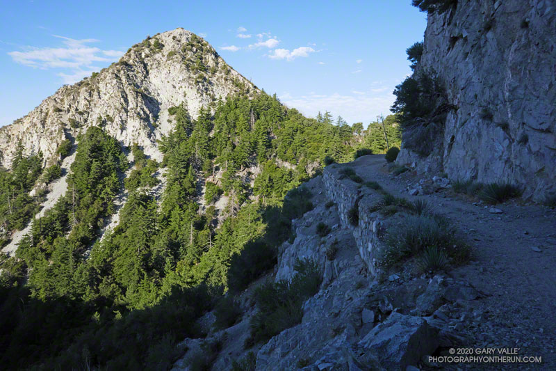
Rugged San Gabriel Peak marked the turn onto Mt. Lowe fire road at Eaton Saddle. From here, the course follows the fire road through Mueller Tunnel and up to the saddle between Mt. Markham and San Gabriel Peak. The first significant climb of the course begins here. Much of the 650′ climb up the single-track trail is in the shade. If it’s already warm here…
Looking back at San Gabriel Peak from near the top of the Lower San Gabriel Peak/Bill Reilly Trail.
The single-track trail leads up to the Mt. Disappointment service road. The high point of the 60K, 50K and 25K courses — about 5780′ — is along this short stretch of road. For the 25K course it’s (almost) all downhill from here to West Fork. A winding, and usually dusty, single-track trail turns off the service road and leads down through scrub oaks to Mt. Wilson Road, just above Red Box.
In the actual event, runners doing the 50K and 60K turn left onto the Gabrielino Trail at Red Box and do a 15+ mile circuit around Strawberry Peak. Runners doing the 25K turn right and continue down Rincon – Red Box Road to West Fork.
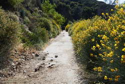
Spanish broom along Rincon – Red Box Road near Valley Forge Campground.
The time of day when you do the 5+ mile segment from Red Box to West Fork makes a huge difference. On hot race days, such as in 2012, 2017 and 2018, the road bakes and in-the-sun temps can reach well over 100 degrees. (This isn’t the only part of the 50K/60K course that can be hot!)
Because I was running the 25K course, I was on Red Box road relatively early. It was probably in the 90s in the direct sun, but there were still some cool stretches of shade. In years with average or above-average rainfall, there are usually a few little stream crossings where capfuls of water can be dumped on your head. They were flowing today. Usually at West Fork there is a hose/shower setup to use for cooling.
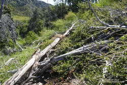
There was a collapsed sycamore on the trail near the spring, but it didn’t look like it was going to be much of a problem. On the run down to West Fork, I’d noticed an increasing number of trees on the road. About a mile from West Fork, a large oak had fallen down a road-cut, blocking the road and bringing with it a pile of debris.
Mass of trees down on the Gabrielino Trail.
Leaving West Fork on the Gabrielino Trail, I worked around the fallen sycamore and then continued up the trail. Within yards there was another fallen tree, then another, and another. The number of trees down on the trail was remarkable. Part of the reason is that the Forest Service isn’t currently allowing volunteer groups to do trail maintenance. I’m sure ANFTR R.D. / AC100 Trail Boss Gary Hilliard is going crazy not being able to work on the trails.
But I think there’s more to it than trail maintenance. There are far more trees down on the trail than I’ve seen in other years. The area is covered in scrub oaks and bay trees that were killed by the Station Fire. I suspect the same storms that broke and toppled trees in the San Gabriels high country over the Winter, toppled dead trees here as well.
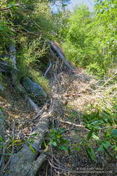
Trees down on the Kenyon Devore Trail.
It became a mantra — over, under, around or through? Over, under, around or through? Tree after tree. It was warming up, and the extra work of battling the trees added to the effort. On the Gabrielino segment of the route, trail users had trimmed some small limbs from a few of the trees, and that helped.
I thought that once I got out of the scrub oaks and into the forest proper, there wouldn’t be so many trees on the trail. That was mostly true, but there were still several tree challenges higher on the Kenyon Devore Trail. One large log was perched across the trail at the top of a steep gully. I didn’t want to slip and started to use the log for hand-holds. Bad idea! Who knew how little force would be required to dislodge the tree.
Eventually, I reached a point on the trail where I could just hike and didn’t have to climb over, under, around or through anything. What a relief!
It’s difficult to estimate just how many trees were down on the trail. Fifty? Sixty? I have no idea. There were many small trees I didn’t even think about, and there were multiple trees down in some spots. However many there are, if another Winter passes before the trails can be maintained, it will require a massive effort to get them cleared.
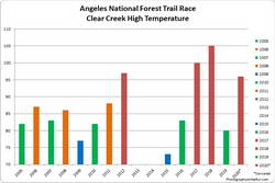
The highest temperature recorded at Clear Creek on the day of the ANFTR/Mt. Disappointment races for 2005-2020. The 2020 race was canceled.
Based on the temperatures recorded at the Clear Creek RAWS, this would have been the #3 or #4 hottest of the ANF Trail Races. Compared to the other hot races, temps were a few degrees cooler early, but reached similar temperatures by mid-afternoon. The Clear Creek RAWS recorded hourly temperatures as high as 96°F and hourly fuel temps as high as 121°F.
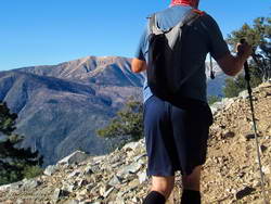
Working up the rocky trail, I looked to my left across the broad valley to San Gorgonio Mountain. There was still a narrow strip of snow near its summit, bright white in the morning sun.
I was about 5.5 miles into the Kodiak 50K and nearing the top of 9952′ Sugarloaf Mountain. There wasn’t any snow here, but the morning had been cool — at least by Southern California summer standards.
San Gorgonio Mountain from the Sugarloaf Trail.
This was my sixth time running Kodiak. The first four times were at the 50M distance, and this year and last, I’d opted for the 50K. There have been a lot of changes in the Kodiak Ultra Marathons since the first 100M & 50M were run in 2013.
Initially held in late September, the event moved to an August date in 2017. 50K options were added in 2015. For the first three years the Kodiak courses were run in the counterclockwise direction. In 2016 the direction switched to clockwise and then alternated direction each year through 2018. This year the direction was the same as in 2018 — clockwise.
The general idea has remained the same. The 100 milers run a loop around Big Bear Lake. On the way, they ascend Sugarloaf Mountain, and also descend thousands of feet into the dank depths of Bear Canyon. The 50 milers run from the north side of the lake to the Finish, climbing either the Siberia Creek Trail if the course direction is counterclockwise, or Sugarloaf Mountain if the course is run clockwise. The options for 50Kers have varied from year to year.
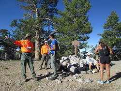
Big Bear SAR volunteers helped out on the top of Sugarloaf Mountain.
This year the 100M start time was moved to 6:00 p.m. This put 100M runners beginning the descent into Bear Canyon between about 8:00 p.m. and 10:30 p.m. — a much cooler time of day. The trade-off was that they would be doing the 3000′ climb up Sugarloaf Mountain with about 67 miles on their legs, and many of the runners would run into a second night.
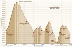
There were two notable changes in the Kodiak 50K this year. One adjustment is that it started two hours earlier — at 6:00 a.m. The other is that it was a couple of rocky miles longer than last year. The mileage was added on the descent of Sugarloaf — with runners looping down Wildhorse Meadow Road instead of retracing their route on the Sugarloaf Trail. My watch recorded a distance of about 34.5 miles and corrected elevation gain of about 6800′.
Because of the change in the 100M and 50K start time, we were ahead of many of the 100M and 50M runners, but we did get to see the 100M leaders flying down Sugarloaf.
2019 Kodiak 50K Elevation Profile
The weather was cool in the morning and warm in the afternoon. At Big Bear Airport the overnight low Friday night was 37°F and the high on Saturday was 77°F. With the clear skies, it was hot on exposed, south-facing trails. The Converse RAWS (5618′) recorded a high (inside a ventilated instrument housing) of 84°F; however the “fuel temperature” of a pine dowel in direct sun hit 106°F. In my experience, the fuel temperature is a better indicator of the temperature runners might encounter on sun-baked sections of trail.
My run went well. There was no repeat of the leg cramps I experienced near the end of this year’s ANFTR/Mt. Disappointment 50K. This 50K was longer, had more elevation gain, was at higher elevation, and was generally more technical, but my legs behaved the entire time. That’s the riddle of Exercise-Associated Muscle Cramps (EAMC). Sometimes you get leg cramps and sometimes you don’t. In this race I made sure that I stayed well-hydrated and fueled. I also used poles on the steeper climbs.
Near the top of the four mile Radford Road descent, with San Gorgonio in the background.
This was one of those races that I could just run and enjoy. It was great to talk with Diana, Gloria and Greg along the way. The runners you meet during races are often very accomplished and usually have some unique stories to share!
Many thanks to Kodiak Race Director Susie Schmelzer, Course Director Harald Zundel, and Communications Director John Emig and to Team Kodiak, all the volunteers, sponsors, Bear Valley SAR, HAM operators, medical personnel, City of Big Bear Lake, US Forest Service, Big Bear Trails Foundation, RIM Nordic and Open Air Big Bear, and everyone that helped put on the event.