Category Archives: nature|trees

Mt. Baldy Run Over the Top

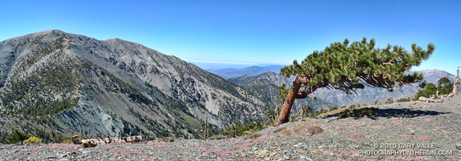
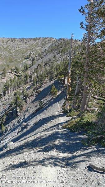
Mt. Baldy from the North Backbone Trail

Mt. Baldy from the North Backbone Trail

If you have a passion for the outdoors, you can get pretty creative when devising a reason for doing a particular run, hike, climb, ride, paddle or other adventure. My rationale for today’s outing was that I “wanted to measure a tree.”

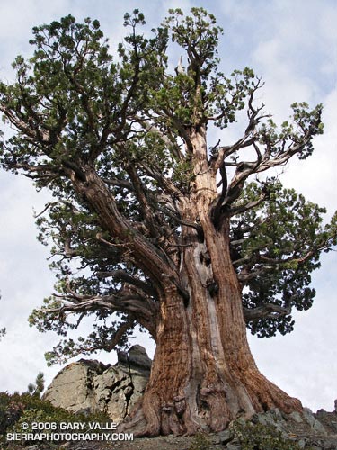
The tree is an isolated and aged Sierra juniper poised on a rocky ridge on the North Backbone Trail on the back side of Mt. Baldy. I’d noticed it while doing the North Backbone Trail in 2006. At that time I had estimated the girth of the tree from a photograph, using my cap for scale. I’ve been intending to get back to the tree for years, and hopefully that was going to happen today.

With one little twist. This time, instead of approaching the tree from the Blue Ridge trailhead on the back side of Baldy, I was going to start at Manker Flat, climb up Baldy, and then descend the North Backbone Trail to the tree. This meant I would get to climb Mt. Baldy twice.


It made sense to me. Labor Day weekend I had opted to do a run in the Sierra instead of the Mt. Baldy Run to the Top race. This way I could get in a good shot of elevation gain on Mt. Baldy, enjoy the wildness of the North Backbone Trail, and also measure the circumference of the Pine Mountain juniper.

Step one was to get to the top of Baldy. Instead of following the more circuitous seven mile route of the “Run to the Top” course, I took the most direct route to Baldy’s summit — the Ski Hut trail. This trail reaches the summit in a little over four miles, gaining about 3800′ of elevation along the way. It’s a rough, no nonsense trail that in its upper reaches has a wonderful high mountain character.

I was a little late getting to the trailhead, and started running up San Antonio Falls Road about 8:30. A little less than a mile from Manker I turned off onto the Ski Hut trail and started chugging upward.


What is it about a trail to the top of a peak that makes you want to push the pace? Even before I noticed the hiker below me, I was pushing it. I ran in the few places I could, but the trail was unrelenting. Was he going to catch me?

In retrospect, I might as well have stopped to pick gooseberries. I was trying to stay ahead of a runner who had averaged 5:40 minute miles on a championship cross-country course.

Hayk caught me just below the ski hut. From there to the summit we talked about running, racing, mountains and more. He had recently run a couple of marathons, and was interested in getting into ultrarunning. Even after slowing to my pace for the last two miles, his time to the summit from Manker Flat was a speedy 1:26.


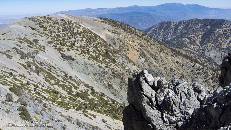
It was clear above the haze in the valleys and low clouds along the coast. From Mt. Baldy’s summit, all of Southern California’s high points could be seen. To the east were the mountains of the San Gorgonio group and San Jacinto Peak; to the south Santiago Peak; and to the northwest an array of peaks in the San Gabriel mountains, including Mt. Wilson, Strawberry Peak, Twin Peaks, Mt. Waterman and Mt. Baden-Powell.

After spending a few minutes proselytizing about the great running in the surrounding mountains, I shook hands with Hayk and started jogging down the North Backbone Trail. Step two in this adventure was to get down to the tree.

After all the uphill on the Ski Hut trail, the first few yards of downhill felt pretty good. But as the trail started to plunge down Baldy’s north face, it became all too clear that THIS downhill came at a high price. Every stride down was going cost at least a couple of steep steps up on the way back.

Then there was the uphill on the downhill. The North Backbone isn’t a uniform, well behaved ridge. It has ups and downs. Big ups and downs named Dawson Peak and Pine Mountain. Just descending to the tree would require 1200′ of elevation gain, and there would be much more than that returning to Baldy.

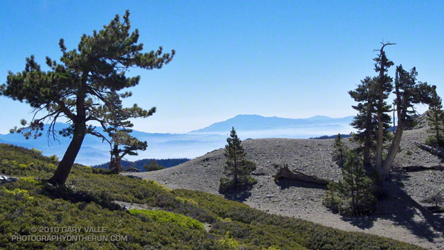
I tried not to think about it. There was just too much to see and enjoy. The area’s complex geology had produced dramatic ridges, mile deep canyons, and 9000′-10,000′ peaks. There were windswept Jeffrey pines and gnarled and twisted lodgepoles. Rabbitbrush bloomed in profusion, its bright yellow flowers contrasting sharply with the greens of the manzanita. Here and there red daubs of paintbrush accented the sparkling tiles of gray-green Pelona schist.


It was a spectacular place to be. After doing the North Backbone Trail for the first time in 2006, I came back the following weekend and did it again. It’s that kind of place — wild, scenic and adventurous.

How far down was that (dang) tree? I’d left the summit of Pine Mountain some time ago, and was still going down, down, down. The lodgepole pine forest on my right had the right look, but the slope to my left wasn’t steep enough. Maybe just down this hill… Is it at this little saddle? Just down the ridge a little more…

Epilogue: The circumference of the juniper measured 14′ 6.5″ or about 174.5 inches. See the post Pine Mountain Juniper for more info about the tree.

Some related posts: Mt. Baldy North Backbone Trail, North Backbone Trail Revisited

Limber Pine Cone

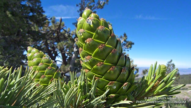
Developing Limber pine cones

Developing cones on a limber pine near the start of the Vincent Tumamait Trail on Mt. Pinos (8831′). Limber pines are a hardy, 5-needled, species generally found at higher altitude in the western U.S.

Limber pine (Pinus flexilis) is a white pine, related to whitebark and bristlecone pines. They are slow growing, and can be very long-lived. According to the Gymnosperm Database, two trees have been crossdated with ages of about 1600 years.

In Southern California limber pines are found on Mt. Pinos, Mt. Baden-Powell, San Gorgonio Mountain, Mt. San Jacinto, and some other areas above about 8500′.

Related post: Forest Green

Sugar Pine Silhouette

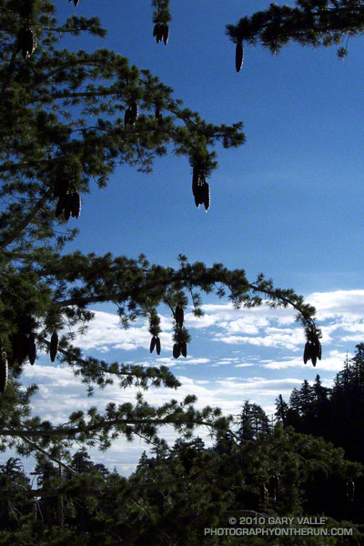
Sugar pine

Its long limbs bending with the weight, a sugar pine reaches as far as it can to drop its heavy, resin-covered cones.

Because of its short needles and long branches, the silhouette of a sugar pine is particularly distinctive.

From Sunday’s run on the PCT.

Some related posts: Sugar Pine & Clouds, Kratka Ridge Sugar Pine

July Fourth Trail Run to Trippet Ranch, Hondo Canyon and Saddle Peak

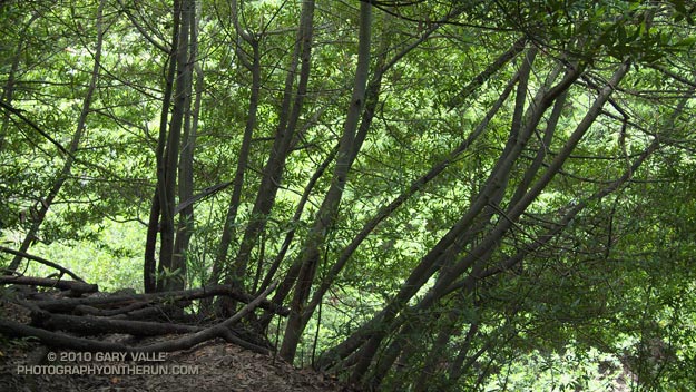
Bay trees on the Hondo Canyon Trail

It was about 9:45 a.m., and I was switchbacking up through a surprisingly dense forest of California bay on the Hondo Canyon segment of the Backbone Trail. The trail was carpeted in bay leaves, and a hint of the sharp, sweet smell of bay lingered in the still morning air. It had been four years since I had run this trail, and I had forgotten just how lush and green it was. The geology, oaks, bay trees, ferns, and poison oak were spectacular.

The run from the end of Reseda to Saddle Peak (and back) was going well. The route was a tricky one, and it really helped that I had done it before. Lower in the canyon there had been a misleading Backbone Trail marker, and that was just one of several potential gotcha’s.

Even if you know the way, the run is no gimme. Depending on the route used, its length works out to around 26 – 28 miles, and it has a legit elevation gain/loss approaching 5000′. Throw in the route-finding challenges, and it’s possible to have a long day.

The run starts at Marvin Braude Mulholland Gateway Park, on the San Fernando Valley side of the Santa Monica Mountains. The first leg of the run goes to Trippet Ranch. I usually run the fire roads out to Trippet Ranch, and then take the Musch, Garapito, and Bent Arrow trails on the way back to Reseda.

The route-finding fun begins on the Dead Horse Trail at Trippet Ranch. From Trippet Ranch to Saddle Peak the route is all on the Backbone Trail, and is (almost) all single track. Some of it is marked, and some of it isn’t. Some of it is obvious, and some of it is not.


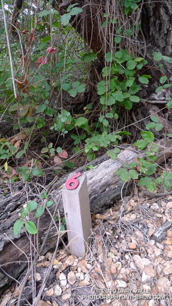
The most obscure section is between Topanga Canyon and Old Topanga Canyon. From the Dead Horse Trail parking lot, the Backbone Trail starts behind the bathrooms and follows a brushy canyon down to Topanga Canyon Blvd. The trail picks up again across Topanga, about 50 yards west on Greenleaf Canyon Road. The trail is on the left, just before a creekbed, and leads uphill. There are some nature trail markers along the steep trail, and the top of the hill is about a quarter-mile from Greenleaf. From the top of the hill, the trail zigs south and zags west, working down to a dirt road. The route continues across the road and down an overgrown slope to the north side of the water tanks. A trail leads northwest from the water tanks and down to Old Topanga. The total distance from Topanga to Old Topanga is about 0.6 mile.

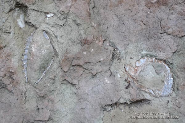
I was glad to have that convoluted stretch behind me. A few minutes ago I’d reached the top of Hondo Canyon, and turned onto the Fossil Ridge Trail. When the visibility is good, the views along Fossil Ridge and the crest leading to Saddle Peak are excellent. Today the marine layer had been slow to clear, and the tops of the peaks were cloaked in fog. The chaparral plants were so wet that I was able to squeeze a gulp of water from the brush-like flowers of a laurel sumac.


After about a half-mile on the Fossil Ridge Trail, I emerged from the chaparral, turned left on Topanga Tower Mtwy, and ran down to the popular overlook at the junction of Schuerren, Stunt, and Saddle Peak roads. Here I continued west across the highway and scrambled up to a ridgetop trail that leads to a big water tank. From the water tank it’s about  0.3 mile up the trail to the turn-off to Saddle Peak, and then another 0.4 mile to the summit. The western peak (2805′), the one with all the communications equipment, is the high point.

Keeping in mind that GPS traces are not exact, and the route I used isn’t necessarily the “official” or “best” route, here’s a Google Earth interactive view of a GPS trace of my 27.5 mile route.

Some related posts: Garapito Trail Runs, Born to Run, Musch Trail Mule Deer, Red Rock Canyon – Hondo Canyon – Saddle Peak Loop

Trail Work and Tree Rings

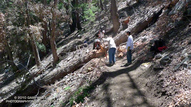
Trail work on the Kenyon Devore Trail after the Station Fire.

Last year’s Station Fire, and the Winter storms that followed, combined to damage many miles of trail in the San Gabriel Mountains. Among the volunteers working hard to restore the trails are runners that will doing the Mt. Disappointment 50K and Angeles Crest 100 mile endurance runs later this Summer.

Gary Hilliard, trail maestro and R.D. of the Mt. Disappointment runs, dedicates an astonishing amount of time to the task of preserving trails — encouraging and organizing volunteers, surveying trails, and doing the down and dirty work of maintenance and restoration. If it’s a Summer Saturday, chances are good you’ll find him in Angeles National Forest, working with a group of runners to make a trail better.


Today’s trail was the Kenyon DeVore Trail on the north side of Mt. Wilson. Originally a part of the Rattlesnake Trail, the trail was renamed in tribute to the Forest Service patrolman, hydrographer, and Angeles National Forest volunteer, Kenyon DeVore. The trail is the toughest part of infamous final leg of the Mt. Disappointment 50K and 50 mile courses, climbing about 2300′ in 3.6 miles.

There was plenty to do on the Kenyon DeVore Trail, and Gary divided us into three groups. One group was given the job of restoring a long stretch of trail that had been obliterated by debris flows, and another group was assigned the chore of clearing a rock slide. Our group’s task was removing several trees that had fallen across the trail, and working on the trail along the way.


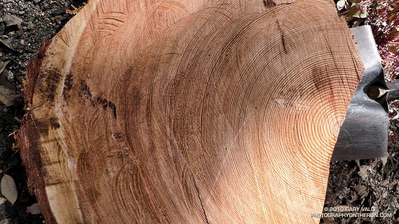
The largest of the trees blocking the trail was a sizable bigcone Douglas-fir. At the point where it was cut, the diameter of the trunk was about 26″-28″. For its size, the tree was surprisingly old. A rough count of the rings from a contrast enhanced photo gives an approximate age of 310 years. The age was not cross dated, but appeared reasonable when compared to a standard tree ring chronology.

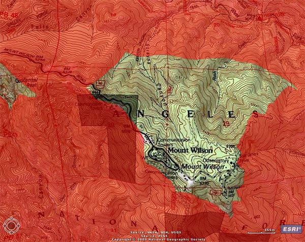
The cut sections of the tree had no obvious fire scars. The CDF/FRAP Fire History Database indicated that, prior to the Station Fire, a large part of the canyon in which the tree was located had no reported fire history.

When we were done, about two-thirds of the Kenyon Devore Trail had been restored. No worries about the other third, Gary has trailwork scheduled most weekends through the end of July.

Wolf Lichen on White Fir

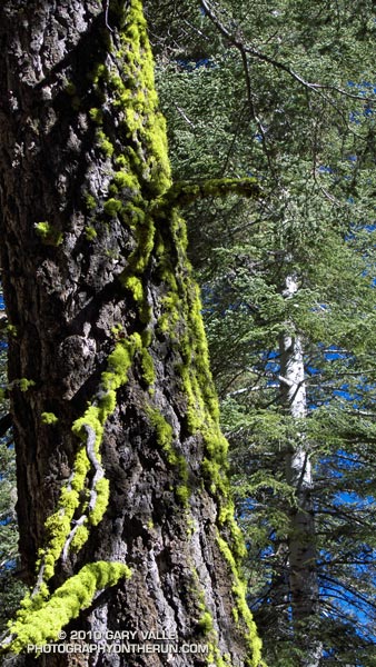
Wolf lichen (Letharia vulpina) on white fir

The vibrance of the green caught my eye. Flourishing as a result of a May’s unusually cool, damp, and cloudy weather, the wolf lichen on this White Fir seemed to glow in the morning sun. I was on the Vincent Tumamait Trail, in a dense forest of White Fir and Jeffrey Pine.

The weather at 8500 ft. was idyllic, but here – as elsewhere in the mountains – Spring had been slow to arrive. Scattered patches of snow remained on the forest floor, and the smell of damp soil, warm pine needles, and broken fir limbs filled the air. Exposed by melting snow, the Winter workings of voles wound snake-like across the ground, and I wondered how many mountain canyons had started with the erosion of a vole’s Winter run.

Given its bright chartreuse green color, it isn’t surprising that this lichen (Letharia vulpina) has been used by various indigenous groups to make a dye. Perhaps more of a curiosity is that it is toxic, and has reportedly been used as a poison, and medicinal remedy.

From Sunday’s trail run in the Chumash Wilderness.

Some related trail runs: Fresh Air Traverse, Mt. Pinos – Mt. Abel Out & Back