Category Archives: nature|trees

Ahmanson Blue Oak

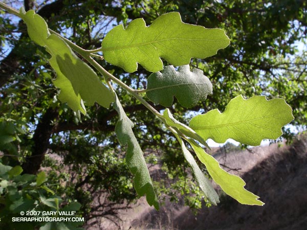
Photograph of leaves of blue oak in East Las Virgenes Canyon.

Update April 14, 2023. The Ahmanson Blue Oak has died. Please see the post Ahmanson Blue Oak Succumbs to Climate Change.

Blue oak (Quercus douglasii) is a characteristic oak of the lower elevations of the Sierra foothills and coastal mountains, its range essentially encircling California’s Central Valley.

Based on its reported range, Upper Las Virgenes Canyon Open Space Preserve (formerly Ahmanson Ranch) contains one of the southernmost populations of blue oak within its range. However, the predominate deciduous oak in the area is valley oak (Quercus lobata), and occurrences of blue oak appear to be rare. Regional climate modeling suggests that over the next century the range of blue oak could shift northward and diminish to nearly 60% of its current range.

Blue oak is reported to hybridize with valley oak, however a 2005 study suggests hybrids of these species may be more rare than generally accepted.

The photograph of the leaves of a blue oak was taken on a run along East Las Virgenes Canyon to Lasky Mesa on April 24, 2007. A valley oak immediately adjacent to this blue oak was killed in the 2005 Topanga Fire.

Related posts: Ahmanson Blue Oak Succumbs to Climate Change, Valley Oak Savanna, Laskey Mesa Oak

Technical papers:

Modeled regional climate change and California endemic oak ranges.
Kueppers, L.M., M.A. Snyder, L.C. Sloan, E.S. Zavaleta, and Brian Fulfrost. 2005.
Proceedings of the National Academy of Sciences of the United States of America, 102(45): 16281 – 16286.

Limited hybridization between Quercus lobata and Quercus douglasii (Fagaceae) in a mixed stand in central coastal California.
Kathleen J. Craft, Mary V. Ashley and Walter D. Koenig.
American Journal of Botany. 2002;89:1792-1798.

Ahmanson Lollipop Tree

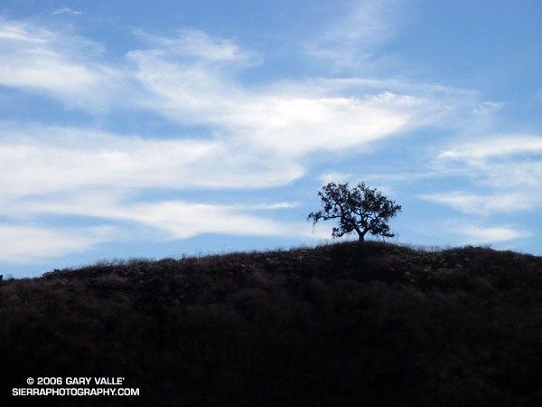
The Ahmanson lollipop tree can be seen on the skyline south of the main drag about 1.25 miles from the Victory trailhead.

On the South Fork American River is a tree high on a ridge that rafters and kayakers refer to as the Lollipop Tree. It marks the beginning of the Gorge run and the class III rapid “Fowler’s Rock.”

When I run on the “main drag” at Ahmanson Ranch (Upper Las Virgenes Open Space Preserve) there is an oak tree that sits on a hilltop near Laskey Mesa that reminds me of the S.F. American tree. The Ahmanson lollipop tree can be seen on the skyline south of the main drag about a mile from the Victory trailhead.

This photograph was taken on an exploratory out and back run to the headwaters of Las Virgenes Creek on Christmas Eve.

Note: Jon Sutherland nicknamed the main road that connects the Victory trailhead to Las Virgenes Canyon the “main drag.” Jon has run out at Ahmanson for more than 30 years. He is second on the Running Streak List for most consecutive days run. As of September 1, 2006 his streak was 13,613 consecutive days (37 years 99 days), and still counting!

Chumash-Hummingbird Loop

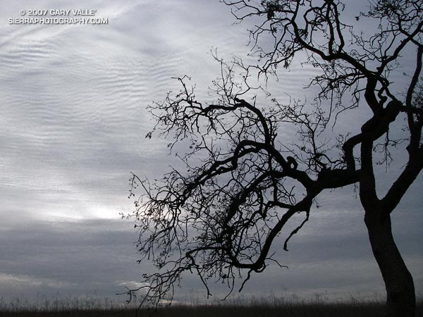
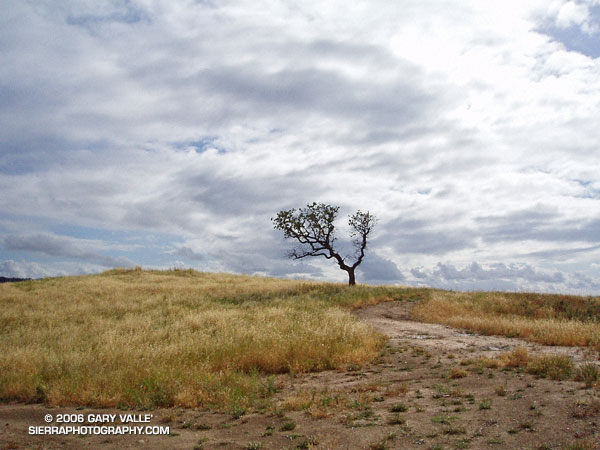
Oak, grass, and clouds in Simi Valley, California.

The Chumash and Hummingbird trails are popular trails in the eastern Simi Valley, north of the 118 Freeway. These trails ascend the steep western flank of the Santa Susana Mountains to Rocky Peak fireroad. A scenic loop can be created using these trails and a connection between the Chumash and Hummingbird trailheads down in the valley. There are a few ways to do this, and the loop has proved popular.

The Chumash trailhead is on Flanagan Dr., off of Yosemite, and the Hummingbird trailhead is on Kuehner Dr. just north of the 118 Frwy. Currently, no official trail connects these trailheads. To connect them via city streets (Yosemite, E. Los Angeles Ave., Kuehner) is a long detour on pavement and doesn’t make sense from a trail-running or hiking point of view.

For many years a more direct, unofficial route has been used to connect the two trailheads. Most of the route is on dirt roads through undeveloped property. Using this route the length of the Chumash-Hummingbird loop works out to about 9.2 miles with about 1700′ of elevation gain. It’s an excellent hike, run or ride with great scenery and views.

For a number of years access to the Hummingbird Trail from Kuehner Dr. has been across property that is now being developed. A chain link fence has been in place along Kuehner for some time. Apparently, at the north end of this chain link fence there is a conservation easement that allows access to the Hummingbird Trail  via a corridor adjacent to the (private) Hummingbird Ranch property. It was necessary to use this access easement when I ran this loop last weekend.

The property on the west side of Kuehner is also being developed. As I understand it, Mt. Sinai Dr. will eventually connect to Kuehner and a small parking lot will be built for trail users. Hopefully, some provision will also be made to officially connect the Chumash and Hummingbird trailheads and preserve this scenic loop.

The photograph of the oak is from a run of the loop on April 28, 2005.

Update 12/26/06 – Mike Kuhn, the director of the Rancho Simi Trailblazers, sent me the following information regarding the Hummingbird trail easement:

“At the top of Kuehner Drive is a cul-de-sac at the gate to the Hummingbird’s Nest Ranch. The white plastic fence marks the boundary of the ranch. There is a corridor of land owned by the park district along the white plastic fence down to the creek and hence to the usual crossing of the creek.”

He also said that a trail connection between Chumash and Hummingbird is in the planning stages, and encourages all trail users to be patient while the construction at Kuehner is underway.

Related post: Lower Stagecoach – Hummingbird Loop
Pine Mountain Juniper

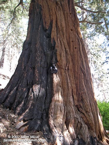
Ancient Sierra Juniper (Juniperus occidentalis var. australis) on the rocky slopes of Pine Mountain.

Updated September 19, 2010.

This Sierra Juniper (Juniperus occidentalis var. australis) resides at an elevation of 9000′ on the rocky slopes of Pine Mountain in the Sheep Mountain Wilderness of Southern California. It is an impressive and aged tree. The question is, how old might it be?

Junipers are very slow growing and seem to prefer the dry and difficult conditions that can produce very long-lived trees. Two junipers more than 2000 years old are listed in OLDLIST, a database of scientifically supported tree ages maintained by Rocky Mountain Tree-Ring Research, Inc.

Both of these trees are located in the Sierra near Sonora Pass. OLDLIST lists the age of the Bennett Juniper, a living tree, at an extrapolated age of 2200 years. This estimate is based on a crossdated incremental core. The Scofield Juniper, a tree that died in 1165, has been crossdated at an age of 2675 years.

The Bennett Juniper is a massive tree. The National Register of Big Trees lists its circumference at 481 inches, and height at 78 feet. The juniper on Pine Mountain is not nearly as large, but it is still a sizeable tree.

Update 9/19/2010. I measured the circumference of the Pine Mountain juniper at 14′ 6.5″ or 174.5 inches. This works out to an average diameter of 55.5 inches. The tree is more or less elliptical in cross section, with the major axis aligned along the ridgeline. The tree’s diameter along the major axis is estimated to be 65-70 inches.

If the Bennett Juniper’s diameter is about 153 inches and its age is 2200 years, its average growth in diameter would be 0.0695 inch a year. Applying this same growth rate to the average diameter of the Pine Mountain tree, and its estimated maximum diameter, yields an age range estimate of 800 to 1007 years.

But relative size may not be indicative of relative age. The Pine Mountain Juniper’s shorter rain season and rocky, ridgetop location likely resulted in a slower growth rate than the Bennett tree. The Wally Waldron Limber Pine on nearby Mt. Baden-Powell is estimated to be 1500 years old, and some other Limber Pines on Baden-Powell are thought to be 2000 years old. Whatever its exact age the Pine Mountain Juniper is an extraordinary tree.

The photographs in this post (except for the Wally Waldron tree) were taken on the Mt. Baldy North Backbone Trail and North Backbone Trail Revisited run/hikes.

Some related posts: Inspiration Point to the Pine Mountain Juniper, Mt. Baldy Run Over the Top

Lightning Tree

Spiral lightning scar on a Jeffrey Pine.

Mt. Baldy’s North Backbone Trail is not a place to be in a thunderstorm. From start to finish it seems you are either on the crest of a ridge, or on or near the summit of a peak.

The photo above is of a spiral lightning scar on a Jeffrey Pine on the trail at the summit of peaklet marked 8555 on the USGS Mount San Antonio quad. The scar appears to be fresh, and could be from a strike that occurred this Summer. Perhaps the most remarkable thing, given the tree’s prominent location, is that it hasn’t been struck and scarred before.

The photographs are from Sunday’s North Backbone Trail Revisited hike and run. A photograph of another Jeffrey pine that was struck by lightning can be found in the post Three Points – Mt. Waterman Loop.

Google search: $g(lightning), $g(Jeffrey Pine), $g(lightning tree), $g(North Backbone Trail), $g(Mt. Baldy)