Category Archives: photography

La Jolla Valley & Mugu Peak from Wendy Drive

Pt. Mugu from Mugu Peak.

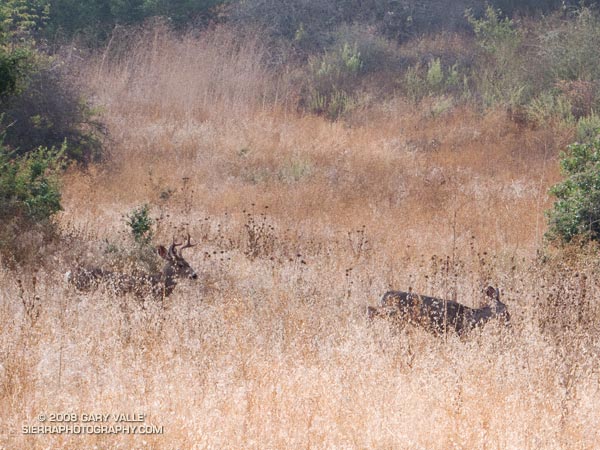
The scat appeared to be a day or two old, and was much bigger than a coyote’s. It was full of fur and could only be from one animal — a mountain lion. The spot had been used before, and it probably wasn’t a coincidence that this was one of the few points along the trail with a good view and nearby cover. I looked into the brush and wondered if unseen eyes looked back.

The sun was well above the horizon, but the first gusts of a developing Santa Ana wind kept the morning cool. No one was on the trail ahead or behind me, and the best I could tell, I was the only two-legged creature within sight.


Spring in La Jolla Valley. Boney Mountain in the distance. March 2002.
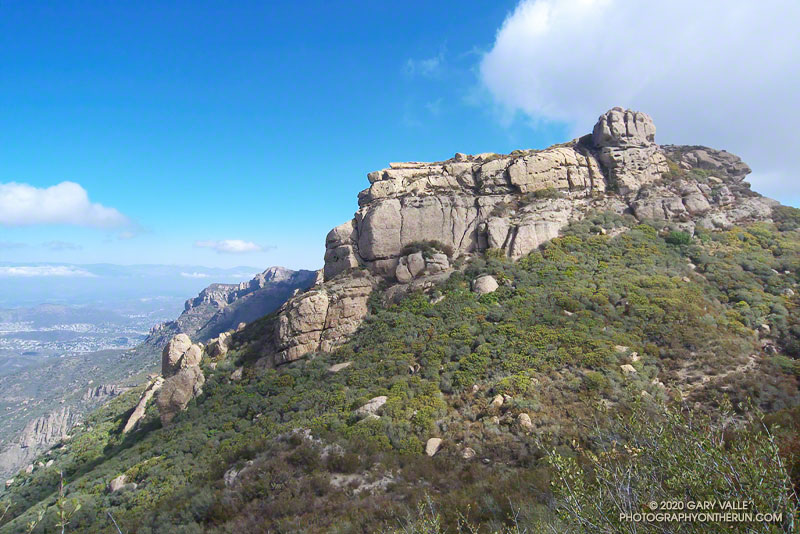
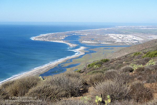
Walking slowly from the spot, I surveyed the secluded valley. Perched on the edge of the coastal mountains, La Jolla Valley is extraordinary. Surrounded by wind-sculpted peaks, it is situated above and to the west of Big Sycamore Canyon. Its bottom is carpeted with areas of native and non-native grass. Only a tiny percentage of California’s native perennial grasslands remain, and like the big trees, they are relics of the past. Preservation of this native grassland is probably due to the valley’s proximity to the ocean, and its unique microclimate.

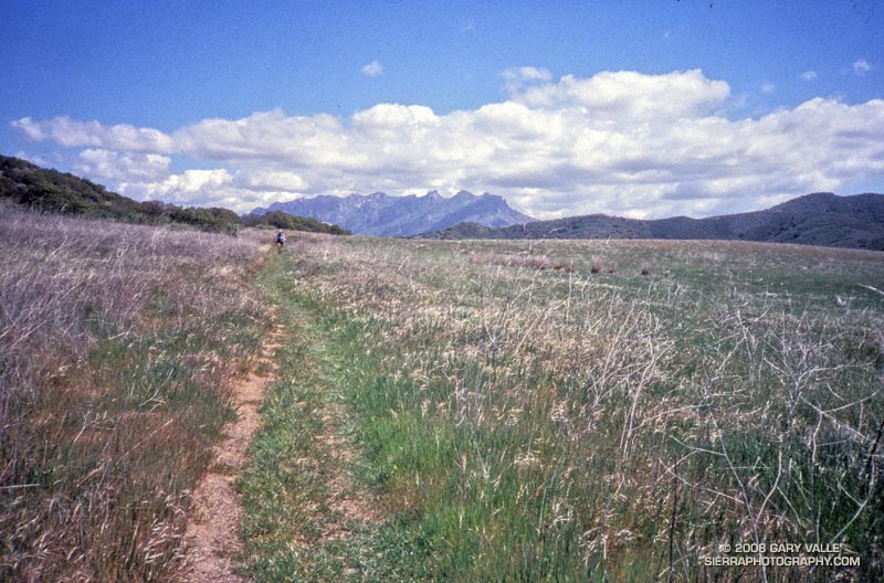
Here, trails have been run and peaks climbed for thousands of years. (Charcoal at an archaeological site in the valley has been dated to a maximum age of 7000 B.P.) Above me a raven calls, and Spirit-like, a gust of wind rustles through the grass. Respectfully, I continue running in the direction of Mugu Peak.

The run from Wendy Dr. was more moderate than expected. The first 3 miles of Sycamore Canyon Fire Road are paved, and whether on the fire road, or the single track trails that parallel the road at times, a fast pace can be maintained down to the junction with Wood Canyon Fire Road.

The Wood Canyon Vista Trail/Backbone Trail takes off right (west) from Sycamore Canyon Fire Road a short distance past the Wood Canyon Fire Road junction. It is moderately graded and very runnable. At it’s top a short zig right (north) on the Overlook Fire Road leads to the La Jolla Valley Fire Road, which can be followed left (west) down into La Jolla Valley.

Many, many variations of this course are possible. Here are archived maps of Rancho Sierra Vista/Satwiwa and Pt. Mugu State Park originally from the NPS Santa Monica Mountains web site. Also see the Pt. Mugu State Park maps on VenturaCountyTrails.org.

Depending on whether you want the beta, a little time in Google Earth should help clarify the options. This particular course worked out to about 21 miles, with about 2200 ft. of elevation gain/loss. Here’s a Google Earth image and 3D interactive view of a GPS trace of my route.

Boney Mountain – Big Sycamore Canyon Circuit – Coyote Trail Variation

https://photographyontherun.com/content/binary/BoneyMountain1000130b.jpg

It’s fun to link together several trails into a loop, and it’s even more fun when the trails are single-track, or at least have a single-track flavor. The Boney Mountain – Big Sycamore Canyon circuit links together segments of more than ten trails and roads in Rancho Sierra Vista/Satwiwa and Pt. Mugu State Park. The route is characterized by airy ridges, steep climbs, wide-ranging views, towering rock formations, and one of the best downhill running segments in the Santa Monica Mountains. Today’s run expanded the loop, adding even more single-track trail — and elevation gain.

This route also climbs over Boney Mountain and descends the Chamberlain Trail segment of the Backbone Trail. However, at the Old Boney Trail junction, instead of descending to the Danielson multi-use area on the Old Boney Trail (northbound) and Blue Canyon Trail, this route follows the Old Boney Trail (westbound) to Sycamore Canyon Fire Road.

From the junction of the Old Boney Trail with the Sycamore Canyon Fire Road the goal is to hook up with the Coyote Trail, which can be seen switchbacking steeply up a slope on the other side of the canyon. We did this by continuing about 0.5 mile down Sycamore Canyon Fire Road, and then turning right on Wood Canyon Fire Road. The Two Foxes Trail starts a short distance up the fire road, and in about 0.4 mile leads to the start of the Coyote Trail. Once on the Coyote Trail it is about 2.3 tough — and often hot — miles to the start of the Hidden Pond Trail at Ranch Center Road. The rest of the route is the same as in the Boney Mountain – Big Sycamore Canyon circuit.

All in all the course is about 21 miles long, with 4000 ft. of elevation gain/loss. Here’s a Google Earth image and Google Earth KMZ file of a GPS trace of the route.

Downed Trees Near Mt. Abel

Area of downed trees near the Cerro Noroeste road on the way to Mt. Abel.

Most of the trail between Mt. Pinos and Mt. Abel is in old growth pine and fir. One exception is this area of downed trees near the Cerro Noroeste road. The brushy plant with yellow flowers is rabbitbrush (probably Chrysothamnus viscidiflorus).

From today’s run to Mt. Abel and back from Mt. Pinos on the Vincent Tumamait Trail in Los Padres National Forest.

More Musch Trail Mule Deer

A young buck and a doe along the Musch Meadow Trail near Trippet Ranch in Topanga State Park.

When running in the Trippet Ranch area of Topanga State Park, more often than not, I see mule deer browsing among the oaks along Eagle Springs Fire Road, or along the Musch Meadow Trail.

On Sunday’s Trippet Ranch loop, these deer were near the Musch Meadow Trail. The young buck appeared to be taking more than a passing interest in the doe. The breeding season for mule deer varies widely, and begins as early as mid-September in some locations.

Here is a zoomed view of the doe and buck.

Related post: Musch Trail Mule Deer