Category Archives: photography

Tracking the Sun

Mallow leaves tracking the sun.

Updated 03/13/08.

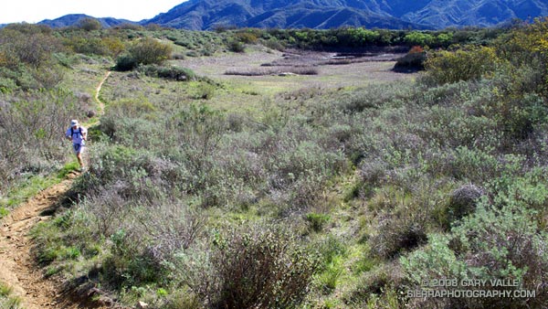
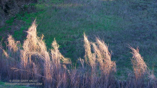
My run of the “keyhole loop” at Ahmanson Ranch started out as a tempo run — not so much as being part of a rigorous training program, but because of a dead battery in my car remote. It felt good to push the pace a bit.

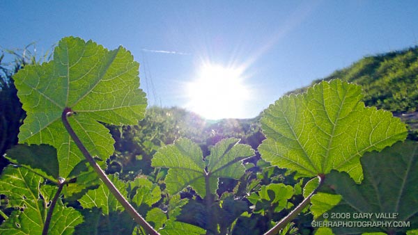
Part way through the loop, running up a short hill into the sun, I was struck by a repetitive pattern of backlit leaves in the new growth on and alongside the road. Like little green satellite dishes, hundreds of the round leaves of mallow were facing directly into the late afternoon sun.

Mallow (Malva spp.) is an invasive plant from the Mediterranean area that has flourished in Southern California’s Mediterranean climate. In most years, it is very common. I’ve run and hiked past thousands of these plants, but never noticed this synchronicity.

Tracking the sun makes sense. Our climate has an extremely variable and relatively short growing season. A plant that maximizes its intake of solar energy and growth by orienting its leaves toward the sun would have an advantage over a less adaptable species. This is probably one of the reasons mallow is such a successful invasive. Another invasive that grows alongside mallow, black mustard, also appears to exhibit heliotropism as it is growing. It creates a rosette of leaves facing into the sun by raising leaves on the side of the stalk away from the sun, and lowering leaves on the side of the stalk toward the sun.

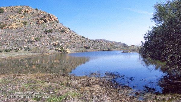
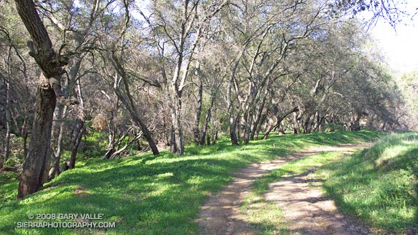
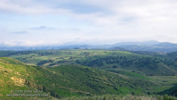
From a run during the week at Ahmanson Ranch — now Upper Las Virgenes Canyon Open Space Preserve.

Technical papers:

Diaphototropic Movement of the Leaves of Malva Neglecta

H. C. Yin
American Journal of Botany, Vol. 25, No. 1 (Jan., 1938), pp. 1-6

HELIOTROPISM AND WATER AVAILABILITY EFFECTS ON FLOWERING DYNAMICS AND SEED PRODUCTION IN Macroptilium lathyroides

ARMANDO MARTINS DOS SANTOS, LUIS MAURO GONÇALVES ROSA, LUCIA BRANDÃO FRANKE, CARLOS NABINGER

Vernal Pool at China Flat

Vernal pool near the sheep corral at China Flat in the Simi Hills.

In normal to wet rain seasons vernal pools can be found throughout the Simi Hills. The pool pictured above is near the sheep corral at China Flat, and another small pond was found nearby, along Albertson Motorway fire road. I’ve also found vernal pools in the Rocky Peak area and near Sage Ranch.

Geologically, the Simi Hills are characterized by the sandstone rocks of the Chatsworth formation. These inclined layers are of varying hardness, and erode at different rates. It’s my guess that water collects in sandy soils between, or at the base of, the more resistant layers.

The photographs of the ponds at China Flat are from Sunday’s Scenic Route to Simi Peak run.

Scenic Route to Simi Peak

Oaks along the route to Simi Peak.

When the rainy season turns wet and the grasses green, all routes to Simi Peak are scenic, but the varied trails and terrain, and the wilderness feel of the more remote sections of this 21.5 mile run makes it one of my local favorites.

It is a longer variation of the route described in the post Upper Las Virgenes Canyon Backcountry. The run starts at the Victory (or Vanowen, or Las Virgenes) trailhead of Upper Las Virgenes Canyon Open Space Preserve and explores the headwaters of Las Virgenes Creek. At the junction of the power line service road and “backcountry” trail, instead of turning south up the power line service road, this option works west over to Albertson Motorway fire road, and on to China Flat and Simi Peak.

Here’s a Google Earth image and Google Earth KMZ file of a GPS trace of the route.

Return to Hidden Pond

A trail runner on the Hidden Pond Trail in Pt. Mugu State Park.

Southern California can have inclement Winter weather. This January downtown Los Angeles experienced a streak with 8 days of measurable rain, and last year temperatures in the suburbs plunged to a frigid 20°F. Maybe this doesn’t compare to Seattle’s 2005-2006 rain streak of 27 days, or International Falls’ recent record low of 40° below zero, but it qualifies as rainy and cold none the less.

Today it was not rainy and cold. It was just about as pleasant as a day could be. Skies were blue, winds were light, and the temperature was in the mid-seventies. Starting at the Wendy Dr. trailhead on Potrero Rd., we enjoyed the perfect weather by doing a 14.5 mile variant of the Boney Mountain Half Marathon Course.

The photograph above is of the Hidden Pond Trail near Hidden Pond — recently restored by Winter rains.

Related posts: Boney Mountain Half Marathon, Big Sycamore Canyon Circuit, Boney Mountain – Big Sycamore Canyon Circuit