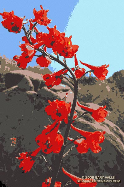
From a run at Sage Ranch earlier this Summer.

From a run at Sage Ranch earlier this Summer.
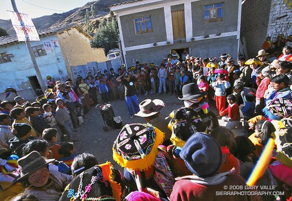
Our stopover at the Peruvian highland village of Tinqui was one of many memorable experiences on my running trip to Peru. At 12,400′, Tinqui is the trailhead for the Ausangate Circuit — an adventurous route around Mt. Ausangate that crosses two 16,500′ passes.
A 4-5 hour bus ride from Cusco, Tinqui is pleasantly remote and rustic. We arrived on a Sunday afternoon, and after getting settled into our hostel, walked down the dusty main street to the market. Music and laughter erupted from a nearby crowd…
“She told me her name was billie jean, as she caused a scene
Then every head turned with eyes that dreamed of being the one
Who will dance on the floor in the round”
Boombox at his side, a blue-jeaned and baseball-capped performer treated the crowd to his best Michael Jackson.
Later that evening, breathing deeply and thinking of the run ahead, I drifted to sleep on the distant, interleaving harmonies of a Catholic Mass sung in the native Quechua language — far from home, but not very far from the nearest boombox, and the influence of Michael Jackson.
Related posts: Peru Running, Runner on Circuit of Mt. Ausangate
Google search: $g(michael jackson), $g(trail running), $g(Peru), $g(adventure travel)
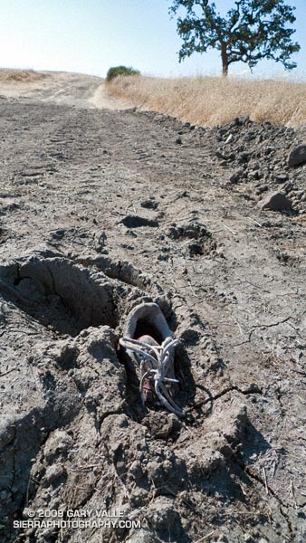
Exactly as I found it on my run at Ahmanson today. Looked like a fairly new running shoe.
There is nothing quite so compelling as an unanswered question.
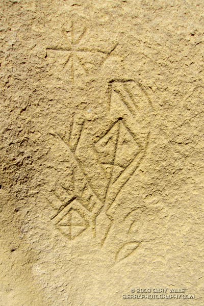
Several years ago, in the middle of a trail run, an unusually shaped rock formation caught my eye. After a little bushwhacking and exploration, I found a way to climb the formation, and on its summit found a small pictograph. I wondered if there might be other pictographs in the area, and on the way back to the trail found the inscription pictured above.
Later, I took a friend with more ethnographic experience to the top of the rock, and it was his opinion that the pictograph, as well as the nearby inscription, were not of modern origin. He also mentioned that the rock likely marked the point on the southeastern horizon where the sun rises on the Winter Solstice, as seen from a Chumash shrine several miles away.
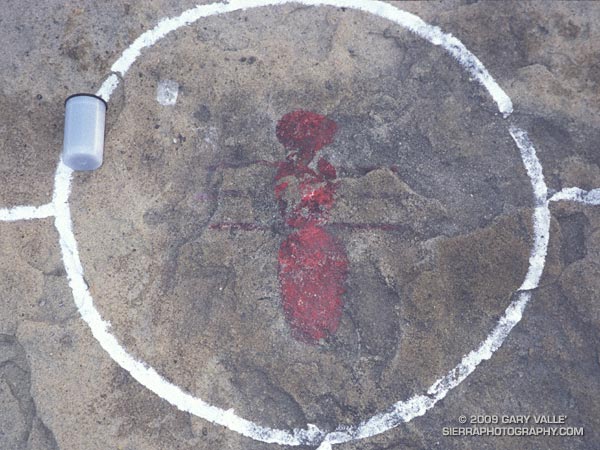
The pictograph on the solstice rock appears to have been painted using an ochre pigment, which may have been mixed in an adjacent cupule. It is in a harsh environment, fully exposed to the sun, wind and rain. It’s my guess that the white “alignment” reticule surrounding the pictograph is an unfortunate recent addition.
The petroglyph is in a concavity on the north side of a large boulder, and is better protected. That the drawing appears to be astronomical in nature, and is adjacent to a rock possibly used to mark the Winter solstice is probably not a coincidence.
To speculate on the purpose and meaning of such a drawing is to travel in time, and through the thoughts and eyes of another, visit a world far different than our own.
In this case that someone was probably an ‘alchuklash — an astronomer-priest-shaman who was a part of a religious-spiritual cult known as the ‘antap — a pervasive power elite within Chumash society.
The ‘alchuklash were adept astronomers, not only observing the Winter and Summer Solstices, but the moon, individual stars, asterisms, constellations, planets, Milky Way, eclipses and more. The observation and interpretation of the Upper World were an integral part of the Chumash cultural and world view.
But the Upper World did not exist on its own. The Chumash appreciated and celebrated the interdependency of Nature, and events in the Upper and Lower Worlds were inexorably tied to those in the Middle World of everyday existence. Using their specialized knowledge, the ‘antap facilitated communication and interaction between these worlds to the benefit, or peril, of the People.
It is in this context that in the drawing I see the powerful personage of an ‘alchuklash, who has reached into the Upper World. Perhaps the drawing is a commemoration of the power of the place. Perhaps it is a kind of owner’s manual, a premodern PDF, illustrating the purpose of the solstice rock. Or, perhaps it is something we cannot know.
Note: The contrast of the lines in the image has been increased to make them easier to see. In the ten years since I first photographed the etching, some detail has been lost in the lower right corner of the drawing. This image is from April 21, 2009.
Reference: Crystals in the Sky: An Intellectual Odyssey Involving Chumash Astronomy, Cosmology, and Rock Art. Travis Hudson and Ernest Underhay (Foreword by Anthony F. Aveni and illustrated by Campbell Grant). Socorro, New Mexico: Ballena Press Anthropological Papers No. 10, 1978, 163 pp.
Google search: $g(Chumash), $g(petroglyph), $g(pictograph), $g(rock art), $g(solstice), $g(astronomy), $g(ethnography), $g(shaman)
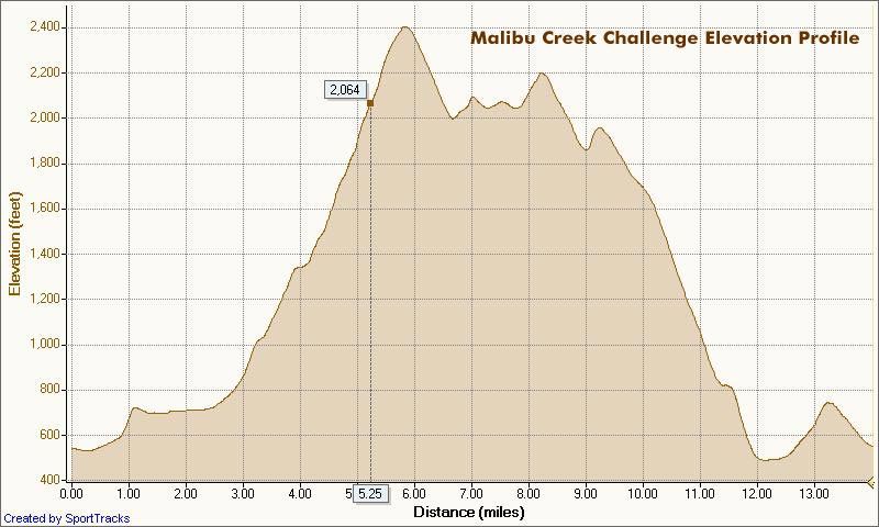
I glanced at my watch — 5.25 miles. Clouds and fog had kept temps on the cool side for more than three-quarters of the Bulldog climb, but the sun was finally breaking through. Even though temps were down a few degrees, the long climb had still been grueling. The runner next to me was breathing heavily, and I mentally repeated my Bulldog mantra — don’t redline, don’t redline.
For many of us, that’s the problem with Bulldog — some of it is runnable and some of it isn’t. For the moment I was running, but I knew the grade well, and just ahead the fire road switchbacked right, and steepened.
I’ve been over the “I can run this hill no matter what” thing for a long time. For me, and the majority of trail runners, walking the steeps is a good thing. The little bit of time lost by walking is generally made up — and more — on other sections of the course.
Rounding a corner, the grade did steepen, and I slowed and started to walk. Taking advantage of the slow pace, I ate a Gu, took a Salt Stick cap, and gulped down some Gatorade. Another runner and I had been swapping leads up the hill, and he passed me — again. As he increased his lead, I wondered if I should be pushing a little harder.
A left turn never felt so good! A few minutes before I had reached the top of Bulldog grade, and the highest point on the course. Now gravity was on my side, and I was enjoying the downhill. There were more challenges ahead, but for now I was lost in the moment — savoring the wind in my face, the far reaching views along the rocky crest, and that wonderful feeling of being a runner.
Here’s a Cesium browser View of a GPS trace of the 22K course with my half-mile splits. (Generated in SportTracks.) See the XTERRA Malibu Creek Trail Run web page for race results and additional info.
Some related posts: Malibu Creek State Park Shadow & Sun, Fog Along Malibu Creek, Bulldog Loop and the Corral Fire, Rock Formations Along the Backbone Trail
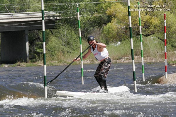
One of the more unusual watercraft at the 2009 Kern River Festival was Dan Gavere’s ULI inflatable stand up paddleboard.
Dan finished second in the 2.5 mile Downriver race, and made all the gates in the Slalom event!