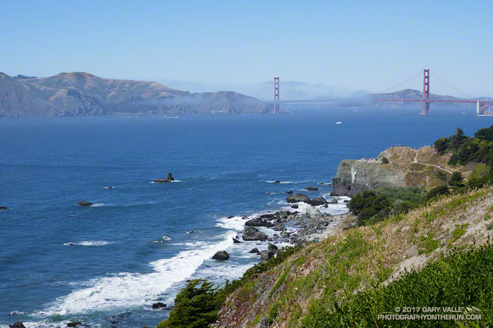
It was a warm day by San Francisco standards — sunny and in the seventies. We’d planned to go “across the bridge” for today’s run, but with the great weather it seemed half the city’s residents and visitors were queued up on the streets leading to the Golden Gate Bridge. We opted for a run in the city instead.
This was not an inferior alternative. Running in the city is fun; there are many options and much to see. Today’s course took us from Industrial Light & Magic, to Mountain Lake, Land’s End, Sutro Heights, Ocean Beach and Golden Gate Park.
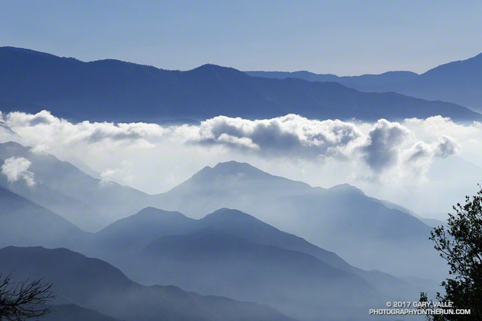
I’d just finished an 18 mile loop from the top of Mt. Wilson and was changing my shoes, when I noticed a group of six hikers walking down the Mt. Wilson loop road toward me. I’d started my run before the Mt. Wilson gate was open and was parked in a turnout near the top of the Kenyon Devore Trail.
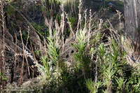
Poodle-dog bush along the Rim Trail on Mt. Wilson.
The run over to Newcomb Pass, down to Chantry Flat, and then back up to Wilson had gone well. If you don’t mind a little Poodle-dog bush and a lot of poison oak, the Rim Trail is one of the hidden gems of the San Gabriels. And the Gabrielino Trail’s excursion through the forests and along the creeks of Big Santa Anita Canyon is a classic.
When the group reached me, one of them asked,”We’re looking for the Winter Trail, do you know where that is?” I did know where the Upper Winter Creek Trail was, because I’d just been at the top of it about 45 minutes earlier.
With its maze of antennae, telescopes and other facilities, it’s not uncommon for hikers and runners unfamiliar with the top of Wilson to become temporarily misplaced. The trails are, of course, on maps — including Google Maps — and described in various online and offline resources.
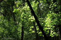
Bigleaf maple along the Gabrielino Trail in Big Santa Anita Canyon.
In this case the hikers didn’t know where they had parked and they didn’t know the route that had taken up the mountain. If you don’t have a clue where you need to go, a map isn’t very useful.
When I described where they needed to go, there were groans all around.
It was midday, the weather was good, it wasn’t hot, they had water and a phone, they would be hiking mostly downhill, and there were plenty of other hikers on the trail. Unless they did something really stoopid, it was just going to be a long day.
From Gone with the Wind to the bridge scene of Mission Impossible III, there have been some big productions on Lasky Mesa. I’ve seen TV shows, commercials, music videos, photo shoots, and even an online game being filmed on Lasky Mesa. But as I ran past the complex of canopies and tents on the grassland site, I never would have guessed that this time the production was a fashion show.
It was not only a fashion show, but a runway show by the French fashion house Dior, introducing their “Cruise 2018” collection. Given the dry-golden-grass character of Lasky Mesa in May, I jokingly wondered if the designs were all going to be in tones of beige, tan and brown. Not quite, but from a photographer’s perspective of color and texture Lasky Mesa appears to have been a surprisingly complementary location for the event.
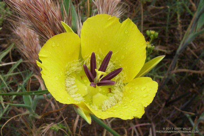
Still wet from a morning shower, this yellow mariposa lily (Calochortus clavatus) was found along the Satwiwa Loop Trail near the end of Saturday’s run to Serrano Valley.
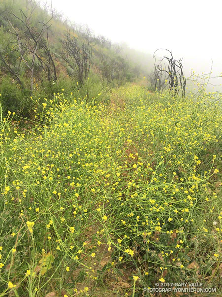
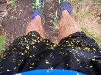
I was covered with bright yellow mustard petals and soaked from head to toe. It had been raining, and I’d just wrestled my way through another tangle of 10 foot high mustard plants. On some parts of the Old Boney Trail the mustard was so thick it was almost impenetrable. The pestilent species becomes especially prolific in wet years, growing rapidly and overwhelming native species and habitats.
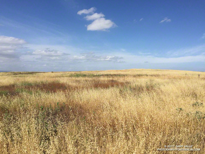
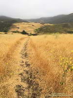
After turning onto the Serrano Valley Trail and climbing up to the overlook of Serrano Valley the trail wasn’t quite so overgrown — at least I could run. In the grasslands below the greens of the rainy season were gone, replaced with the straw-colored hues of dried grass gone to seed.
Serrano Valley
Like mustard, foxtails are bad this year. In recent weeks I’ve picked a multitude of the barbed grass seeds from my socks and shoes. Today, I’d worn ankle gaiters hoping to ward off the expected seed-storm in Serrano Valley. The seed-storm turned out to be more of a seed-shower, but the gaiters did help.
Part way through Serrano Valley I happened on a hiker, coming up from Serrano Canyon. We said hi to each other and then after he passed, he turned around and dramatically exclaimed “Don’t go down Serrano Canyon!!”
What?? Were there ogres down there? He’d obviously made it through the canyon OK. All limbs were intact and I didn’t see any cuts or bruises. I quickly ran through the possibilities and rejected most of them. One possibility that seemed plausible was that the trail had been washed out.
Covered in mustard petals.
One of the reasons I was doing this run was to see how Serrano Canyon had fared during the February 17 atmospheric river event. I’d seen the damage caused by high flows in Blue Canyon and Upper Sycamore Canyon. This was the first chance I’d had to investigate Serrano Canyon since the flooding, so the hiker’s warning had the opposite of its intended effect — it just made me more curious about what was going on in the canyon.
All the way down the canyon I kept an eye out for X-Files monstrosities, but saw none. Serrano Canyon did not appear to have had as severe flooding as Blue Canyon and Upper Sycamore Canyon. Some sections of the trail were very overgrown and a short section of the trail was partially washed away, but with care and a bit of mustard-whacking the trail was passable.
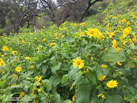
Canyon Sunflowers
I’d had my fill of mustard and was happy to reach the dirt road in Big Sycamore Canyon. I returned up canyon using a combination of Big Sycamore Canyon Road and the Two Foxes Trail. This was much more straightforward than Old Boney and it took only about an hour to reach the Upper Sycamore Trail.