Category Archives: trails|san gabriels

Pleasant View Ridge

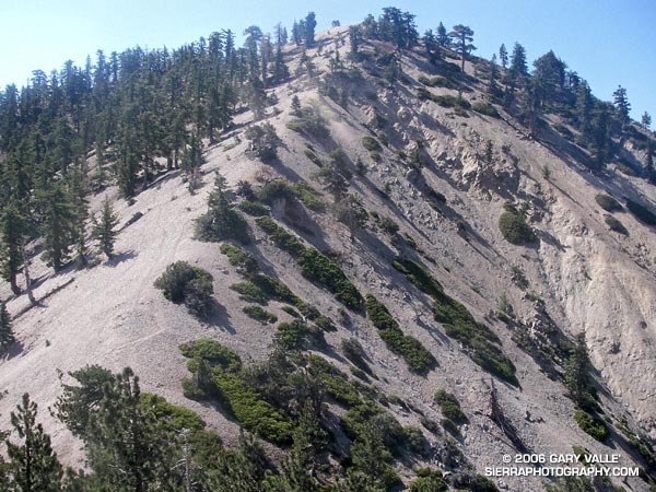
Peak 8248, the highest point on Pleasant View Ridge

The photograph is of peak 8248, the highest point on Pleasant View Ridge, viewed from the saddle northwest of the peak. Located in the San Gabriel Mountains, Pleasant View Ridge extends northwest about 8 miles from  Mt. Williamson to the vicinity of Indian Bill Canyon.

When hikers refer to Pleasant View Ridge, they are usually talking about a 3 mile segment of the ridge that runs from the southeastern summit of Mt. Williamson (8214′) to Burkhart Saddle (6959′). From Mt. Williamson, the ridge follows along a series of 8000’+ summits, then crosses a deep gap to the broad summit of Pallett Mountain (7760’+). From this point, Burkhart Saddle and the Burkhart Trail are another 0.6 of a mile to the west.  There is no maintained trail on the ridge, but over time a use trail has developed and is generally (but not always) distinct. In this photograph of the ridge from the PCT, Pallett Mountain is the peak on the left, in the distance.

Mt. Williamson is in the peculiar situation that the register for the peak is not on the peak labeled “Mt. Williamson” on the Crystal Lake topo. According to the Sierra Club Hundred Peaks Section Peak List, the register is normally located on peak 8244, which is the next peak along the ridge to the northwest. What is even more peculiar, peak 8248, which is a little further on the ridge, is the highest point of all three!

The section of Pleasant View Ridge between Mt. Williamson and Burkhart Saddle is commonly done as part of a 13 mile loop from Eagles Roost. In order to protect critical habitat of the mountain yellow-legged frog, the Forest Service has closed the PCT between Eagle’s Roost and the Burkhart Trail. In addition, Angeles Crest Highway (SR2) is now closed 0.25 mile west of Eagles Roost. (Update May 27, 2007. Angeles Crest Highway has since been re-opened to Islip Saddle. It was open to Islip Saddle on May 27, 2007, but closed beyond this point. It looked like the road past Islip was being resurfaced.) If the PCT detour suggested by the Forest Service is followed, the loop length is increased to about 14.4 miles, and it is necessary to hike/run a 2.4 mile stretch of Angeles Crest Highway. Done this way, the route has an elevation gain and loss of 4000′ or so.

I usually like to do the loop in the counter-clockwise direction, and that’s what I did on this day. It’s nice to get a big chunk of elevation gain done in the morning while it’s cool, and then have a net elevation loss doing the ridge. Also, except for a few downed trees, the running is outstanding from Burkhart Saddle down to Little Rock Creek. Some Western Columbine (Aquilegia formosa) was blooming along Little Rock Creek.

Here is a Google Earth image and Google Earth KMZ file of a GPS trace of the loop with the PCT detour through Buckhorn Campground. The ridge parallels the San Andreas Fault zone, whose linear features can be seen in the valley below. This Google Earth image shows the approximate position of the fault zone in relation to Pleasant View Ridge loop. It also shows the section of Pleasant View Ridge northwest of Burkhart Saddle.

For more information regarding the PCT detour see the News section of the Angeles National Forest web site.

Updated May 5, 2008. Added elevation profile.

Google search: $g(Pleasant View Ridge), $g(Mt. Williamson), $g(Pallet Mountain), $g(Burkart Trail), $g(trail running), $g(mountain yellow-legged frog), $g(PCT), $g(Pacific Crest Trail), $g(San Gabriel Mountains)

Related post: Peaks Along Pleasant View Ridge

PCT Above Windy Gap

Mt. Williamson from the PCT above Windy Gap.

Mt. Williamson from the PCT above Windy Gap

Update May 21, 2009. Angeles Crest Highway (SR2) has since been re-opened to Islip Saddle, and through to Wrightwood.

There’s more of a wilderness feel in the Angeles Forest high country today. A big chunk of Angeles Crest Highway is closed. From Eagles Roost to Mt. Baden-Powell, and back again, the absence of vehicle noise has been startling. There have been no squealing tires, warbling sirens, or red-lined RC51’s echoing up from Highway 2. Instead, the loudest sound is Little Jimmy spring water splashing at my feet. High on a ridge, a Clark’s Nutcracker tells me I’m in the mountains. and overhead, the wind plays quietly in the boughs of an immense Incense Cedar.

It’s been a blazing, triple digit day down in the valleys, and even at 8000 ft. the south-facing slopes have been warm. Chased by the warm weather, several PCTers trek northward; hoping that by the time they get to the Sierra the passes will not be choked with snow. Most have seemed enthusiastic, and eager to face the challenges ahead.

The crux of this day’s adventure looms around the corner at Islip Saddle. The steep 1.5 mile climb to near the summit of Mt. Williamson, and 1.5 mile descent to Hwy. 2 will retrace earlier miles of my trek. A mirror image of this morning’s pleasant ascent, this afternoon’s climb will be a cruel and evil twin. The 1200 ft. elevation gain will bring the day’s total to around 7000 ft.

Descending to the parking lot at Islip Saddle, I automatically look for my car. The lot is empty. Tufts of grass growing in in the pavement cracks waft in the breeze. A couple of PCTers rest in the shade of the restroom. A bird sings a cheerful tune from a nearby tree. I head on up the trail…

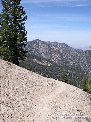
Today’s photograph is of a nice downhill section of trail at about 8200 ft, northbound on the PCT, above Windy Gap. That’s Mt. Williamson in the background. I was surprised I didn’t run into anyone that was doing Mt. Williamson. Williamson Rock is in the area closed by the Forest Service to protect critical habitat of the mountain yellow-legged frog, but Mt. Williamson is outside of the closed area (PDF Map). The Hwy 2 closure is about 0.25 mile west of Eagles Roost, and only adds about 2 scenic miles to the round trip up Williamson. If your favorite hikes or runs start at Islip Saddle, here’s a topo map of the area that shows the approximate mileages from the locked gate on Hwy 2 to Islip Saddle. For more information regarding the closure of Williamson Rock, see the  Access Fund Williamson Rock page for more information.

Spring Growth

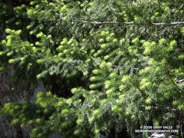
New growth on a Big Cone Douglas Fir (Pseudotsuga macrocarpa) in the San Gabriel Mountains.

Bright green highlights new growth on a Big Cone Douglas Fir (Pseudotsuga macrocarpa) in the San Gabriel Mountains near Josephine Peak and Strawberry Peak.

These peaks are popular lower elevation summits, that can be snow-free in Winter, or a blast furnace in Summer. Josephine Peak (5558 ft.) was once the site of fire lookout, and a fire road leads from Clear Creek Station to its summit. From the west, via Clear Creek or Colby Canyon, Strawberry Peak (6164 ft.) is a more difficult ascent that requires careful route-finding and rudimentary rock climbing skills. Many hikers prefer to do Strawberry from the east, starting at Red Box.

The day this photograph was taken, I wasn’t climbing Strawberry Peak, but instead was running a circuit around the peak. Part of the Angeles National Forest Trail Race course, the circuit is an excellent 15 mile loop with an elevation gain/loss of about 2700 ft. Here’s a Google Earth image and Google Earth KMZ file of a GPS trace of the Strawberry Peak Circuit. A longer variant of this route is described in Fall Leaves on Bear Creek and Strawberry – Bear Canyon Loop.

Complications

This photograph was taken October 23, 2005, on one of my favorite loops in the San Gabriel Mountains. This adventurous route starts at Islip Saddle, follows the South Fork trail down to South Fork Campground, then takes the Manzanita Trail up to Vincent Gap and the Pacific Crest Trail. From here, the PCT is followed up, and with a slight detour, over Mt. Baden-Powell, and then along the crest of the San Gabriels back to Islip Saddle. It’s a very wild and scenic 23 mile run that covers a wide range of elevations. South Fork Campground is at 4,560 ft., and the summit of Baden-Powell is at 9399 ft. Total elevation gain and loss on the run is well over 5000 ft.

This year, it might make more sense to start this loop at Vincent Gap. In order to protect critical habitat of the mountain yellow-legged frog, the Forest Service has closed 1,000 acres in the upper Little Rock Creek drainage, including Williamson Rock, and the PCT between Eagle’s Roost and the Burkhart Trail. In addition, Angeles Crest Highway (SR2) is now closed at Cedar Springs, just west of Eagles Roost.

Update May 21, 2009. Angeles Crest Highway (SR2) has since been re-opened to Islip Saddle, and through to Wrightwood.

For more information regarding the closure of Williamson Rock and the related PCT Detour see the Angeles National Forest web site and Re-Open Williamson Rock on the Access Fund web site.

The post Wally Waldron Limber Pine includes links to a Google Earth image and Google Earth KMZ file of this route.

PLEASE NOTE: The condition of certain sections of the Manzanita and South Fork trails is marginal, and rock slides and washouts may block the trail.

Fall Leaves On Bear Creek

Fall leaves on Bear Creek, an isolated tributary of Arroyo Seco Creek.

Bear Creek is an isolated tributary of Arroyo Seco Creek, north of Pasadena, in the San Gabriel Mountains. This photo was taken on a spectacular Fall day in upper Bear Canyon on a long trail run that started at Clear Creek Station. The route worked around the north side of Strawberry Peak to Red Box, down to the West Fork, up the Valley Forge trail on Mt. Wilson to Eaton Saddle, then through the Mueller Tunnel and past San Gabriel Peak and Mt. Lowe to Tom Sloan Saddle. From here it continued down into Bear Canyon, up the Gabrielino Trail to Switzers, and then back to Clear Creek using the Nature’s Canteen trail. (Photo from November 11, 2005.)

Related post: Strawberry – Bear Canyon Loop.