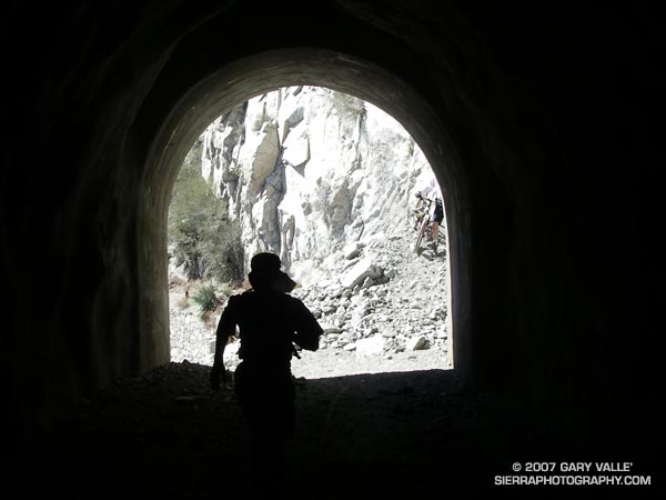
Runner in Mueller Tunnel, near Mt. Wilson, in the San Gabriel Mountains. From Sunday’s Strawberry – Bear Canyon Loop run.

Runner in Mueller Tunnel, near Mt. Wilson, in the San Gabriel Mountains. From Sunday’s Strawberry – Bear Canyon Loop run.
The Strawberry – Bear Canyon loop trail run is a longer, more adventurous variation of the run around Strawberry Peak described in the post Strawberry Peak Circuit.
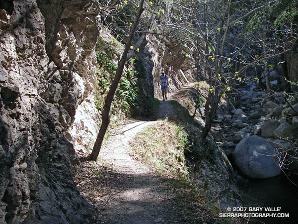
The photograph Fall Leaves On Bear Creek was taken on this loop in November 2005. As described in that post, instead of descending directly to Switzer’s from Red Box, this route descends the West Fork to Valley Forge Campground and then climbs up and over the shoulder of Mt. Wilson, and down into Bear Canyon, eventually working its way back to Switzer’s and Clear Creek.
Without any wrong turns or other route finding issues the loop works out to about 25.5 miles with an elevation gain and loss of about 5500-6000 ft. The running (and hiking) is extremely varied, including fire roads, old road beds, easy trail, technical trail, and lots of up and down. Bear Creek’s lush canyon is gorgeous, but 20 miles into the run, it’s winding course and many creek crossings can prove demanding.
I attempted to obtain a GPS trace of this route in 2005, but the steep, narrow canyons defeated my Foretrex 201. Not so with my Forerunner 205. I continue to be amazed at the 205’s performance. Here’s a Google Earth image and Google Earth KMZ file of the GPS trace of my route.
Related posts: Spring Growth, Fall Leaves On Bear Creek, Forerunner 205.
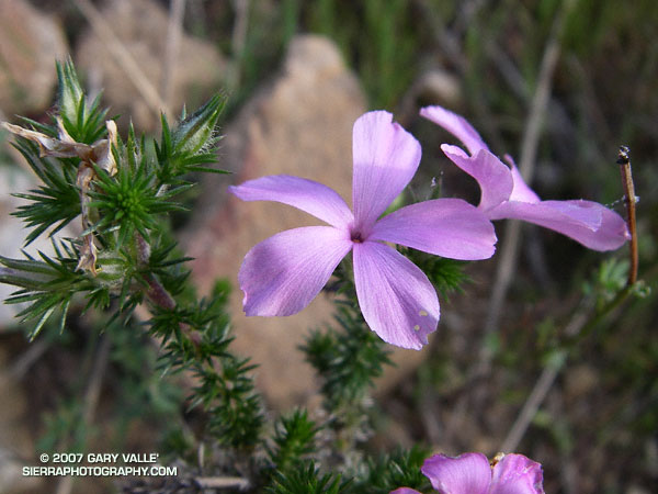
A Winter bloomer, California prickly phlox (Leptodactylon californicum) likes warm, rocky, southwest facing slopes where it can bask in the afternoon sun. The flowers have a subtle, musty-sweet fragrance that is especially pleasant when encountered on a still evening, in fading twilight, near the end of a run.
From Sunday’s Cheeseboro Bound run. Exactly as found.
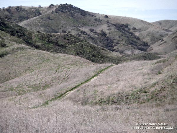
Two runners climb up the last yards of a hill before descending into Las Virgenes Canyon in Upper Las Virgenes Canyon Open Space Preserve.
The trail is a connector that joins East Las Virgenes Canyon with upper Las Virgenes Canyon. Our 15 mile loop started at the Victory trailhead, following the El Scorpion Trail to another long-used trail that climbs up to the ridge along the northern boundary of the preserve. From here we descended to Las Virgenes Canyon and worked over to Shepherd’s Flat and down Cheeseboro Canyon, eventually returning to the Victory trailhead by way of the main drag.
The area seen in the photograph is a small portion of the 24,000 acres that was burned in the Topanga Fire in late September 2005.
Although an undercoat of green is apparent, the drought in Southern California continues. According to NWS climate data, as of today, Downtown Los Angeles (USC) has recorded only 2.42 inches of rain since the water year began on July 1, 2006. This total is nearly 9 inches less than normal.
From Sunday’s Backbone, Bulldog & Beyond run.