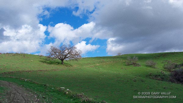
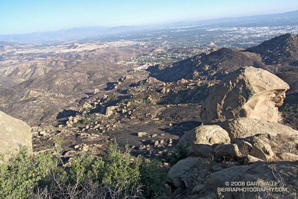
Hill 2484 is near the top of the oil field service road that connects Las Llajas Canyon to Rocky Peak fire road.
From Sunday’s Bandit 30K Course Preview run.
Some related posts: Chumash-Las Llajas Loop, Chumash Trail Rocks & Snow

Hill 2484 is near the top of the oil field service road that connects Las Llajas Canyon to Rocky Peak fire road.
From Sunday’s Bandit 30K Course Preview run.
Some related posts: Chumash-Las Llajas Loop, Chumash Trail Rocks & Snow
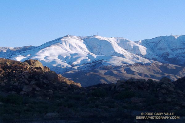
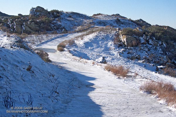
Our latest storm added another half-inch of rain to our water year total in Los Angeles. This brings the water year rainfall total to 2.85 inches. This is 1.35 inches above normal for the date. As much as a foot of snow was reported in the Antelope Valley and the snow level dropped to nearly 2000 ft in the foothills and mountains of Ventura and Los Angeles counties.
What’s next? Things should stay dry in Southern California until around Monday when a fast-moving front sweeps through the state. Later in the week, sometime around Christmas, the models are suggesting the possibility of a major system impacting California. We’ll see!
The photograph of Oat Mountain was taken this morning on an out and back run on Rocky Peak fire road. The highest stretches of the fire road were covered with an icy layer of snow.
Related post: Chumash Trail Rocks & Snow
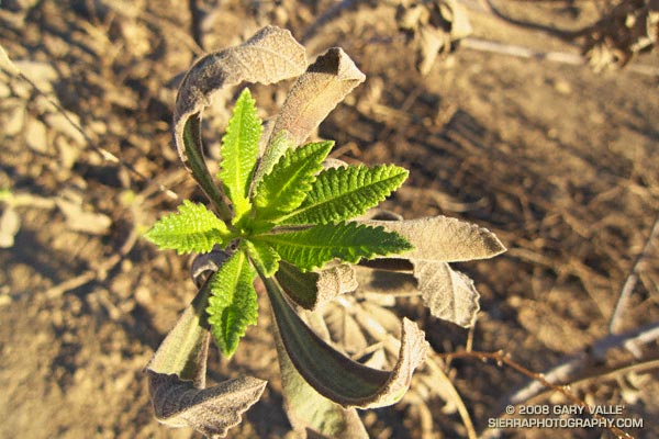
Only three weeks after the area was burned in the 2008 Sesnon Fire, this yerba santa shrub on the Chumash Trail has started the process of foliage replacement. In many areas along the trail, grasses and other annuals (many invasive) were consumed, but adjacent chaparral shrubs were only scorched. Many of these shrubs look like they will be able to recover through budding of existing stems, rather than crown-sprouting.
Some related posts: Chumash Trail – Sesnon & Simi Fires, Rocky Peak After the Sesnon Fire
My run to “Fossil Point” on Rocky Peak road, and side trip to Rocky Peak, was not the appalling experience I’ve come to expect when investigating a wildland area that has been overrun by a Southern California brush fire. Much of the chaparral along the fire road was not burned. Here are a few photos:
View southeast toward Porter Ranch from the summit of Rocky Peak (larger image).
View north toward Rocky Peak where the trail levels out, about 1.4 miles from the trailhead.
Burned area near viewpoint of Simi Valley about 2.3 miles from the trailhead.
View north from the summit of Rocky Peak. Rocky Peak fire road is on the far left, and the Johnson trail is on the right.
Unburned area along Rocky Peak fire road about 2.8 miles from the trailhead. Rocky Peak is the peak on the left.
False color image of slopes on the southwest side of Blind Canyon. The image has been modified to emphasize burned and unburned areas.
Some related posts: Chumash Trail – Sesnon & Simi Fires, San Fernando Valley from Rocky Peak
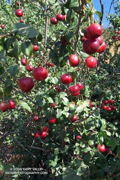
Sometimes growing as large as a supermarket cherry, the sweetish, thin-pulped fruit of hollyleaf cherry (Prunus ilicifolia) is a favorite snack of coyotes.
These are on the Chumash Trail in Rocky Peak Park. This is the first year since the 2003 Simi Fire that there has been a sizable hollyleaf cherry crop along the trail.
It is commonly reported that an “acid treatment” in the digestive tract of a coyote or bird is required for germination. However, according to the University of Texas Native Plant Information Network Native Plant Database, fresh seeds require no treatment.
Related post: Holly-leaved Cherry
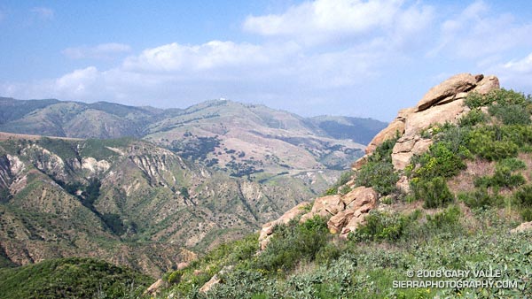
View across Blind Canyon to Oat Mountain from the Rocky Peak fire road. At one time slated to become a Los Angeles County landfill, Blind Canyon is now part of Rocky Peak Park.
From an out and back run on Rocky Peak Road to the top of the Chumash Trail.
Related post: San Fernando Valley from Rocky Peak
Google search: $g(Rocky Peak), $g(Blind Canyon), $g(landscape photography)