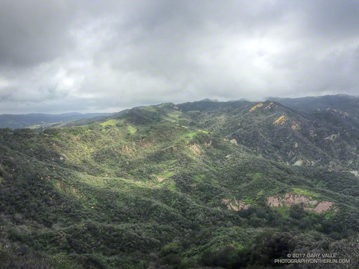
View of upper Santa Ynez Canyon and the Eagle Rock area of Topanga State Park from East Topanga Fire Road. From today’s run from the Top of Reseda to the Los Liones Trailhead and back.

View of upper Santa Ynez Canyon and the Eagle Rock area of Topanga State Park from East Topanga Fire Road. From today’s run from the Top of Reseda to the Los Liones Trailhead and back.
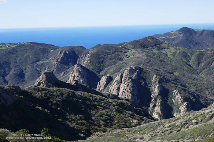
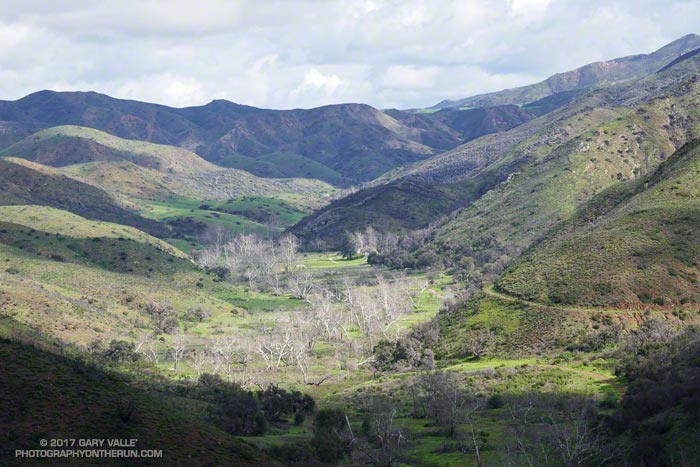
As I rounded the rib extending down from Peak 2658 — the site of the old Triunfo Lookout — I peered down into the deep canyon of the West Fork Arroyo Sequit and the towering rock formations above the Grotto. As is the case along many sections of the Backbone Trail the view was superb.
Earlier, from the Etz Meloy fire road, Anacapa and Santa Cruz Islands had seemed to be magnified by the ocean haze — the lighter-colored rocks of San Pedro Point clearly visible on the east end of Santa Cruz. To the south, Santa Barbara Island, the smallest of the Channel Islands, had been visible near the horizon.
I was doing an out and back run on the Backbone Trail from the Kanan Road trailhead, and wondering if I had enough water to go to Mishe Mokwa and then the 15 miles back to Kanan. The irony was that, following several years of drought, this Winter it had rained and rained. Water was everywhere, but I had not thought to bring a UV pen or filter.
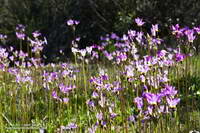
Reaching the point where the trail turns to the north and has a great view of Sandstone Peak, Circle X and the Mishe Mokwa trailhead I again debated turning around. Across the canyon, sunlight gleamed from the cars parked at the Mishe Mokwa Trailhead. The rocky knolls below the trailhead were green with rain and though I couldn’t see them from here, would be covered with a spectacular patchwork of purple and yellow shooting stars.
Hmm… I’d run a little over 13 miles, so Mishe Mokwa was less than two trail miles away. Going there would add about 3.5 miles to my run. I lifted my pack to see how much water I had left, and then continued down the trail.
Big Sycamore Canyon from the Wood Canyon Vista Trail segment of the Backbone Trail in Pt. Mugu State Park.
From Saturday’s run to Serrano Canyon and La Jolla Valley.
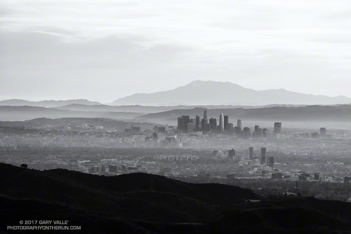
Downtown Los Angeles, with San Jacinto Peak in the background, approximately 110 miles distant. San Jacinto Peak is a bit over 10,800 feet in elevation.
The photograph was taken from a viewpoint off the Temescal Ridge Trail while doing a loop from the End of Reseda to Will Rogers State Park earlier this month.
Some related posts: San Jacinto Peak and Tahquitz Peak Trail Run, Skiing San Jacinto, Mountain Weather
As of yesterday Downtown Los Angeles (USC) has recorded 8.80 inches of rainfall for both the Rainfall Year (July 1 – June 30) and Water Year (October 1 – September 30). By either measure Los Angeles rainfall is well above normal, and with three well-advertised storms in the forecast it looks like Los Angeles rainfall could remain above normal for at least a few weeks.
Even if it has been a bit wet — and muddy — it’s been great to have a more normal rain season. The rain has been very beneficial and has impacted the drought, at least in the short term. Just how much a continued wet rain season would impact the drought in the long term is a question that has to wait for future analysis.
There has been a five year precipitation deficit of nearly 36 inches at Downtown Los Angeles (USC). It’s hard to appreciate the size of this deficit while running in the rain, splashing through puddles, and trying not to slip in the mud. One tangible indicator of this deficit is that despite above average rainfall, many creeks in the Santa Monica Mountains and Simi Hills have remained dry or are barely flowing. Some have been dry for years.
Update Wednesday, March 1, 2017. The atmospheric river event on February 17 produced high flows on many local streams and many of these streams continue to flow. Rainfall totals in Los Angeles, Ventura and Santa Barbara Counties for the storm generally ranged from 4 to 8 inches with some higher totals recorded. On subsequent trail runs flooding, debris flows and erosion were noted in Upper Sycamore and Blue Canyons in Pt. Mugu State Park. Remarkably, some groundwater monitoring stations in Santa Barbara and San Bernardino Counties remain well below normal.
As of February 28, 2017, Downtown Los Angeles (USC) had recorded 18.50 inches of rain for the Rain Year and Water Year. This is 165% of the normal amount of 11.24 inches for the date, and 124% of the normal amount of rainfall for an entire year. This is the wettest Rain Year (July 1 – June 30) and Water Year (October 1 to September 30) to date since the very wet year of 2004-2005.
Update Tuesday, January 24, 2017. From Wednesday, January 18 through Monday, January 23, Downtown Los Angeles (USC) recorded 5.53 inches of rain, bringing the Rain Year and Water Year precipitation totals to 14.33 inches. This is 217% of the normal amount of 6.65 inches for the date, and 97% of the normal amount of rainfall for the entire Rain Year. It has been the wettest start to the Rain Year (July 1 – June 30) and Water Year (October 1 to September 30) since the very wet year of 2004-2005. There were high rain rates on Sunday, January 22, and Upper Las Virgenes Creek did finally flow for a period of time.
Update Saturday, January 21, 2017. From Wednesday, January 18 through Friday, January 20, Downtown Los Angeles (USC) recorded 2.53 inches of rain, bringing the Rain Year and Water Year precipitation totals to 11.33 inches. The average annual rainfall for Downtown Los Angeles is 14.93 inches. The rain, which was heavy at times on Friday, produced some flooding, rockslides and debris flows. Both branches of upper Garapito Creek are flowing as a result, but Saturday afternoon Upper Las Virgenes Creek was still not flowing.
Upper Las Virgenes Creek – February 22 the flow on Upper Las Virgenes Creek near the Cheeseboro connector and the two downstream crossings was enough that you couldn’t cross without getting your shoes wet. Previously, on January 24, there was no flow near the connector and only a slight trickle downstream. On January 21 the creek was not flowing and there was no evidence it had flowed during a recent storm.
Garapito Creek – On Saturday, January 21, 2017, both branches of upper Garapito Creek were nice burbling brooks. Previously, on January 15, the north branch was just starting to flow, but the south branch was dry.
Upper Sycamore Creek – Flash flooding, debris flows and erosion occurred on this creek following the heavy rain on February 17-18. Nearly 6 inches of rain was recorded at Circle X Ranch, which is also in the western Santa Monica Mountains. Previously, was flowing on February 4, but not on January 1, 2017.
Serrano Creek – Was flowing on February 4, but not on January 1, 2017.
If the wet forecast holds will these streams start to flow? We’ll see!
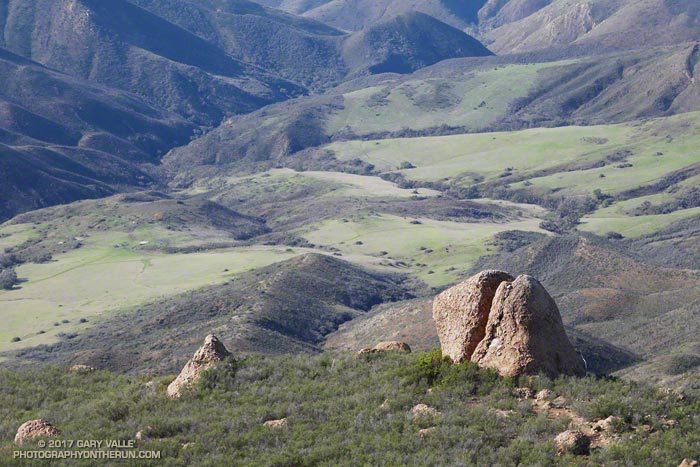
From today’s New Year’s Day run over Boney Mountain to Sandstone Peak and Serrano Valley from Wendy Drive.
Some related posts: Over Boney Mountain to Sandstone Peak and Serrano Valley, Chamberlain Rock