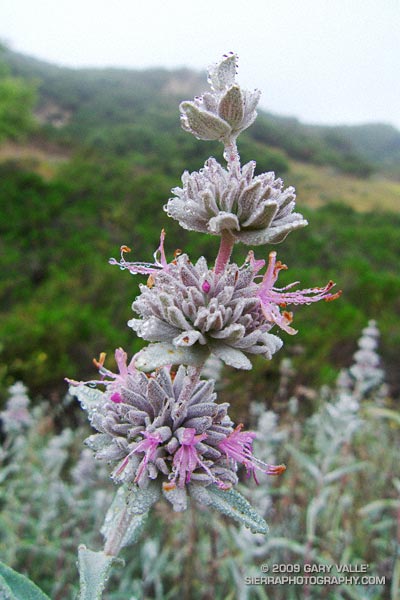
Purple sage covered with tiny droplets of dew. From Sunday’s run to Calabasas Peak on the Secret Trail.

Purple sage covered with tiny droplets of dew. From Sunday’s run to Calabasas Peak on the Secret Trail.
Saturday, I’d run in the Malibu Creek Challenge 22K. Today I Wanted to do something low key. Not too long, not too steep, but still a run that would work out the kinks that follow a race. I finally settled on the Secret Trail to Calabasas Peak, a 4.25 mile course with an elevation gain/loss of around 750 ft.
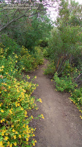
The low clouds and fog that surged into the Santa Monica Mountains on Saturday had returned during the night. The mustard and monkeyflower along the trail were soaked with dew, and now, so was I. Running felt good, and the two or so miles to the peak passed quickly.
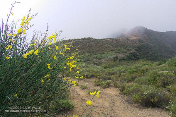
The sun had nearly burned through the morning overcast, and just below the summit of Calabasas Peak, the bright yellow flowers of a Spanish broom seemed to capture and concentrate the subdued sunlight.
Spanish broom (Spartium junceum) is a twiggy, green shrub that originated in the Mediterranean. It is common at lower elevations of our local mountains. According to the California Invasive Plant Council it was introduced as an ornamental in San Francisco in 1848, and planted along highways in Southern California in the 1930s. Its color and fragrance are distinctive.
Prior to running the Inca Trail we did an acclimatization run at 11,000 ft on the altiplano near Chinchero. The very first flower I saw on the run was a Spanish broom! This suggests that Spanish broom could spread to higher elevations of the San Gabriel Mountains, particularly if climate change results in more arid conditions.
Some related posts: Peru Running, Secret Trail to Calabasas Peak, Tapia Bound
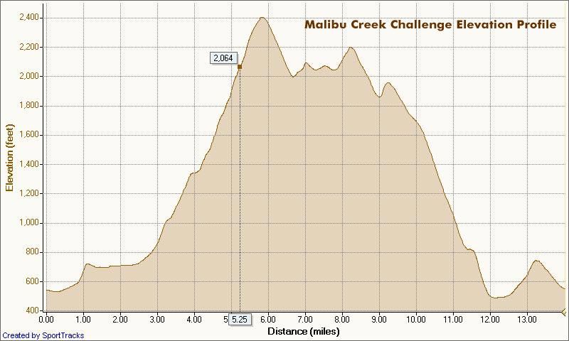
I glanced at my watch — 5.25 miles. Clouds and fog had kept temps on the cool side for more than three-quarters of the Bulldog climb, but the sun was finally breaking through. Even though temps were down a few degrees, the long climb had still been grueling. The runner next to me was breathing heavily, and I mentally repeated my Bulldog mantra — don’t redline, don’t redline.
For many of us, that’s the problem with Bulldog — some of it is runnable and some of it isn’t. For the moment I was running, but I knew the grade well, and just ahead the fire road switchbacked right, and steepened.
I’ve been over the “I can run this hill no matter what” thing for a long time. For me, and the majority of trail runners, walking the steeps is a good thing. The little bit of time lost by walking is generally made up — and more — on other sections of the course.
Rounding a corner, the grade did steepen, and I slowed and started to walk. Taking advantage of the slow pace, I ate a Gu, took a Salt Stick cap, and gulped down some Gatorade. Another runner and I had been swapping leads up the hill, and he passed me — again. As he increased his lead, I wondered if I should be pushing a little harder.
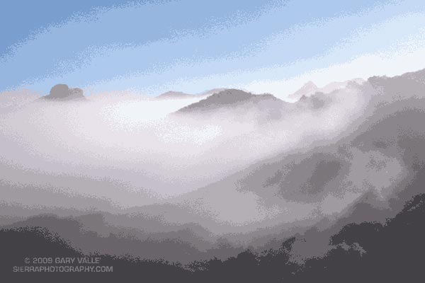
A left turn never felt so good! A few minutes before I had reached the top of Bulldog grade, and the highest point on the course. Now gravity was on my side, and I was enjoying the downhill. There were more challenges ahead, but for now I was lost in the moment — savoring the wind in my face, the far reaching views along the rocky crest, and that wonderful feeling of being a runner.
Here’s a Cesium browser View of a GPS trace of the 22K course with my half-mile splits. (Generated in SportTracks.) See the XTERRA Malibu Creek Trail Run web page for race results and additional info.
Some related posts: Malibu Creek State Park Shadow & Sun, Fog Along Malibu Creek, Bulldog Loop and the Corral Fire, Rock Formations Along the Backbone Trail
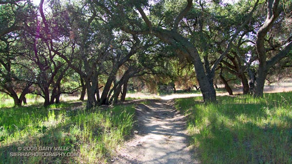
The 13 mile keyhole loop through Las Virgenes and Cheeseboro Canyons from the Ahmanson Victory trailhead is a classic Southern California mix of multi-use fire roads and single track trail.
The segment from Shepherd’s Flat down through Cheeseboro Canyon is especially popular, and on the weekend you’ll find an assortment of hikers, runners, mountain bikers, and sometimes an equestrian group or two. Even on a warm day, the oak-shaded sections of the canyon can be surprisingly comfortable.
Here’s a Google Earth image and Cesium browser View of a GPS trace of the loop, and links to trail maps for Upper Las Virgenes Canyon Open Space Preserve (formerly Ahmanson Ranch) and Cheeseboro/Palo Comado Canyons.
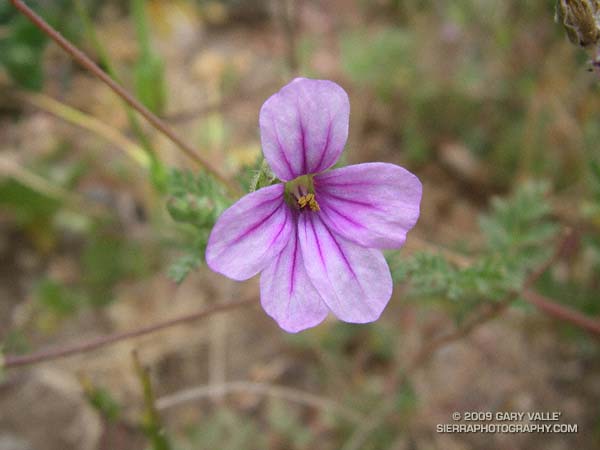
Closer view of Filaree (Erodium botrys). Filaree’s blossoms are about the size of a pencil eraser. They are common underfoot, Spring into Summer, in dry, weedy areas of Southern California.
From this morning’s bouldering session at Stoney Point.
From this morning’s bouldering session at Stoney Point.