Category Archives: kayaking|southern california

Vincent Gulch and the Mine Gulch Trail

Mine Gulch Trail near Vincent Gap

Nearly back to Vincent Gap after visiting Big Horn Mine, I debated whether to run part way down Vincent Gulch on the Mine Gulch Trail. The Mine Gulch Trail leads to the confluence of Vincent Gulch, Prairie Fork, and Mine Gulch on the headwaters of the East Fork San Gabriel River.

The only reason I was hesitant was that hunters might not expect anyone else to be down in the isolated canyon. On the way out to Big Horn Mine I’d encountered a couple of hunters and heard the occasional report of a deer rifle down in Vincent Gulch. After my experience in Colby Canyon the previous Saturday, I hoped my neon-yellow-green Mt. Disappointment 50K shirt would help make me more visible.
Hiking up the East Fork to kayak from the Bridge to Nowhere.

I’d wanted to check out the Mine Gulch Trail for a long time. Back before the drought, when rainy season storms would sometimes rejuvenate the streams of Southern California, the West and East Forks of the San Gabriel River were a local alternative to the three hour drive up to kayak the Kern River. My kayaking partner Gary Gunder, myself and other local kayakers had paddled as high on the East Fork as the Bridge to Nowhere. In 2003 Gary kayaked the upper East Fork from the Iron Fork. We’d done a lot of hiking with our kayaks and we began to wonder if it might make more sense to hike down the Mine Gulch Trail from Vincent Gap, rather than hiking up the East Fork.
Bigleaf maple along the Mine Gulch Trail.

Reaching the well-marked trail junction a quarter-mile from Vincent Gap, I turned down the Mine Gulch Trail. I was finally going to see what the trail was like!

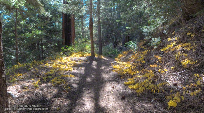
I had been expecting the Mine Gulch Trail to be a rough, overgrown and little-used path. After crossing an area stripped of trees by sporadic debris flows and avalanches, I was stunned to be running in an idyllic forest of pine, fir and oak on a wide, needle-covered trail bordered with golden leaves of snowberry.
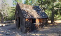
Tom Vincent's cabin in Vincent Gulch.
Tom Vincent’s cabin in Vincent Gulch.

Continuing to descend, the trail passed near Tom Vincent’s cabin site and then a mile or so from Vincent Gap started a series of long switchbacks. A couple of switchbacks down, at an elevation of about 5900′, was a small stand of ponderosa pines. Ponderosa pines are less common in the San Gabriels than the similar Jeffrey pine, but can usually be distinguished by their smaller cones. The trees had drawn my attention because one of them was especially drought-stressed.
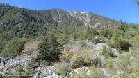
Vincent Gulch and Mt. Baden-Powell from the Mine Gulch Trail.
Vincent Gulch and Mt. Baden-Powell

Below the switchbacks and about two miles from Vincent Gap, the trail crosses a stream bed. The seems to be a spot where many hikers turn around. The trail sees less use beyond this point, and as it descends the east side of the gulch it becomes increasingly adventurous and isolated.

About three miles in I encountered a group of four hunters hiking up the trail. They were a bit surprised to see someone running down the trail and asked if I knew about a “flat” area down the trail. Now I realize they must have been referring to Cabin Flat, which was some distance and much bushwhacking away.
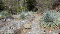
Mine Gulch Trail low in Vincent Gulch.

After encountering the hunters, the trail became less distinct and more disconnected. The “good” sections of trail were relatively long and the game became to piece together the sections of old trail, rather than traipsing through the rubble of the ravine. Intending to be back at Vincent Gap by about 1:00, I continued working down the gulch about another 30 minutes and finally turned around about a half-mile before the Prairie Fork junction.
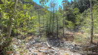
Terrain in lower Vincent Gulch.
Where’s the trail?

Having just solved the main trail-finding puzzles on the way down, the ascent of the gulch was relatively fast and took about as much time as the descent. Part way up the switchbacks I caught up to the hunting group on their way out. They joked around, asking what my “secret” was. I told them I’d still be down in the canyon if I was loaded down with the 50-60 pounds of gear they were carrying.

Running down the Manzanita Trail, then over to Big Horn Mine, and then down the Mine Gulch Trail had been an enjoyable stream of thought adventure. I’d found Icy Springs was still running and learned more about the geology and history of the San Gabriels. While I probably wouldn’t be carrying my kayak down Vincent Gulch, becoming familiar with the trail did open the door to other adventures.

Arroyo Seco Sedimentation

Sedimentation on Arroyo Seco upstream of Bear Creek

Since kayaking Arroyo Seco with Gary Gunder during the 1997-1998 El Nino, I’ve enjoyed revisiting the many drops and falls along Arroyo Seco when running in the area.

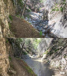
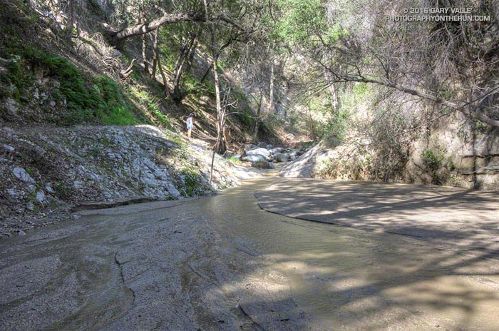
When we did the Bear Canyon loop a couple of weeks ago, I was amazed to see many of Arroyo Seco’s stream features were nearly filled in with sediment. This image comparison shows a drop below Switzer Falls in March 2012 and in March 2016.

Arroyo Seco Sediment 2012 vs 2016.
Arroyo Seco Sediment 2012 vs 2016. Click for larger image.

Doing a little sleuthing using Yelp reviews of Switzer Falls, it looks like the creek had low sediment levels in early January 2014, but was heavily silted in mid-March 2014. Based on this, it appears that the initial sedimentation event occurred during the  storms of February 26 – March 2, 2014, when nearby Opids Camp recorded 10.95 inches of rain.

The origin of the 2009 Station Fire was in the Arroyo Seco watershed and it was one of the most severely impacted. A question that comes to mind is why did the Arroyo Seco drainage produce such a high rate of stream sedimentation in the February-March 2014 rain event, but not in the very high flows of February 2010 and December 2010, and the moderately high flows of March 2011?

Some of the factors likely include vegetative cover, rainfall rate, recent rainfall history, the soil’s hydrophobicity, the soil support provided by degrading root systems, the magnitude of the peak flow and the shape of the stream discharge curve. Our multi-year drought has been an amplifying factor, further reducing vegetative cover and soil support.

For more information regarding the history of the Arroyo Seco watershed and plans for its rehabilitation see the Arroyo Seco Foundation web site.

Kern River Festival 2013

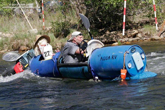
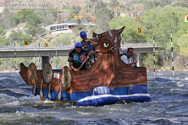
Hyside's Richard Dechants Aqua RV Hooligan Boat

Hyside’s Richard Dechant’s Aqua RV Hooligan Boat

Last summer it looked like El Nino was ramping up for a moderate-level event and the buzz was that Warm Episode ENSO Conditions were pretty much a done deal for the Winter. Only no one told the atmosphere — and it didn’t cooperate with warming SSTs to produce the expected event.


This and other factors resulted in one of the most meager Kern snowpacks on record with the April 1 snow courses averaging about 23% of normal. The lowest was in 1977 when the April snow courses averaged 19% of normal. Not only was this year dry, but last year was also a low snowpack year. 2011-2012 and 2012-2013 ranked a close second to 1975-1976 and 1976-1977 as having the lowest snowpacks on record in consecutive seasons.


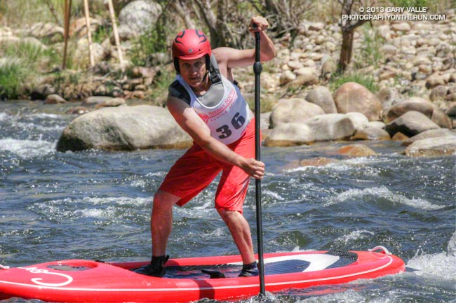
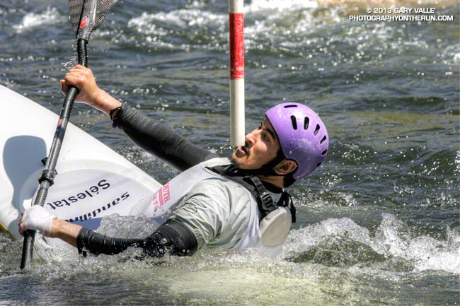
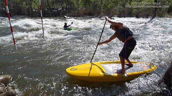
The shallow snowpack and a cold weather system the week preceding Festival kept flows in the 450-500 cfs range Saturday and Sunday. There was enough water for Hooligan Boats, SUP Races, Whitewater Triathlon and Slalom Race, but the Brush Creek races had to be cancelled.

The weather for the 49th edition of the Kern River Festival was perfect, and even with the low flow there was plenty of whitewater action. Everyone looked like they enjoyed paddling the Kern. I know I did. More info, results and photos can be found on the KVRC.org and KernFestival.com web sites.

River Up for the 2011 Kern River Festival

Hooligan Boat - 2011 Kern River Festival

Big snow equals big water, and this year the Kern River snowpack was measured at nearly twice normal, jump-starting the paddling season and producing summer-level flows in mid April for the 2011 Kern River Festival.

Saturday, racers had great water for paddling the spectacular waterfalls, steep drops, and slides on Brush Creek; and Saturday afternoon at Riverside Park there was good coverage and splashy rapids for the second edition of the Hooligan Boat competition. Once again, the Hooligan boats were a spectator favorite.


Saturday night the Kern River flow increased from about 2250 cfs to 2800 cfs, and Sunday morning racers competing in the Tom Johnson Whitewater Slalom had the most water for the slalom in over 20 years. This resulted in some challenging moves on the fast moving river, and many paddlers had to go to “plan B” after getting pushed off line, coming in low on a gate, or blowing a ferry.

Speaking of hard moves, here’s a video snapshot of innovative kayak, surfboard and SUP designer Corran Addison (sans Mohawk) doing the difficult cross river move from gate #11 to gate #12, and then down through gates #13 and #14 on a SUP.

The 2012 Kern River Festival will be April 20-22 in Kernville, California.

Hooligan Boat Race – 2010 Kern River Festival

This year’s Kern River Festival had the best weather and water the event has seen for several years. Racers had a great flow for paddling the waterfalls, steep drops, and slides on Brush Creek; and boaters enjoyed paddling a challenging slalom course through the whitewater of Riverside Park in downtown Kernville.

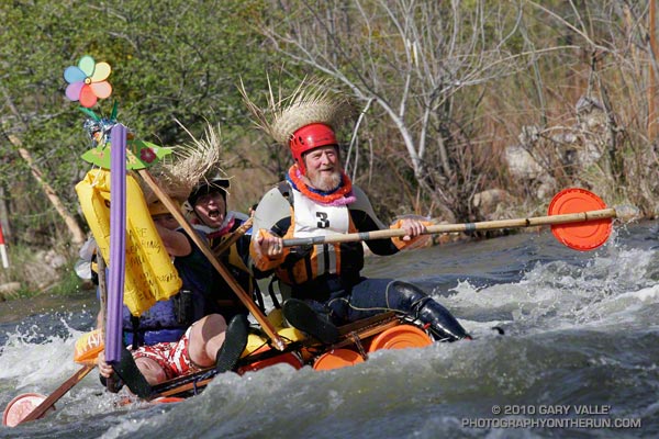
A new event this year, the Hooligan Boat Race, was a spectator and participant favorite. Inspired by the event at the FIBArk River Festival, paddlers constructed their own boats out of “non-boat” materials and attempted to paddle their creations from upstream of the bridge in Kernville, down through the class II rapids in Riverside Park.

The photograph above is of “Al’s Original Bucket Boat.” Usually a bucket boat refers to a raft that isn’t self-bailing, but in this case the boat is made of buckets, and the paddles from bucket lids.

As you might expect there were some outrageous designs, and not every boat made it to the finish line.

Next year the Hooligan Boat Race is expected to be even more popular. The Kern River Festival is held annually, the third weekend in April, in Kernville, California. In 2011 it is scheduled for April 16-17. (Easter is April 24, 2011.)

Spring Conditions


End of Joes Diner on Upper Kern River.


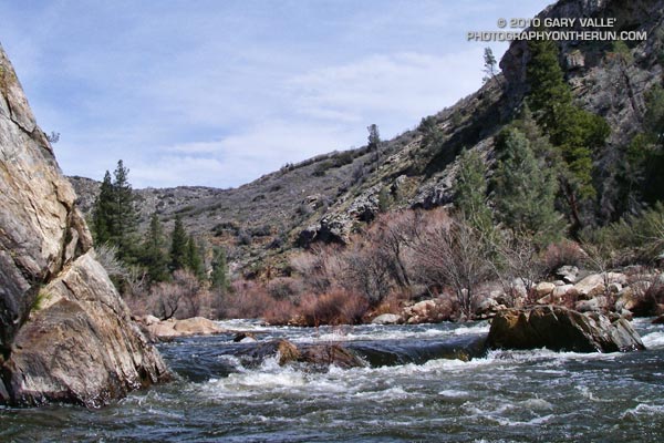
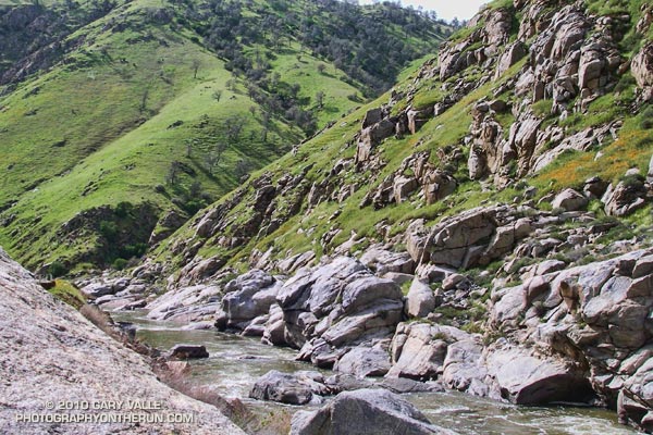
Kern Canyon along Hwy 178
Paddled Limestone on the Upper Kern today. The flow on the Upper was about 1000 cfs, midday temps were around 70, and the water a balmy 40-something. Given the good Spring flow and weather, we were surprised no other paddlers were on this section of the river.

The drive between Kernville and the San Joaquin Valley was exceptionally scenic. Kern Canyon’s steep slopes were as green as they get.