Category Archives: photography|landscape

Dowsing for Rain: The 2013-14 Southern California Winter Precipitation Outlook

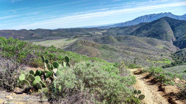
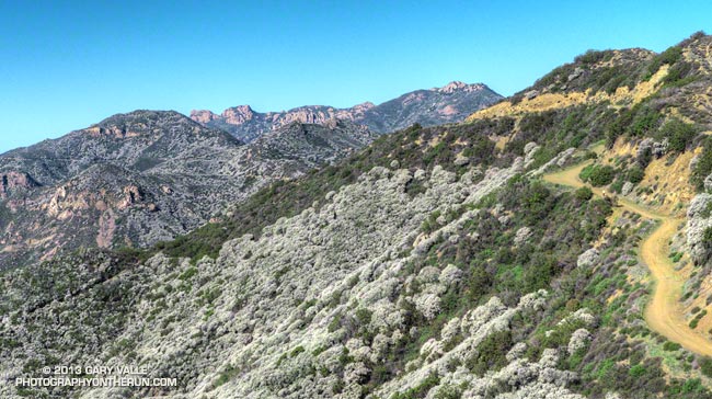
Rocky Peak Road near its junction with the Chumash Trail

Updated October 17, 2013.

As I started up the Chumash Trail, a patchwork of clouds filled the sky, and the fresh smell of a recent shower filled my lungs. A strong and unseasonably cold low pressure system was producing the first widespread rainfall of Southern California’s 2013-14 rain season.

I hoped there would be another shower during my run. The plants and animals needed it and I needed it. It had been many months since I had run in the rain on a local trail.

As I worked up the trail I thought about how dry it had been. Downtown Los Angeles’ 2012-13 water year (Jul 1 – Jun 30) was the sixth driest on record. Rainfall in Los Angeles since January 1 has been about 25% of normal. The 2012-13 Sierra snowpack was one of the worst on record.

Will this rain and snow season be any better? For months I’ve been monitoring climate data and forecasts looking for something on which to base a 2013-14 Winter Outlook. Historically, ENSO has been the big dog in Southern California rain season weather with El Nino conditions generally producing wetter weather and La Nina conditions generally drier.

But ENSO conditions are currently Neutral and are expected to remain so through the end of the year. Most climate models forecast there will be slow warming of SSTs in the equatorial Pacific (NINO 3.4 region) over the next several months, but at this time of the year it would be very unusual to have substantial warming. The CPC/IRI ENSO Forecasts from IRI’s October Quick Look indicate the probability of an El Nino developing before the end of the year is less than 20% — and 20% seems high.

One computer model that at times has been forecasting above average precipitation this Winter in Southern California is the Climate Forecast System version 2 (CFSv2). The CFSv2 is fully coupled ocean-atmosphere-land-sea ice model used to forecast parameters such as sea surface temperature, temperature and precipitation rate. While skillful at predicting tropical SSTs, the CFSv2 generally performs very poorly when forecasting precipitation over land, so forecasts such as this one for Dec-Jan-Feb must be viewed somewhat skeptically.

Another glass half-full observation is that the Madden-Julian Oscillation (MJO) has been relatively active this year and if this activity continues it provides recurring opportunities for enhanced U.S. West Coast precipitation. The downside is that it can result in periods of dry weather as well.

With the ocean and atmosphere neutral there’s just not much on which to base a rain season forecast. According to the Climate Prediction Center, the current winter precipitation outlook for most of Southern California calls for an equal chance of below average, average, or above average rainfall. I know — that’s no help at all — you might as well flip a three-sided coin!

Update October 17, 2013. The Climate Prediction Center released its updated U.S. Dec-Jan-Feb Precipitation Outlook today. The outlook now indicates an equal chance of below average, average, or above average precipitation for all of Southern California. The October CPC outlook is usually the basis for the initial official NOAA U.S. Winter Outlook.

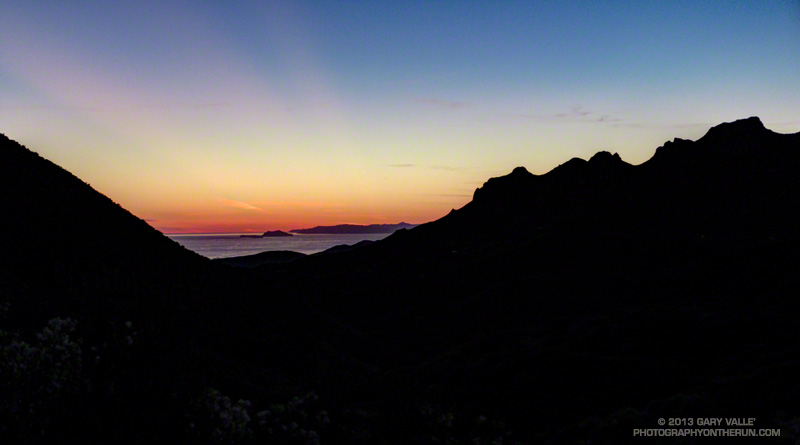
The title photo is of Rocky Peak Road, near its junction with the Chumash Trail. Here’s a larger version of the panorama.

Sugarloaf Mountain from the South Fork Trail

Sugarloaf Mountain from the South Fork Trail just above Horse Meadows, on the way down from an ascent of San Gorgonio Mountain

Sugarloaf Mountain (9952′) is the high point of the Kodiak 100 Ultramarathon, a new ultra being run this Friday, Saturday & Sunday, Sept 20-22, 2013, in Big Bear. A 50 mile course is also being offered.

The 100 mile race begins Friday at 6:00 p.m. at The Village of Big Bear Lake. The summit of Sugarloaf Mountain is at about mile 17.5 of the course. Assuming clear skies, runners will ascend the peak under the light of a 98% full moon. According to the U.S. Naval Observatory data, sunset on Friday will be at 6:47 p.m., with “civil twilight” ending at 7:12 p.m. Moonrise will be at 7:30 p.m. At 9:00 p.m. the moon will be about 18 degrees above the eastern horizon.

The 50 mile race begins Saturday at 6:00 a.m. at about the half-way point of the 50 mile course. Saturday, civil twilight begins at 6:10 a.m., with sunrise at 6:35 a.m. Sunset is at 6:45 p.m., with civil twilight ending at 7:10 p.m. Moonrise Saturday evening will be at 8:08 p.m.

The photo of Sugarloaf Mountain is from the South Fork Trail just above Horse Meadows on the way down from an ascent of San Gorgonio Mountain this August. The south face of Sugarloaf Mountain drops about 3800′ to the Santa Ana River east of Barton Flats.

Note: Sun and moon rise and set times depend on the altitude and location of the observer, and other factors, so may vary a few minutes from the times mentioned above.

Cottonwood Pass – New Army Pass Loop 2013

View east past High Lake from the switchbacks below New Army Pass

The Cottonwood Pass – New Army Pass loop is one of the best 20+ mile mountain trail runs that can be done as a day trip from L.A. You don’t have to get up any earlier than for a local race, and even if you want to get back to the city by 8:00 pm or so there’s still time to enjoy the sights and serenity of the high mountains.

Looking toward Cottonwood Pass (center) from the margin of Horseshoe Meadow (thumbnail)
Cottonwood Pass (center) from the margin of Horseshoe Meadow. Click for larger image!

The monsoon has been active this Summer and more than once I postponed this run because of a threat of thunderstorms. As late as midday yesterday (Friday) the forecast had been for increasing clouds and a chance of thunderstorms, as the moisture from Tropical Storm Lorena was drawn into the area.

View southeast from the Cottonwood Pass Trail past Horseshoe Meadow. (thumbnail)
Horseshoe Meadow from the Cottonwood Pass Trail. Click for larger image!

It may seem like a no-brainer, but it’s worth waiting for good weather to do this run. The views aren’t that great from inside a cloud, and there’s enough going on that you might as well try to eliminate the complications poor weather can create. I always try to carry enough to get by if things go sideways. You can’t avoid all risk, but you can be smart about the risks you take. Decades of climbing, kayaking and skiing adventures have shown me both sides of that adage.

Chicken Spring Lake (11,420') from the PCT. (thumbnail)
Chicken Spring Lake (11,420′). Click for larger image!

This time I hoped the weather would cooperate. With a race on the schedule for September 21, and allowing for taper and recovery, it looked like today might be my last chance to do the Cottonwood loop this year. The main influx of moisture wasn’t expected until Sunday, so it looked like any thunderstorm development would probably be later in the day and isolated.

As it worked out the weather did cooperate. The flow of moisture into the area was delayed, and except for some clouds off to the east and southeast, it was another blue skies, sunshine and short-sleeves Sierra day.

Why do I like this run so much?

Siberian Outpost from the PCT.
Siberian Outpost from the PCT. Click for larger image!

– It’s incredibly scenic. You run along high mountain lakes and meadows, in glaciated canyons, and over high passes.

– It has long runnable stretches. The longest is from New Army Pass back to the car, but there is also good running on the Pacific Crest Trail west of the crest, and as you leave Horseshoe Meadows at the beginning of the run.

– It is cool on a hot summer’s day. As long as you have extra layers in your pack, and pick a good day, the run can often be done in shorts and short-sleeves.

View down the Rock Creek trail on the western approach to New Army Pass. (thumbnail)
Rock Creek Trail. Click for larger image!

– It crosses the Sierra crest twice, at Cottonwood Pass (11,160′) and New Army Pass (12,300′). New Army Pass is the third highest Sierra pass crossed by a major trail, and is a spectacular vantage point.

– It is the closest 20+ mile run to Los Angeles that is almost entirely above 10,000′ and climbs to over 12,000′. All 21 miles of the run are higher than Mt. Baden-Powell (9399′). About 19 miles are higher than Mt. Baldy (10,064′); about 17 miles are higher than Mt. San Jacinto (10,834′); and about 3 miles are higher than Mt. San Gorgonio (11,499′).

Mt. Langley (14,026') from New Army Pass (12,300'). (thumbnail)
Mt. Langley (14,026′) from New Army Pass (12,300′). Click for larger image!

– There is a moderate amount of elevation gain — approximately 3500′.

– Except for one key turn off the PCT that connects to the Rock Creek Trail, the route-finding is relatively straightforward. If you miss that turn you’re going to be doing a much longer run. Take a map!

– Runs through forests of gnarled southern foxtail pines – a close relative of the bristlecone pine. Some of the trees may be a 1000 years old. Some of the dead trunks at higher elevation are several thousand years old and have been studied to see how the tree line has changed in the Sierra.

View east from the top of New Army Pass (12,300'). (thumbnail)
View east from the top of New Army Pass (12,300′). Click for larger image!

– The route is a loop. I’ve done it both directions and prefer doing it clockwise — going over Cottonwood Pass first, and then New Army Pass.

– Snow often persists near New Army Pass well into Summer and small, shaded patches may last through Fall. While it’s fun to see a huge cornice of snow in July, it can also be a problem. If you don’t have mountaineering experience be sure the trail over New Army Pass is clear before doing this loop. Don’t force the issue. The pass is at about mile 12.5. If you turn around at the pass and reverse the route you’ll be doing a 25 mile run instead of 21.

Sierra gentian along an inlet stream to High Lake. (thumbnail)
Sierra gentian along an inlet stream to High Lake. Click for larger image!

– Includes a 5 mile segment of the Pacific Crest Trail. It’s always fun to do another segment of the PCT!

– The drive up the switchbacks on Horseshoe Meadows Road is nearly as exciting and scenic as the run.

– Can check the weather on a web cam. This view is from Lone Pine.

– Can check the temperature and snowpack at 10150′ using the Cottonwood Lakes snow sensor.

Additional details, an interactive Google Earth view, and more photos can be found in the post Cottonwood Pass – New Army Pass Loop 2011 and related posts.

But it is a Dry Heat

Mugu Peak in Pt. Mugu State Park

It was humid — Atlanta in the Summer without air conditioning humid. I was sopping wet from head to toe and had just wrung out my high tech shirt like it was a cotton wash rag. Sweat just wasn’t evaporating.

The humidity is often low when it’s hot in Southern California, but not today. I was at the Danielson Multiuse area on my way back to Wendy Drive after doing Mugu Peak in Pt. Mugu State Park. Because of its moderate elevation gain the 21 mile run (round trip) to Mugu Peak is a good one to do back-to-back with another run when training for a longer event. Today’s run was a follow-up to a 20 mile run in the San Gabriel Mountains yesterday.

When I got back home I checked some Remote Automated Weather Stations (RAWS) to see just how humid it was. At the Circle X RAWS at 10:10 am the temperature was 86°F, the dew point 70°F, and the relative humidity 59%. Further inland at the Cheeseboro RAWS at 10:38 am the temperature was 91°F, the “in the sun” temperature was 97°F, and the dew point was 65°F. Those are conditions you might find in Hawaii or the Southeastern U.S. in the summertime.

The NWS uses the Heat Index as a guide for issuing alerts related to heat. In practice runners will find that the Heat Index doesn’t do a very good job because it makes assumptions that don’t necessarily apply to runners — for example that you are in the shade and walking. According to the NWS “exposure to full sunshine can increase heat index values by up to 15°F.”

I’ve found the dew point to be an easy to apply indicator of humidity on hot days. If the air temperature on a run is in the neighborhood of 90°F I start to notice the humidity at a dew point of around 55°F. At a dew point of 60°F the humidity is definitely noticeable, and at a dew point of 65°F and above the humidity is increasingly oppressive.

Some related posts: After the Springs Fire: A Run Through Pt. Mugu State Park, Back on the Backbone Trail, Wendy Drive – Mugu Peak Challenge

San Gorgonio Mountain: Dollar Lake – Dry Lake Trail Run

Craig running on the Sky High Trail on San Gorgonio Mountain

As we rounded the shoulder of Jepson Peak the pyramidal form of San Jacinto Peak came into view. A strong southerly flow was pushing a layer of cumulus clouds up the Coachella Valley, into Banning Pass, and toward San Gorgonio Mountain. Above, a higher layer of clouds was beginning to coalesce.

Moisture from the remnants of Tropical Storm Ivo was being drawn into the monsoonal flow, and if the weather models had it right the increasingly strong flow would result in an increasing chance of thunderstorms over the next few days. Even today the NWS Zone Forecast indicated a slight chance of a showers and thunderstorms:

SAN BERNARDINO COUNTY MOUNTAINS-
330 AM PDT SAT AUG 24 2013
…FLASH FLOOD WATCH IN EFFECT FROM SUNDAY MORNING THROUGH MONDAY
EVENING…
.TODAY…MOSTLY SUNNY IN THE MORNING…THEN PARTLY CLOUDY WITH A
SLIGHT CHANCE OF SHOWERS AND THUNDERSTORMS IN THE AFTERNOON.
WARMER. HIGHS 76 TO 86 ABOVE 6000 FEET TO 88 TO 98 BELOW
6000 FEET. SNOW LEVEL ABOVE 8000 FEET. AREAS OF WINDS SOUTH
15 MPH. GUSTS TO 25 MPH IN THE AFTERNOON. CHANCE OF MEASURABLE
PRECIPITATION 20 PERCENT.


We had left South Fork trailhead a few minutes late, but were making good time. Including stops for photos and a wilderness permit check it had taken us about 2 1/4 hours to reach Dollar Lake Saddle. A quick calculation put us on the summit of Gorgonio around 11:00-11:15. Based on what I was seeing over and around the mountain I thought that we would probably get to summit before weather became an issue. The key word was “probably.” Experience has taught that computer weather models don’t always get it right, and mountain weather often seems to have a mind of its own.

Craig and I were doing the reverse a route I’d done three weeks before. This time at South Fork Meadows we’d turned right at the fork and gone up the Dollar Lake Trail to Dollar Lake Saddle. I was curious to see if the counter-clockwise version of the loop was a better trail run than the clockwise loop.

On the way up to Dollar Lake Saddle we’d stopped to take a closer look at a tall pine I’d noticed on my last run here. It had been struck by lightning. Judging from the width of the scar and its ragged, pitch-covered margins, the stroke had been a strong one and had occurred within the last couple of years. Based on the tree’s elevation (about 8400′), the size of the cones, and the shape of the prickles on the cones, the tree was a Jeffrey pine.


Now we were on the San Bernardino Divide Trail, about 1 1/2 miles beyond Dollar Lake Saddle and about 2 miles from the summit. After doing the peak we would descend via the Sky High and Dry Lake Trails to South Fork Meadows, where we’d refill our hydration packs and continue down the South Fork Trail to the trailhead. We’d be descending directly to Dry Lake, rather than taking the route via Fish Creek Saddle and Lodgepole Spring.

It was chilly! For the first time in several weeks of mountain running I pulled on my sleeves. There was a different feeling about the mountain today. A fitful wind streamed through the branches of the lodgepole and limber pines, its flow noisy and turbulent, and its speed and direction unsettled.


As we worked toward the summit, it was evident the top of the cumulus cloud layer was rising and the clouds in all layers were starting to show more development. On top, I was surprised to see how far the cumulus had pushed up Whitewater Canyon. Everyone on the summit was in good spirits — some more so than others. Now that we were on top we could talk about how spectacular the weather was, rather than how threatening.


The run down from the peak on the Sky High Trail was absolutely superb — and far less rocky than running down to Dollar Lake Saddle on the Divide Trail. At about 10,600′, and a couple of switchbacks above the C-47 crash memorial, we were suddenly surrounded by clouds. This was a treat for us — we were headed down — but for the people headed up the peak it posed a quandry that has faced mountaineers for millennia: Continue up, or go down?


This time, as this Aqua/MODIS satellite image from 2:15 pm shows, San Gorgonio Mountain was on the margin of the monsoon flow. Although there was a lot of cumulus around and over the mountain, most of the major thunderstorm development was to the east and southeast of the peak. The closest automated weather station I could find with measurable rainfall was the Burns Canyon RAWS, 13 miles to the northeast. It recorded 0.17 inch between 2:00 pm and 4:00 pm. The Yucca Valley RAWS, 22 miles away, recorded 0.18 inch between 1:00 pm and 2:00 pm. In the big storms to the southeast, Fish Creek Mountain recorded nearly one inch in one hour.

So which direction of the loop was the better trail run? I’d have to give the edge to the counterclockwise loop — up the Dollar Lake and Divide Trails and down the Sky High and Dry Lake Trails. There is still a lot of very rocky, technical trail — particularly on the Dry Lake Trail, but the outstanding running on the Sky High Trail between 11,400′ and 10,000′ more than makes up for it!

Some related posts: San Gorgonio Mountain: Dry Lake – Fish Creek Saddle – Dollar Lake Loop, San Gorgonio Mountain: Falls Creek Loop August 2013