Category Archives: photography|landscape

Mt. Wilson – Newcomb Pass – Chantry Flat Loop

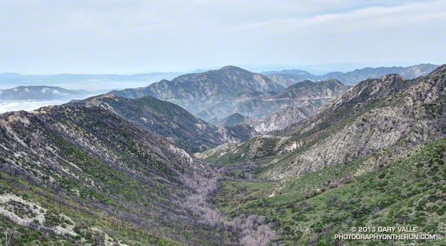
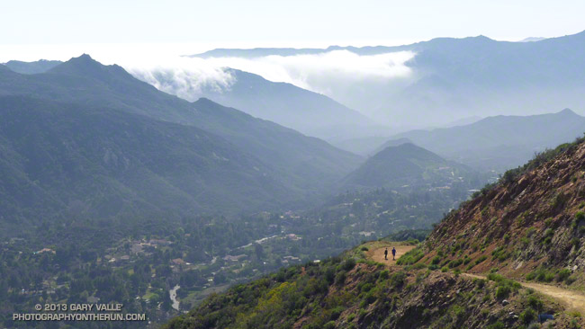
Santiago Peak (Saddleback) from the Rim Trail on Mt. Wilson

As I ran through the scrub oak near the summit of Mt. Wilson, my footfalls and the distant hum of a generator were the only sounds that disrupted the quiet of the early morning. A patchwork of high clouds covered the sky, muting the rising sun and prolonging the dawn-like light.

Suddenly, I caught the movement of something large off to the side on the trail ahead. It took a moment to decipher the scene, but over a second or two the camouflaged bowhunter emerged from the background of oak leaves and limbs. Never turning to look at me, he continued to creep up a game trail toward the observatory grounds.


I wasn’t sure how the bowhunter fit in the array of hunting seasons and regulations, but if the general deer hunting season was open in Angeles National Forest I hoped my bright blue shirt and yellow “rodeo clown” running shoes would make me appear sufficiently unnatural.

Unlike last week, today I had a plan — to run down the Rim Trail from Mt. Wilson to Newcomb Pass, then down the Gabrielino Trail to Chantry Flat and back up to Wilson on the Upper Winter Creek Trail. I had not done this loop and it would give me a chance to do the stretch of the AC100 course between Newcomb Pass and the Mt. Wilson Toll Road.


The Rim Trail is a key part of several Mt. Wilson loops. The trailhead is about a quarter-mile east of the Skyline parking lot along the lower paved road with the nature trail signs. It is an adventurous and scenic trail that switchbacks steeply down the rocky northeast shoulder of Mt. Wilson and then contours over to Newcomb Pass. The trail has many long stretches of outstanding running in a forest of bigcone Douglas-fir and oak.

I’d been on the Rim Trail a few times this year and today was glad to see the poison oak along the trail was leafless and the patches of Poodle-dog bush had been trimmed. It’s harder to spot the poison oak without its “leaves of three” but it seems when it is dormant it is less of an issue.

At Newcomb Pass I turned right (south) onto the Gabrielino Trail, joining the AC100 course and beginning the descent to Sturtevant Camp in Big Santa Anita Canyon. Of all the trails on today’s loop the Gabrielino was the most technical.


In true Fall fashion the temperature on the sun-facing, chaparral-covered upper reaches of Big Santa Anita Canyon contrasted sharply with the forested north-facing slopes traversed by the Rim Trail and along the streams in the depths of the canyon.

The running between Sturtevant Camp and Roberts Camp was superb. The forests of bigcone Douglas-fir, alder, California bay and bigleaf maple are remarkable and among the most developed in Southern California. The yellows of the bigleaf maples stood out brightly against the greens of the other trees, beacons of Autumn in a mostly evergreen habitat.


The 6 mile, 3100′ climb that starts at the green foot bridge below Chantry Flat and ends at the Mt. Wilson Toll Road is the biggest on the AC100 course. On today’s run it started at a little under the 10 mile point, but during the AC100 comes at about mile 74.

After huffing up the paved road three-quarters of a mile, I refilled my Camelbak at the picnic area at Chantry Flat and continued the loop on the Upper Winter Creek Trail. The uphill on this trail was mostly moderate and runnable, and there is even some downhill to be enjoyed on its descent to the Winter Creek Trail junction near Hoegees.


The climb out on the Winter Creek Trail to Manzanita Ridge is toughest on the loop. Last week I jumped onto the undulating and sunbaked Manzanita Ridge Trail to finish the climb to the Mt. Wilson Trail junction. The “Winton Bypass” extension of the Winter Creek Trail built by Hal Winton and AC100 volunteers is a much better trail and option.

From the turnout near the top of the Kenyon Devore Trail (outside of Skyline Park) the loop worked out to about 17.5 miles, with an elevation gain/loss of about 4500′. Two shorter variations of this loop are possible. At about mile 6.5 the Sturtevant Trail can be taken directly back up to Mt. Wilson or the trail can be used to connect to the Mt. Zion Trail and eventually the Winter Creek Trail near Hoegees.

Some related posts: Mt. Wilson Trail Plus; Bigcone ENSO Prediction, Poodle-dog Bush Blues, and a Surprise on Kenyon Devore; GSU Mt. Wilson CHARA Telescope Array; Mt. Wilson Rim Trail – Kenyon Devore Trail Loop; Twenty-Two Miles and Two Classic Climbs

Mt. Wilson Trail Plus

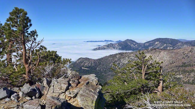
Sunrise behind San Jacinto Peak from the Mt. Wilson Trail.

As I worked up the Mt. Wilson Trail the first flare of sunlight gleamed from behind Mt. San Jacinto. The entire mountain was backlit by the sun, an aura of sunbeams radiating from its ridges. It was about 7:15 and along with a few other hikers and runners, I was chugging up the well-used trail from its Mira Monte Avenue trailhead.

Other than going to the top of Mt. Wilson, I had no specific plan in mind. I’d see how I felt on top and then decide whether to run back down the Mt. Wilson Trail or do something longer.


The run/hike to the top is a little over 7 miles one way with an elevation gain of about 4700′. It’s a spectacular trail that works up rugged Little Santa Anita Canyon to historic Orchard Camp (about mile 3.5), and then climbs up to Manzanita Ridge and the Winter Creek Trail junction (about mile 5.4). Around mile 6 the trail joins the Mt. Wilson Toll Road for about a half-mile, then forks from it on the right, leading in another half-mile to the main parking lot at Skyline Park.

In addition to the original Mt. Wilson Trail there are four other trails that start/end at the top of Mt. Wilson: the Kenyon Devore Trail, Rim Trail, Sturtevant Trail and the Mt. Wilson Toll Road. Using these trails and interconnecting trails and roads a multitude of Mt. Wilson runs and hikes are possible.


At around 9:30 I topped out at the Skyline parking lot and while filling my Camelbak at a water faucet pondered some options. I could just retrace my steps and run back down the Mt. Wilson Trail. That would be the simplest and would be nearly all downhill. Tempting. But the weather was Autumn perfect and the visibility at least 100 miles. It was early and there was plenty of time to do a longer outing.

I’d been toying with the idea of descending the Sturtevant Trail to the Mt. Zion Trail, taking that trail to Hoegees Camp, and then ascending the Winter Creek Trail back up to the Mt. Wilson Trail at Manzanita Ridge. Variations of this loop are popular and most often done from Chantry Flats.


I didn’t know what it would be like to do the loop from the Mt. Wilson Trail, but I had a pretty good idea. On the way up Wilson I’d peered down, down, down into the canyon ascended by the Winter Creek Trail. It looked like the climb out would add another couple thousand feet to an already stout tally.

And it did! Overall the trails were in great shape and there were many miles of superb running. Near Sturtevant Camp at the Mt. Zion Trail junction (about mile 10.3) and continuing above Spruce Grove on the Mt. Zion Trail the forests of bigcone Douglas-fir, oak, alder and bay were so dense and shady I had to check if my sunglasses were still on.

The difficulty of the ascent of the Winter Creek Trail from Hoegees Camp (about mile 13) on tired legs was offset by the beauty of the canyon. At the top of the Winter Creek Trail, I jumped onto the Manzanita Ridge Trail, so that added a little extra gain. I was happy to finally see the bench at the Mt. Wilson Trail & Manzanita Ridge junction (about mile 15.4).


Although there are several places that a fall could “ruin your whole day,” the run down on the Mt. Wilson Trail is one of my favorite descents in Southern California. It’s generally not super steep and there are long stretches of relatively straightforward trail.

The run worked out to 20+ miles with an elevation gain/loss of about 7200′. Although a bit strenuous, it visited some of the most scenic areas found on Mt. Wilson.

Seventh Driest January 1 to November 1 On Record in Los Angeles

Oak and clouds on the El Escorpion loop near West Hills, California

Updated November 5, 2013. My mistake — a spreadsheet range error — thanks for the heads up Reg! The driest January 1 to November 1 for Downtown Los Angeles was in 1972 with 0.92 inch. Here are the driest ten years for that period:

1. 1972 0.92
2. 2002 1.62
3. 1984 1.93
4. 1961 2.37
5. 1971 2.39
6. 1947 2.45
7. 2013 2.78
8. 1894 2.89
9. 1953 2.89
10. 2007 3.37

As much as I enjoyed running in the showery weather Monday, I barely got wet. What Los Angeles needs is a good soaking.

Year to date Downtown Los Angeles (USC) has only recorded 2.78 inches of rain. This is the seventh driest January 1 – November 1  in Los Angeles over the past 135 years! To get out of the bottom ten for calendar year rainfall Los Angeles needs about 3.5 inches of rain by December 31. Normal rainfall for November is 1.04 inches and for December is 2.33 inches.

Although it’s still early in the rain season Downtown Los Angeles (USC) is already 0.83 inch below normal for water year rainfall. The water year extends from July 1 to June 30.

Watch and Wonder

Crown-sprouting laurel sumac in Pt. Mugu State Park following the Springs Fire.

Trying to understand the behavior of wildlife can be perplexing, particularly when it involves human interaction. Sometimes I just shake my head and wonder what an animal is thinking.

I was in the middle of a 13.5 mile loop in Pt. Mugu State Park, chugging up the Old Boney Trail in the Boney Mountain Wilderness, about 2.5 miles past its junction with the Blue Canyon Trail.


From time to time I’ve been checking the progress of recovery in Springs Fire burn area. Ecologically the area is very complex and as a result of the varied terrain, habitats, vegetation patterns, soil moisture and burn severity, the rate of recovery has also been varied.

The recovery has been further complicated by the season of the fire — just before Summer — and by below average rainfall. Taking into account the unusual circumstances, the sprouting of sycamore, oak, walnut, bay, red shanks, laurel sumac, toyon, mule fat and other plants has been surprisingly robust.

The stretch of the Old Boney Trail I was on now had been severely burned. It was along a steep, rocky canyon that still looked quite barren. Many chaparral plants sprout from surviving roots following a fire, but some plants such as the bigpod Ceanothus in this area must regrow from seeds which sprout following Winter rains.

With the lack of vegetation I was a little surprised to see a California Towhee land on the rocky trail a few feet ahead of me.

The California Towhee lives in the chaparral and I see them frequently on trail runs. It is about as nondescript as a bird can be — gray-brown and little smaller than a dove. They have a peculiar habit of emerging from the brush, scurrying a few feet along a trail just ahead of a hiker or runner, and then darting back into the brush.


Inexplicably this particular bird carried this behavior to the extreme, scampering along the trail just ahead of me for more than 2 minutes, eventually pausing on some rocks along the trail and watching me pass. The time from the first picture of the bird on the trail to the last was 2 minutes 14 seconds. That’s one-Mississippi, two-Mississippi, all the way up to one hundred thirty-four-Mississippi.

I often see towhees in pairs and sometimes with rabbits when both are foraging. The rabbit acts as an early warning device for the bird and vice versa. Did the towhee see me as a really big rabbit? All I could do is watch the bird and wonder.

Some related posts: Chasing Towhees and Other Rainy Day Activities, Coyote Tag, Coyote Tag II, Hawk, Bobcat and Rabbit

Best Trailhead to Start the Bulldog Loop?

Goat Buttes and Century Lake and Gorge in Malibu Creek State Park.

There are several places runners can start the Bulldog Loop: the main parking lot at MCSP, Piuma & Malibu Canyon, and Malibu Canyon & Mulholland are all popular starting points.


One of the best trailheads for starting this loop is often overlooked — the Cistern Trail and Phantom Trail trailhead on Mulholland Highway. Starting at this trailhead adds about 1.5 mile and 500′ gain/loss to the standard 14+ mile loop. Less than a quarter-mile into the run this variation passes one of the best viewpoints in Malibu Creek State Park. 

The run begins on the Cistern Trail on the south side of Mulholland and follows that trail about a quarter-mile to the Lookout Trail junction. At the junction the route turns right on the Lookout Trail and follows it about 0.4 mile to the Cage Creek Trail, which leads down to Crags Road and the regular Bulldog Loop. Near the end of the loop, after climbing a hill and passing the spur trail down to Century Lake, the Lookout Trail is taken from Crags Road back up to the Cistern Trail and car.


Much of Malibu Creek State Park and the route of the Bulldog Loop can be seen from the Cistern Trail at the beginning of the run. There are excellent views of Reagan Ranch, Brents Mountain, Goat Buttes, Century Lake and Gorge on the way down the Cistern Trail and climbing back up the Lookout Trail at the end of the loop.

The run can be easily extended by tacking on the Yearling and Deer Leg Trails in the Reagan Ranch area or by doing the Phantom Loop when the Grasslands Trail & Crags Road junction is reached after passing the MCSP parking lot.

The title photo is of Goat Buttes and Century Lake & Gorge from this morning’s run of the loop.

Some related posts: Century Lake, Dam and Gorge on Malibu Creek, Malibu Creek State Park Scenic Loop, Vertical Relief