Category Archives: photography|landscape

Above Satwiwa

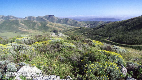
A view of the Conejo Valley from the crags west of the Danielson cabin site.

A view of the Conejo Valley from the crags west of the Danielson cabin site. The grassland area in the valley is Rancho Sierra Vista/Satwiwa in Newbury Park, California.

From Sunday’s adventure hike and run to Sandstone Peak in the Santa Monica Mountains.

Related post: Satwiwa Loop Trail

Sandstone Peak from Wendy Drive

Big Dome and Sandstone Peak from Tri-Peaks

Whatever route you use to get there, Sandstone Peak (3111 ft.) is a rewarding summit with sweeping views that range from the Channel Islands to Mt. Baldy and beyond. It is the highest peak in the Santa Monica Mountains, and a popular destination.

The peak is usually done as a steep 3-mile hike (round trip) from the Sandstone Peak Trailhead, or as part of a scenic 6-mile loop from the Mishe Mokwa trailhead. This National Park Service PDF provides additional information and a map of these trails.

A third option is to skip the drive to Yerba Buena Rd., and do the peak as an adventure hike/run from Wendy Drive trailhead in the Conejo Valley. This can be done by ascending one of the routes on the north side of Boney Mountain, then continuing up and over Tri-Peaks to the Mishe Mokwa/Backbone trail junction. From here the Backbone Trail leads to a spur trail that climbs the peak.

View west from Sandstone Peak of the Boney Mountain massif.

We took this last option and climbed Boney Mountain’s more technical western ridge. Done this way, it was about 6.8 miles to Sandstone Peak’s summit, with an elevation gain of about 3100 ft. This includes the short side trip to the high point near the top of the western ridge generally referred to as “Boney Mountain.”

Here’s a view west from Sandstone Peak of the Boney Mountain summit area. Tri-Peaks is the rocky peak on the skyline, right of center, and Big Dome is to the right of Tri-Peaks. The route up the western ridge tops out on the crest between these two peaks. (As seen from Sandstone Peak.)

The basic choices for getting back to the Wendy Drive trailhead are to go back down one of the trails on Boney Mountain’s north side; descend the Chamberlain Trail to the Old Boney Trail, and then loop back over the shoulder of Boney, or descend to Big Sycamore Canyon and then return from there.

Miklos and Krisztina had not run down Boney’s eastern ridge, so they backtracked over Tri-Peaks, and descended the use trail to the Danielson cabin site. I was looking to do some additional mileage, so ran down the Chamberlain, Old Boney, and Blue Canyon trails to the Danielson multi-use area in Big Sycamore Canyon, and then up Sycamore Canyon to the Upper Sycamore Trail, and back to Satwiwa.

Here’s a  Cesium ion view of a GPS trace of my route. The eastern ridge route is also shown.

Related posts: Balance Rock, Boney Mountain Western Ridge & Loop

Running Rocky Peak Road

Stretch of Rocky Peak Road about 1.5 miles from the trailhead at the 118 freeway.

I was surprised how good my legs felt on the steeps on Rocky Peak. Apparently skiing San Jacinto was a great way to knock my legs out of the doldrums — and make them happy to be using shoes that weigh only 22 ounces/pair!

This stretch of Rocky Peak Road is about 1.5 miles from the trailhead at the 118 freeway. It is also about 2.7 miles into the Bandit 30K and 14K courses.

Related posts: Bandit 30K Course Preview, Rainy Morning on Rocky Peak Road

Skiing San Jacinto

Charles Foster on the summit of San Jacinto Peak. San Gorgonio Mountain is in the background.

The wind had been blowing in fitful gusts, but calmed as I approached the precipice. Despite its foundation of granite, I felt exposed out on the narrow promontory of snow. Just beyond the tips of my skiis, the north face of San Jacinto Peak dropped 8500 dizzying feet to the desert floor.

The summit of San Jacinto (10,834′) is always spectacular, but with the addition of snow it is transformed into a peak with a high mountain character — a wild and wintry landscape shaped by wind and weather.

Our route to the summit was only four miles long, but with 8 lbs. of ski, boot and binding latched to each foot, the 2400 ft. ascent from the Long Valley ranger station had been strenuous. Rather than following the trail southwest toward Round Valley, we chose to ascend the east-west trending drainage that leads to Tamarack Valley. The steep maze of snow pillows, rocks and trees is a more direct alternative to the well-used Round Valley trail.


Charles Foster works up the scenic east ridge of Mt. San Jacinto. February 21, 2009.
Once out of the maze, we continued west past Tamarack Valley, eventually working up onto the slopes below Miller Peak. From here we switchbacked up the bowl to the saddle between Miller and San Jacinto. From the saddle it was a scenic half mile up the broad east ridge to the summit. Here’s a Google Earth image, a Google Earth KMZ file, and a Cesium ion view of a GPS trace of our route.

Like any real world mountain, the snow conditions on San Jacinto are not always the best. However, today the snow was pretty good — maybe a 7 or 8 out of 10. It had snowed a few days before, and temps were just starting to warm up. The top 4-5 inches of the pack were dense, and the surface was soft. The sun was muted my a thin veil of high clouds, so the snow did not vary much in and out of the trees.

As we removed our climbing skins and prepared to ski down, Charles and I reminisced about skinny ski descents of San Jacinto, and other peaks. Like sticky rubber on rock climbing shoes, shaped skiis had changed the sport. Easier to manage and turn, shaped skiis handle crud so much better than long, narrow skiis with little side cut.

My initial turns off the summit were a bit tentative, but improved as we skied down through the Lodgepole pines on the east ridge. By the time we dropped into the big bowl southeast of the summit, I was getting my ski legs back, swinging turns, and feeling like it had been 3-4 weeks, rather than 3-4 years, since I had skied here.

Related posts: Room with a View; Rock on Rock, Snow on Snow

Hammering Up the Chumash Trail

Mountain bikers working up the 2.6 mile Chumash Trail.

Mountain bikers working up the 2.6 mile Chumash Trail. Simi Hills and Simi Valley are in the distance. This section of the trail was burned in the Sesnon Fire in October 2008.

Here is a Live Browser View of a GPS trace of the Chumash Trail.

Related post: Chumash Trail Training, Chumash Trail – Sesnon & Simi Fires