Category Archives: trails

Clouds, But Not Much Rain in Los Angeles

Running up to Lasky Mesa

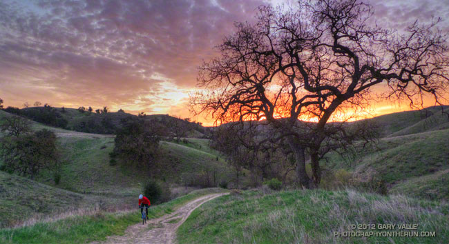
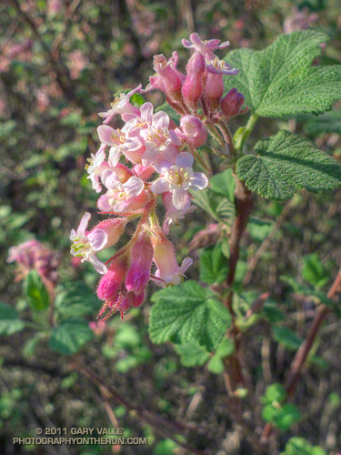
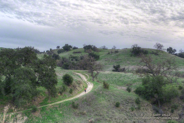
The Cheeseboro RAWS, a couple of miles west of where this photograph was taken, is usually a good indicator of the weather in the Ahmanson Ranch area. The automated weather station recorded a paltry 0.01 inch of rain Tuesday. While this was enough to dampen the trails and create a little mud, it didn’t help much with our low water year precipitation totals.

Downtown Los Angeles (USC) also recorded 0.01 inch of rain Tuesday, bringing the water year (July 1 to June 30) total to 5.07 inches, or about 60% of normal. Some areas have had a little more rain and some a lot less. According to NWS data the Santa Barbara water year rainfall total stands at about 69% of normal, while Burbank out in the Valley has recorded only about 44% of the normal amount of rain.

Central California isn’t doing any better. Downtown San Francisco has only recorded about 42% of normal rainfall and Sacramento 45% of normal. In the first full Sierra snow survey of the season, basin averages ranged from about 28% to 54% of the normal snowpack, with a statewide weighted average of 35%.

The medium range weather models are forecasting a series of shortwave troughs will move through Southern California over the next 10 days. At the moment the systems aren’t forecast to produce much rain in the Los Angeles, but maybe that will change. We’ll see!

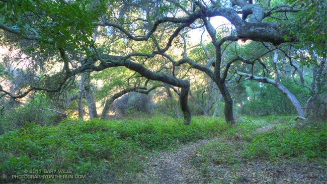
The photograph is from a run last week. The road leads up to Lasky Mesa in Upper Las Virgenes Canyon Open Space Preserve (formerly Ahmanson Ranch).

Cape Ivy on the Rivas Canyon Trail

Cape Ivy on the Rivas Canyon Trail

Did the Will Rogers – Temescal Loop this morning from the End of Reseda. It had been more than a month since we’d had measureable rain in Los Angeles and it was great to be out in the Santa Monica Mountains after a rainstorm, dodging a few mud puddles and enjoying the good running weather!

A key segment of the 21 mile loop is the Rivas Canyon Trail, which connects Will Rogers State Historic Park to Temescal Gateway Park. Each time I run the trail I’m blown away by the oceans of Cape ivy in Rivas Canyon. Having grown up in the Southeastern U.S. it reminds me of kudzu.

Both are introduced perennial climbing vines — kudzu from Japan and Cape ivy from South Africa. Both are prolific and can cause severe negative impacts to native plants and other vegetation.

More information about Cape ivy (Delairea odorata) can be obtained on the California Invasive Plant Council web site.

Related post: Christmas Eve Trail Run

Circle X Crags and the Channel Islands

Crags in the Circle X area and the Channel Islands from the Etz Meloy section of the Backbone Trail

The view above is of crags in the Circle X area and the Channel Islands from the Etz Meloy section of the Backbone Trail in the Santa Monica Mountains.

From today’s out and back run on the Backbone Trail from Kanan Road to a viewpoint on Etz Meloy Mtwy fire road. The fire road continues west about a mile and links to the Yerba Buena segment of the Backbone Trail.

The segment between Kanan Road and Yerba Buena Road includes the two remaining gaps in the Backbone Trail — the 0.1 mile Etz Meloy gap and the 0.4 mile Upper Trancas gap.

Here are a few additional photographs from the run:


Etz Meloy Motorway


Chaparral Currant


Oak Grove

Rocks & Clouds Along Edison Road

In this case the Edison Road is in Upper Las Virgenes Canyon Open Space Preserve.

From this morning’s run of the Upper Las Virgenes Canyon – Cheeseboro Ridge Loop. This Park Service PDF includes a map of the area, and this interactive Cesium browser View shows the route.

You Ride an Elevator, but Crawl Over a Wall

The post on the XTERRA web site said the new Crystal Cove 15K course had been approved, and also mentioned something about a “gnarly” hill. I thought I better check it out, and followed a link to the course info on MapMyRun.

The elevation profile didn’t look too bad. It had the usual ups and downs you expect to see on a Southern California trail run. In Tour de France fashion, MapMyRun categorizes the more difficult climbs on a course from Cat 5 to Cat 1 with Cat 1 being more difficult.  Climbs that are crazy difficult are rated Hors catégorie (HC). A climb has to be at least 0.3 mile long to be categorized.

Two categorized climbs were noted on the MapMyRun elevation profile of the Crystal Cove 15K course: a Cat 3 that began about a half-mile into the race and climbed about 775′ over 3.4 miles, and a Cat 5 that started at about mile 4.7 and gained about 130′. The gnarly climb was supposed to be somewhere around mile 5, but the MapMyRun profile indicated that section had a grade of 2.6%??

The gnarly hill was waiting for us around a sharp corner at mile 4.75. Locals refer to it as the Elevator, but the runners I talked to call it THE WALL. Since you ride an Elevator, but have to crawl up and over a wall I’m going with THE WALL. Whatever you call the thing, it was the steepest pitch I’ve ever encountered on a race course, and steep enough that hikers often descend it on their backside. (It’s steeper than it looks in the video!)

And once you’ve clawed your way over THE WALL you’re not done — the hill continues another 0.4 mile and averages about a 15% grade. I pushed on up the climb, propelled by the thought that the MapMyRun profile showed it was nearly all downhill from around mile 5.7 to the Finish — I would have almost four miles of downhill bliss.

Or not! It was in the middle of the uphill around mile seven that I was beginning to wonder when the “good” downhill was going to begin. It had to start soon; the course was only about 9.5 miles long! After struggling to keep my pace up through a long stretch of level terrain around mile eight, I wondered — probably out loud — if the course was going to fall off the edge of the earth.


From madness comes revelation, and in this case the edge of the world. The last mile-plus of the course plummeted nearly 700 quad-numbing feet to the Finish.

Reality check: Here’s a higher resolution elevation profile generated in SportTracks using my GPS track from this year’s race. You can see there was a lot more to the course than shown in the MapMyRun profile. There are several tough climbs, ranging in grade from about 5% to 15%, and the last big hill was definitely gnarly! The course was great, and much more interesting than the MapMyRun profile suggested.

Here’s a Crystal Cove State Park Trail Map (PDF).