Category Archives: trails

Afternoon Run

View west from Rocky Peak road, past Simi Valley to Boney Mountain.

Started the weekend with an exhilarating Morning Run in the Santa Monica Mountains near Saddle Peak, and wrapped it up with another enjoyable run, the Chumash – Hummingbird loop in the Santa Susana Mountains.


Prior to the start of a controversial condo development near Happy Face Hill, the Chumash – Hummingbird loop was a favorite of mountain bikers and trail runners. According to an article in the Simi Valley Acorn, the original developer abandoned the project in 2008, and the land was recently purchased by a new developer.

Hopefully any new construction plans will continue to include a trail connection from the Chumash trailhead on Flanagan Dr. to the Hummingbird trailhead on Kuehner Dr.

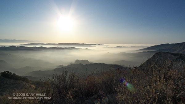
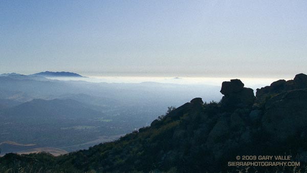
The title photo is a view west from Rocky Peak road, past Simi Valley to Boney Mountain.

Related post: Chumash-Hummingbird Loop

Interactive Google Earth View of the Area Burned by the Station Fire


Click for an interactive view using Google Earth plug-in.

Update May 29, 2010. Angeles National Forest has issued Forest Order 01-10-02 redefining the Station Fire closure area. See the Angeles National Forest website and this May 29, 2010 post for more info.

Updated October 7, 2009. Added Sheep Fire Perimeter from GEOMAC and the approximate eastern boundary of the Station Fire Closure Area.

Here’s an interactive Cesium browser View of the approximate areas burned by the Station (2009), Sheep (2009), Morris (2009), Curve (2002), and Williams (2002) fires. The Station, Sheep, and Morris fire perimeters are from the GEOMAC website, and the Curve and Williams perimeters are from the CDF/FRAP website.

The magenta line is the approximate eastern boundary of the Station Fire Closure Area as derived from Angeles National Forest Order No. 01-08-09, Exhibit A and Exhibit B. Please refer to the most current Forest Orders and Exhibits for official information. (See note above, this boundary no longer applies.)

GPS traces of some trail runs inside and outside the Station Fire area have been added, along with links to related photos and stories on PhotographyontheRun.com. Click on the green hiker icon to access the link.

The view also includes a partial track of the Pacific Crest Trail (2009 ver. 1) from the Pacific Crest National Scenic Trail website.

Some placenames have also been added –the locations should be considered approximate.

Related post: Station Fire MODIS Fire Detections

How Many Tree Rings?

Fallen Jeffrey Pine in an area of downed trees located on the western end of the Vincent Tumamait Trail

I’ve run past this fallen Jeffrey Pine a number of times. It’s in an area of downed trees located on the western end of the Vincent Tumamait Trail, near Cerro Noroeste road. The trees probably fell after being killed by a fire. It’s a relatively large tree, and I’ve always wondered about its age.

A rough count of the growth rings gives an approximate age of 200 years. The tree ring sequence shows periods of fast growth, associated with above normal precipitation; and periods of slow growth, associated with drought.

Some related posts: Downed Trees Near Mt. Abel, Vincent Tumamait Trail

The Run Down After the Run to the Top

Runners Descending the Devil's Backbone on Mt. Baldy

Runners Descending the Devil’s Backbone on Mt. Baldy

It’s a lot more fun working with gravity, than against it! For many runners, the run down from the summit of Mt. Baldy is as much a part of the Run to the Top experience as the race up.

Grueling sections of trail are effortlessly retraced, and there is more of an opportunity to enjoy the Devil’s Backbone, and other spectacular sections of trail. Those needing more mileage skip the chair lift ride down from the Notch, and continue down the service road, following the route of the race.

Related post: Mt. Baldy Run to the Top 2009

Mt. Baldy Run to the Top 2009

Finish line of the Mt. Baldy Run to the Top.

The weather for the 44th edition of the Mt. Baldy Run to the Top was nearly identical to last year, with clear blue skies and temps in the 50’s.


Station Fire from Mt. Baldy.
The Station Fire could be seen from the top of Mt. Baldy, but with the wind from the southwest, the smoke was blowing elsewhere.

This challenging mountain run gains about 3800 feet over 7 miles, starting at the bottom of the Mt. Baldy ski lift parking lot and ending on the summit of 10,064′ Mt. Baldy. Here’s a Cesium browser View of a GPS trace of the course.

This year the men’s overall winner was Jonathan Toker in a time of 1:12:11, and the women’s overall winner was Hannah Valenzuela in a time of 1:26:03. For all of the results see the Run to the Top web site. Many thanks to the race organizers, volunteers, USFS, Mt Baldy Ski Lifts and the Mt. Baldy Fire Department for a great race!

Related post: Mt. Baldy Run to the Top 2007