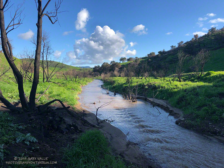
There were two crossings of the creek on my run today. My shoes were already wet from running on wet trails, so I didn’t worry about keeping my shoes dry.
Here’s a video snapshot of the creek on Vimeo. It’s carrying a bit more sediment than normal, as a result of the Woolsey Fire.
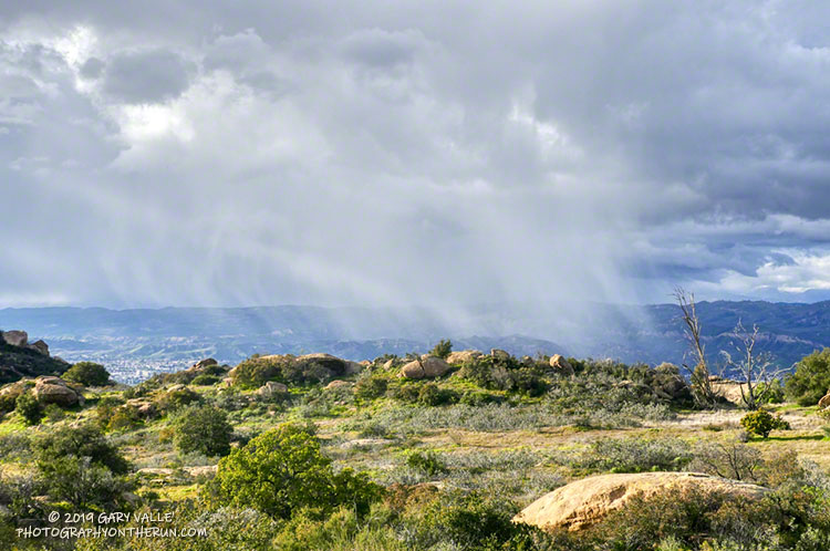
There were many reports of snow, sleet, hail, and graupel around the area yesterday.
It was definitely cold! The afternoon temperature at 1700′ at the Cheeseboro RAWS was around 42°F. And the temperature was probably cooler in the vicinity of convective showers, such as the one above.
The photograph is from Sage Ranch, at an elevation of about 2000′. I was hoping to see some snow on the ground — but no cloud buildups cooperated.
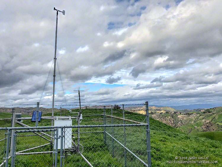
This afternoon’s run was to the Cheeseboro Remote Automated Weather Station (RAWS). The station is perched on the ridge between Las Virgenes Canyon and Cheeseboro Canyon, along the Cheeseboro Ridge power line service road.
It is about 5 miles from the Victory Trailhead of Upper Las Virgenes Canyon Open Space Preserve (formerly Ahmanson Ranch) and one of many good runs from that trailhead into the Cheeseboro – Palo Comado Canyon area.
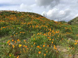
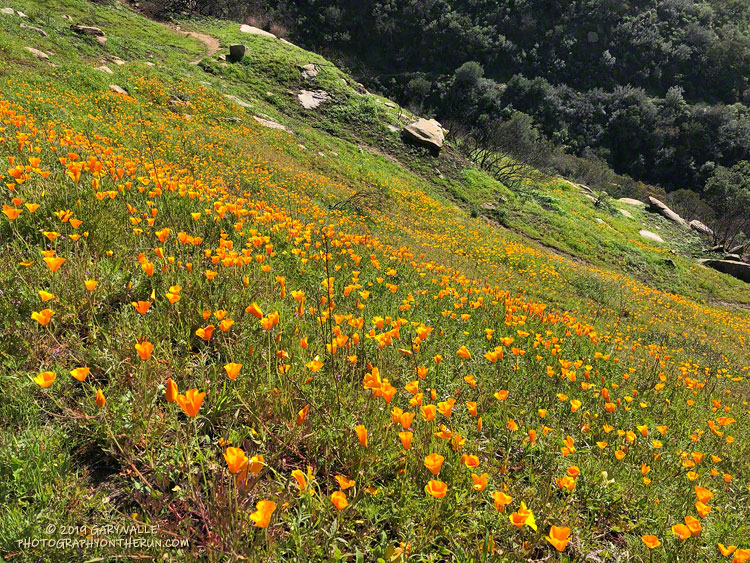
California poppies in Las Virgenes Canyon
Runs in the Ahmanson Ranch area are especially scenic at the moment. Above average rainfall has produced lush green growth in the oak grasslands following the Woolsey Fire. Many of the oaks are beginning to sprout new leaves and poppies and other wildflowers are beginning to bloom. Today there was a nice show of poppies in Las Virgenes Canyon at the connector leading to Cheeseboro Ridge and Cheeseboro Canyon.
Operated by the BLM and NPS the Cheeseboro RAWS (CEEC1) has been in service since September 1995. The station was in the area burned by the 2005 Topanga and 2018 Woolsey Fires and was active throughout each event.
Following are some of the extremes recorded by the station:
• Highest hourly temperature was 115 °F on July 7, 2018.
• Lowest hourly temperature was 32 °F on December 12, 1998.
• Maximum hourly wind speed was 37 mph on October 22, 2007.
• Maximum wind gust was 92 mph on January 6, 2003.
• Maximum daily precipitation was 5.01 inches on February 12, 2003.
So far this rain year (July 1 to June 30), 15.67 inches of rain has been recorded by the station.
Rounded a corner running down the Lower Stagecoach Trail, above Corriganville, and was suddenly immersed in a sea of orange.
The area was burned in a potentially dangerous fire, the Peak Fire, that started along the 118 Frwy on November 12, 2018, while the Woolsey Fire was still being fought. The fire threatened homes in the eastern Simi Valley and Box Canyon, but was aggressively attacked by firefighters and quickly knocked down.
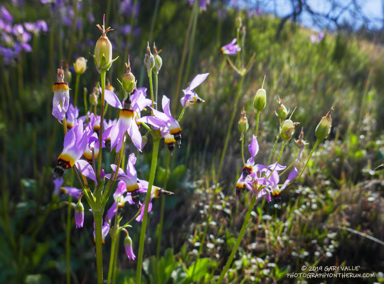
Shooting stars (Dodecatheon clevelandii ssp. patulum) love wet weather, but produce capsules that help protect their seeds should the weather turn suddenly dry.
These shooting stars are on a new section of the Loop Trail at Sage Ranch Park. The Loop Trail was rerouted due to the ongoing cleanup at the Santa Susana Field Lab.
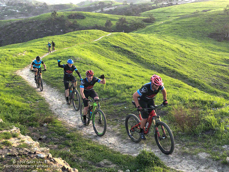
Out at Ahmanson the other day I happen to run into the same group of mountain bikers twice, and both times was on hills. One time was on the easy hill pictured above and the other was on a hill named “The Beast” by 70’s era cross-country runners.
The Beast climbs up to Lasky Mesa from East Las Virgenes Canyon. The turn (south) off of East Las Virgenes Canyon Road to the Beast is about 2.25 miles from the Victory Trailhead and 0.7 miles from the Las Virgenes Trailhead. A short descent leads down a dirt service road to the start of the hill. The climb is about 0.8 mile long and has an average grade of around 9%-10%. Here’s the Strava run segment and ride segment for the climb.
Riders were much faster than runners on this short uphill. The average speed of the top rider was about 1.5 times faster than the top runner. The fastest rider did the Beast in 4:34 and the fastest runner in 6:49. The top 10 riders averaged 5:19 up the hill and the top 10 runners 7:36.
On this moderate hill the bike’s mechanical advantage and efficiency more than make up for its weight.