From a trail run at Sage Ranch Park earlier this year.

From a trail run at Sage Ranch Park earlier this year.
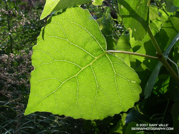
Who hasn’t pondered the intriguing network formed by the interconnected veins of a leaf? Like many apparently complex self-organized structures, there is a recognizable pattern, but the basis of the pattern is difficult to grasp.
Remarkably, research published in 2002 (S. Bohn et al., Phys. Rev. E, June 2002.) found that there is a simple relationship governing the angles between vein segments in the leaves of dicotyledons, and that this relationship is universal. The study also found that the observed vein angles can be reproduced using a simple force model.
Numerical analysis of leaf scans revealed that the angles between vein segments are directly related to the thickness of the segments. When the vein sizes are similar, the connection appears to form a three-way junction with the angle between the veins about 120 degrees. If the vein sizes are dissimilar, with one much larger than the other, the smaller vein joins the larger at about a 90 degree angle.
The photograph is of a leaf of a Fremont cottonwood (Populus fremontii) along Las Virgenes Creek in Upper Las Virgenes Canyon Open Space Preserve. It was taken on a run from the Victory trailhead on May 16, 2007.
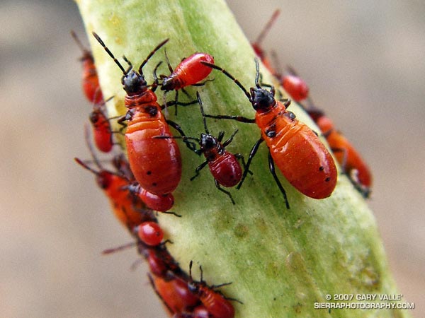
The bright orange-red coloration of these immature large milkweed bugs (Oncopeltus fasciatus) is a warning to predators that they taste bad. Like monarch butterflies, they concentrate foul-tasting compounds from the narrow-leaf milkweed (Asclepias fascicularis) in their bodies.
Following several instars (molts), the nymph is transformed into the adult insect.
The photograph is from a run at Sage Ranch on July 23, 2007.
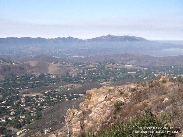
Sandstone Peak and Boney Mountain from Simi Peak
I hadn’t done this course in midsummer, but a long run close to home, and an early morning ascent of Simi Peak sounded like a nice change of pace. A dawn start from El Scorpion Park put me on the peak and back to the car before temps got out of hand.
On the way out to Simi Peak I usually run up Las Virgenes Canyon and then follow a single track popular with mountain-bikers to Shepherds’ Flat. From here the Sheep Corral Trail leads west to the Palo Comado Canyon fire road, which can be followed up to China Flat. On the way back, from Shepherds’ Flat I run down the Cheeseboro Canyon trail to a connector that can be followed east back to Las Virgenes Canyon. Done this way, and tacking on a short scenic tour of China Flat, the route works out to be about 22.5 miles, with an elevation gain and loss of about 2200 ft. Here’s a Google Earth image and Google Earth KMZ file of a GPS trace of the run.
There is an extensive network of trails in Upper Las Virgenes Canyon Open Space Preserve (trail map) and Cheeseboro/Palo Comado Canyons (trail map) , and many routes to Simi Peak are possible. El Scorpion Park is the most distant trailhead from Simi Peak. Starting at the Victory trailhead will decrease the round-trip mileage by about 2.5 miles, and from the Las Virgenes trailhead by about 6 miles. Simi Peak can also be accessed from the Cheeseboro Canyon, Lindero Canyon, Lang Ranch, and Long Canyon trailheads.
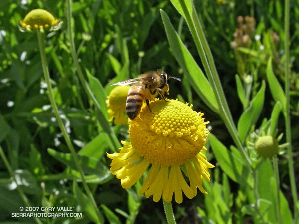
A bee forages on Bigelow’s sneezeweed (Helenium bigelovii) at Little Jimmy Spring. From Sunday’s Islip – Baden-Powell loop.
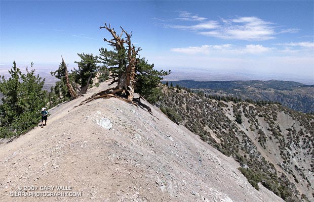
A grizzled guardian of the San Gabriel Mountains, the Wally Waldron Tree stands defiantly astride an airy, rock strewn ridge, just below the summit of 9399 ft. Mt. Baden-Powell.
Perched on the brink of the mountain’s precipitous southeast face, the weather-sculpted Limber Pine is at an elevation and in an environment similar to the 4000+ yr. old White Mountain Bristlecone Pines. Burnished and hardened, the tree’s huge, gnarled roots anchor it firmly to the mountain, helping it to resist the whims of weather and time. The tree is estimated to be 1500 years old.
We had stopped to visit the tree part way through an approximately 23.5 mile loop from Islip Saddle. Our route had descended to South Fork Campground (4560′), before climbing back up to Vincent Gap and Mt. Baden-Powell. In a few minutes we would continue to Baden-Powell’s summit, and from there follow the PCT along the crest back to Islip Saddle. Here’s a Google Earth image and Google Earth KMZ file of a GPS trace of the loop.
Water Notes: The little stream on the Manzanita Trail about 1.5 miles from Vincent Gap was still running. The flow from Little Jimmy Spring was lower than normal, but still very reasonable. We did not detour to Lamil Spring.
Related posts: Vincent Gap – Little Jimmy Spring Out & Back, Complications, Heat Wave