Chumash Astronomy: Reaching into the Upper World

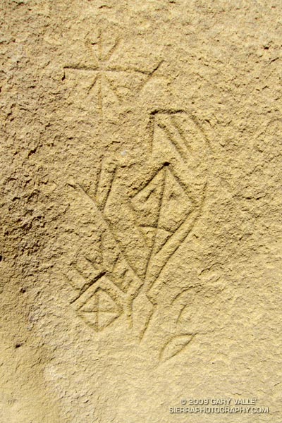
Chumash astronomical petroglyph.

There is nothing quite so compelling as an unanswered question.

Several years ago, in the middle of a trail run, an unusually shaped rock formation caught my eye. After a little bushwhacking and exploration, I found a way to climb the formation, and on its summit found a small pictograph. I wondered if there might be other pictographs in the area, and on the way back to the trail found the inscription pictured above.

Later, I took a friend with more ethnographic experience to the top of the rock, and it was his opinion that the pictograph, as well as the nearby inscription, were not of modern origin. He also mentioned that the rock likely marked the point on the southeastern horizon where the sun rises on the Winter Solstice, as seen from a Chumash shrine several miles away.
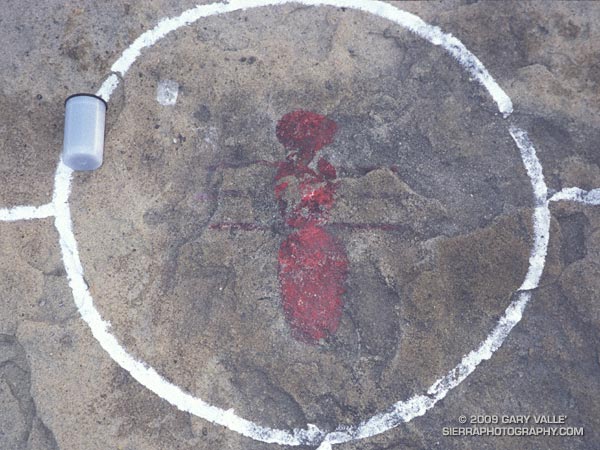

Chumash pictograph
The pictograph on the solstice rock appears to have been painted using an ochre pigment, which may have been mixed in an adjacent cupule. It is in a harsh environment, fully exposed to the sun, wind and rain. It’s my guess that the white “alignment” reticule surrounding the pictograph is an unfortunate recent addition.

The petroglyph is in a concavity on the north side of a large boulder, and is better protected. That the drawing appears to be astronomical in nature, and is adjacent to a rock possibly used to mark the Winter solstice is probably not a coincidence.

To speculate on the purpose and meaning of such a drawing is to travel in time, and through the thoughts and eyes of another, visit a world far different than our own.

In this case that someone was probably an ‘alchuklash — an astronomer-priest-shaman who was a part of a religious-spiritual cult known as the ‘antap — a pervasive power elite within Chumash society.

The ‘alchuklash were adept astronomers, not only observing the Winter and Summer Solstices, but the moon, individual stars, asterisms, constellations, planets, Milky Way, eclipses and more. The observation and interpretation of the Upper World were an integral part of the Chumash cultural and world view.

But the Upper World did not exist on its own. The Chumash appreciated and celebrated the interdependency of Nature, and events in the Upper and Lower Worlds were inexorably tied to those in the Middle World of everyday existence. Using their specialized knowledge, the ‘antap facilitated communication and interaction between these worlds to the benefit, or peril, of the People.

It is in this context that in the drawing I see the powerful personage of an ‘alchuklash, who has reached into the Upper World. Perhaps the drawing is a commemoration of the power of the place. Perhaps it is a kind of owner’s manual, a premodern PDF, illustrating the purpose of the solstice rock. Or, perhaps it is something we cannot know.

Note: The contrast of the lines in the image has been increased to make them easier to see. In the ten years since I first photographed the etching, some detail has been lost in the lower right corner of the drawing. This image is from April 21, 2009.

Reference: Crystals in the Sky: An Intellectual Odyssey Involving Chumash Astronomy, Cosmology, and Rock Art. Travis Hudson and Ernest Underhay (Foreword by Anthony F. Aveni and illustrated by Campbell Grant). Socorro, New Mexico: Ballena Press Anthropological Papers No. 10, 1978, 163 pp.

Google search: $g(Chumash), $g(petroglyph), $g(pictograph), $g(rock art), $g(solstice), $g(astronomy), $g(ethnography), $g(shaman)

Chumash Clouds

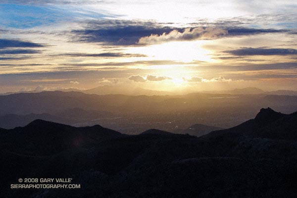
Sunset view of Simi Valley, with Boney Mountain and Conejo Mountain in the distance.

Clouds moving onshore ahead of a low pressure system that is expected to produce rain in Southern California Christmas Eve into Christmas Day. Track of the low is now projected to be a little more to the west, so the heaviest rain may occur just offshore.

From an out and back run yesterday to “fossil point” via the Chumash Trail and Rocky Peak fire road. View is of Simi Valley, with Boney Mountain and Conejo Mountain in the distance.

Secret Trail to Calabasas Peak

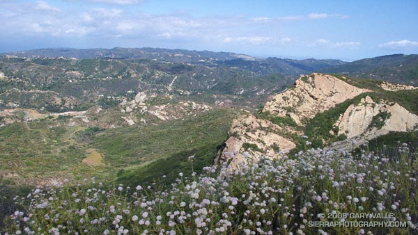
View east from near the summit of Calabasas Peak.

Along with the Chumash Trail to Rocky Peak Rd., the Secret Trail to Calabasas Peak is one of my favorite local short trail runs. The two mile route to the peak is a mix of single track and dirt road that gains about 750′ in elevation.

The trail winds its way through shaded ravines, dense chaparral and sandstone outcrops to Calabasas Peak Motorway. This fire road is followed south about half a mile to a use trail (on the right) that follows a ridge to the summit. It’s also possible to continue higher up the road and access the summit from the south. There is a survey marker (actually two) on the summit.

Here’s a Google Earth image showing the summit area, and a Google Earth KMZ file of a GPS trace of my route.

Calabasas Peak Motorway continues down to Stunt Rd. and connects to the Stunt High Trail and points beyond. Here’s what Calabasas Peak looks like from the Backbone Trail near Saddle Peak.

Related posts: Tapia Bound, A Long Run Kind of Day

Salomon XT Wings Trail Running Shoe

Salomon XT Wings Trail Running Shoe

Last updated 07/05/10. Symmetrical lacing and new eyelets working great on XT Wings 2!

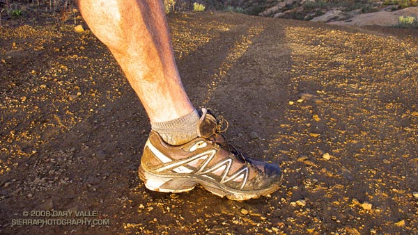
Wow — what a great ride! That was my impression the first time I used the Salomon XT Wings trail running shoes. That continues to be my feeling after using the shoe for a couple of weeks and doing several runs in the 15-20 mile range. For my particular trail running requirements, this shoe has a near perfect balance of comfort, smooth ride, cushioning, traction and support.

It’s been my experience that if a running shoe doesn’t feel comfortable when you first try it on, it’s not going to feel any better on a long trail run, and it’s probably going to feel worse. The XT Wings felt great from the start. I first tried a pair of 9.5’s — my usual trail shoe size — but found size 9.0 was better in this shoe.

Under foot, the shock adsorption and cushioning gave that “ahh..” feeling without feeling bouncy or unstable. The shoe provides just the right level of support, without overly restricting the motion of my foot. When combined with the super smooth foot strike to toe transition, the overall ride is the best of any trail shoe I’ve used.

The outsole rubber appears to have excellent friction, and the lug pattern seems to have good traction without being too grabby. The speed-lacing system is convenient and appears to work well. Some friends have had Salomon speed-laces prematurely fray at the first eyelet on their XA Comp 2 XCRs, and prevent that by using a little duct tape around the lace. I’ll see if that happens with this model.

Update 07/05/10. I now have about 190 miles on each of three pairs of Salomons with the the new eyelets (XT Wings, XT Wings 2 & XT Hawk 2), and I’ve had no problems with the laces fraying.

Update 02/22/10. In addition to new eyelets, the XT Wings 2 also uses symmetrical lacing. This should completely resolve the old lace-fraying issue.


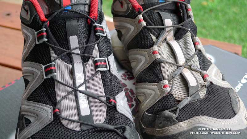
New XT Wings eyelets
Update 01/22/10.
Recently retired my fifth pair of XT Wings, again at about 300 miles. When I purchased my sixth pair was surprised to discover that the eyelet system has been redesigned. Hopefully this will resolve the problem I’ve had with the laces fraying, and I won’t have to use the “duct tape fix” on future pairs. Here’s a photo comparing the new lacing system (left) to the old one, and a close up of the new eyelet.

Update 08/05/09. Recently retired my third pair of XT Wings, at about 300 miles, and purchased my fifth pair. It’s still my shoe of choice for long runs.

Update 05/29/09. With the “duct tape fix” applied, I’m now 244 miles into my third pair of XT Wings, and 95 miles into my fourth pair — no problems. My Speedcomps, which don’t have the “toe anchored” lace like the XT Wings, have 235 miles on them, and no duct tape on the laces!

Update 09/24/08. Not good — with only 135-150 miles on my second pair of XT Wings, the lace has frayed on the left shoe at the same point (second eyelet from the anchor eyelet) as it did on the right shoe of the first pair. I’ve exchanged the pair and applied the “duct tape fix” at the second eyelets. We’ll see how it goes. Shouldn’t have to do this with a $120 pair of shoes.

Update 09/12/08. The Salomon XT Wings continues to be my shoe of choice for demanding trail runs. They are what I was in for the New Army Pass – Cottonwood Pass Loop in the Sierra, the Falls Creek Loop on San Gorgonio Mountain, the Islip Saddle – Mt. Baden-Powell South Fork Loop and Mt. Disappointment 50K in the San Gabriel Mountains, and several other long mountain runs.

Update 06/21/08. With about 250-275 miles on the pair, the lace on my right shoe broke on Thursday while running the Chumash Trail. I tied off the broken end, tightened the lace and continued the run — no big deal. In my case the lace broke at the middle eyelet on the left side of the tongue. While I hope Salomon will make the laces bombproof, the lace breaking won’t keep me from running in this outstanding shoe. I primarily use the XT Wings for longer runs.

Update 03/21/08. I’ve done several longer (20-29 mile) trail runs the last month and the shoe has performed exceptionally. I’ve had no problems with the laces or anything else. It sure seems that the smooth ride of this shoe translates to my legs feeling better at the end of a long run!

There are a couple of things I have to gripe about. At 27.7 oz, the size 9 pair I purchased is a little heavier than my Vitesses. The shoe is also expensive — $120 compared to around $85 for the Vitesse.

Related post: Salomon XT Wings 2 Trail Running Shoe

Google search: $g(Salomon XT Wings), $g(trail running)

Chumash View II

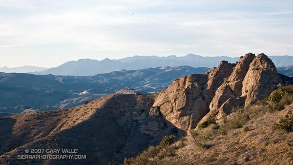
View northwest to the Ventura Mountains from the Chumash Trail.

View northwest to the Ventura Mountains from the Chumash Trail. The highest peak on the skyline is Hines Peak (6716′), about 28 miles distant. Here’s a larger version of the 16:9 format image. Note the hawk soaring high above the terrain.

I run the Chumash Trail frequently, but had not seen the bulldozed track on the steep slope near the start of the trail. The trail hasn’t been re-routed. Apparently on the 13th a 4WD truck that was part of a fire department response to a cycling accident got stuck, and a bulldozer was called in to extricate the vehicle. I’ve been told the Park District and Mountains Conservancy are considering next steps.

Chumash-Hummingbird Loop

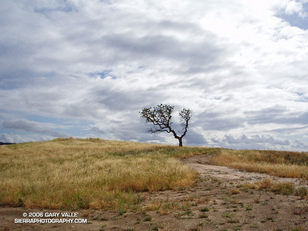
Oak, grass, and clouds in Simi Valley, California.

The Chumash and Hummingbird trails are popular trails in the eastern Simi Valley, north of the 118 Freeway. These trails ascend the steep western flank of the Santa Susana Mountains to Rocky Peak fireroad. A scenic loop can be created using these trails and a connection between the Chumash and Hummingbird trailheads down in the valley. There are a few ways to do this, and the loop has proved popular.

The Chumash trailhead is on Flanagan Dr., off of Yosemite, and the Hummingbird trailhead is on Kuehner Dr. just north of the 118 Frwy. Currently, no official trail connects these trailheads. To connect them via city streets (Yosemite, E. Los Angeles Ave., Kuehner) is a long detour on pavement and doesn’t make sense from a trail-running or hiking point of view.

For many years a more direct, unofficial route has been used to connect the two trailheads. Most of the route is on dirt roads through undeveloped property. Using this route the length of the Chumash-Hummingbird loop works out to about 9.2 miles with about 1700′ of elevation gain. It’s an excellent hike, run or ride with great scenery and views.

For a number of years access to the Hummingbird Trail from Kuehner Dr. has been across property that is now being developed. A chain link fence has been in place along Kuehner for some time. Apparently, at the north end of this chain link fence there is a conservation easement that allows access to the Hummingbird Trail  via a corridor adjacent to the (private) Hummingbird Ranch property. It was necessary to use this access easement when I ran this loop last weekend.

The property on the west side of Kuehner is also being developed. As I understand it, Mt. Sinai Dr. will eventually connect to Kuehner and a small parking lot will be built for trail users. Hopefully, some provision will also be made to officially connect the Chumash and Hummingbird trailheads and preserve this scenic loop.

The photograph of the oak is from a run of the loop on April 28, 2005.

Update 12/26/06 – Mike Kuhn, the director of the Rancho Simi Trailblazers, sent me the following information regarding the Hummingbird trail easement:

“At the top of Kuehner Drive is a cul-de-sac at the gate to the Hummingbird’s Nest Ranch. The white plastic fence marks the boundary of the ranch. There is a corridor of land owned by the park district along the white plastic fence down to the creek and hence to the usual crossing of the creek.”

He also said that a trail connection between Chumash and Hummingbird is in the planning stages, and encourages all trail users to be patient while the construction at Kuehner is underway.

Related post: Lower Stagecoach – Hummingbird Loop