Racing the Sun, Catching the Moon

Racing the Sun, Catching the Moon

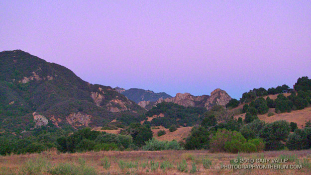
For an eighty degree day, it had been surprisingly cold in Las Virgenes Canyon. The canyon’s east-facing slopes had been in shadow for much of the afternoon, and had lost any residual warmth to a crystal clear sky. The refrigerated air had spilled from the hillsides, collected in low points, and flowed in a frigid stream down the canyon.

In running shorts and a t-shirt, the cold air had been invigorating, but in the fading light I was glad to be out of the canyon, and running up the Beast toward Lasky Mesa.


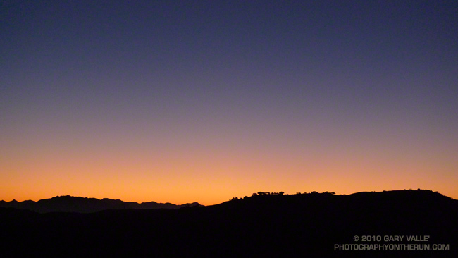
The sun had set about 30 minutes before. Unmarked by clouds or contrails, the colors of the western sky were remarkably pure, ranging from the warm yellow-orange of a fleeting day to the cold steel blue of approaching night.

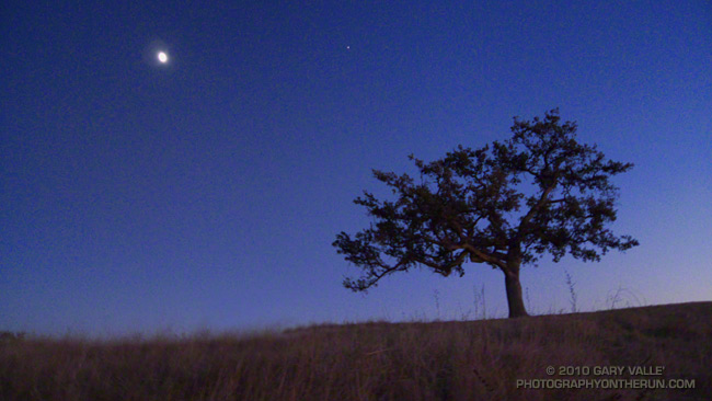
The sweet licorice scent of fennel swept past on a warm current of air. Along the trail crickets called, buoyant and hopeful; and a covey of quail chattered anxiously, debating flight. Above, the moon and Jupiter shone brightly, already beginning to illuminate the landscape.

On a hill to my right a solitary coyote yipped, and a nearby hillside answered in an excited sing-song of yips, yaps and yowls. Moments later another band answered the first, and then faraway a third.

Early in the run I had pushed the pace hoping to beat the sun back to car. Somewhere on the north boundary ridge it had become clear that I would lose the race with the sun. But I also realized it would not be a problem. There was no rush. I could catch the moon.

Bulldog 50K 2010 Notes

Goat Buttes and the Bulldog Climb from Near the Start of the Bulldog 50K

Goat Buttes and the Bulldog Climb from Near the Start

The week following the Mt. Disappointment 50K, with the Edison and Kenyon Devore climbs still etched in my mind, I noticed that the Bulldog 50K hadn’t filled yet. Hmmm… Could I do it? The little hill on my Wednesday afternoon run hadn’t felt bad. Thursday I had done a little longer run, with a little longer hill. It was no Bulldog climb, but it felt OK. I decided that if the 50K didn’t fill by Friday, and the weather forecast for the race wasn’t crazy hot, I’d give the Bulldog 50K a go.

Malibu Creek State Park is only about 20 minutes from my home, and I run the Bulldog loop frequently, but because of scheduling conflicts I’m usually unable to run the Bulldog 50K. It often falls on the same weekend as the Miracle Hot Springs Whitewater Slalom race, and just two weeks after the Mt. Disappointment 50K. This year, because of a good “El Nino” snowpack, the paddling season on the Lower Kern was going to be longer than usual, and the Miracle Race was moved to late September. But had my legs recovered enough from Mt. Dis?

Friday the 50K hadn’t filled, the weather forecast looked OK, my legs seemed to be OK, so click-click enter, click-click enter, and I was doing Bulldog.

As the week before the race progressed it became evident a) my legs were not as recovered as I had hoped, and b) race day temps were going to be a little warmer than originally forecast. The RD’s day-before-the-race email confirmed the warmer weather:

“IT WAS 82 DEGREES AND NO CLOUD COVER AT 8:30AM THIS MORNING AT THE PARK. BE PREPARED FOR HIGH TEMPERATURES AND FULL SUN ON RACE DAY TOMORROW… NSD”

Race day dawned coolish, but there was not a cloud in the sky. (Last year there had been cloud cover until around 11:00 a.m.) At the Malibu Hills weather station, the temperature at 6:00 a.m was 71°. By 8:00 it would be 80°, and by 9:00 84°. It would be even warmer in the direct sun.

Whatever the thermometer said, the temperature on the first loop wasn’t an issue. There were a couple of warm spots on the Bulldog climb, but there was also a lot of shade. Bulldog was actually pretty painless, and I commented to another runner that I wished it would be like that the second time around!

The last time I’d done the Bulldog 50K was in 2003. Back then the course wasn’t a double loop. There are pros and cons to the double loop format. Sometimes it helps to know what’s coming, and sometimes it doesn’t. It depends on what kind of day you’re having. This morning the first 25K had gone well, and as I jogged under the oaks along Malibu Creek at the beginning of the second loop, I thought maybe, just maybe, my legs would last.

It was about half-way up the Bulldog climb the second time that reality set in. The sun was 3 hours warmer, the climb longer, and gravity (for sure) stronger. I overheard another runner remark, “from here there’s no more shade.” And there wasn’t.

From the top of Bulldog it’s less than a mile of downhill to the Corral aid station. My mind liked the idea of running downhill, but after all the miles of uphill my legs were having trouble with the transition, and were getting a little crampy. It probably wasn’t a coincidence that this was also the point where I started to run out of gas. Not a full-on bonk, but there wasn’t much left in the tank.

The parts of the course I enjoy the most — running through the rock formations east of the Corral aid station, and the panoramic views of the ocean and mountains from Mesa Peak fire road — were a bit of a struggle. It helped to talk with some of the runners along the way. There were new runners, old runners, fast runners, and slow. Every runner has a different story, perspective and challenge.

Eventually I reached the start of the long, sometimes steep, downhill to Tapia Park. On the way down, one runner that passed me commented, “I was looking forward to this section, I didn’t expect it to be so hard!” No argument there. After cooling off at the Tapia aid station, it was on to another tough part of the course. I was prepared for the Tapia Spur Trail to be an oven, but a nice breeze kept the temperature reasonable.
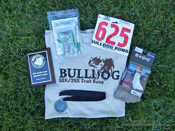


I had been warned that the final little climb up the paved road and around to the finish would be a killer. It was a long, long half mile, and at one point I wondered if the course might continue past the entrance station and out of the park! A couple minutes later I was across the finish line. And about a minute after that I was eating a big chunk of ice cold watermelon!

Many thanks to R.D. Nancy Shura-Dervin and Larry Dervin, all the volunteers, sponsors, support personnel, and runners for a great race. The aid station volunteers were fantastic. All I had to do was soak my head in ice water while my bottles were being filled!  For Nancy’s race report, all the results, and 2000+ photos, see the Trail Run Events web site.
July Fourth Trail Run to Trippet Ranch, Hondo Canyon and Saddle Peak

Bay trees on the Hondo Canyon Trail

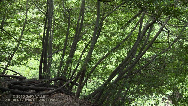
It was about 9:45 a.m., and I was switchbacking up through a surprisingly dense forest of California bay on the Hondo Canyon segment of the Backbone Trail. The trail was carpeted in bay leaves, and a hint of the sharp, sweet smell of bay lingered in the still morning air. It had been four years since I had run this trail, and I had forgotten just how lush and green it was. The geology, oaks, bay trees, ferns, and poison oak were spectacular.

The run from the end of Reseda to Saddle Peak (and back) was going well. The route was a tricky one, and it really helped that I had done it before. Lower in the canyon there had been a misleading Backbone Trail marker, and that was just one of several potential gotcha’s.

Even if you know the way, the run is no gimme. Depending on the route used, its length works out to around 26 – 28 miles, and it has a legit elevation gain/loss approaching 5000′. Throw in the route-finding challenges, and it’s possible to have a long day.

The run starts at Marvin Braude Mulholland Gateway Park, on the San Fernando Valley side of the Santa Monica Mountains. The first leg of the run goes to Trippet Ranch. I usually run the fire roads out to Trippet Ranch, and then take the Musch, Garapito, and Bent Arrow trails on the way back to Reseda.

The route-finding fun begins on the Dead Horse Trail at Trippet Ranch. From Trippet Ranch to Saddle Peak the route is all on the Backbone Trail, and is (almost) all single track. Some of it is marked, and some of it isn’t. Some of it is obvious, and some of it is not.


The most obscure section is between Topanga Canyon and Old Topanga Canyon. From the Dead Horse Trail parking lot, the Backbone Trail starts behind the bathrooms and follows a brushy canyon down to Topanga Canyon Blvd. The trail picks up again across Topanga, about 50 yards west on Greenleaf Canyon Road. The trail is on the left, just before a creekbed, and leads uphill. There are some nature trail markers along the steep trail, and the top of the hill is about a quarter-mile from Greenleaf. From the top of the hill, the trail zigs south and zags west, working down to a dirt road. The route continues across the road and down an overgrown slope to the north side of the water tanks. A trail leads northwest from the water tanks and down to Old Topanga. The total distance from Topanga to Old Topanga is about 0.6 mile.

I was glad to have that convoluted stretch behind me. A few minutes ago I’d reached the top of Hondo Canyon, and turned onto the Fossil Ridge Trail. When the visibility is good, the views along Fossil Ridge and the crest leading to Saddle Peak are excellent. Today the marine layer had been slow to clear, and the tops of the peaks were cloaked in fog. The chaparral plants were so wet that I was able to squeeze a gulp of water from the brush-like flowers of a laurel sumac.


After about a half-mile on the Fossil Ridge Trail, I emerged from the chaparral, turned left on Topanga Tower Mtwy, and ran down to the popular overlook at the junction of Schuerren, Stunt, and Saddle Peak roads. Here I continued west across the highway and scrambled up to a ridgetop trail that leads to a big water tank. From the water tank it’s about  0.3 mile up the trail to the turn-off to Saddle Peak, and then another 0.4 mile to the summit. The western peak (2805′), the one with all the communications equipment, is the high point.

Keeping in mind that GPS traces are not exact, and the route I used isn’t necessarily the “official” or “best” route, here’s a Google Earth interactive view of a GPS trace of my 27.5 mile route.

Some related posts: Garapito Trail Runs, Born to Run, Musch Trail Mule Deer, Red Rock Canyon – Hondo Canyon – Saddle Peak Loop

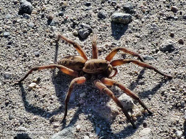
Great Leaping Wolf Spiders!

Wolf spider (probably Schizocosa mccooki)

I’d just run up the long hill we call “The Beast,” and was running east on a relatively level stretch of gravelly dirt road on Lasky Mesa, when it’s movement caught my eye.

My first thought was “Tarantula!” but this spider was slightly smaller than a tarantula, and running. Tarantulas walk, they (usually) don’t run. This spider ran with a smooth, agile, articulated gait that must be the envy of the Arachnid world. I had never seen a spider like this, and started moving in its direction.

Lurking in the back of my mind was an experience I’d had with a tarantula, also on Lasky Mesa. In an attempt to redirect the tarantula from the margin of a dirt road, I’d blocked its intended path with my foot. This had worked a couple of times before, but this time the big spider briefly paused and  then continued to walk toward my running shoe. My shoe was on top of some dried oak leaves, in the grass on the side of the road. I thought maybe if I rustled the leaves… with lightning speed the tarantula charged my foot, and I jumped the proverbial mile.

Today I was going to have to react quickly if I was going to get a photograph. As I started moving toward this unusual spider, it saw me, and increased its speed. I continued to move in its direction, and it suddenly began a series of bizarre, defensive leaps. In a couple of seconds, the spider did three exaggerated “accordion” leaps, extending vertically to the full length of its impossibly long legs. The motion was somehow reminiscent of the propulsive action of a jellyfish. It was unexpected, and very effective!

After that the spider hunkered down, but seeing how quickly it had moved, I only took photos from a “respectable” distance. I wasn’t real excited about putting my hand a couple of inches from its big fangs.

Saturday, I was running at Ahmanson with Brett, on Lasky Mesa, and shortly after telling him this story, he spotted the wolf spider (probably Schizocosa mccooki) pictured above!

Related post: Tarantula Time

Clearing Skies

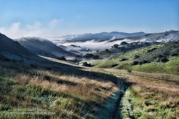
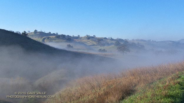
Six days of rain had finally come to an end. Soaked hillsides steamed in the morning sun; but still in shadow, tussocks of grass along the dirt road wore a thick coat of frost. Running west on the main drag in Ahmanson Ranch, we were working our way over to Cheeseboro Canyon.


Whether the conditions were imperfect or perfect was a matter of perspective. Yes, it had been a little muddy and wet, but that was part of the experience, and part of the morning.

In some places droplets of water refracted and reflected tiny spectra of color, while in others flat plates of frost glittered in the sun. Running along a rejuvenated creek, the smell of wet earth mixed with the rich organic odors of old willow leaves and other vegetation.

Away from the trailhead there was not a hiker, runner, rider or mountain biker to be seen. Remarkably, even in Cheeseboro Canyon no one was on the trail.

Sometimes I’m asked,”What are you training for?” Being able to enjoy a run like today’s is my reply.

Residual Showers

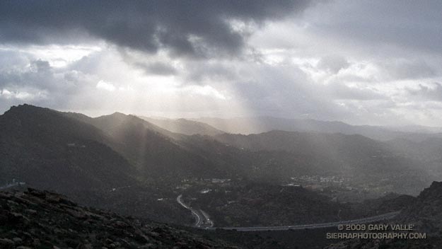
Got caught in some showers this afternoon on Rocky Peak, returning from a rambling trail run from the San Fernando Valley over into Simi Valley.

This was one of those “not sure where I’m going” runs that unfolded as it progressed. It started near Chatsworth Reservoir at Chatsworth Oaks Park, worked over to Santa Susana State Historic Park, then up the Old Stagecoach Road. At the top of the old Stagecoach Road, I picked up the Upper Stagecoach Trail and followed that to Santa Susana Pass and the 118 Frwy. From there it was a short distance down the west side of Santa Susana Pass Rd. to the Lower Stagecoach Trail, which took me to Corriganville.

Once down in Simi Valley there are four trails that ascend to Rocky Peak road, and my return route. From the shortest to the longest, they are the Wildlife Corridor trail, Hummingbird Trail, Chumash Trail and the Marrland/Las Llajas trail. Not sure how long it would take to get back to the SFV, I finally decided on the Chumash Trail.

Running up the Chumash Trail, the wind picked up, the clouds began to lower and thicken, and the temperature dropped. Minutes after turning right onto Rocky Peak road the showers began, and it wasn’t long before the sleeves came out of the pack.

The return trip, with a net elevation loss, went a little quicker than expected. Next time I’ll have to give the Las Llajas option a try. That would extend the run from about 17 miles, to something over 20. The approximate elevation gain/loss on the 17 mile version was a little under 3000 ft.

Related post: Old Santa Susana Stage Road