
You know what they say about making assumptions. Did the Three Points loop around Mt. Waterman today (July 25), and assumed that water would be available at Buckhorn Campground. In a normal summer that would be a reasonable assumption, but this has been anything but a normal summer.
Running down through the campground, I thought it was strange that many of the spaces were empty. Following the signs that said, “Day Use Parking,” and then “Burkhart Trail,” I stopped at a spigot across from some restrooms.
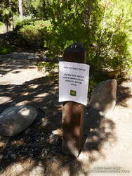
Surprise, surprise! The stapled-on Forest Service sign said, “Non-potable water. Please boil water for a minimum of 5 minutes before using.”
Later, I talked to a ranger and learned that the campground had just reopened on Friday! He said routine tests on the water system had to be completed before the water could be deemed potable.
So I had a choice to make. I was doing the loop counterclockwise, which put Buckhorn at about mile 9 of a 20-mile loop. The second half of the loop — on the PCT — can bake on a hot day, with the climb out of Cooper Canyon being especially blistering.
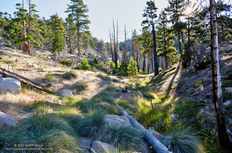
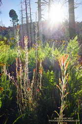
So far, the run had gone well. The Mt. Waterman Trail between Three Points and the turn off to Twin Peaks had been in excellent shape. No trees had blocked the trail, and the wildflowers and ferns at Waterman Meadow had been extraordinary. Like last year, a rejuvenated spring about 0.5 mile west of the Twin Peaks junction had water. (Not aware of the situation at Buckhorn, I didn’t top off my water.)
Beyond the Twin Peaks junction, there were some toppled trees. These were probably blown down by the same Winter storms that broke and toppled trees along the crest between Throop Peak and Mt. Baden-Powell, and between West Fork and Mt. Wilson. A few of the trees had fallen across the trail, but none were a problem.
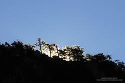
As usual, the run down the Mt. Waterman Trail to Highway 2 was excellent. A lot of people were enjoying the hike to the peak, but no more than is typical for that trail in the summertime.
Which brings me back to Buckhorn and my water problem. I could have shortcut the loop by skipping Cooper Canyon and running directly to Cloudburst Summit on Highway 2. That would have shortened the loop by 5 miles. But the day wasn’t super-hot, and there were several places where water could be used for cooling — even if I couldn’t drink it.
Reconfirming how much water I had left, I squeezed the Camelbak(TM) in my pack, and then started running down the Burkhart Trail into Cooper Canyon.
By maintaining a comfortable pace, and using seeps for cooling, my water lasted until I was within sight of the Three Points parking lot. This probably wouldn’t have been the case on a hot day.
Here are some photos taken along the way, and a Cesium interactive 3D view of the route.
Some related posts: Lemon Lilies, Tree Rings and More Heat Training on the Three Points Loop; Pine Seedling Along the Mt. Waterman Trail; Three Points Loop Twice