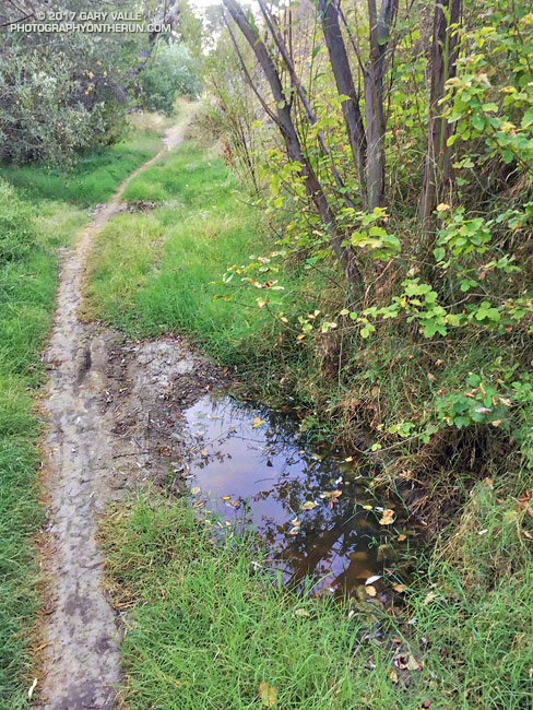
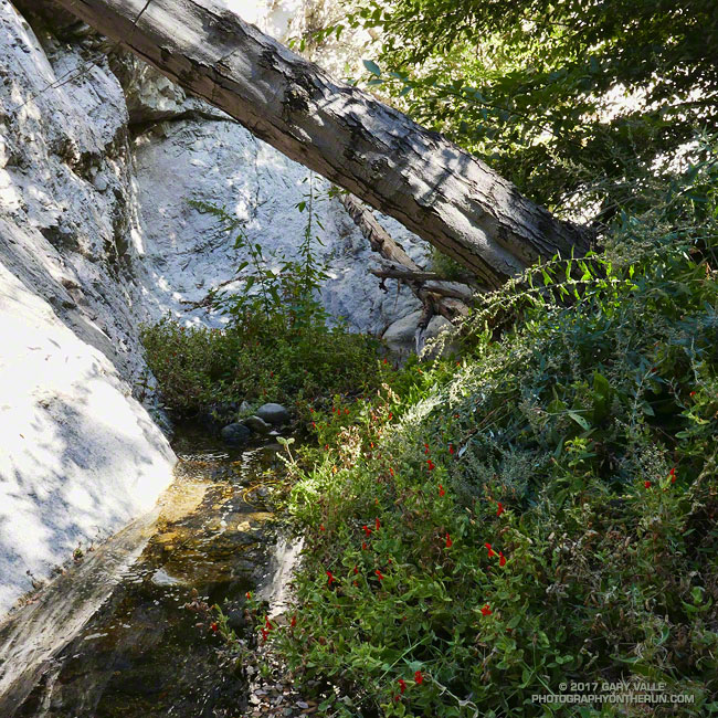
The groundwater in upper Las Virgenes Canyon appears to have been replenished by the above normal rainfall last rain season.
The little spring pictured above has persisted through the dry season and farther up the canyon a tiny stream has trickled defiantly through the Summer. The mainstem creek in upper Las Virgenes Canyon isn’t flowing as it was during the Winter, but the sand at the crossing near the Cheeseboro connector trail remains damp.
It shouldn’t take a huge amount of rain to get the creek flowing again. We’ll see!
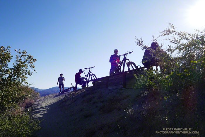
The group of five mountain bikers first passed me at Strawberry Potrero, a picturesque area on the north side of Strawberry Peak. The circuit around Strawberry Peak is a favorite of MTBers and in recent years I’ve encountered bikes on the loop nearly every time I’ve done it. It’s also an excellent run and part of the Mt. Disappointment 50K course.
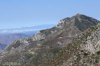
Josephine Peak and fire road. Click for larger image.
The trail segments that make up the usual loop are Josephine Fire Road, Strawberry Spur Trail, Colby Canyon Trail, Strawberry Peak Trail, Gabrielino Trail, and Nature’s Canteen Trail. Today, I was doing a variation of the circuit that swapped out some fire road for trail. Instead of parking at Clear Creek, and running up Josephine Fire Road, I parked at the Colby Canyon trailhead and ran up the Colby Canyon Trail. This variation joins the usual course at Josephine Saddle** and continues around the peak. (Another option climbs over Strawberry Peak.)
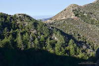
Stand of Bigcone Douglas-fir that didn’t burn in the 2009 Station Fire. Click for larger image.
I thought I’d seen the last of the mountain bikers, but found them taking a break near the beginning of the two mile, 750′ climb to Lawlor Saddle. We chatted about the great weather and the next section of trail. As I turned to continue, one of the riders asked, “Hey, do you need a GU or anything?” I told them I was good, and started running.
Mountain bikers expect to be faster than a runner — and they usually are — but there are certain situations where runners have an edge. This was one of them. The first half-mile of the climb to Lawlor Saddle is relatively steep. After that the trail backs off a bit, but is still a decent climb. Since I had a head start, I decided to play the “How Long Can I Stay Ahead of Them” game.
I didn’t know if they were going to play or not, but it really didn’t matter. It was a way of having a little fun and motivating myself to push a little harder and run a little faster.
Parish’s goldenbush. Click for a larger image.
Whether you’re doing the Mt. Disappointment race or not, the climb to Lawlor Saddle will tell you if you are having a good day or bad. Today I was having a good day. The temperature was about 30 degrees cooler than at this year’s Mt. D, and after the initial steep section I ran nearly every step to Lawlor Saddle. A couple of times I thought I heard the bikers behind me, but somehow made it to the saddle without being tagged.
But now I was in trouble. Just past Lawlor Saddle the uphill ends. The question wasn’t if they would catch me, but when. Just before the trail turned to the east I caught a glimpse of a bike at the saddle, so the when might be in just a few minutes. It would depend on how spread out the riders were and if they decided to take another break.
Hikers on the Strawberry Peak Trail. Click for a larger image.
From Lawlor Saddle the trail contours around the south side of Mt. Lawlor for a mile or so, winding in and out of one ravine after another. It’s not particularly technical, but I hoped the frequent turns might slow a bike. I pushed the pace as much as I could.
About a mile from Red Box the trail finished its traverse around Mt. Lawlor and dropped down a rocky section of trail to an abandoned Forest Service road. Foolishly I started thinking maybe, just maybe, I’d make it to Red Box ahead of them.
Only about a quarter-mile from Red Box and in sight of the parking lot, I heard the tell-tale jingle-jangle of a bike bell. It wasn’t far behind me, and I moved to the side of the trail to let them pass. As the lead bike rolled leisurely past, he commented, “Hey, we weren’t sure we were going to catch you!”
The game over, I settled back in for the last few miles of the run.
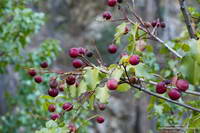
Holly-leaved cherry, a favorite of coyotes and black bears in Southern California.
** The location of Josephine Saddle is currently mismarked on Google Earth and Google Maps. The saddle at the top of the Colby Canyon Trail has long been known as Josephine Saddle. It is marked as such on the U.S.G.S 7.5 Minute Condor Peak Quadrangles from 1959 to 2012. It is called Josephine Saddle in John Robinson’s authoritative guidebook Trails of the Angeles and numerous other guidebooks and route descriptions.
Running or hiking the Bear Canyon Trail is always an adventure. The loop from Red Box, past Mt. Disappointment, down Mt. Lowe Road, over to Tom Sloan Saddle, through Bear Canyon, and up the Gabrielino Trail is about 15-16 miles long. But it isn’t it’s length that makes it interesting.
The two miles of trail between Tom Sloan Saddle and Bear Trail Camp is isolated and little-used. The difficulty of the trail above the camp varies from year to year, and today it was a bit more challenging than usual.
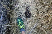
Black bear scat along the Bear Canyon Trail.
Copious Winter rain had promoted the growth of all things green in the canyon — including much poison oak and stinging nettle — and the trail wasn’t always easy to follow. Thunderstorms had recently washed away any tracks, so the only sign on the trail was bear scat and some cut trees from years past.
Because of the lush growth, fallen trees, brush, fire debris and flood debris, the trail ahead sometimes looked very improbable. A couple of times I stopped and walked back up the trail a few steps to confirm the trail was a trail and I hadn’t missed a turn. The path repeatedly crossed the creek and the creek is where the difficulties tended to be. In places the poison oak and nettle blocked the way and were not easily avoided.
Click for more information.
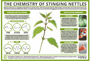
Dealing with the poison oak was easy — I just ignored it. That’s something I could worry about later. Hopefully the Technu Extreme I had in my car would take care of it. On the other hand, when you are bare-legged and bare-armed ignoring stinging nettle is a hard thing to do — contact with the plant produces instantaneous burning and stinging.
I always thought formic acid was the culprit, but apparently stinging nettle’s micro-needles contain a potent blend of chemicals that produces a poorly understood and unusually prolonged reaction.
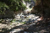
Arroyo Seco below Switzer Falls
There isn’t much you can do about the burning and stinging in the middle of a run or day hike. Some say flushing the affected area with water (without rubbing) can help. If you Google “first aid stinging nettle” you’ll see various suggestions. By the time I reached Bear Canyon Trail Camp my legs felt like they had been painted with horse liniment.
The trail between the trail camp and the canyon’s confluence with Arroyo Seco is well-used and is usually in better condition than the trail above the camp. From the confluence it’s about a mile to the Gabrielino Trail, which is followed past Switzers Picnic Area to Red Box.
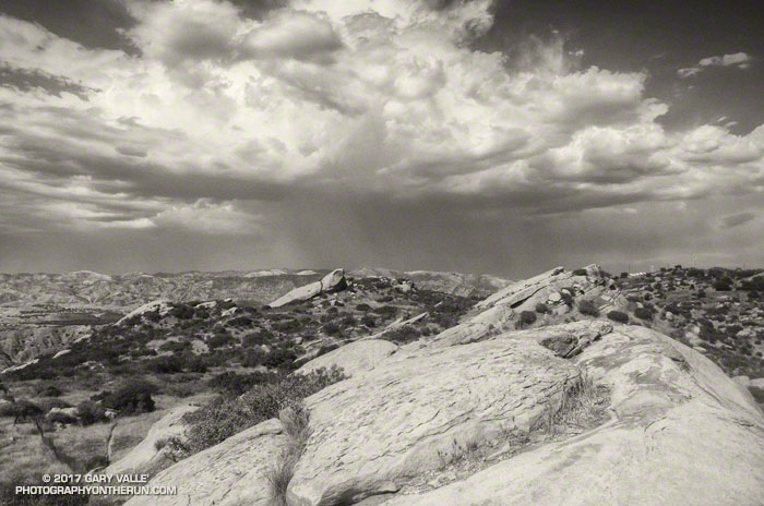
The photo above is from an afternoon run at Sage Ranch Park on August 31, 2017, during our recent heat wave. The thunderstorm in the distance is over Santa Clarita.
Around the time the photo was taken the temperature at the Cheeseboro RAWS was 110 °F, with an “in the sun” fuel temperature of 119 °F. The temperature at Ahmanson Ranch, where I often run on weekdays, was probably higher. I was running at Sage Ranch to try and take the edge off the heat — even if the reduction in temperature was only a few degrees.
During the heat wave the high temperature at Pierce College in Woodland Hills in the West San Fernando Valley exceeded 100 °F on nine consecutive days (August 24 to September 3) and exceeded 110 °F on five consecutive days (August 28 to September 1). Numerous temperature records were broken in Southern California and across the state. On September 1, Downtown San Francisco set a new all-time record high temperature of 106 °F.
At my West Hills weather station the high temperature for the month of June was 109 °F; for July 111 °F; for August 112 °F; and so far this September the high has been 113 °F. If I’m not heat-acclimated by now, I never will be.