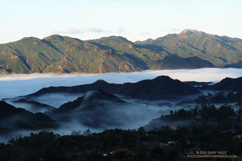
The paved turnout where I usually park at the Stunt Road trailhead was covered with mud, rocks, and debris. And near the entrance of Calabasas Peak fire road, two large boulders had been dragged to the shoulder to clear the road.
Following another big storm in a Winter of big storms, I was doing the Topanga Lookout Ridge Loop — curious to see what I could see. Nearby Stunt Ranch Reserve had recorded over 10 inches of rain the past three days, and there had been numerous reports of low elevation snow.
Runners working up a hill above the Placerita Canyon Rd. aid station. Photo: Paksit Photos
I don’t know why. But for some reason, I had it in my head that the turnaround point for the Placerita Canyon 30K was the halfway point of the course.
I had just passed the third aid station and was climbing a short — but steep — hill. From there, it was at least a couple of miles to the turnaround, and my projected time to that crucial point was adding up to more than I expected.
The thing was, I felt good and was enjoying the race. Everything seemed to be going well. It’s fun to run new trails, and I hadn’t run any of these.
The temp had been near freezing at the start, but the initial steep climb and energetic descent took care of that. The course would continue in this vein as a series of ups and downs on fire roads, single-track trails, and a bridle path. A few of the hills were slow and strenuous, but those were offset by fast-paced running on a mile and a half of bridle path. The longest hill was out of Aid Station #2 — 700 feet of gain over about 1.6 miles.
My confusion about the turnaround point could have been easily remedied by simply checking the mileage on my watch. It’s on the second data screen, and I only had to push a button to see it. But like a small, annoying rock in my shoe, it just didn’t seem to matter that much.
Eventually, somewhere around the Fair Oaks Aid Station, I checked my average pace. It was about at my goal pace. That’s when I realized the halfway point had to be behind me. When I reached the “Turn Back!” sign, I checked the mileage. It was 11.7 miles. A bit more than 6 miles to go. That was better!
As it turns out, the halfway point on the way out had been near Uncle Remi Trail junction. This outstanding single-track trail is a direct route down to Placerita Canyon and would be our route on the way back.
About 40 minutes later, I was running down the flowing turns of the Uncle Remi Trail. It didn’t take long to get to Placerita Canyon Road, and I soon found myself chugging up the last (long) hill. There were a couple of runners ahead of me that I’d been chasing for miles. Although I didn’t catch them, the attempt seemed to shorten the final 1.5-mile climb.
Partway down the subsequent descent, I heard a cheer in the distance as the pair crossed the finish line. A couple of minutes later, I also enjoyed the finish-line applause.
This was the inaugural running of the Placerita Canyon Trail Runs 10K, Half Marathon+, and 30K. As you would expect at a KH Races event, everything was well done – from the marking of the course to the aid station fare. The hills were green, the trails in good shape, and the weather invigorating. All the runners were super-friendly, and the aid station and course volunteers were very helpful. Thank you!
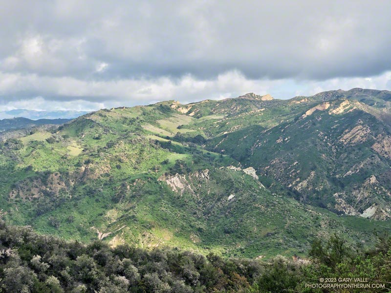
Upper Santa Ynez Canyon and Eagle Rock from East Topanga Fire Road
The view from Parker Mesa Overlook was the uniform gray of the inside of a cloud. I was about 30 minutes too early, and the low clouds hadn’t cleared. The Pacific Ocean was out there somewhere.
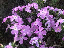
Even so, the run from the Top of Reseda to the Overlook had been excellent. The hills and canyons were painted in a muted palette of sun and shadow. Purple-pink prickly phlox brightened the roadside, and the “Beech-nut Gum” scent of Bigpod Ceoanthus filled the air.
Prickly phlox along East Topanga Fire Road
Fire Road #30, Eagle Springs Fire Road, and East Topanga Fire Road had all been cleared of the sluffs and slides that resulted from January’s rainstorms. Overnight, there had been a little drizzle, but the fire roads hadn’t been muddy at all.
Rather than just retracing my steps, on the way back to the Top of Reseda I opted to do the Musch and Garapito Trails. I had run the Garapito Trail in mid-January but hadn’t been on the Musch Trail since the January deluge.
The Trippet Ranch parking lot had been packed, and several groups appeared to be on their way to Eagle Rock via the Musch Trail. Overall, the trail weathered the storms reasonably well, but one badly eroded section and a couple other spots will need some work.
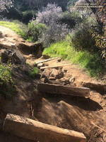
Damaged section of the Musch Trail
While it still had some issues, use of the Garapito Trail had moderated its condition since the last time I was on it. Some brush that had blocked the trail had been removed, and paths were evolving through the collapsed sections of trail. However, some extra care was still required in some spots.
The Bent Arrow Trail was closed, necessitating a return to dirt Mulholland on Fire Road #30, following the same route as had been used at the beginning of the run.
Here is an interactive, 3D terrain view of a GPS track (yellow) to Parker Mesa Overlook from the Top of Reseda. The Bent Arrow Trail is temporarily closed for repair and is shown in red. To change the view, use the control on the upper right side of the screen. Track and placename locations are approximate and subject to errors. Poor weather and other conditions may make this route unsuitable for this activity.