Out and Back Trail Run from Islip Saddle to Mt. Baden-Powell – July 2024 Update

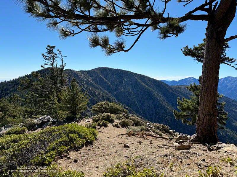
Mt. Baden-Powell from the PCT near Throop Peak.

Update July 22, 2024. The Poodle-dog bush along the PCT near Islip Saddle has been cleared by Gary Hilliard and the AC 100 Trail Team!

When I reached the summit of Mt. Baden-Powell (9,399′), it was empty, save an opportunistic raven who was evaluating the chances that the Larabar I was eating might fall to the ground.

On top, the heat of the strong Summer sun was offset by a cooling breeze. There was still a few thin ribbons of snow in the chutes on Mt. Baldy. With the excellent visibility, San Jacinto Peak could be seen in the notch between Mt. Baldy and Dawson Peak, and San Gorgonio Mountain was sharply visible to the left of Pine Mountain.
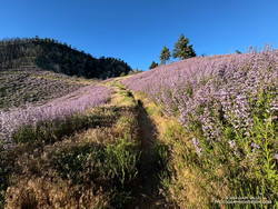
Poodle-dog bush (Eriodictyon parryi) along the PCT just east of Islip Saddle. (thumbnail)
Poodle-dog bush along the PCT just east of Islip Saddle.

Other than a few people at Little Jimmy hike-in camp, I saw no one on the way up from Islip Saddle. A quarter-mile from the trailhead, there was an astonishing display of Poodle-dog bush along the PCT. In 2011, when a large part of Angeles National Forest reopened following the Station Fire, I developed an extensive rash after bushwhacking through Poodle-dog on overgrown trails. After that experience I’ve been more careful around the plant, and haven’t had a bad case since.

Trees were across the trail in a few places. Most were fairly easy to bypass, but a couple were “inconvenient,” such as this big log, about 0.75 mile east of Windy Gap.
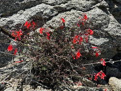
Bright red beaked penstemon (Penstemon rostriflorus) along the PCT above Windy Gap. (thumbnail)
Bright red beaked penstemon along the PCT above Windy Gap

As I worked up the switchbacks above the log, to the southwest I could see the observatory and towers on Mt. Wilson. As a result of the damage to Chantry Flat in the Bobcat Fire, Mt. Wilson was on the Angeles Crest 100 Mile course last year, and will be again this year. As the raven flies, Mt. Wilson was only about 16 miles away, but for someone running the AC100, the miles along its challenging course would total well over 50!

For several years I’ve been following the regrowth of conifers in four places along the PCT that were burned in the 2002 Curve Fire. What has been underscored in my informal study is a) trees take a long time to regrow, and b) frequent fires in an area are particularly devastating. Stand #1 (1.5 miles east of Islip Saddle on the PCT) was recovering nicely from the 2002 Curve Fire when it was burned in the 2020 Bobcat Fire. This comparison shows the result. The other three stands continue to recover well, with south-facing Stand #4, west of Throop Peak, growing particularly vigorously.
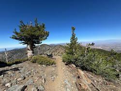
View WNW along Mt. Baden-Powell's west ridge. (thumbnail)
Limber pine (left) along Mt. Baden-Powell’s west ridge.

Ascending the final 400′ of gain on Baden-Powell’s west ridge, I was surprised to see a couple of small patches of snow remained on the north side of the ridge. The snowpack here was nowhere near as big as in 2023, but it was still pleasing to see that a little of the white stuff survived until July.

No out and back to Baden-Powell is complete without a quick stop at Little Jimmy Spring. Today, the water from spring was so cold it was painful to hold my hand in the water flowing from the pipe!

Some related posts:
It’s Mid-July And There Is Still Snow in Los Angeles County!
A Cool and Breezy Out and Back Trail Run from Islip Saddle to Mt. Baden-Powell
Contact Dermatitis from Eriodictyon parryi – Poodle-dog Bush
Regrowth of Trees Along the PCT Following the 2002 Curve Fire

The Ups and Downs of the Angeles Crest 100 Mile Run


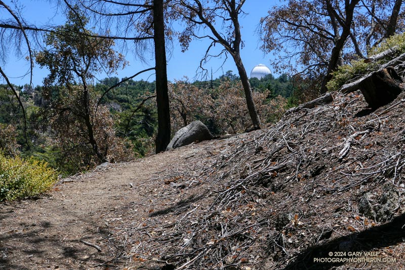
The white dome of Mt. Wilson Observatory from near the top of the Kenyon Devore Trail.

First published on June 30, 2015. Updated July 8, 2024.

August 3rd  runners from near and far gather in a small parking lot in Wrightwood, California, to start the Angeles Crest 100 Mile Endurance Run (AC100). Begun in 1986, the AC100 is one of the original five 100-mile U.S. endurance races. It has endured fires, floods, the Covid-19 pandemic, and changing trail restrictions.

There’s a tradition of running grueling endurance races in the San Gabriel Mountains. The Big Pines Trail Marathon was one of the first organized mountain ultramarathons in the U.S. First run in August 1934, its course used some of the same trails that AC100 runners enjoy today.

The AC100 is not like a road marathon. It is an entirely different kind of running event and an entirely different kind of running experience. The 2024 L.A. Marathon had about 25,000 participants. About 1/100th of that number — around 250 runners — are expected to start the AC100.

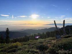
Sunrise from Blue Ridge during the 2015 Angeles Crest 100.
Sunrise from Blue Ridge during the 2015 AC100.

For many, one of the primary reasons for running the AC100 is to be fully immersed in the beauty and majesty of the San Gabriel Mountains. Runners start at 5:00 a.m., ascend the Acorn Trail, and as the sun rises, find themselves above 8000′, reveling in the spectacular views from Blue Ridge.

Even at this early stage of the race, the field is already becoming dispersed. By the time runners reach the first checkpoint, nine miles into the run, there is an hour spread between the first and last runner. Unlike a road marathon, much of the time a runner in the AC100 will be alone.

This year’s course returns to a point-to-point format, ending in Altadena. Because of damage to the Chantry Flat area by the Bobcat Fire, runners will bypass Chantry and ascend Mt. Wilson using the grueling Kenyon-Devore Trail, returning to the traditional course at the Mt. Wilson Toll Road above Idlehour.

As a result of this frequent storms the past two Winters, many trails have been damaged or blocked by trees and debris. Ultrarunners not only spend many hours enjoying the trails in our local mountains but also do hours of trailwork that helps keep trails open and usable for everyone.

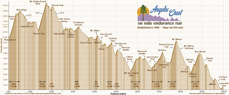
This elevation profile for the 2024 AC100 course was created in SportTracks from a GPX file provided by the event organizers. The elevation profile was corrected using 3DEP 1-meter Lidar-based DEMs. A conservative elevation data smoothing setting was used, resulting in an estimated cumulative gain of about 17,890′ and loss of 22,550′. The actual gain and loss are probably a bit more. Placemark locations, mileages, and elevation gains and losses are approximate. The elevation profile can be downloaded from the Course Overview page on the AC100 website.

Estimated Angeles Crest 100 Mile Elevation Profile (link)
Click to download from AC100 Course Overview page.

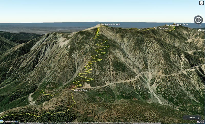
In addition, here is an interactive, high resolution, 3D-terrain map of the 2024 Angeles Crest 100 Mile Race. It is based on the course GPX file downloaded from the AC100 website. The view is initially zoomed in on the climb up Mt. Baden-Powell. To change the view, use the control on the upper right side of the screen. Track and placename locations are approximate and subject to errors.

Click to view 2024 AC100 course with high resolution, photographic 3D terrain.

Here is another high resolution view of the Shortcut Saddle – Red Box – Mt. Wilson section of the AC100 course.

See the AC100 website for official information and details.