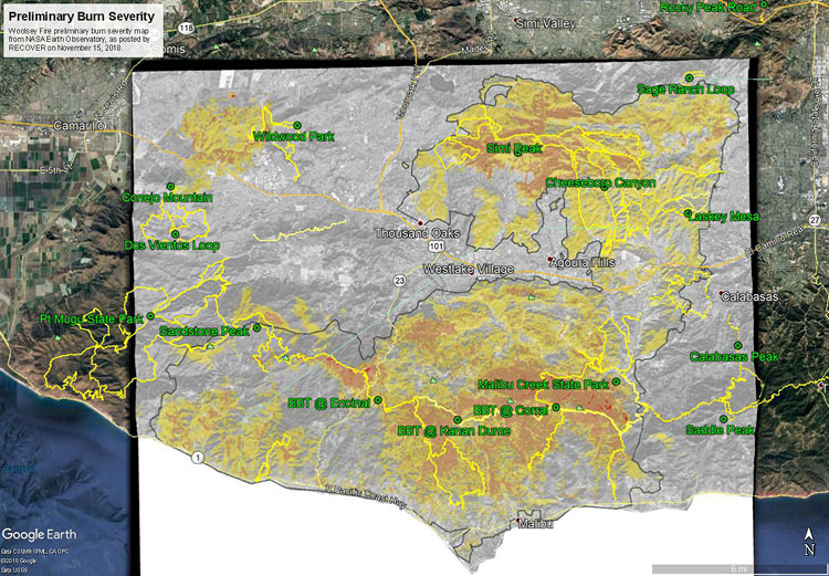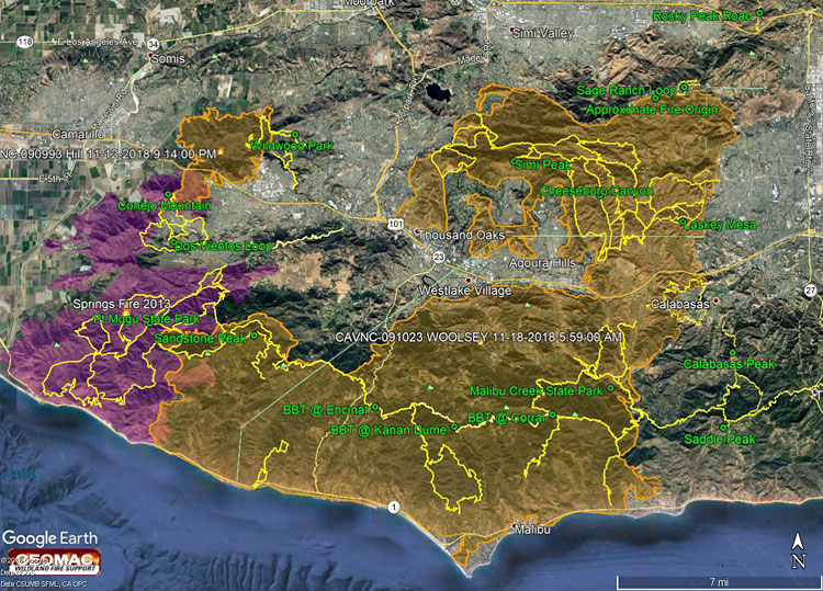
During the later stages of the Woolsey Fire one of the big questions was how far west in the Santa Monica Mountains would it burn. Would it consume Pt. Mugu State Park only five years after the Springs Fire ravaged the area?
The answer to that question became far less clear following the big flare-up in the Sandstone Peak – Boney Mountain area on November 13, and the subsequent advance of the fire into the eastern part of Pt. Mugu State Park.
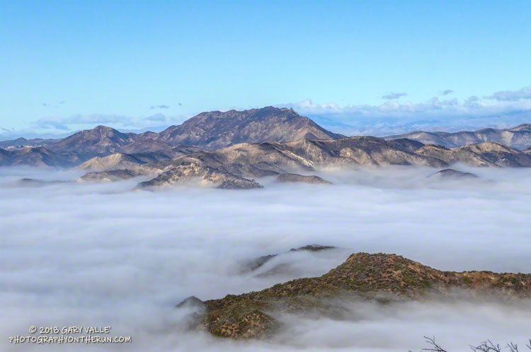
The Woolsey Fire was fully contained on November 21. A bit of good news in the midst of a whole lot of bad was that fire maps showed the north side of Boney Mountain and most of Pt. Mugu State Park had been spared. That’s what today’s outing was about — checking if the conditions on the ground on the north side of Boney Mountain and in Pt. Mugu State Park matched up to fire maps and data.
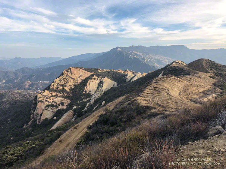
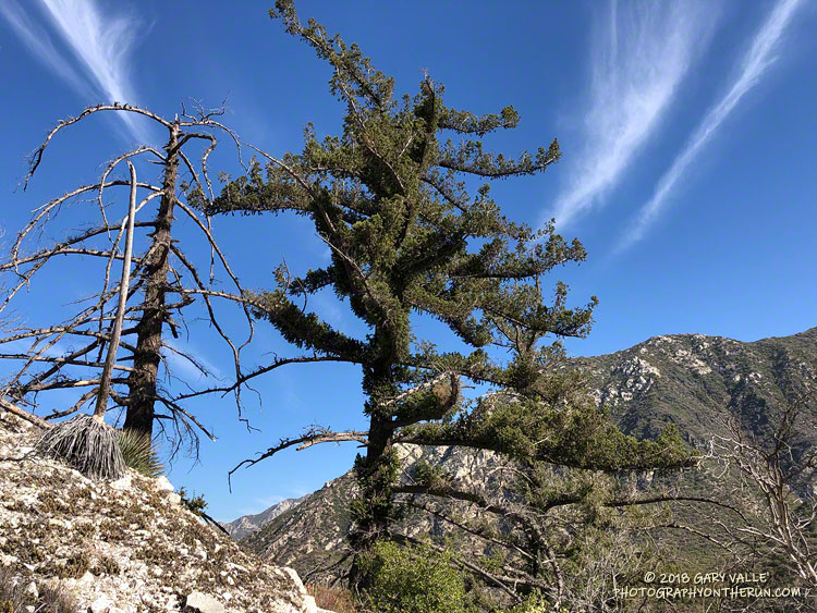
First up was the climb of Boney Mountain’s Western Ridge (Mountaineer’s Route) from Wendy Drive. Except for a little spillover along the crest at the top of the ridge, it was a relief to find that the Western Ridge route and its companion route, the Cabin Trail, were essentially unburned. Both of these routes are used to reach the popular high point along the crest that is generally regarded as “Boney Mountain.” The DEM-based elevation of this point is about 2935′. I enjoy climbing up the Western Ridge and descending the Cabin Trail, so it was good to know that option is still available.
While the north side of Boney Mountain didn’t burn, it was a different story to the south of the crest. The drainage between the top of the Western Ridge and Tri Peaks, and beyond, was badly burned. The last time this area burned was in the 1993 Green Meadows Fire, so the fuel load had been relatively high. From what I could see, the burn severity was generally on the high side of mid-range, but with patches of unburned, low, and more severely burned terrain.
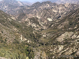
In Pt. Mugu State Park aggressive firefighting and the effects of the 2013 Springs Fire generally — but not entirely — restricted the Woolsey Fire to areas that were not burned in 2013. Much of the Chamberlain Trail did not burn in 2013, and the Woolsey Fire followed this swath of 25-year-old growth westward, burning nearly all of the Chamberlain Trail, as well as the steep slopes to the north of the trail. About half of the large bowl forming Boney Mountain’s western escarpment was burned. As was the case after the Springs Fire, Blue Canyon could once again be at risk from flash floods and debris flows, should a heavy or extended rain event occur.
The westernmost tongue of the Woolsey Fire, near Blue Canyon, reached to within 0.5 mile of the Big Sycamore Canyon Road. For the most part, the fire was held east of the Old Boney Trail. There were several fire retardant drops along this front and the Old Boney Trail was cut into a firebreak/access route. It looked like the dozers came in from Serrano Road. It boggles the mind to think of the logistics required to move firefighting personnel and equipment into wildland areas.
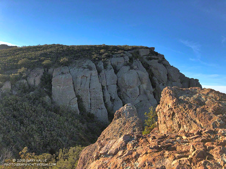
The west side of Serrano Valley and Serrano Canyon turned out to be OK, although you could see where the fire had burned part of the valley and the southwest slopes of Boney Mountain.
Running north on Sycamore Canyon Road, other than the tracks of heavy equipment, there was little to suggest the extent of the devastation to the east. My route back to Satwiwa and Wendy Drive included the Two Foxes Trail, and Upper Sycamore Trail. Except for the Chamberlain Trail, a segment of the Old Boney Trail, and part of the Blue Canyon Trail, other trails and roads in Pt. Mugu State Park appeared to be unaffected by the fire.
Here are a few photos taken along the way. Some additional photos were added from a December 22 run on the Old Boney Trail.