Category Archives: photography

Upper Las Virgenes Canyon Backcountry

Sandstone formations on trail run in the Simi Hills

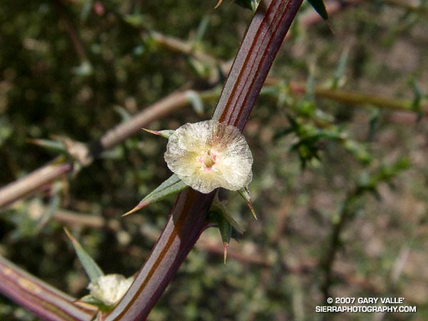
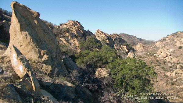
One of the most scenic and isolated areas of Upper Las Virgenes Canyon is traversed by a single track trail that links the Upper Las Virgenes Canyon fire road, northwest of Bell Canyon, to the northern extension of the Cheeseboro Ridge power line service road. The trail, shown on this Park Service map, follows an old road bed through improbable terrain.

I like to do the trail east to west. Once the power line service road is reached the most straightforward option is to turn left, and follow the road up and over the ridge and down to the 4-way junction east of Shepherds Flat. Another option is to turn right on the road and follow it a short distance to another single track that branches left from the road and leads to the Albertson Mtwy. This (dirt) road leads west to a signed intersection near China Flat. From here it is possible to work back to Shepherds Flat at the the top of Cheeseboro.

Many variations are possible, but starting at the Victory Trailhead of Upper Las Virgenes Open Space Preserve, and following the course indicated in this Google Earth image, the first route (up and over the ridge) is about 17.5 miles long. According to my GPS, an alternate route through China Flat is about 19.25 miles long. Both are interesting and challenging trail runs.

Kern ‘Four Mile’ River Trail

Kern River from the River Trail, upstream of the Johnsondale Bridge.

One of many excellent hikes/runs in the Southern Sierra, the River Trail starts at Johnsondale Bridge — about 19 miles north of Kernville, California on highway Mountain 99 — and follows the river north 4 miles to Four Mile rapid. Here the trail turns east and works up to the Rincon Trail.

This section of the Kern River is part of the beautiful and challenging Forks of the Kern class V whitewater run. Numerous class IV rapids and the class V rapids Carson Falls and Confusion are found on this reach. In the Spring and Summer expert kayakers and rafters may be seen maneuvering among the many boulders and drops. (A Forest Service permit is required to paddle the Forks.)

Santa Susana Tarweed

Santa Susana tarweed (Deinandra minthornii)

Listed by the California Native Plant Society as being rare, threatened, or endangered, Santa Susana tarweed (Deinandra minthornii) can be found where sandstone outcrops of the Chatsworth formation occur, such as in the Santa Susana Pass area in the Simi Hills.

This photograph was taken on a run at Sage Ranch on October 1, 2007.

Note: Treated as Hemizonia minthornii in the 1993 Jepson Manual.

Garapito Trail Runs

Red -orange berries of toyon along the Garapito Trail

First published October 14, 2007. Updated February 4, 2021.

The numerous interconnecting roads and trails of the eastern Santa Monica Mountains can be combined to create trail runs ranging from a few miles to marathon length or more.

One of my favorite trails in this area is the Garapito Trail — a winding, up and down trail through dense, old growth chaparral. The trail connects Fire Road #30, near dirt Mulholland, to the Eagle Rock Fire road segment of the Backbone Trail, near Eagle Rock. Because it’s such a enjoyable trail, I include it in most of the runs I do from Marvin Braude Mulholland Gateway Park (Top of Reseda). The trailhead is at the southern end of Reseda Blvd., on the San Fernando Valley side of the Santa Monica Mountains.

Each run in the series starts the same way, going up to Mulholland using the single track trail that forks right off the fire road near the Reseda trailhead, and then heading southwest a short distance on Mulholland to Fire Road 30, which works south, up to the Hub.

The shortest run in the Garapito series is the 7.5 mile Garapito Loop. Somewhat longer and more strenuous is the 12+ mile Trippet Ranch Loop. A very demanding run in the series is an approximately 26 mile route out to Saddle Peak and back. The popular run out to Parker Mesa Overlook and back tacks on about 6 miles to any of these routes.

Below are links to 3D, interactive views of GPS tracks of some of the Garapito Series trail runs from the Top of Reseda. The scene can be zoomed, tilted, rotated and panned. Placemark and track locations are approximate and subject to errors.

Garapito Loop Plus Eagle Rock (8 miles)
Trippet Ranch Loop (12.3 miles)
Trippet Ranch Loop Plus Temescal Peak (14 miles)
Trippet Ranch Loop Plus Parker Mesa Overlook (18.6 miles)
Trailer Canyon – Trippet Ranch Loop (17.2 miles)

These are just a few of the many variations that are possible.

Some related posts: Trippet Ranch Loop Plus Temescal Peak; Trail Run to Trippet Ranch, Hondo Canyon and Saddle PeakGo Figure

Tumbleweed Blossom

Blossom of tumbleweed (Salsola tragus)

Maybe it’s the result of record low rainfall, or the 2005 Topanga Fire, or a combination of the two — there has been a dramatic increase in the amount of tumbleweed (Salsola tragus) along the dirt roads in Upper Las Virgenes Canyon Open Space Preserve (formerly Ahmanson Ranch).

Like black mustard, and milk thistle, tumbleweed is an invasive plant. According to UC IPM Online tumbleweed is native to southeastern Russia and western Siberia and was first introduced into the United States (South Dakota) in 1873.

The photograph of the tumbleweed flower was taken on a run at Ahmanson Ranch on October 3, 2007.

Some related posts: Dealing With Drought, Milk Thistle Seed Heads, Curly Dock