Category Archives: running

Boney Mountain Morning

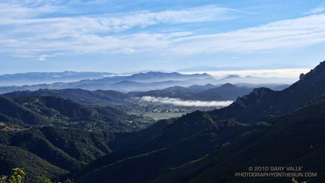
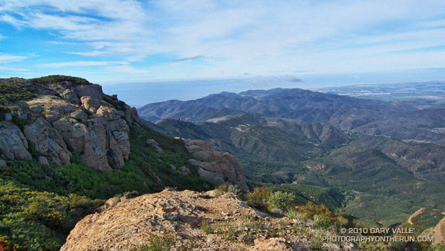
Crags on Boney Mountain's western ridge.

The face was not steep, but I was glad the pockmarked volcanic rock had big holds. Rainwater filled some of the pockets, and patches of lichen and moss on the face were saturated and slippery. It wasn’t a runout climb at the Needles or Tuolumne Meadows, but gravity still worked the same way. I reminded myself not to do something “stoopid.”


At the top of the face I looked around and sighed, and then looked around and sighed again. It was another stunning morning on the western ridge of Boney Mountain. To the west a nearly full moon struggled to remain above the hills, its brightness veiled in a mix of clouds. Another storm was expected in the evening, and the sky told of its approach. Broad strokes of cirrus brushed the blue above, and here and there fingers of tattered stratus reached into the coastal canyons and clung to the wet hillsides.

Today’s forecast for the Santa Monica National Recreation Area had called for mostly cloudy skies, and a high in the 60s. At the moment it was mostly sunny, but already there were hints of clouds developing on the ridges and mountaintops. At some point in the day the clouds would envelop the mountains, and transform the morning’s expansive vistas into a dimensionless gray. I hoped to get up the ridge, over Tri-Peaks, and to Sandstone Peak before that happened.


By chance the clouds behaved, and the splendid views and weather continued all the way to Sandstone Peak, and beyond. The run back to the Wendy Drive trailhead on the Backbone, Sycamore Canyon, and Upper Sycamore trails could not have been better.

As I climbed the final little hill to the parking area I noticed I had no shadow. Over the course of the afternoon the cloud deck would continue to lower and thicken, and by evening light rain would begin across the area.

Some related posts: Clouds and Crags, Conejo Valley Sun and Boney Mountain Clouds, Sandstone Peak from Wendy Drive

Angeles National Forest Extends Station Fire Closure to September 19, 2011

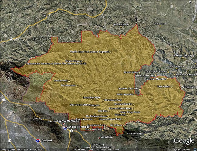
Update Friday, May 13, 2011. Good news! Effective Monday, May 16, 2011, Angeles National Forest is reopening about half of the area of the Forest currently closed as a result of the Station Fire. This reduces the closure area from 186,318 acres to 88,411 acres, and opens most of the burn area south and east of Angeles Crest Highway (Hwy 2) from Bear Canyon east to Twin Peaks. Some of the trails and areas opened are the Sunset Ridge Trail, Bear Canyon Trail, segments of the Gabrielino Trail, Nature’s Canteen Trail, San Gabriel Peak and Mt. Disappointment, Valley Forge Trail, Kenyon DeVore Trail, Silver Moccasin Trail, Pacific Crest Trail (some rerouting), Twin Peaks and the Mt. Waterman-Twin Peaks Trail from Three Points. For more information see the news release, detailed map, and other information related to Closure Order No. 01-11-03 on the Angeles National Forest web site.

On September 20th, after issuing a press release with the title, “Angeles National Forest reopens areas offering hiking, picnicking,”  Angeles National Forest (ANF) reopened about 5 percent of the Station Fire closure area, and extended the closure of the remaining 186,320 acres another year to September 19, 2011. Here’s an ANF map of the revised closure area (PDF).

According to the press release, most of the areas burned in the Station Fire remain closed “for public safety.” When will these areas reopen? In the press release former ANF forest supervisor Jody Noiron states, “The Forest Service intent is to reopen areas severely damaged in the fire over the next few years as conditions allow.”

It’s hard to understand the rationale for the extent and duration of this closure. Over the past year, many dedicated forest users have participated in permitted work parties and events in the closure area. We’ve  been on the trails and roads. We know firsthand that many miles of trails and dirt roads are passable, and much of the closure area could reasonably be in use.

Remarkably, a year after the fire, the size of the Station Fire closure area remains LARGER than the area burned by the fire! Some areas in the Forest that were burned are open, and some large areas that did not burn are closed.

Other than the boilerplate “to protect natural resources and provide for public safety” in the closure order, and some bureaucratic arm-waving, there has been very little information released documenting why these areas of ANF should remain closed.

According to an article posted on the Pasadena Star News web site (08/22/10 by Beige Luciano-Adams), acting ANF forest supervisor Marty Dumpis said, “It’s not just safety but also we have to allow the area to recover because if we allow people to start trampling over regrowth then they’ve just set it back another year. We hope people will be patient enough, allow natural recovery to begin, and then we can get some of these areas open.”

Is that the way Angeles National Forest higher-ups see us? The hikers, runners, and riders that most frequently use these trails are among the most experienced that visit the Forest. Trails constrain use, and are a minuscule part of the recovery area. If credible evidence exists that trail use would delay the area’s fire recovery, Angeles National Forest should make it available to the public.

To keep such a large area of public land closed for such an extended period following a Southern California fire is unprecedented. Even in the case of the largest Southern California fires, the Cedar and Zaca fires, closed areas in Cleveland and Los Padres National Forests were reopened within a year of the fire. In many cases fire closures in the National Forests of California have been lifted within days or weeks of a large fire. This reflects a general policy that closures be implemented and maintained as a last resort.

In a 2009 presentation following the Station Fire, Jody Noiren noted that Angeles National Forest:

– provides 72% of all open space in Los Angeles County
– has 17 million people living and working within 1 hour drive
– has 3.5 million visitors per year, of which half come from within a 50 mile radius of the Forest

It may simplify forest management, and be more convenient for the Forest Service to keep such a large area of Angeles National Forest closed, but it is clearly not in the public interest. Extending the Station Fire closure will not enhance recovery, increase protection of sensitive species, or prevent the spread of invasive plants. But it will deprive millions of people living and working nearby of an indispensable and intrinsic public resource.

Long experience in Southern California demonstrates that public lands can be reopened in a timely fashion following a fire without abusing resources, or putting the public in undue peril. It is time to stop the doublespeak and reopen all but the most severely damaged areas of the Station Fire burn area to public use.

The Station Fire closure area is in the congressional districts of Rep. David Dreier [R-CA26] and Rep. Howard McKeon [R-CA25]. California’s senators are Sen. Barbara Boxer [D-CA] and Sen. Dianne Feinstein [D-CA]. Determine and contact your Representative and Senators.

Morning Fog – Malibu Canyon

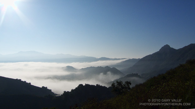
Fog in Malibu Canyon

Did a variation of the “Phantom” loop in Malibu Creek State Park this morning. The basic loop links together the Grassland, Liberty Canyon, Phantom, Cistern, Lookout, Yearling, Deer Leg, and Cage Creek Trails, as well as Crags Rd.

The peak in the haze on the left of the photograph in the distance is Saddle Peak. The peak on the right is Brent’s Mountain.

The Heat Was Hot

Record heat in Southern California

Today at 12:15 p.m. PDT the temperature at Downtown Los Angeles (USC) reached 113°F (45°C), which is the highest temperature recorded downtown since weather recordkeeping began in 1877.

It wasn’t quite as hot in the San Fernando Valley. The high temperature at Pierce College reached 110°F.

When I started my run at Ahmanson Ranch it was 106°F. I took two bottles with ice water. One was used to keep my arms, legs and head/neck wet. With the relative humidity low, this was very effective for cooling. I picked a 45-50 minute course that was not too strenuous, and kept the pace moderate.

It was a surprisingly moderate run, but I sure wouldn’t want to run out of water or have some other problem when the temperature is that high!

Mt. Baldy Run Over the Top

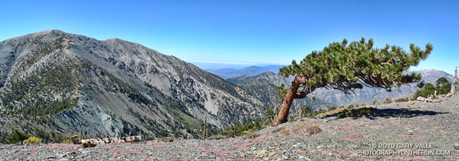
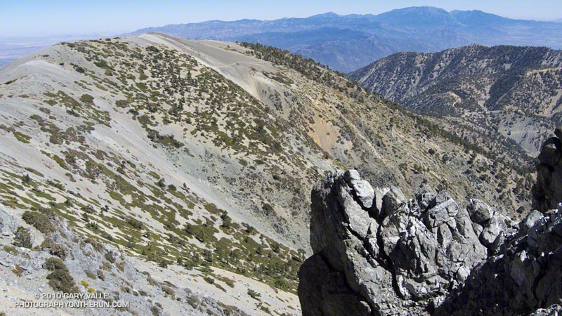
Mt. Baldy from the North Backbone Trail

Mt. Baldy from the North Backbone Trail

If you have a passion for the outdoors, you can get pretty creative when devising a reason for doing a particular run, hike, climb, ride, paddle or other adventure. My rationale for today’s outing was that I “wanted to measure a tree.”

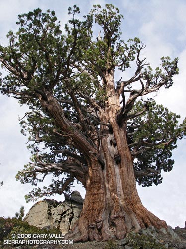
The tree is an isolated and aged Sierra juniper poised on a rocky ridge on the North Backbone Trail on the back side of Mt. Baldy. I’d noticed it while doing the North Backbone Trail in 2006. At that time I had estimated the girth of the tree from a photograph, using my cap for scale. I’ve been intending to get back to the tree for years, and hopefully that was going to happen today.

With one little twist. This time, instead of approaching the tree from the Blue Ridge trailhead on the back side of Baldy, I was going to start at Manker Flat, climb up Baldy, and then descend the North Backbone Trail to the tree. This meant I would get to climb Mt. Baldy twice.


It made sense to me. Labor Day weekend I had opted to do a run in the Sierra instead of the Mt. Baldy Run to the Top race. This way I could get in a good shot of elevation gain on Mt. Baldy, enjoy the wildness of the North Backbone Trail, and also measure the circumference of the Pine Mountain juniper.

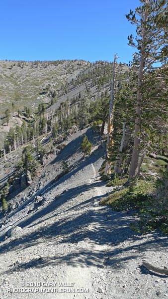
Step one was to get to the top of Baldy. Instead of following the more circuitous seven mile route of the “Run to the Top” course, I took the most direct route to Baldy’s summit — the Ski Hut trail. This trail reaches the summit in a little over four miles, gaining about 3800′ of elevation along the way. It’s a rough, no nonsense trail that in its upper reaches has a wonderful high mountain character.

I was a little late getting to the trailhead, and started running up San Antonio Falls Road about 8:30. A little less than a mile from Manker I turned off onto the Ski Hut trail and started chugging upward.


What is it about a trail to the top of a peak that makes you want to push the pace? Even before I noticed the hiker below me, I was pushing it. I ran in the few places I could, but the trail was unrelenting. Was he going to catch me?

In retrospect, I might as well have stopped to pick gooseberries. I was trying to stay ahead of a runner who had averaged 5:40 minute miles on a championship cross-country course.

Hayk caught me just below the ski hut. From there to the summit we talked about running, racing, mountains and more. He had recently run a couple of marathons, and was interested in getting into ultrarunning. Even after slowing to my pace for the last two miles, his time to the summit from Manker Flat was a speedy 1:26.


It was clear above the haze in the valleys and low clouds along the coast. From Mt. Baldy’s summit, all of Southern California’s high points could be seen. To the east were the mountains of the San Gorgonio group and San Jacinto Peak; to the south Santiago Peak; and to the northwest an array of peaks in the San Gabriel mountains, including Mt. Wilson, Strawberry Peak, Twin Peaks, Mt. Waterman and Mt. Baden-Powell.

After spending a few minutes proselytizing about the great running in the surrounding mountains, I shook hands with Hayk and started jogging down the North Backbone Trail. Step two in this adventure was to get down to the tree.

After all the uphill on the Ski Hut trail, the first few yards of downhill felt pretty good. But as the trail started to plunge down Baldy’s north face, it became all too clear that THIS downhill came at a high price. Every stride down was going cost at least a couple of steep steps up on the way back.

Then there was the uphill on the downhill. The North Backbone isn’t a uniform, well behaved ridge. It has ups and downs. Big ups and downs named Dawson Peak and Pine Mountain. Just descending to the tree would require 1200′ of elevation gain, and there would be much more than that returning to Baldy.

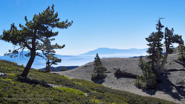
I tried not to think about it. There was just too much to see and enjoy. The area’s complex geology had produced dramatic ridges, mile deep canyons, and 9000′-10,000′ peaks. There were windswept Jeffrey pines and gnarled and twisted lodgepoles. Rabbitbrush bloomed in profusion, its bright yellow flowers contrasting sharply with the greens of the manzanita. Here and there red daubs of paintbrush accented the sparkling tiles of gray-green Pelona schist.


It was a spectacular place to be. After doing the North Backbone Trail for the first time in 2006, I came back the following weekend and did it again. It’s that kind of place — wild, scenic and adventurous.

How far down was that (dang) tree? I’d left the summit of Pine Mountain some time ago, and was still going down, down, down. The lodgepole pine forest on my right had the right look, but the slope to my left wasn’t steep enough. Maybe just down this hill… Is it at this little saddle? Just down the ridge a little more…

Epilogue: The circumference of the juniper measured 14′ 6.5″ or about 174.5 inches. See the post Pine Mountain Juniper for more info about the tree.

Some related posts: Mt. Baldy North Backbone Trail, North Backbone Trail Revisited
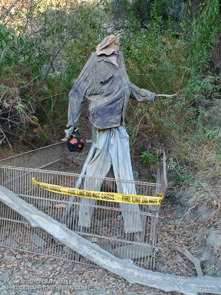
Coach Las Llajas

Coach Las Llajas

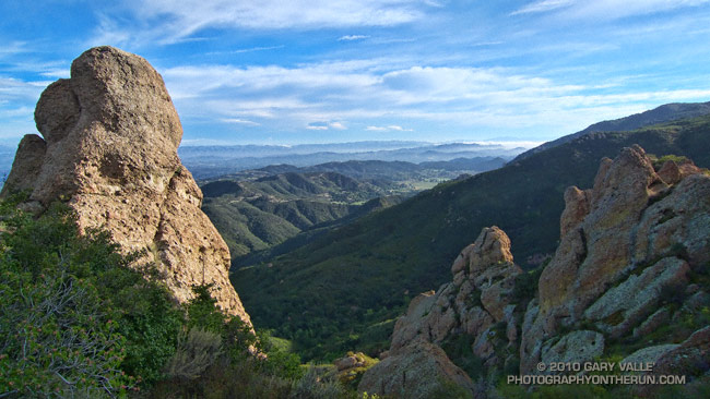
Las Llajas Canyon is a quirky place with a colorful history that includes oil production, grit mining, cattle ranching, and land development.

Coach Las Llajas has been keeping an eye on things in the canyon for a few months now. I didn’t check, but rumor has it he’s wearing a New Basin Blues t-shirt.

Some related posts: Chumash-Las Llajas Loop, Las Llajas Longhorns, Exploring Las Llajas