Category Archives: running|adventures

Races, Ravens and Running in Rocky Peak Park

Simi Valley with Boney Mountain in the distance

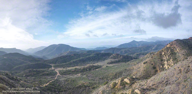
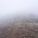
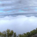
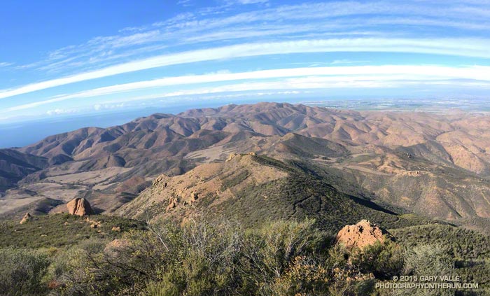
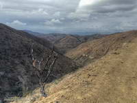
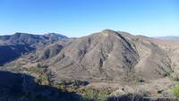
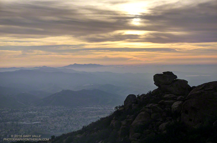
Been enjoying the views from Rocky Peak Road a lot this past month. That’s Simi Valley, with Boney Mountain in the distance. On a clear day the view extends to the Channel Islands.

That viewpoint is at about mile 4.5 of the Bandit 50K/30K/15K and there are many other superb views along the way. This year, as a result of the L.A. Marathon date change, the Bandit races were moved from President’s Day weekend to January 30. El Nino or not, we had near perfect running weather for the event. Thanks to Randy, Sarita & crew and all the volunteers for all the work putting together the eight edition of the Bandit Ultra Trail Run!

Rocky Peak Road
Rocky Peak Road

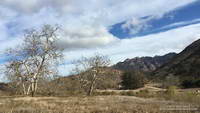
The Tuesday following Bandit I’d run farther than planned, so on Wednesday the plan had been to drive over to Simi Valley and do a short recovery run/hike up the Chumash Trail. As I parked on Flanagan Drive, it occurred to me it would be a good day to see if the linkup from the Chumash trailhead to the Hummingbird trailhead was once again possible. The 9.3 mile Hummingbird-Chumash loop used to be a favorite, but because of construction I had not done the loop since 2010. An out and back to check out the first couple of miles of the loop would be the perfect recovery run!

I was happy to discover the trails east of Chumash Park and behind the cemetery had not changed. Construction of the extension of Mt. Sinai Drive appears to be mostly complete, but residential construction along the street is ongoing. The work day was ending, so running the quarter-mile stretch of Mt. Sinai Drive to get to Kuehner didn’t seem to be an issue.

Once on Kuehner my thought was, “What now?” The run was going to be too short if I turned around, so I decided to go just “15 minutes up the Hummingbird Trail.”

Greening hills along the Chumash Trail

Right… I soon found myself most of the way up the trail and estimating what time I needed to get to the top of Hummingbird in order to make it to the Chumash Trail and complete the loop before dark. I’m sure my pace was not too far off what it had been in the 50K, just a few days before. At some point an official trail is supposed to link the bottom of the Chumash and Hummingbird Trails, and I hope that is in the not too distant future.

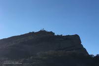
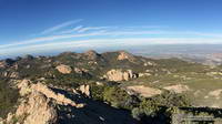
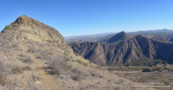
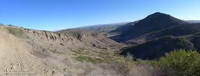
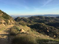
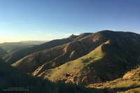
The single track trails in Rocky Peak Park — and even Rocky Peak Road — tend to be technical. It’s excellent training and I try to run there at least once a week. A run I’ve been doing frequently is an out and back from the Chumash trailhead to an airy overlook near Rocky Peak. (This run also passes the point on Rocky Peak Road where the title photo was taken.) Today, as I approached the overlook I saw that it was occupied by a pair of large ravens.

Often seen in pairs, ravens are perceptive, intelligent birds. Depending on the situation, they can be somewhat tolerant of humans. Sometimes it is possible to pass within a few feet of them and not make them fly. They really don’t want to waste the energy if they don’t have to.

Overlook near Rocky Peak

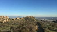
As I worked up the path to the overlook I could see that the birds were watching me intently and trying to decide if I posed a threat. Knowing they are curious birds, I clucked my tongue in an attempt to mimic one of their more simple calls. Perhaps they were perplexed by the garbled raven-talk coming from the troublesome, large, bipedal, wingless creature. In any case they didn’t fly and continued to watch me. As “politely” as I could, I moved up and about four feet to their left, sharing the high point. For seconds I stood by them on the overlook, enjoying the view.

I’d flown a hang glider from a point such as this and understood why it was so special to the birds. With care, I turned away from them and walked down an alternate path. Slowly turning my head, I could see they had not flown.

Note: The Bandit Trail Runs event is now Rocky Peak Trails.

Canyon View

Cheeseboro Ridge Trail, Cheeseboro Canyon and Sheep Corral Trail

Cheeseboro Canyon is the prominent canyon on the left of the photo. The dirt road is the Cheeseboro Ridge Trail — a power line service road. The Sheep Corral Trail follows the flat-ish terrain in the little valley. It links the Cheeseboro Ridge Trail to the top of the Cheeseboro Canyon Trail about a quarter-mile to the west (right) at Shepherds’ Flat.

There are innumerable trail runs, hikes and rides that pass through here. Here’s a NPS map of the Cheeseboro/Palo Comado area trails (PDF). On this cool, mid-January day I was doing the Upper Las Virgenes Canyon – Cheeseboro Ridge Loop.

Some related posts: Upper Las Virgenes Canyon Backcountry, Upper Las Virgenes Canyon – Cheeseboro Ridge Loop, Scenic Route to Simi Peak

You Can’t See Far in a Cloud

Clouds along the crest of the Santa Monica Mountains near Sandstone Peak

For the most part the upper layer of clouds had been above Boney Mountain. Thin wisps of cloud had clung to the ridges in a couple of places, but the ceiling looked like it was going to remain above the peak.

But then something unusual happened. A lower deck of clouds formed in the Conejo Valley, and then expanded upward, enveloping me as I worked up Boney’s Western Ridge. It wasn’t a whiteout, but in places the visibility was reduced to about twenty feet.

Fog changes the mood and character of a place, particularly a place where airy views and an expansive mindset are the norm. Thoughts turn inward and perceptions more narrowly focused. The big picture becomes entirely virtual.

Earlier in the week the area had been drenched by more than two inches of rain. It had been damp overnight and water filled the profusion of irregular pockets covering the volcanic rock. The rock was plastered with a patchwork of bright green moss and gray-green lichen. Saturated with water, the moss was slippery as ice. I climbed with extra care, especially on the steeper sections.

Where soil collected on tiered steps, obovate leaves of shooting-star and other annuals sprouted, presaging a show of the purple and yellow wildflowers. Chalk liveforever relished the moisture, its drought-scarred leaves rehydrating and recovering.

Higher on the ridge the intricate green foliage of red shanks, still recovering from the 2013 Springs Fire, was heavily-beaded with water. Brushing against it was like being sprayed with ice-cold water.

I remained immersed in cloud all the way up the Western Ridge, past Tri Peaks and over to Sandstone Peak, and didn’t climb above them until near the summit of Sandstone Peak.

A few photos from the climb and run are below. Click an image for more info and to display the image full-size.

Related post: Increasing Clouds

Increasing Clouds

Pt. Mugu State Park from the Chamberlain segment of the Backbone Trail

The last couple of days I’d been checking the weather models to try and get an idea of when the cold front might reach Pt. Mugu State Park. Projections ranged from around 10:00 AM to about 1:00 PM.

A group of us were doing an annual end of the year trail run and scramble over Boney Mountain to the Backbone Trail, and then returning by various routes to the Wendy Drive trailhead. Along the way there are great views of the Boney Mountain Wilderness, Channel Islands, Conejo Valley and Ventura Mountains, but you can’t see very far from inside of a cloud.

Runners on the crest of the western ridge of Boney Mountain.
Boney Mountain’s Western Ridge

It turned out clouds would not be a problem. At least not the first half of the day. When I pulled into the parking area at Wendy Drive the front was little more than a white smudge on the western horizon. The sky was clear and it remained clear the entire time we worked up Boney’s Western Ridge. Everyone enjoyed scrambling up the gullies and rocks to the top of the mountain and then over to Tri Peaks.

View west from Sandstone Peak, the highest peak in the Santa Monica Mountains
Approaching cold front from Sandstone Peak

We’d reached Tri Peaks about 40 minutes ago. From there I’d run over to Sandstone Peak, the highest peak in the Santa Monica Mountains. From this panoramic vantage point I could see the front was still well to the west, near Santa Barbara. This gave me some time. I was prepared for rain, but didn’t want to miss the wonderful scenery running down the Chamberlain Trail, over to Serrano Valley, and through Serrano Canyon.

Sycamore Canyon near the Danielson Multi-Use Area.
Increasing clouds near Danielson Ranch

Over the remainder of the run I watched as cirrus clouds ahead of the front gradually muted the sun, mid-level clouds began to develop over the peaks, and the wind became more gusty and fitful. Later in the run the clouds started to lower and thicken and the temperature dropped. Eventually it began to smell like rain.

Cold front moving into Pt. Mugu State Park
Here comes the rain!

As I crested the hill on Danielson Road I felt a cold drop of rain on my arm and then another on the back of a leg. Clouds covered the sky, and to the west showers draped the ridges and filled the canyons. The front and I were racing the last mile to the trailhead, and I knew who had won.

Arroyo Conejo, Wildwood Park and Elliot Mountain

Elliot Mountain with Lizard Head, Mountclef Ridge and Wildwood mesa in the distance

This morning’s run had started on the southern boundary of the Arroyo Conejo Open Space near Amgen in Thousand Oaks. It was 39°F at the beginning of the run and the chill of dawn and brisk north wind made it feel even colder. The plan was to run north on the Arroyo Conejo Trail and connect to the trails in Wildwood Park.

Gorge cut by Arroyo Conejo Creek

Running on automatic, and hoping to warm up quickly, I followed the Arroyo Conejo Trail north along the shoulder of the canyon. Known as “La Barranca” the three mile long canyon extends from the 101 Freeway to Hill Canyon near Santa Rosa Road. Rounding a corner and working up and over a little hill I looked to my right and was astonished to see that in this section of the canyon a deep, vertical-walled gorge had been cut into the residential landscape.

Mountclef Ridge from the Stagecoach Bluff Trail in Wildwood Park.

The wildness of the gorge set the tone for the remainder of the run. Arroyo Conejo, Wildwood Park and the Western Plateau have a scenic, desert southwest character all their own and an extensive trail system. If a bluff, peak or other feature looked interesting, there was generally a way to get to it. I ran along Stagecoach Bluff, then to Lizard Head, and then over to the Canyon Overlook Trail and down to the Conejo Canyons Bridge at the Hill Canyon trailhead.

Hill Canyon and Elliot Mountain from the Canyon Overlook Trail.

After running up Hill Canyon, I was once again headed uphill, this time on the Western Plateau Trail. I’d caught a glimpse of some mountain bikers high on the bluff above and couldn’t resist continuing. I had more than 10 miles in and was planning to go back through Wildwood Park. Each mile added now would add two miles to my growing round trip total.

Box Canyon and Mountclef Ridge from the Canyon Overlook Trail

That’s the difficult thing about doing an exploratory run — deciding where to turn around. You HAVE to see what’s around each corner and what the view is like from the top of every hill. You can’t turn around just anywhere, and I was looking for the right place.

Turning onto the Outlaw/Gnome Trail, in a few minutes I reached the top of the rock outcrop where I’d seen the mountain bikers.  But it wasn’t the top of the climb, and it definitely wasn’t the right spot to turn around. A bit higher I could see a sign silhouetted on the skyline and was curious to see what it said.

Trail to Elliot Mountain in the Western Plateau area near Hill Canyon
Trail to Elliot Mountain

The sign read “Elliot Mountain Trail.” How could I turn around now? Continuing east, a newly cut trail with a bench en route led to the top of the peak. Recently named in honor of Burt Elliot, “a tireless volunteer, open space advocate and champion of trails,” the peak was the perfect place to spend a few minutes enjoying the great view and then start my circuitous trip back to the car.

For trail maps and more information see the Conejo Open Space Foundation web site.

The title photograph is Elliot Mountain with Lizard Head, Mountclef Ridge and Wildwood mesa in the distance.

Boney Mountain’s Western Ridge

Boney Mountain's Western Ridge

From today’s run, hike, scramble and climb of Boney Mountain’s Western Ridge. The rounded pinnacle at the  top of the formation is this one.

Some related posts: Boney Mountain Western Ridge & Loop, Over Boney Mountain to Sandstone Peak and Serrano Valley, Boney Mountain Eclipse Run, Boney Mountain – Serrano Valley Adventure Run, Boney Mountain Views