Category Archives: running|races

Holcomb Valley 33 Mile Trail Run 2010

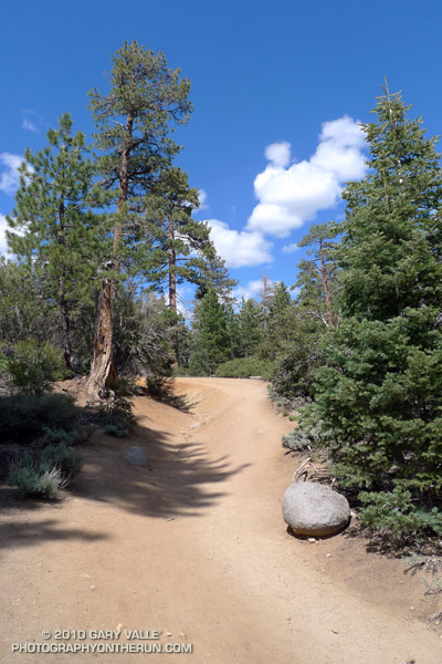
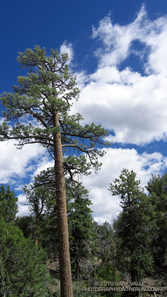
Jeffrey pine on the Cougar Crest Trail, near Big Bear Lake.

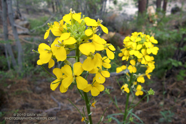
At aid station #2 we turned onto the Pacific Crest Trail, and followed the smooth single-track through a serene Jeffrey pine forest on the north slopes of Delamar Mountain. It was a little chilly and breezy at 7800′, and the strong June sun felt good on my bare arms. I was at about mile 9 of the Holcomb Valley 33 Mile Trail Run and all was good. The subtle vanilla scent of the pines wafted through the trees, and here and there bright yellow blossoms of western wallflower seemed to mark the way.

Rounding a corner, a pine framed image of Big Bear Lake and snow covered San Gorgonio popped into view. Behind me, a runner exclaimed, “Gorgeous!” As she passed, she commented, “This is my favorite race!” And I can see why. Not only is the race well organized, with great aid stations and super helpful volunteers, it challenges the runner with a unique mix of terrain and altitude.


Some stretches of the course are smooth and fast, some technical, and some downright gnarly. Most of the hills are not steep — at least by sea level standards — and the total elevation gain/loss is only about 3600′. But the gotcha is this: the course has the highest average elevation of any 50K race in Southern California, including the Bishop High Sierra 50K! Nearly 30 miles of the course is above 7000′, and the altitude has an unavoidable effect on performance, particularly for the unacclimatized, middle-of-the-pack runner.

How much of an effect? There is an often referenced chart in the book the Daniels Running Formula that can be used to estimate how much slower we will run at a particular altitude. Using an online running calculator based on the chart, we can project that a runner that does a 33 mile course at an elevation of 1000′ in 6.5 hours would take about 7 hours at 7500′ — assuming the runner is fully acclimatized! In the book, Daniels says that the increase in time could be as much as double for an unacclimatized runner. So 33 miles in 6.5 hours near sea level might turn into 7.5 hours at 7500′.

At altitude, elite runners have an advantage — even more of an advantage than they have at lower elevations. Because of the reduction in air density and drag, running at altitude at their faster pace is more efficient than near sea level. This partially offsets the loss in aerobic power that results from the reduction in atmospheric pressure. Again using the Runworks calculator, a runner that runs 33 miles in 4 hours at 1000′, would be projected to run about 4:18:00 at 7500′.


Apparently immune to the altitude, and flowing over the rocky sections of trail like the wind, Michelle Barton and Jorge Pacheco set new records on the Holcomb course this year. Michelle Barton flew through the 33 mile course in 4:56:21 (8:59 min/mi), and Jorge Pacheco cranked out an amazing 4:13:44 (7:41 min/mi). To put those times in perspective, this year the median time (half the runners above, half below) was  about 7:36:00.

Here is a Cesium ion interactive view of my GPS trace of the 33.1 mile course, and an elevation profile generated in SportTracks. Distances specified are based on the trace, and were calculated in SportTracks. During the race the only segment that seemed significantly longer than expected was from aid station #4 to aid station #5. Part of the reason is it was a tough leg, and has some very rocky stretches. But it also looks like the segment was about 7 miles long, rather than the expected 5.9 miles.

Many thanks to Pam and Gary Kalina, Bear Valley Search & Rescue, the sponsors, and all the volunteers for a great race! All the results can be found on the Holcomb Valley Trail Runs web site.

Blue Skies and Sunshine for the 2010 Twin Peaks 50K & 50M Trail Runs

It had been a long time since I was on the summit of Santiago Peak (aka Saddleback). The last time was in 1975, when I flew from the peak on a Sunbird “Butterfly” hang glider. That day had been spectacular, and this was turning out to be a spectacular day as well.

In the throes of an El Niño Winter, Southern California had been pummeled by a series of Pacific storms. With all the rain and snow it seemed unlikely that the Twin Peaks 50/50 would be run as planned. But the key access roads didn’t wash out, most of the snow melted, and blue skies and great weather greeted runners race day morning.


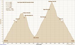
Twin Peaks 50K Elevation Profile
The race started at the bottom of Indian Truck Trail, off the I-15 near Corona. It was warm enough that in our 8:00 wave of 50K runners, only a few people wore sleeves and extra clothing. As we worked up the first switchbacks into the sun, those were quickly shed. The enthusiasm of the other runners was contagious, and this helped with the challenges of the initial 7 mile, 2600′ climb to the Indian Truck Trail aid station.

At that first aid station I grabbed a GU gel, and then headed east on the Main Divide Road toward West Horsethief. For some reason I had it in my head that I might get to run on the flat here for a few minutes. The only way that was going to happen is if I ran around the aid station table. On this course you’re either going up or you’re going down, and here the arrow still pointed up.

The views along the Main Divide were fantastic. The high peaks of Southern California — Mt. Baldy (10,064′), San Jacinto Peak (10,834′) and San Gorgonio Mountain (11,499′) — glistened in the morning sun, their new snow impossibly white. Down in the valley, an ant-like stream of vehicles moved along the Corona freeway, and our parked cars glittered like a string of tiny beads along Santiago Road. To my right, steep, chaparral covered slopes plunged into the depths of Trabuco and Holy Jim canyons. Somewhere down there was the Holy Jim aid station, and it looked like a long way down.

Billy and Lori working the West Horsethief aid station.
At the West Horsethief Trail aid station (10.2 mi), Billy and Lori greeted me with big smiles and asked if there was anything I needed. I had just been asking myself that same question, wondering if I had enough water to make it to Holy Jim. I guessed that I did, thanked them for being there, and turned down the single track trail.

Varied and technical, the West Horsethief and Trabuco trails were my favorite part of the course. While some sections were rocky, or V-rutted from recent rains, long stretches of of the trail were smooth and fast. Once down in the canyon, the creek crossings on the Trabuco Trail were great fun. With the warm weather, wet socks and squishing shoes were no big deal. The lush green growth and the burbling stream eased the long run down the canyon, and at about the 3 hour mark, I reached the Holy Jim aid station (14.5 mi).

This aid station is on the opposite side of the mountain from the start. You’ve done a lot of work to get there, and you’re going to do a lot more to get back. From here it is about 8 miles and a 3900′ gain to the summit of Santiago Peak. It took a while to work up past the cabins in Holy Jim Canyon to the start of the Holy Jim Trail. I knew I was on-route, but I hadn’t run any of these trails, and worried I might accidentally run up somebody’s long driveway.

As I climbed out on the first switchbacks above the creek, Hiroki Ishikawa, the eventual winner of the 50 mile race, rounded a switchback. Elite athletes stand out in any sport — there is a an efficiency and fluidity of movement that is unmistakable. Hiroki was quicksilver fast, and seemed to flow effortlessly down the trail.

In contrast, I felt a little like mud trying to flow uphill. Fortunately, long stretches of the trail were runnable, and ever so slowly I rose above Holy Jim Canyon. Gradually, the peak tops and rigelines that had been towering above me fell away. About 4.5 hours into the race, I reached the top of the Holy Jim Trail at Bear Springs, and turned left onto the Main Divide road.

The surprising thing about this shady nook is that when you reach this point, you’ve only done a little more than half (56%) of the gain from Holy Jim to Santiago Peak. But hey, I was happy with that, and it felt good to be in the pines and plodding up toward the peak.

It took about 30 minutes to reach the big switchback at the Upper Holy Jim checkpoint (21.1 mi). From here the summit towers looked tantalizing close. I was happy to keep pace with the “runner in blue” about a hundred yards ahead.  As we neared the top of the peak, sun turned to shade, and the road became covered with snow. It was a cool way to finish a warm climb, and a not so subtle reminder of what the weather might have been.

Leaving the top of Santiago Peak (22.6 mi) I thought back to that day in 1975. I wouldn’t be flying down the mountain today, with a hang glider or without. In its own way the 10 mile descent from the peak would be just as challenging as the climb up earlier in the day. But I wasn’t thinking about that. I was smiling and thinking that the running had been about as good as trail running gets.


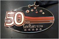
Twin Peaks 50/50 Finishers MedalMany thanks to RD Jessica DeLine, and all the volunteers and runners for an excellent event! Kudos to the 50 mile runners, who not only got to climb Santiago Peak via Holy Jim, but had the pleasure of running down Holy Jim and then climbing up West Horsethief and doing Santiago a second time.

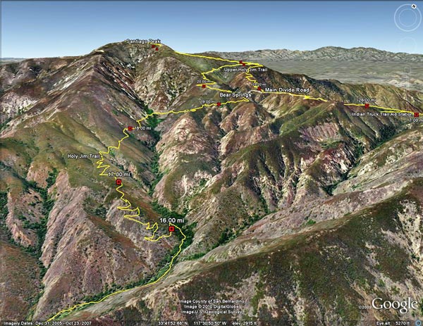
Here’s an interactive Cesium browser View of the 50K course, and an elevation profile generated in SportTracks. Based on my GPS track, the distance worked out to a little over 33 miles, with an elevation gain of about 7600′. The elevation gain was hand calculated using SRTM corrected profile elevations. (For more info about measuring elevation gains on mountain trail runs, see the post What’s the Elevation Gain?)

When split times are available, you can learn a lot about how you, and others, ran the course. Everyone’s race is unique, and no one approach works the best. In the following listings, I’ve calculated the time from the start to each aid station, the time between aid stations, and the split rank at each aid station. These are totally unofficial. In a few places where a split time was invalid (for example earlier than a previous aid station) I’ve substituted estimated times. The “Rank” indicated is based on the time from the start to that point in the course. In both the 50K and 50M the top runners had missing splits, so for that split, they will not be included in the split rankings.

Here are the 50K Split Calculations and the 50M Split Calculations. If you want to send me your corrected or missing splits, I will update the listings when I have a chance. Please see the Twin Peaks 50/50 web site  for official results and information.

The Run Down After the Run to the Top

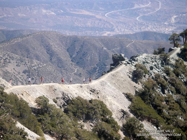
Runners Descending the Devil's Backbone on Mt. Baldy

Runners Descending the Devil’s Backbone on Mt. Baldy

It’s a lot more fun working with gravity, than against it! For many runners, the run down from the summit of Mt. Baldy is as much a part of the Run to the Top experience as the race up.

Grueling sections of trail are effortlessly retraced, and there is more of an opportunity to enjoy the Devil’s Backbone, and other spectacular sections of trail. Those needing more mileage skip the chair lift ride down from the Notch, and continue down the service road, following the route of the race.

Related post: Mt. Baldy Run to the Top 2009

Mt. Baldy Run to the Top 2009

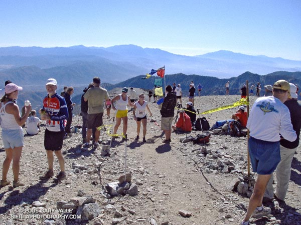
Finish line of the Mt. Baldy Run to the Top.

The weather for the 44th edition of the Mt. Baldy Run to the Top was nearly identical to last year, with clear blue skies and temps in the 50’s.


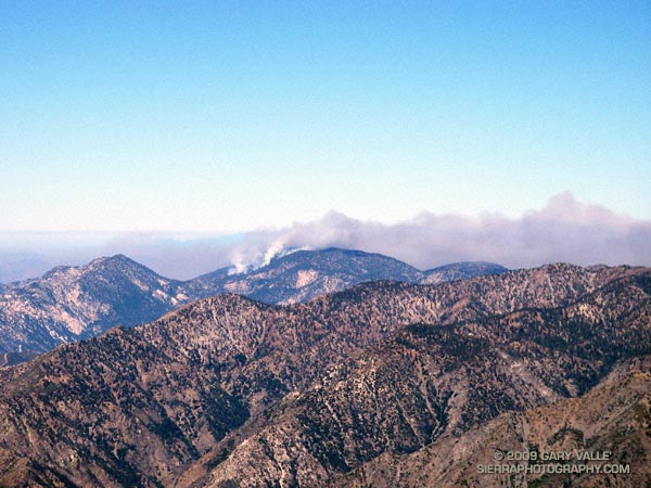
Station Fire from Mt. Baldy.
The Station Fire could be seen from the top of Mt. Baldy, but with the wind from the southwest, the smoke was blowing elsewhere.

This challenging mountain run gains about 3800 feet over 7 miles, starting at the bottom of the Mt. Baldy ski lift parking lot and ending on the summit of 10,064′ Mt. Baldy. Here’s a Cesium browser View of a GPS trace of the course.

This year the men’s overall winner was Jonathan Toker in a time of 1:12:11, and the women’s overall winner was Hannah Valenzuela in a time of 1:26:03. For all of the results see the Run to the Top web site. Many thanks to the race organizers, volunteers, USFS, Mt Baldy Ski Lifts and the Mt. Baldy Fire Department for a great race!

Related post: Mt. Baldy Run to the Top 2007

Mt. Disappointment 50K 2009 Notes

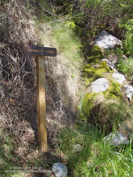
Strawberry Spring, about 1.25 mile from Lawlor Saddle (2005)

Strawberry Spring, about 1.25 mile from Lawlor Saddle

Note: The Mt. Disappointment Endurance Run is now the Angeles National Forest Trail Race.

Race day dawned clear, cool and breezy — nearly perfect conditions for the start of the 2009 Mt. Disappointment 50K and 50 mile Endurance Runs.

This was the 5th edition of the 50K, a classic race that starts and ends on the summit of Mt. Wilson, and features a demanding mix of technical single track trail, dirt fire roads, and the Mt. Wilson Rd. With over 5000′ of legit gain and loss, and a climb to the finish of 2600′, it is a course that many underestimate. If the 50K is difficult, the 50 mile is difficult squared. In addition to the final arduous climb to the finish, the 50 mile run features a brutally exposed 6 mile ascent to Shortcut saddle that most do during the hottest part of the day.

My goals for this year’s 50K were to a) complete it, b) have fun!, and c) try to get my time back down under 7 hours. I’d been working some on improving my running technique. Would it make any difference?

Following are some notes from this year’s race. This year I’ve used the GPS distance as calculated by SportTracks, rather than the official aid station distances. These distances are approximate. The times between aid stations should be relatively accurate, but may differ from the official times.

Mile 0 to 4.7 (Red Box Aid #1)
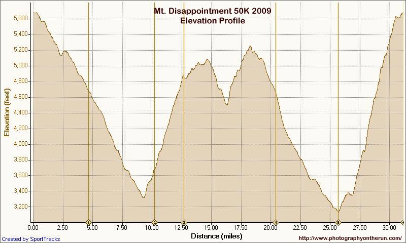

Mt. Disappointment 50K 2009 Elevation Profile
As a result of the Mt. Lowe Fire Road closure, instead of turning at Eaton Saddle and climbing up and over the shoulder of Mt. Disappointment, the first leg of the race followed (paved) Mt. Wilson Rd. all the way down to Red Box. According to the topo map, this reduces the total elevation gain by about 700′ — from about 5800′ to 5100′. Comparing GPS traces from last year and this year, it looks like the 2009 course is about 0.8 mile shorter — 5.5 miles vs. 4.7 miles.

How much would the change in course effect times? And, how do you compare a 2008 time to 2009 time? And, what time on this course would be (more or less) equivalent to my goal of finishing in under 7 hours on the standard course?

In my case, I’ve run the 50K four times before, so I know my average time down to Red Box is about 60 minutes. This year the split was 20 minutes faster. I figure about 16-17 minutes of that is due to the difference in courses, This is close to what the 8:1 Naismith’s Rule would predict. Assuming an 8.5 min/mile pace on the flat, the 700′ climb should add about 9 minutes, and the additional 0.8 mile should add about 7 minutes. So, subtracting 16 minutes from 7:00 hours my new time goal was 6:44.

I might have run this leg a little too fast — I did feel some tightness in my quads at Red Box — but the long, fast downhill on pavement was an offer I couldn’t refuse.

2007: 59 min 2008: 66 min 2009: 40 min

Mile 4.7 to 10.2 (Clear Creek Aid #2)

Behind me, I heard the surprisingly loud, “thunk!”of the toe of a running shoe catching on a rock, and then a grunt. Time expanded as I turned, and I watched in slow motion as a runner gracefully flew through the air, tucked, rolled, and in a backlit cloud of swirling dust, slid 50 feet down the steep, pine needle covered slope.

Maybe because it’s downhill and in shade, I’ve seen a number of runners trip on this section of the course, but this fall took the Gold. The good news was the runner was OK.

Although this was probably the fastest I’ve done this leg, it didn’t feel that way. I wasn’t holding back, but wasn’t pushing the pace either.

2007: 58 min 2008: 63 min 2009: 56 min
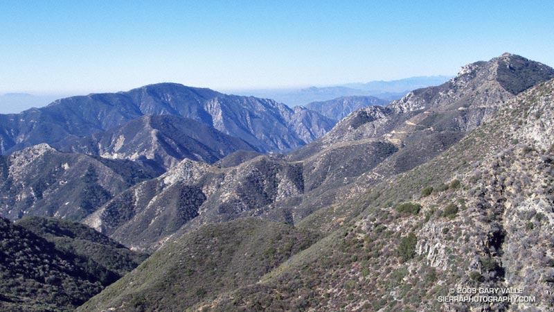


Mile 10.2 to 12.7 (Josephine Aid #2.5)

OK, OK, I know better than to push the climb up the Josephine Fire Road too hard. To this point, I was hanging with a some runners that would eventually finish the 50K in the 6:00-6:15 range. Didn’t know that at the time, and in my enthusiasm passed them on the hill. Bad move.

2007: 43 min 2008: 43 min 2009: 38 min

Mile 12.7 to 20.5 (Red Box Aid #3)


I coughed and sputtered after accidentally inhaling some of the Heed I was trying to drink. Jimmy Dean Freeman was cracking me up telling stories about some recent ultras.

There are two legs of the course where training pays big dividends, and this is one of them. Jimmy Dean and his wife, Kate, were running free and easy. It didn’t take long and they started to pull away. Runners trained for longer distances seem to have a much better time of it on this part of the course.

Even on a coolish day like today, the climb to Lawlor Saddle was on the warm side, and I found myself walking stretches that with just a little more “umph” I could have been running. For a while, I ran with a runner, who — if I heard correctly — warmed up for the Mt. Disappointment 50 miler by doing an Ironman Tri the previous weekend!

Although my time from Clear Creek to Red Box was 10 minutes faster than last year, I think my overall time would have been faster if I had taken it easier on the Josephine climb.

2007: 129 min 2008: 103 min 2009: 98 min

Mile 20.5 to 25.7 (West Fork Aid #4)

I don’t know what makes this leg so difficult, but every year it’s a tough one for me. Fresh, it would be a run in the park. After 21 miles of this race, and 4000′ of elevation loss, “it ain’t so easy anymore.” Some years there is water in the creeks that cross road, and a cap-full of water over the head helps. Not this year.

Lynn Longan, another one of the runners I’d passed on the climb up to the Josephine aid station, caught up to me a little before the West Fork aid station. In addition to two 50 milers earlier in the year, she had run the TRT 50 mile three weeks ago, and the Miwok 100K before that. I was about to learn what running longer can do for you.

2007: 66 min 2008: 61 min 2009: 57 min

Mile 25.7 to 31.1 (Finish on Mt. Wilson)

I left the aid station a little ahead of Lynn, but it wasn’t long and I heard footsteps coming up behind me. Looking strong, she cruised past and was soon out of sight.

I was worked. I could run some on the flat, but uphill running was not going to happen. Then there the water issue. Two bottles is never enough for me on the Kenyon DeVore climb. I knew that going in, and should have taken the time at the West Fork aid station to drink more water and defizzed cola. The plan had been to refill at a creek crossing a couple of miles up the trail. But there was a potential problem — this year almost all of the small creeks had been dry!

The creek wasn’t dry, but it wasn’t all that wet either. The flow was marginal and there was a lot of debris in water. But I had refilled here several times before, so maybe it would be OK. I’d already gone through my first bottle, and had started on the second, and there was still 3.5 miles and 1700 feet of climb to go. I decided I would only drink it if I had to. Without inspecting the source too carefully, I filled the bottle and hurried back to the trail.  While I had been busy getting water, two runners had run past.

The Kenyon DeVore trail is cruel. Glimpses of the antennas on Mt. Wilson look tantalizingly close, but the trail climbs, turns, and then climbs some more. I drank all of the  creek water and was happy to have it. Even with the extra water, my legs were getting crampy, and I just hoped I could get to the finish without a full-on bout of adductor and hamstring cramps.

2007: 112 min 2008: 100 min 2009: 104 min
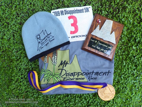


Time in… 6 hours 34 minutes — with an average pace more than a minute per mile faster than last year, and ahead of my adjusted time goal of 6:44.

Here’s an elevation profile, and a Cesium browser View of a GPS trace of the course, with mile splits generated by SportTracks. Click on the red icon for the split time. The 2009 course is the yellow trace, and the 2005-2008 course is the red trace.

As always the event was superbly conducted by race director Gary Hilliard, the Mt. Disappointment 50/50 Staff, and a extraordinary group of friends and volunteers. Thank you!

Related post: Mt. Disappointment 50K 2008 Notes

Google search: $g(Mt. Disappointment 50K), $g(trail running)
Malibu Creek Challenge 2009

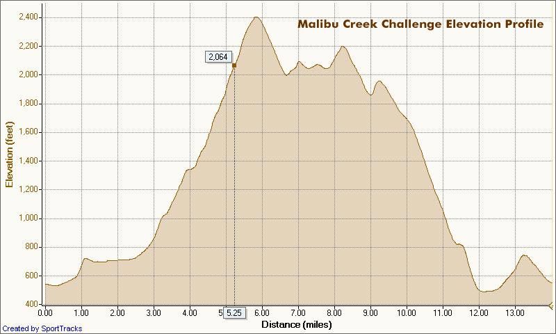
I glanced at my watch — 5.25 miles. Clouds and fog had kept temps on the cool side for more than three-quarters of the Bulldog climb, but the sun was finally breaking through. Even though temps were down a few degrees, the long climb had still been grueling. The runner next to me was breathing heavily, and I mentally repeated my Bulldog mantra — don’t redline, don’t redline.


Malibu Creek Challenge 22K Elevation Profile
For many of us, that’s the problem with Bulldog — some of it is runnable and some of it isn’t. For the moment I was running, but I knew the grade well, and just ahead the fire road switchbacked right, and steepened.

I’ve been over the “I can run this hill no matter what” thing for a long time. For me, and the majority of trail runners, walking the steeps is a good thing. The little bit of time lost by walking is generally made up — and more — on other sections of the course.

Rounding a corner, the grade did steepen, and I slowed and started to walk. Taking advantage of the slow pace, I ate a Gu, took a Salt Stick cap, and gulped down some Gatorade. Another runner and I had been swapping leads up the hill, and he passed me — again. As he increased his lead, I wondered if I should be pushing a little harder.

A left turn never felt so good! A few minutes before I had reached the top of Bulldog grade, and the highest point on the course. Now gravity was on my side, and I was enjoying the downhill. There were more challenges ahead, but for now I was lost in the moment — savoring the wind in my face, the far reaching views along the rocky crest, and that wonderful feeling of being a runner.

Here’s a Cesium browser View of a GPS trace of the 22K course with my half-mile splits. (Generated in SportTracks.) See the XTERRA Malibu Creek Trail Run web page for race results and additional info.

Some related posts: Malibu Creek State Park Shadow & Sun, Fog Along Malibu Creek, Bulldog Loop and the Corral Fire, Rock Formations Along the Backbone Trail