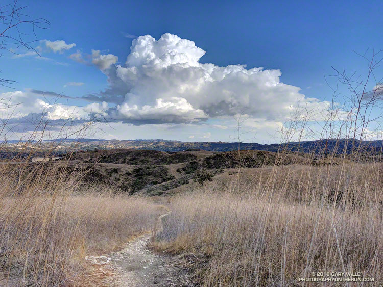
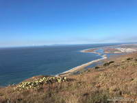
Chasing a cumulus cloud on a trail run in El Escorpion Park.

Chasing a cumulus cloud on a trail run in El Escorpion Park.
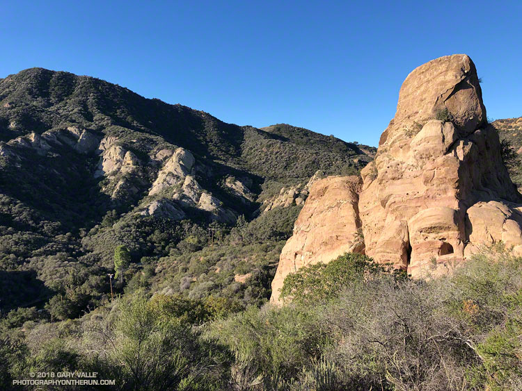
Nope, I wasn’t running near Las Vegas or north of Mojave, this Red Rock Canyon is in Old Topanga Canyon, southeast of Calabasas Peak.
Although there’s a trailhead off of Old Topanga Canyon Road, I usually access Red Rock Canyon from the top, using Calabasas Peak Mtwy and Red Rock Road.
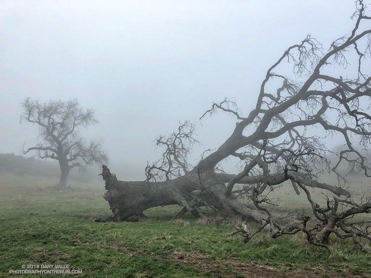
The fallen oak pictured above — one of the larger valley oaks along Rocky Peak fire road — toppled over in the summer of 2016 following five years of drought. Fire and drought are a natural part of the valley oak’s habitat and the trees have evolved to withstand ordinary variations in their environment. However, severe fires or extended droughts, or fire in combination with drought can overcome the tree’s defenses. The drought may have been the culminating factor in the felling of this oak, but fire and other factors may have also played a role.
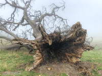
According to the Fire Effects Information System (FEIS), the heart-rot fungus Armillaria mellea is usually present in valley oaks and larger oaks tend to be hollow or rotten in the center. The toppled oak was hollow near its base and its interior appears to have been blackened by fire. The FEIS describes instances where the decaying wood in the interior of older valley oaks could ignite in a fire, but leave the exterior bark uncharred.
What fire might have burned the tree? There are two possibilities: the 2008 Sesnon Fire and the 2003 Simi Fire. It probably wasn’t the Sesnon Fire — this photo of the tree, taken about a month after the Sesnon fire, shows little impact. I couldn’t find a photo of the tree following the Simi Fire, but photos taken nearby show a severely burned landscape. Ultimately, it appears fire and drought weakened the tree, accelerating its heart rot and weakening its roots to the point it could no longer support itself.
Photos of the fallen oak are from this morning’s foggy run along Rocky Peak fire road.
Related post: Ahmanson Blue Oak Succumbs to Climate Change, Chumash Trail – Sesnon & Simi Fires
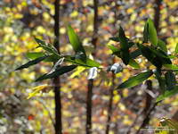
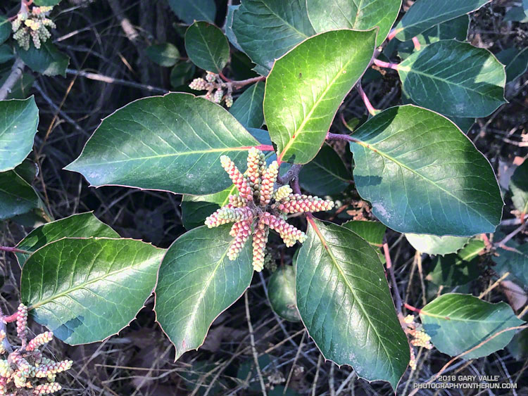 Sugar bush (Rhus ovata) along the Garapito Trail in Topanga State Park. January 13, 2018.
My legs hadn’t fully recovered from a bit-too-long training run a couple of weeks ago and I’d been looking to do a 4 to 5 hour trail run that didn’t involve a huge amount of elevation gain. In the areas of Southern California where I run, it’s tough to find a 20 mile trail run that isn’t hilly. With “only” about 3000′ of gain, I’d opted to do an out and back to Mugu Peak from from the Wendy Drive trailhead in Newbury Park.
Mugu Peak is a very popular summit. With the La Jolla Canyon Trail still closed, most of the hikers doing the peak are now using the Chumash Trail as an alternate. Runners have more options and can reach the peak from the Ray Miller, Sycamore Canyon, and Wendy Drive trailheads.
At the moment I was about a mile north the Danielson Multi Use Area, running on a paved section of road in Big Sycamore Canyon. The Sin Nombre and Hidden Pond trails can be used to avoid this stretch of pavement, but at this point in a long run I usually just want to get to the Upper Sycamore Trail as quickly and easily as possible.
Running a couple of miles on pavement isn’t necessarily a bad thing. Especially in Sycamore Canyon. The road is lined with sycamores and oaks and there is plenty of shade. The uniformity of the road is both good and bad. It’s good because the running is more automatic and bad for the same reason. It can be tedious — especially on tired legs at the tail end of a long run.
The traffic along the road is usually not an issue. Today, I had passed a couple of groups of hikers and been passed by a few mountain bikers. Most of the time the road was empty.
I first heard the sound some distance behind me. Hissing isn’t quite the right word. It was a synchronized blend of aerodynamic, mechanical and road noises and it was getting closer. At first I thought it might be a ranger’s truck, but it didn’t sound like a vehicle. I glanced behind me to see a mass of approaching cyclists, and wondered how many bikes there would be.
I heard a shout of “Right!” as the lead cyclist alerted the group, and in an instant the peloton began to sweep past. I felt a little like the breakaway racer that is inevitably consumed by the unrelenting pack. For a few moments I could feel the push of the peloton and then they were gone.
The lead group was followed by a second group, nearly as large, and then an assortment of riders that had been left behind. After they were past, I settled back into the run and soon saw the yellow “narrow bridge” sign near the start of the Upper Sycamore Trail. Turning onto the rocky, narrow trail, I switched back into trail mode. A little less than three miles to go…
Related posts: Busy Mugu Peak, Wendy Drive – Mugu Peak Challenge