The weather was surprisingly cool for a Memorial Day weekend in the San Gabriel Mountains. At Three Points (5925′) the temperature was a brisk 43°F when I started my run, and it remained in the 40s as I worked up the Three Points – Mt. Waterman Trail toward Twin Peaks and Mt. Waterman. The trail from Three Points is a long-time favorite and part of an adventurous — and scenic — 20 mile loop around Waterman Mountain.
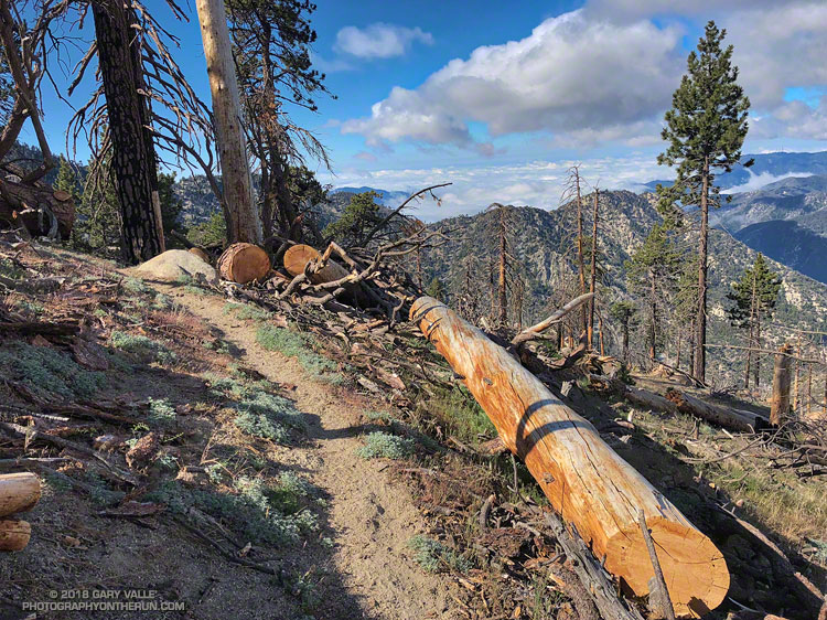
In 2009 the Station Fire ran up the ribs and gullies of the south face of Mt. Waterman, ravaging some slopes, but leaving others untouched. Many trees were killed, including some old growth incense cedars and Jeffrey pines. On a run in March 2017 I counted more than 40 dead trees down on the trail. At that time a few trees had already been cleared from the trail and in the following months many more would be.
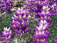
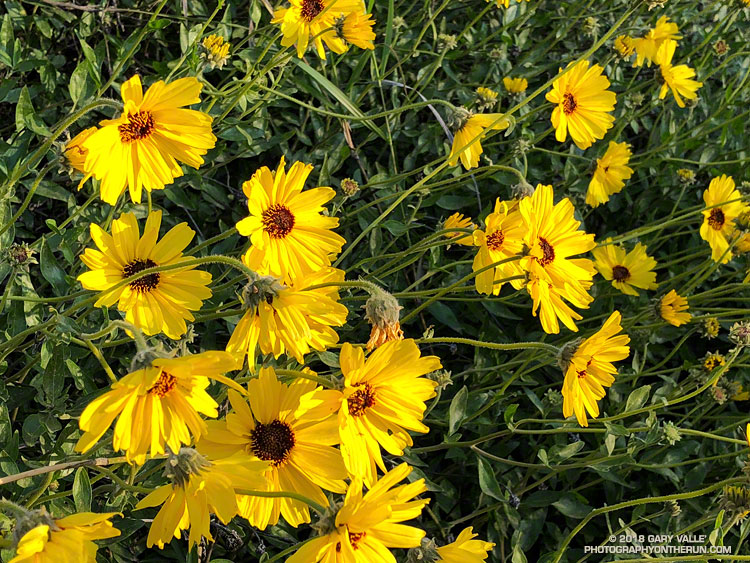
Grape soda lupine along the PCT in Cooper Canyon. Click for larger image.
One particularly hard hit area is about a half-mile west of the Twin Peaks Trail junction. Last Summer dead trees blocked the trail in this area and in places were stacked one on top of another. The title photo is of the same area after the trail was cleared.
On a previous run I’d photographed the growth rings of a burned Jeffrey pine above the Twin Peaks Trail junction and estimated the total at about 325. Today, a recently cut Jeffrey pine just west of the Twin Peaks Trail looked like it might be considerably older. A very rough count of its rings totaled 475.
On this run the Three Points – Mt. Waterman Trail was almost entirely clear of trees and in the best condition I’ve seen since the Station Fire. Many thanks to Alan and the SoCal Hikers & Trail Builders for restoring this trail!
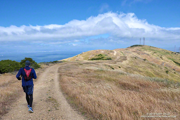
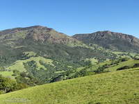
I staggered in the wind gust. It had to have been at least 45 mph. The views along the undulating ridge to the Bay were spectacular, but the wind was ferocious.
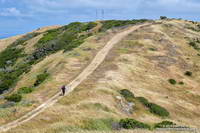
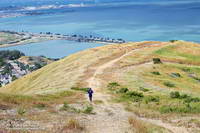
Hill on the San Bruno Mountain Ridge Trail.
Brett and I were running on the San Bruno Mountain Ridge Trail. We’d started at the summit parking lot and weren’t exactly sure where we were going to turn around. We’d know when we got to it.
The NWS forecast for San Francisco had called for “breezy” conditions:
.TODAY…Mostly cloudy in the morning then becoming partly
cloudy. Breezy. Patchy drizzle in the morning. Highs in the mid
50s to lower 60s. West winds 20 to 30 mph.
Continuing down, down, down the ridge.
That forecast was for the city — and of course up on the peak the wind was even “breezier.” The SF Giants beanie I borrowed was the right call. So were the gloves, extra shirt and wind shell.
We continued along the ridge past the second set of loudly singing power lines and continued downhill. It became one of those, “let’s just go down to that next overlook,” and then the next one, and the next one. Not only were we losing a lot of elevation, but we’d be running into the wind on the way back.
San Bruno Mountain Ridge above the 101 and Sierra Point
We eventually turned around a little above Bayshore Blvd., at the “Sierra Point Reset” benchmark marked “487” on the topo map. As is often the case, the return wasn’t nearly as torturous as envisioned, but I was glad to get back to the car!
San Bruno Mountain is an invaluable island of open space, about 20 minutes from downtown San Francisco. For more information see the San Bruno Mountain Watch website.
As of March 1, Downtown Los Angeles had recorded only 1.99 inches rain over the past eight months. Most of that was recorded in one storm in early January. It was the second driest July 1 – February 28 on record.
Following the January storm, temperatures warmed up and stayed relatively warm for much of the next 30 days. In the West San Fernando Valley the high temperature hit 89 °F at Pierce College on February 4, and was over 80 °F for 12 consecutive days. Some plants (and some rattlesnakes) responded as if it was Spring.
In mid February Winter returned, with cool daytime temperatures and cold nights. There were Frost and Freeze Warnings on several nights.
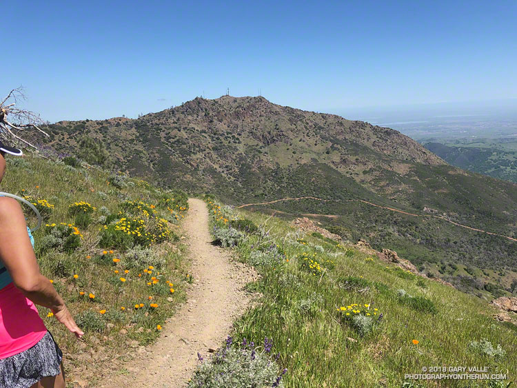
In March the ridiculously resilient ridge of high pressure over the West Coast finally relented, resulting in above normal rainfall. It took awhile, but the March rain and April sun eventually produced an assortment of wildflowers.
Just 48 hours before the start of the Diablo Trails Challenge the temperature on Mt. Diablo’s summit was a chilly 31°F. Gray, wind-driven clouds shrouded the summit, propelled by 20-30 mph winds. Over the 10 days preceding the race, it had rained on four, and Concord had received about two inches of rain.
That’s the thing about Spring weather – a couple of days can make a huge difference. Today – race day – the sun is out, the hills are green and skies blue. Very little mud remains – the trails are in great shape and hills sprinkled with wildflowers. It’s the perfect day for a run on Mt. Diablo!
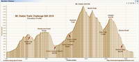
Diablo Trails Challenge 50K Elevation Profile
With around 7000′ of elevation gain/loss, the Diablo Trails Challenge 50K is characterized by its many ups and downs. The core of the 50K course is the 7 mile, 3000′ climb from the Curry Canyon Ranch aid station to Diablo’s main summit. But before you can enjoy this fine ascent, you have to get to Curry Canyon Ranch. And it’s on the other side of the mountain – about 12.5 miles away. Here’s a 3D interactive view of my GPS track of the 50K course.
Along the way there are several get-your-feet-wet creek crossings and many hills. Following along on the map, the course works its way past Wall Point, Artist Point, Knob Point and finally Windy Point. Did I mention the course is hilly?
Somewhere around Mile 10 you get the first good view of Mt. Diablo and North Peak. The runner in front of me exclaimed, “Holy guacamole, is that what we are going to climb?” My choice of words were similar, but not quite as polite. Yes indeed, those were the peaks, and they loomed LARGE across the valley.
Mt. Diablo (left) and North Peak
Elevation gained is so easily lost. After gaining about 2500′ on the way to Windy Point, a 1000′ descent leads to the Curry Canyon Ranch Aid Station. The climb of Diablo starts here, but you really don’t feel like you’re on the mountain until you reach South Gate Road and the Curry Point Aid Station, about three miles up the canyon. The grade in Curry Canyon is moderate and I tried to take advantage of that, knowing steeper terrain was ahead.
The Half-Marathoners joined the course at Curry Point — adding their enthusiasm and company – but they were soon headed back down, leaving us to cope with the Summit Trail all on our own.
“Jalapeño chip?,” I asked the runner hiking up the hill next to me. He smiled and said something like, “Maybe next time.” I did what I could to keep from constantly looking up at the summit. I munched on chips, talked to runners and hikers, read the “Trail Through Time” interpretive signs, looked at wildflowers and enjoyed the great views. As long as you keep putting one foot ahead of the other — and maybe smile from time to time – summits will eventually arrive.
Yahoo! The Summit Aid Station! There is almost no wind. In the sun it’s comfortably warm and in the shade comfortably cool. As at the other aid stations, the volunteers are great, helping me to get my hydration pack sorted and get me on my way. After seven miles of uphill, a little downhill is going to feel really good.
North Peak Trail near Devil’s Pulpit.
The next few miles I’d done before and they are among the most interesting on the course. It helped to be familiar it – especially the notoriously steep section of North Peak Road, just before the summit. Everyone picks a different route. This time I stayed on the left going up and the right going down, and didn’t fall on my butt!
Once past the “slide” it didn’t take long to get down to Prospector’s Gap. I recalled that the running on the Bald Ridge Trail was excellent and wasn’t disappointed. At Meridian Ridge Road we left Bald Ridge and descended into Mitchell Canyon. At Deer Flat Creek, once again the course headed up. I couldn’t recall how long the climb was going to be, but it looked like we were going to have to work over a high ridge to get to the Castle Rock side of the mountain. The ridge turned out to be Moses Rock Ridge and the climb over it fit right in with the other hills on the course. Click, click goes the elevation-gained counter.
Most of the course is a big loop, but to access the peaks and aid stations there are four short out and back sections. You get to know the runners around you on these sections and we’d give each other encouragement as we passed. The runners around me were great and throughout the run we had many good conversations.
Then there was Burma Road. Somewhere around mile 26, I commented to another runner that we were running out of miles and at some point we were going to have to lose a lot of elevation. The Burma Road descent took care of that.
Many thanks to Jasmin and Sam of Brazen Racing for putting together such a superb event! And a BIG thank you to all the volunteers, ham operators, runners, park staff, sponsors and especially the Save Mount Diablo Foundation. I thoroughly enjoyed running on Mt. Diablo!
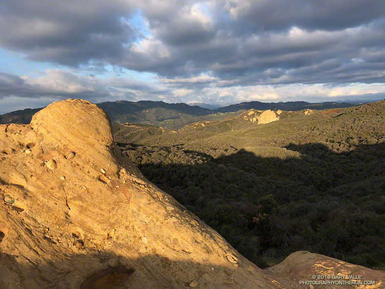
Colors enriched by the early morning light and recent rain, this view of the Santa Monica Mountains is from “Cathedral Rocks,” near the Hub in Topanga State Park. The rock formation in the distance is Eagle Rock.
Unlike most of the rainy season, March rainfall has generally been above average in Los Angeles, Ventura and Santa Barbara Counties. Last Saturday I’d enjoyed a run in Pt. Mugu State Park following a few days of wet weather, and today my outing would be in the wake of the strongest storm to affect the area since January.
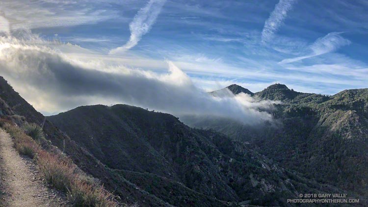
I was in the San Gabriel Mountains, and doing a get-your-hear-rate-up combo run I did last year — ascending San Gabriel Peak and Strawberry Peak from Red Box. The duo are the two highest peaks in the Front Range of the San Gabriel Mountains and have been popular for many years.
The storm had been a warm one, with high snow levels, and I was surprised to find the morning temperature at Red Box in the mid-30s. The surface low and trough associated with the storm were still along the West Coast and the circulation was creating a strong southwesterly flow. This was pushing mostly benign mid-level clouds into the valleys and mountains. More picturesque than threatening, the clouds imparted a high mountain flavor to the surroundings.
Last year I’d done San Gabriel Peak first, so today I started with Strawberry. It’s the more difficult of the two peaks. The route to its summit is about a mile longer; it has a bit more elevation gain; and it includes a stretch on rough, steep, unmaintained trail. Of course, that’s part of its appeal.
The clouds were ever changing. While Strawberry Peak escaped most of the clouds, San Gabriel Peak was often obscured.