Category Archives: trails|san gabriels

Strawberry Peak, Switzer’s and the Old Colby Trail

Strawberry Peak and Colby Canyon

The Colby Canyon Trail is one of the historic trails of the San Gabriel Mountains. When Switzer Camp was established in 1884, Colby Canyon was an irresistible gateway leading deeper into the wilderness. The compelling and sometimes snow-covered peak at its head was one of Switzer’s many attractions.
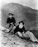
Jason and Owen Brown (1884). Photo: Los Angeles Public LIbrary

In the History of Pasadena Hiram A. Reid recounts the story of how the peak was named in 1886 “by some wags at Switzer’s camp” because of its resemblance to a strawberry. He goes on to describe how one of them irreverently added, “We called it Strawberry peak because there weren‘t any strawberries on it.”

While Strawberry may have been climbed previously, the establishment of Switzer’s made it possible to climb the peak recreationally. In Early Mountain Ascents in the San Gabriels (100 PEAKS Lookout, Jul-Aug 1971) John Robinson notes an 1887 ascent of Strawberry Peak by Owen and Jason Brown — sons of abolitionist John Brown. Robinson describes the “Brown Boys” as the first local “peak baggers.”
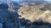
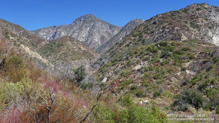
Colby Canyon and Arroyo Seco from high on Strawberry Peak.
Colby Canyon and Arroyo Seco from Strawberry Peak.

Climbing Strawberry via Colby Canyon has been a long-time favorite. Last Saturday I’d done Strawberry via Colby Canyon as part of loop — ascending the Colby Canyon Trail to Josephine Saddle, climbing over Strawberry Peak, running down to Red Box and then down the Gabrieleno Trail to Switzer’s. A 0.3 mile connection along Angeles Crest Highway completed the route.

Today I did a variation of the same loop, this time bypassing Josephine Saddle and following (more or less) the route of the old Colby Trail up the ridge at the head of Colby Canyon to Strawberry’s main west ridge.
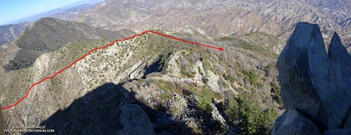
Overview of the route of the old Colby Trail from Strawberry Peak
Overview of the route of the old Colby Trail

As shown on this USGS Tujunga topo map from 1900, a century ago the Colby Trail was much more direct. It linked Switzer’s Camp in upper Arroyo Seco to the Colby Ranch and other ranches and holdings in Big Tujunga Canyon. It was a much shorter alternative to the roundabout route that ascended to the head of Arroyo Seco (then Long Canyon), and then continued past present day Red Box to Barley Flats and down to Wickiup Canyon. More on the history of Colby Ranch and Big Tujunga Canyon can be found in the Winter 1938 edition of Trails Magazine (12.6 MB PDF).
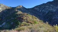
Ridge that was the route of the old Colby Trail.

A well-used game trail wanders up “Colby” ridge, but the path is far from ideal and not always distinct. Our four-legged friends don’t necessarily follow one path, especially where the route is steep and loose. Deer are well-suited to this kind of terrain, their long, skinny legs being perfect for following an overgrown path lined with thorny buck brush. In a couple of places there were short segments of trail that look like they might be remnants of the trail indicated on the 1900 topo.
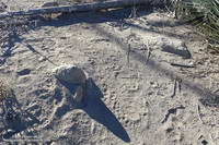
Bear tracks on the west side of Strawberry Peak.

It’s easy to understand why the old route on the ridge was abandoned; the route to Josephine Saddle is far better and MUCH faster!

These sections of the 1934 Mt. Lowe Quadrangle advance sheet and 1939 Mt. Lowe Quadrangle shows the dramatic changes in the area with the construction of Angeles Crest Highway (LRN 61) between La Canada and Colby Canyon. The 1934 sheet shows the reroute of the Colby Canyon Trail to Josephine Saddle and then contouring around Strawberry, as well as the trails along the west and east ridges of Strawberry and connecting from Lawlor Saddle to Colby Ranch. The updated 1939 sheet includes the Josephine Fire Lookout and the Josephine Fire Road.

What’s the Fastest Route Up Mt. Baldy?

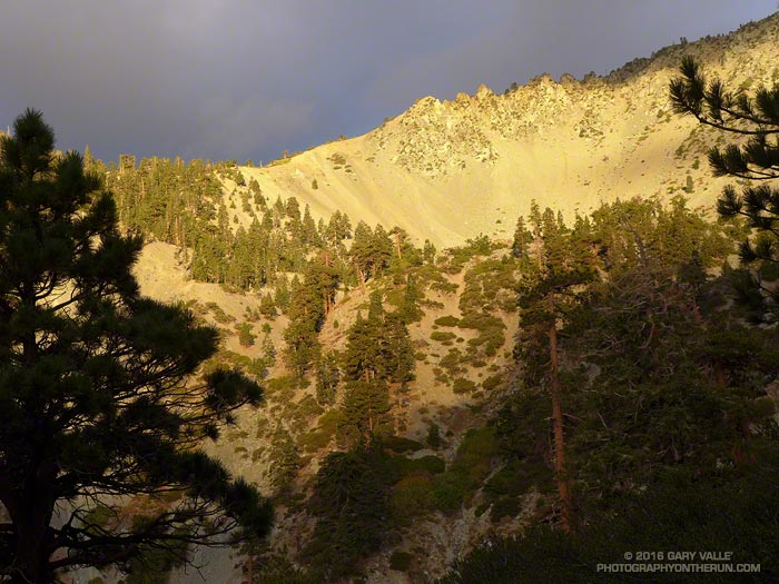
Baldy Bowl

There’s no getting around it. Sometimes it just feels good to go all out and push the pace up a peak. Just ask the 500+ that do the Mt. Baldy Run to the Top each year.

There are three routes up Mt. Baldy from Manker Flat on which I like to push the pace: the Ski Hut Trail, Register Ridge and the Run to the Top route via the Notch.

The 3.5 mile Register Ridge route is the shortest of the three routes. Since all three routes gain about 3900 feet in elevation, Register Ridge is also the steepest. From where the Register Ridge route leaves the Ski Hut Trail to where it joins the Devil’s Backbone Trail, it gains about 2600′ over about 1.5 miles — an AVERAGE grade of nearly 33%.

Since the Register Ridge route is about a half-mile shorter than the Ski Hut Trail, and the Ski Hut Trail is about 3 miles shorter than the R2T, it might seem either Register Ridge or the Ski Hut Trail would have to be the fastest route to the top of Baldy. For someone equally adept at running and steep hiking, this isn’t necessarily the case.

For a “short” ascent for which fatigue is not a major factor, it’s the elevation gain and not the distance that determines the time. Basically it’s a matter of the rate of climb the runner or hiker can sustain. The winning time of the Baldy R2T is usually just over an hour, which works out to about 3900 ft/hour. Pikes Peak Ascent winners average about 3600 ft/hour.

In round numbers to do Baldy in an hour you need to average:

• 7 mph or 9 min/mile on the R2T course.

• 4 mph or 15 min/mile on the Ski Hut Trail.

• 3.5 mph or 17 min/mile via Register Ridge route.

Following are some Strava Segments associated with these routes and the current Course Records:

Mt Baldy Summit via Ski Hut Trail (3.9 mi)
Brad Harris CR 1:06:58 Apr 17, 2015
Segment starts at Falls Road gate.

Mt. Baldy Run to the Top (6.8 mi)
Lucas Matison CR 1:05:24 Sep 5, 2016
Records are 1:00:49 by Matt Ebiner (1987), and 1:15:32 by Carrie Garritson (1988).
Segment starts at the ski area parking lot. Subtract about 1:00 to compare to the Ski Hut Trail time. This adjusts for running down to the Falls Road gate from the R2T start and for the R2T finish not being quite on the top.

Register to Summit (From base of Register Ridge)
Erik Schulte CR 1:08:56 Jun 19, 2015
Segment starts at the Register Ridge – Ski Hut Trail junction. Add about 10:00 to adjust for the time from Falls Road gate.

So even though the R2T course via the Notch is about 3 miles longer than the Ski Hut Trail route, the fastest (reported) times up Baldy have been by the R2T route. The Ski Hut Trail route is a close second, with the Register Ridge route is a distant third.

Old Forest, New Forest

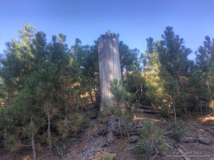
Regrowth near Grassy Hollow following the 1997 Narrows Fire

Each time I’ve run the segment of the Pacific Crest Trail between Inspiration Point and Vincent Gap I’ve been curious about a cluster of young pines in a burned area near Grassy Hollow. The trees appear to be older than similar areas of regrowth along the PCT between Mt. Baden-Powell and Little Jimmy Spring, which burned in the 2002 Curve Fire.

In turns out the area near Grassy Hollow was burned in the 18,186 acre Narrows Fire in 1997. That would make these trees about five years older than the Curve Fire regrowth.

Considering our huge precipitation deficit in Southern California over the past five years, the young trees in the Curve and Narrows fire areas seem to be doing surprisingly well.

Crest and Clouds

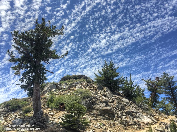
Crest and clouds on the Pacific Crest Trail at 8900' near Mt. Burnham.

Crest and clouds on the Pacific Crest Trail at 8900′ near Mt. Burnham in the San Gabriel Mountains. From Saturday’s 30 mile training run on the PCT and AC100 course.

Cirrocumulus undulatus clouds above the San Gabriel Mountains. June 18, 2016.
Cirrocumulus undulatus clouds

Temps were a bit more manageable on Saturday than Sunday. Saturday the Big Pines RAWS (6964′) recorded a high of 79°F with an “in the sun” temperature of around 101°F. Sunday the Big Pines high was 89°F with a sizzling “in the sun” temperature of about 109°F.

In addition to the air temperature many Remote Automated Weather Stations (RAWS) report the fuel temperature. The air temperature is the temperature inside a ventilated, sun-shielded enclosure approximately 6 ft. off the ground. The fuel temperature is the temperature of a pine dowel in full sun near the ground. The fuel temperature is a good indicator of the much higher temperature runners and hikers can experience in exposed areas facing the sun.

Some related posts: Postcard Weather on the Pacific Crest Trail, What’s the Current Weather on the AC100 Course?

After the Station Fire: Pine Seedling Along the Mt. Waterman Trail

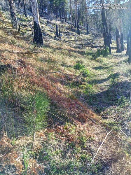
Pine seedling along the Mt. Waterman Trail

It’s been more than six and a half years since the devastating Station Fire burned 160,577 acres in Angeles National Forest.

The pine seedling above is on the Three Points – Mt. Waterman trail (10W04) in an area burned by the Station Fire. It’s 3.5 miles from Three Points and at an elevation of about 7000′. It’s about three years old.

How long will the seedling have to grow to replace the mature trees lost in the fire?

Jeffrey pine on the Mt. Waterman Trail burned in the 2009 Station Fire
Jeffrey pine burned in the 2009 Station Fire

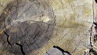
A couple more miles up the trail, near the Twin Peaks Trail junction, is a Jeffrey pine burned by the Station Fire and then cut by fire fighters. The tree is representative of the mature trees in this area of the forest. An inexact, but conservative, count of its growth rings is in the neighborhood of 325.

So the burned tree was a seedling sometime around 1690. If the seedling survives the drought, increasing temperatures, subsequent fires and droughts, and other maladies that can befall a tree, it will reach the age of the burned tree around 2340.

Here’s hoping that it does, and that the forests will be as enjoyable then as they are now…

Update August 4, 2020. In July 2018 a count of the tree rings of a large Jeffrey pine cleared from the Three Points – Mt. Waterman Trail revealed approximately 500 rings!

Some related posts: Lemon Lily Along the Mt. Waterman Trail, After the Station Fire: Three Points – Mt. Waterman Loop, Three Points Loop Plus Mt. Waterman

What’s the Current Weather on the AC100 Course?

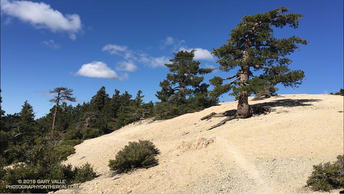
Pacific Crest Trail on Kratka Ridge in the San Gabriel Mountains

A couple of weekends ago we had cool weather for a 28 mile Angeles Crest 100 training run from Islip Saddle to Chilao Flat. It was a bit windy and chilly at Islip Saddle, but once we were up and over the shoulder of Mt. Williamson the wind settled down and the weather for the remainder of the run was near perfect.

This was the second of four supported AC100 training runs, each covering a different section of the course. These organized runs account for just a tiny fraction of the total mileage a runner does to prepare for this event, and much of the mileage is done on the AC100 course.

Where is the AC100 course? Incorporating segments of iconic trails such as the Pacific Crest Trail, Silver Moccasin Trail and Gabrielino Trail, the AC100 starts in the mountain community of Wrightwood, California and ends in Altadena near JPL, traversing a large part of the San Gabriel Mountains.

Mountain weather — even Los Angeles County mountain weather — can be extremely varied and changeable. At about mile 18 the AC100 course reaches an elevation of more than 9,200′, near the summit of Mt. Baden-Powell. On the same day temperatures on the course can differ by 50 degrees or more. One section can be inundated by a flash flood while another is bone dry. During a Spring training run it might be 100 in the sun at Echo Mountain, while it is snowing on Baden-Powell.

Annotated Mt. Wilson Towercam Image

The Mt. Wilson Towercam is usually pointed in the direction of the Angeles high country. When it is, it provides a great overview of about two-thirds of the AC100 course. The view extends from the top of the Acorn Trail at about mile 4 (in the distance on the far right), along the crest past Mt. Baden-Powell, Throop Peak, Twin Peaks and Waterman Mountain to Three Points at about mile 43. Chilao is hidden from view, but the Charlton Flat area and a section of Edison Road is visible on the left. Newcomb Saddle, at about mile 68, is on the lower right. Here’s an annotated Towercam image that shows the approximate location of these features.

Bill Westphal’s Altadena Weather & Webcam gives a lower elevation view of the San Gabriels, near the AC100 Finish. The view is NE toward the Sunset Ridge Trail and Mt. Lowe Road, around mile 93 or 94. The course goes from the right of the photo to the left, but is mostly hidden from view.

If you are willing to jump through some Java security hoops the Mountain Hardware Live Interactive Cam in Wrightwood is a couple blocks from the AC100 Start. It has views of downtown Wrightwood, Wright Mountain, the Heath Canyon landslide, Blue Ridge and several other locations. I temporarily enabled Java and followed the troubleshooting info linked on the web cam page. I’ve been able to get it to work on a desktop system using Firefox or Internet Explorer. Note that enabling Java and adding non-secure URLs to the Java exceptions list decreases the security of your computer.

Following are several Remote Automated Weather Stations (RAWS) and Weather Underground Personal Weather Stations (PWS) along or near the AC100 course, in order from Start to Finish.

It is important to note that the air temperature given by RAWS stations is the temperature inside a sun-shielded, ventilated enclosure 4-8 feet off the ground. Basically it’s the temperature in light shade. The temperature in full sun can be 15°F higher. I’ve found the “Fuel Temperature” to be a better gage of how hellish it’s going to be on exposed areas of trail. (The Fuel Temperature is the temperature of a ponderosa pine dowel in direct sun.)

Wrightwood KCAWRIGH7 PWS (5996′) – Approximately 0.25 mile W of Start. Was 55°F at 5 a.m. for 2015 AC100.

Wrightwood KCAWRIGH9 PWS (6000′) – Approximately 0.6 mile SE of Start. Was 59°F at 5 a.m. for 2015 AC100.

Big Pines BPNC1 RAWS (6964′) – Off Hwy 2 near Mountain High Ski Area. Top of Mt. Baden-Powell can be 12+ degrees cooler and much more windy. Was 64°F at 6:54 a.m. for 2015 AC100. Fuel temp at 11:54 a.m. was 92°F.

Mountain High Ski Area Base & Top Conditions – Approximate elevation of Base is 7000′ and top is 8000′. Compare Base temp to Big Pines temp.

Chilao CHOC1 RAWS (5450′) – Approximately 1.25 miles WNW of Chilao aid. Fuel temp at 1:53 pm was 95°F for 2015 AC100. Air temp at 6:53 pm was 79°F.

Clear Creek CEKC1 RAWS (3000′) – Approximately 6.8 miles W of Shortcut Aid (~4793′) and 2.9 miles W of Red Box Aid (~4620′). Was 71°F at 8:54 p.m. for 2015 AC100.

Mt. Wilson MWSC1 (5710′) – Approximately 1.5 miles NW of and 780′ above the top of Mt. Wilson Toll Road (~4930′). Compare to JPL 5600′. Was 69°F at midnight for 2015 AC100.

Henninger Flats HNGC1 RAWS (2800′) – Approximately 0.8 miles WSW of Idlehour Aid (~3168′). Marine layer can increase humidity on this section of the course. Was 69-70°F from 4 a.m. to 7 a.m. for 2015 AC100. Fuel temp was 89°F by 11a.m.

Altadena KCAALTAD18 PWS (1214′) – Approximately 0.6 miles S of Finish. For 2015 AC100 temp ranged from 66°F at 2 a.m. to 63°F at sunrise. Temp was 79°F at 9 a.m., 82°F at 11 a.m., and 86°F at 1 p.m. Humidity was high with dew point about 70°F.

Altadena KCAALTAD41 PWS (1348′) – Approximately 0.4 miles NW of Finish.

It’s not on the AC100 course, but the Mt. Baldy Ski Lifts Web Cams and Weather can be useful for estimating mountain temps and for Baldy area training runs.

Related post: The Ups and Downs of the Angeles Crest 100 Mile Run